
Mt. Senjōji
千丈寺山
Sanda, Hyogo · Elevation 590 m
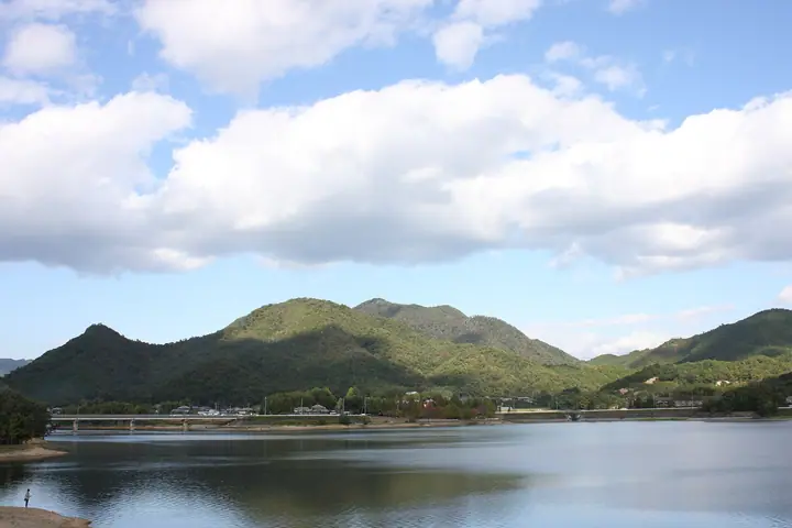
A 589.6-meter peak in Ochihara, Sanda City, Hyōgo Prefecture, sitting at the southern margin of the Tanba Highlands and crowned by the only first-class triangulation point in Sanda City (589.54 m). The temple Senjō-ji, from which the mountain takes its name, was burned by Akechi Mitsuhide's forces in the late Sengoku period and survives only in name; an iwakura (sacred rock) at the summit enshrines a Daigongen, and Kanjinja at the foot holds its festival each 17 March. Local folklore tells that a great tengu from Rokkō-san used the peak as a resting place, and the eastern slope has been developed as the Ochihara Tengu-no-Mori, included in the Hokusetsu Satoyama 30. Trails climb from Kanjinja and Shimoaono Tenmangū, and the peak is listed in the Furusato Hyōgo 100-zan and the Bunken Tozan Guide for Hyōgo.
Mt. Senjōji at a glance
- Weather: The most settled day in the next 7 days is Thu, November 5: clear, gusts up to 6 m/s.
Mt. Senjōji weather (hourly, 14 days)
Sunrise today 06:21, sunset 17:04
| Tue, 11/3 | Wed, 11/4 | Thu, 11/5 | Fri, 11/6 | Sat, 11/7 | Sun, 11/8 | Mon, 11/9 | Tue, 11/10 | Wed, 11/11 | Thu, 11/12 | Fri, 11/13 | Sat, 11/14 | Sun, 11/15 | Mon, 11/16 | Tue, 11/17 | |||||||||||||||||||||||||||||||||||||||||||||||||||||||||||||||||||||||
|---|---|---|---|---|---|---|---|---|---|---|---|---|---|---|---|---|---|---|---|---|---|---|---|---|---|---|---|---|---|---|---|---|---|---|---|---|---|---|---|---|---|---|---|---|---|---|---|---|---|---|---|---|---|---|---|---|---|---|---|---|---|---|---|---|---|---|---|---|---|---|---|---|---|---|---|---|---|---|---|---|---|---|---|---|---|
| Japan time | 15 | 17 | 19 | 21 | 23 | 1 | 3 | 5 | 7 | 9 | 11 | 13 | 15 | 18 | 21 | 0 | 3 | 6 | 9 | 12 | 15 | 18 | 21 | 0 | 3 | 6 | 9 | 12 | 15 | 18 | 21 | 0 | 3 | 6 | 9 | 12 | 15 | 18 | 21 | 0 | 3 | 6 | 9 | 12 | 15 | 18 | 21 | 0 | 3 | 6 | 9 | 15 | 21 | 3 | 9 | 15 | 21 | 3 | 9 | 15 | 21 | 3 | 9 | 15 | 21 | 3 | 9 | 15 | 21 | 3 | 9 | 15 | 21 | 3 | 9 | 15 | 21 | 3 | 9 | 15 | 21 | 3 | 9 | 15 | |
  | |   | | | | | | |  | |   | |   |   |   |   | |   | | |  | | | | |   | |   | | | | | | |   | | | | | | | | | | | | | | | | |   |   | | | | | | | |  | | | | | | | | | | | | | | | | | | | | | | | ||
| Temperature | °C | 14° | 11° | 9° | 9° | 9° | 8° | 8° | 9° | 8° | 12° | 15° | 16° | 16° | 12° | 13° | 11° | 11° | 11° | 12° | 17° | 18° | 14° | 14° | 13° | 13° | 11° | 13° | 15° | 16° | 11° | 9° | 7° | 5° | 5° | 9° | 11° | 10° | 6° | 4° | 4° | 4° | 3° | 10° | 12° | 11° | 9° | 8° | 8° | 7° | 7° | 11° | 12° | 7° | 5° | 9° | 13° | 6° | 5° | 8° | 9° | 4° | 2° | 8° | 11° | 6° | 4° | 9° | 10° | 4° | 3° | 9° | 13° | 7° | 6° | 12° | 13° | 11° | 11° | 13° | 13° | 7° | 4° | 8° | 10° |
| Precipitation | mm | 1.2 | 5 | 3.3 | 0.7 | 0.7 | 0.5 | 0.1 | 1.0 | 0.4 | 0.7 | 0.3 | 0.2 | 0.1 | 0.3 | 2.7 | 2.6 | 0.2 | 1.0 | 0.2 | |||||||||||||||||||||||||||||||||||||||||||||||||||||||||||||||||
| New snow | cm | ||||||||||||||||||||||||||||||||||||||||||||||||||||||||||||||||||||||||||||||||||||
| Snow depth | cm | 0 | 0 | 0 | 0 | 0 | 0 | 0 | 0 | 0 | 0 | 0 | 0 | 0 | 0 | 0 | 0 | 0 | 0 | 0 | 0 | 0 | 0 | 0 | 0 | 0 | 0 | 0 | 0 | 0 | 0 | 0 | 0 | 0 | 0 | 0 | 0 | 0 | 0 | 0 | 0 | 0 | 0 | 0 | 0 | 0 | 0 | 0 | 0 | 0 | 0 | 0 | 0 | 0 | 0 | 0 | 0 | 0 | 0 | 0 | 0 | 0 | 0 | 0 | 0 | 0 | 0 | 0 | 0 | 0 | 0 | 0 | 0 | 0 | 0 | 0 | 0 | 0 | 0 | 0 | 0 | 0 | 0 | 0 | 0 |
| Wind | m/s | 4 | 3 | 4 | 3 | 3 | 3 | 4 | 4 | 4 | 4 | 4 | 3 | 3 | 3 | 4 | 5 | 4 | 2 | 3 | 1 | 1 | 1 | 1 | 2 | 3 | 1 | 2 | 4 | 4 | 4 | 3 | 3 | 2 | 3 | 6 | 6 | 6 | 3 | 1 | 1 | 1 | 1 | 2 | 4 | 4 | 2 | 1 | 1 | 1 | 1 | 1 | 4 | 2 | 1 | 2 | 4 | 3 | 5 | 6 | 6 | 2 | 1 | 1 | 2 | 1 | 1 | 6 | 5 | 3 | 2 | 1 | 2 | 2 | 2 | 2 | 3 | 2 | 2 | 4 | 7 | 6 | 3 | 5 | 3 |
| Wind gusts | m/s | 9 | 9 | 7 | 7 | 6 | 6 | 8 | 9 | 8 | 10 | 9 | 9 | 7 | 6 | 8 | 9 | 11 | 8 | 5 | 6 | 4 | 3 | 3 | 4 | 7 | 7 | 6 | 8 | 9 | 9 | 7 | 6 | 6 | 5 | 12 | 14 | 13 | 12 | 7 | 3 | 3 | 3 | 5 | 11 | 10 | 8 | 4 | 2 | 3 | 2 | 4 | 9 | 8 | 3 | 6 | 11 | 8 | 12 | 13 | 15 | 13 | 5 | 4 | 6 | 5 | 3 | 12 | 13 | 12 | 6 | 5 | 6 | 5 | 4 | 6 | 8 | 8 | 6 | 10 | 15 | 15 | 13 | 10 | 11 |
| Wind dir. | ↓ | ↓ | ↓ | ↓ | ↓ | ↓ | ↓ | ↓ | ↓ | ↓ | ↓ | ↓ | ↓ | ↓ | ↓ | ↓ | ↓ | ↓ | ↓ | ↓ | ↓ | ↓ | ↓ | ↓ | ↓ | ↓ | ↓ | ↓ | ↓ | ↓ | ↓ | ↓ | ↓ | ↓ | ↓ | ↓ | ↓ | ↓ | ↓ | ↓ | ↓ | ↓ | ↓ | ↓ | ↓ | ↓ | ↓ | ↓ | ↓ | ↓ | ↓ | ↓ | ↓ | ↓ | ↓ | ↓ | ↓ | ↓ | ↓ | ↓ | ↓ | ↓ | ↓ | ↓ | ↓ | ↓ | ↓ | ↓ | ↓ | ↓ | ↓ | ↓ | ↓ | ↓ | ↓ | ↓ | ↓ | ↓ | ↓ | ↓ | ↓ | ↓ | ↓ | ↓ | |
Huts, campsites and lodging near Mt. Senjōji
Campsites
- 三田市野外活動センター
Lists that include Mt. Senjōji
Mt. Senjōji facts
- Also known as
- 南千丈寺山
- Elevation
- 590 m
- Location
- Sanda, Hyogo
34.967412, 135.222023 - Website
- www.city.sanda.lg.jp
- Trail Map
- sanda-kankou.jp (PDF)
- Wikipedia
- ja.wikipedia.org