
Mt. Shiragadake
白髪岳
Tamba-Sasayama, Hyogo · Elevation 721 m
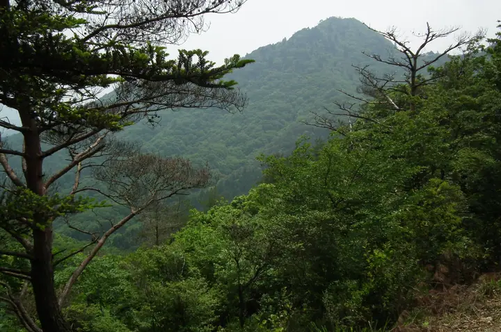
Mt. Shiragadake is a 721.8 m peak rising in the southern part of Tamba-Sasayama City, Hyōgo Prefecture, whose elegant twin-peak silhouette seen from the south has earned it the nickname Tamba-Fuji. It stands on the watershed between the Kako and Mukogawa river systems; rocky outcrops and short rock ridges just below the summit lead to a near-360° panorama. The peak is linked by ridge to the adjacent Mt. Matsuo-yama (Kōsenji-yama), with the Matsuo Castle and Kōsenji ruins on the loop course making for a popular round trip, and is included in the Kansai Hyakumeizan, Kinki Hyakumeizan and the Hyōgo Bunken Tozan Guide.
Mt. Shiragadake at a glance
- Weather: The most settled day in the next 7 days is Wed, November 4: clear, gusts up to 11 m/s.
- Route: The shortest is Mount Shiraga and Mount Matsuo Loop from Sumiyama: about 4 h 8 min, 7.4 km, about 670 m of climbing.
Mt. Shiragadake weather (hourly, 14 days)
Sunrise today 06:22, sunset 17:05
| Tue, 11/3 | Wed, 11/4 | Thu, 11/5 | Fri, 11/6 | Sat, 11/7 | Sun, 11/8 | Mon, 11/9 | Tue, 11/10 | Wed, 11/11 | Thu, 11/12 | Fri, 11/13 | Sat, 11/14 | Sun, 11/15 | Mon, 11/16 | Tue, 11/17 | |||||||||||||||||||||||||||||||||||||||||||||||||||||||||||||||||||||||
|---|---|---|---|---|---|---|---|---|---|---|---|---|---|---|---|---|---|---|---|---|---|---|---|---|---|---|---|---|---|---|---|---|---|---|---|---|---|---|---|---|---|---|---|---|---|---|---|---|---|---|---|---|---|---|---|---|---|---|---|---|---|---|---|---|---|---|---|---|---|---|---|---|---|---|---|---|---|---|---|---|---|---|---|---|---|
| Japan time | 15 | 17 | 19 | 21 | 23 | 1 | 3 | 5 | 7 | 9 | 11 | 13 | 15 | 18 | 21 | 0 | 3 | 6 | 9 | 12 | 15 | 18 | 21 | 0 | 3 | 6 | 9 | 12 | 15 | 18 | 21 | 0 | 3 | 6 | 9 | 12 | 15 | 18 | 21 | 0 | 3 | 6 | 9 | 12 | 15 | 18 | 21 | 0 | 3 | 6 | 9 | 15 | 21 | 3 | 9 | 15 | 21 | 3 | 9 | 15 | 21 | 3 | 9 | 15 | 21 | 3 | 9 | 15 | 21 | 3 | 9 | 15 | 21 | 3 | 9 | 15 | 21 | 3 | 9 | 15 | 21 | 3 | 9 | 15 | |
  | |   | | | | | | |  | |   | |   |   |   | | |   | | | | |   |   | |   | |   |  | | | | | | | | | | | | | | | | | | | | | | | |   | | | | | | | |  | | | | |   | | | | | | | | | | | | | | | | | | ||
| Temperature | °C | 12° | 10° | 8° | 8° | 8° | 8° | 8° | 8° | 8° | 12° | 14° | 15° | 14° | 10° | 11° | 11° | 11° | 10° | 11° | 17° | 17° | 13° | 12° | 12° | 12° | 10° | 12° | 15° | 15° | 10° | 8° | 6° | 5° | 4° | 9° | 10° | 9° | 6° | 4° | 4° | 4° | 3° | 9° | 11° | 12° | 8° | 7° | 7° | 7° | 6° | 10° | 10° | 6° | 4° | 8° | 13° | 5° | 5° | 8° | 8° | 4° | 2° | 8° | 10° | 5° | 4° | 8° | 9° | 4° | 4° | 8° | 13° | 6° | 6° | 12° | 12° | 11° | 11° | 12° | 11° | 6° | 4° | 7° | 9° |
| Precipitation | mm | 1.3 | 1.2 | 2.6 | 1.0 | 0.3 | 0.2 | 0.3 | 0.6 | 0.1 | 0.9 | 1.2 | 0.2 | 0.3 | 0.2 | 1.0 | 4.1 | 2.4 | 0.3 | 1.1 | 0.3 | ||||||||||||||||||||||||||||||||||||||||||||||||||||||||||||||||
| New snow | cm | ||||||||||||||||||||||||||||||||||||||||||||||||||||||||||||||||||||||||||||||||||||
| Snow depth | cm | 0 | 0 | 0 | 0 | 0 | 0 | 0 | 0 | 0 | 0 | 0 | 0 | 0 | 0 | 0 | 0 | 0 | 0 | 0 | 0 | 0 | 0 | 0 | 0 | 0 | 0 | 0 | 0 | 0 | 0 | 0 | 0 | 0 | 0 | 0 | 0 | 0 | 0 | 0 | 0 | 0 | 0 | 0 | 0 | 0 | 0 | 0 | 0 | 0 | 0 | 0 | 0 | 0 | 0 | 0 | 0 | 0 | 0 | 0 | 0 | 0 | 0 | 0 | 0 | 0 | 0 | 0 | 0 | 0 | 0 | 0 | 0 | 0 | 0 | 0 | 0 | 0 | 0 | 0 | 0 | 0 | 0 | 0 | 0 |
| Wind | m/s | 4 | 4 | 4 | 3 | 3 | 3 | 4 | 4 | 4 | 4 | 4 | 3 | 3 | 3 | 2 | 4 | 2 | 2 | 2 | 1 | 1 | 1 | 1 | 2 | 3 | 1 | 2 | 3 | 4 | 3 | 2 | 3 | 2 | 2 | 6 | 6 | 6 | 3 | 2 | 1 | 1 | 1 | 2 | 5 | 4 | 2 | 1 | 1 | 1 | 1 | 2 | 4 | 1 | 1 | 3 | 3 | 1 | 5 | 7 | 6 | 3 | 1 | 1 | 1 | 1 | 1 | 5 | 6 | 3 | 3 | 2 | 2 | 2 | 2 | 2 | 4 | 3 | 2 | 4 | 7 | 7 | 4 | 5 | 4 |
| Wind gusts | m/s | 11 | 10 | 8 | 8 | 8 | 8 | 9 | 10 | 10 | 11 | 11 | 10 | 9 | 8 | 6 | 8 | 10 | 4 | 5 | 5 | 5 | 4 | 3 | 6 | 7 | 8 | 6 | 7 | 10 | 10 | 7 | 7 | 7 | 6 | 13 | 14 | 14 | 13 | 7 | 4 | 4 | 4 | 5 | 12 | 11 | 10 | 5 | 3 | 2 | 2 | 5 | 9 | 9 | 4 | 8 | 12 | 7 | 12 | 16 | 16 | 14 | 6 | 4 | 6 | 5 | 3 | 12 | 15 | 13 | 9 | 7 | 6 | 6 | 5 | 6 | 9 | 10 | 9 | 10 | 16 | 17 | 15 | 11 | 13 |
| Wind dir. | ↓ | ↓ | ↓ | ↓ | ↓ | ↓ | ↓ | ↓ | ↓ | ↓ | ↓ | ↓ | ↓ | ↓ | ↓ | ↓ | ↓ | ↓ | ↓ | ↓ | ↓ | ↓ | ↓ | ↓ | ↓ | ↓ | ↓ | ↓ | ↓ | ↓ | ↓ | ↓ | ↓ | ↓ | ↓ | ↓ | ↓ | ↓ | ↓ | ↓ | ↓ | ↓ | ↓ | ↓ | ↓ | ↓ | ↓ | ↓ | ↓ | ↓ | ↓ | ↓ | ↓ | ↓ | ↓ | ↓ | ↓ | ↓ | ↓ | ↓ | ↓ | ↓ | ↓ | ↓ | ↓ | ↓ | ↓ | ↓ | ↓ | ↓ | ↓ | ↓ | ↓ | ↓ | ↓ | ↓ | ↓ | ↓ | ↓ | ↓ | ↓ | ↓ | ↓ | ↓ | |
Mt. Shiragadake hiking routes
Hiking times are estimates calculated from the terrain.
Huts, campsites and lodging near Mt. Shiragadake
Campsites
- Kawashiro Park Camping Ground 川代公園キャンプ場
Lists that include Mt. Shiragadake
Kansai 100 Famous Mountains · Kinki 100 Famous Mountains · 100 Mountains of Our Home Hyogo · Tamba-Sasayama City Hiking Map · Elevations of 1003 Mountains of Japan · 1000 Mountains of Japan
Mt. Shiragadake facts
- Also known as
- 丹波富士
- Elevation
- 721 m
- Location
- Tamba-Sasayama, Hyogo
35.046116, 135.134738 - Website
- tourism.sasayama.jp
- Wikipedia
- ja.wikipedia.org