
Mount Kokūzō
虚空蔵山
Sanda, Hyogo · Elevation 592 m
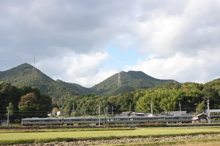
Mount Kokūzō is a 592 m peak in the Tamba Highlands straddling Tamba-Sasayama and Sanda in Hyōgo Prefecture. Once known as Iwatsuji-yama, it has been venerated since legend records Prince Shōtoku founded the Kokūzō-dō hall here in the reign of Empress Suiko. Well-maintained Kinki Nature Trail paths climb to the summit, where views stretch over the Rokkō Range and out to the Akashi Kaikyō Bridge. The mountain is included in lists such as the Furusato Hyōgo 100 Mountains and the Japan 100 Low Mountains.
Mount Kokūzō at a glance
- Weather: The most settled day in the next 7 days is Thu, November 5: clear, gusts up to 5 m/s.
- Route: The shortest is Tambasasayama and Sanda from Mount Kokuzo of Prince Shotoku along the Watershed Ridge, Station to Station: about 3 h 53 min, 7.1 km, about 590 m of climbing.
Mount Kokūzō weather (hourly, 14 days)
Sunrise today 06:22, sunset 17:05
| Tue, 11/3 | Wed, 11/4 | Thu, 11/5 | Fri, 11/6 | Sat, 11/7 | Sun, 11/8 | Mon, 11/9 | Tue, 11/10 | Wed, 11/11 | Thu, 11/12 | Fri, 11/13 | Sat, 11/14 | Sun, 11/15 | Mon, 11/16 | Tue, 11/17 | |||||||||||||||||||||||||||||||||||||||||||||||||||||||||||||||||||||||
|---|---|---|---|---|---|---|---|---|---|---|---|---|---|---|---|---|---|---|---|---|---|---|---|---|---|---|---|---|---|---|---|---|---|---|---|---|---|---|---|---|---|---|---|---|---|---|---|---|---|---|---|---|---|---|---|---|---|---|---|---|---|---|---|---|---|---|---|---|---|---|---|---|---|---|---|---|---|---|---|---|---|---|---|---|---|
| Japan time | 21 | 23 | 1 | 3 | 5 | 7 | 9 | 11 | 13 | 15 | 17 | 19 | 21 | 0 | 3 | 6 | 9 | 12 | 15 | 18 | 21 | 0 | 3 | 6 | 9 | 12 | 15 | 18 | 21 | 0 | 3 | 6 | 9 | 12 | 15 | 18 | 21 | 0 | 3 | 6 | 9 | 12 | 15 | 18 | 21 | 0 | 3 | 6 | 9 | 12 | 15 | 21 | 3 | 9 | 15 | 21 | 3 | 9 | 15 | 21 | 3 | 9 | 15 | 21 | 3 | 9 | 15 | 21 | 3 | 9 | 15 | 21 | 3 | 9 | 15 | 21 | 3 | 9 | 15 | 21 | 3 | 9 | 15 | 21 | |
  | | | |   |   | |   | | | |   | |   | | | | |   |   |   | | | | |   | |  | | | | | |   | | | | | | | | | | | | | | | | | | |   |  | | | | | | |  | | | | | | | | | | | | | | | | |   | | | | | |  | ||
| Temperature | °C | 9° | 9° | 8° | 9° | 9° | 8° | 12° | 15° | 13° | 14° | 12° | 11° | 12° | 12° | 11° | 11° | 13° | 18° | 18° | 14° | 14° | 14° | 12° | 10° | 12° | 17° | 16° | 11° | 8° | 7° | 5° | 4° | 9° | 11° | 10° | 7° | 5° | 5° | 5° | 5° | 8° | 10° | 10° | 7° | 7° | 6° | 7° | 7° | 10° | 14° | 13° | 7° | 5° | 9° | 13° | 5° | 5° | 8° | 9° | 4° | 3° | 8° | 11° | 6° | 4° | 9° | 10° | 4° | 4° | 9° | 13° | 6° | 6° | 12° | 13° | 11° | 11° | 13° | 13° | 7° | 4° | 8° | 9° | 4° |
| Precipitation | mm | 0.3 | 0.7 | 2.1 | 0.1 | 0.4 | 0.4 | 0.8 | 0.7 | 0.3 | 0.3 | 0.5 | 3.0 | 1.9 | 0.2 | 0.5 | 0.2 | ||||||||||||||||||||||||||||||||||||||||||||||||||||||||||||||||||||
| New snow | cm | ||||||||||||||||||||||||||||||||||||||||||||||||||||||||||||||||||||||||||||||||||||
| Snow depth | cm | 0 | 0 | 0 | 0 | 0 | 0 | 0 | 0 | 0 | 0 | 0 | 0 | 0 | 0 | 0 | 0 | 0 | 0 | 0 | 0 | 0 | 0 | 0 | 0 | 0 | 0 | 0 | 0 | 0 | 0 | 0 | 0 | 0 | 0 | 0 | 0 | 0 | 0 | 0 | 0 | 0 | 0 | 0 | 0 | 0 | 0 | 0 | 0 | 0 | 0 | 0 | 0 | 0 | 0 | 0 | 0 | 0 | 0 | 0 | 0 | 0 | 0 | 0 | 0 | 0 | 0 | 0 | 0 | 0 | 0 | 0 | 0 | 0 | 0 | 0 | 0 | 0 | 0 | 0 | 0 | 0 | 0 | 0 | 0 |
| Wind | m/s | 3 | 4 | 3 | 4 | 4 | 3 | 4 | 4 | 4 | 3 | 3 | 3 | 4 | 5 | 3 | 2 | 1 | 0 | 2 | 1 | 3 | 5 | 4 | 1 | 2 | 4 | 4 | 3 | 2 | 2 | 2 | 1 | 4 | 6 | 6 | 4 | 2 | 2 | 3 | 3 | 5 | 5 | 5 | 3 | 3 | 2 | 2 | 1 | 1 | 4 | 3 | 2 | 0 | 2 | 4 | 2 | 5 | 6 | 6 | 2 | 1 | 1 | 1 | 0 | 1 | 5 | 6 | 2 | 2 | 2 | 2 | 2 | 2 | 3 | 4 | 3 | 2 | 5 | 7 | 6 | 3 | 4 | 4 | 2 |
| Wind gusts | m/s | 7 | 7 | 7 | 8 | 8 | 8 | 9 | 9 | 8 | 8 | 7 | 6 | 8 | 9 | 9 | 5 | 5 | 4 | 5 | 5 | 5 | 12 | 10 | 7 | 5 | 9 | 10 | 10 | 7 | 4 | 4 | 4 | 9 | 13 | 13 | 12 | 7 | 5 | 6 | 7 | 9 | 11 | 12 | 10 | 6 | 5 | 3 | 3 | 3 | 8 | 8 | 7 | 3 | 6 | 11 | 8 | 11 | 12 | 14 | 13 | 4 | 4 | 6 | 5 | 2 | 11 | 13 | 11 | 6 | 5 | 5 | 5 | 4 | 6 | 8 | 10 | 7 | 9 | 15 | 16 | 13 | 9 | 11 | 8 |
| Wind dir. | ↓ | ↓ | ↓ | ↓ | ↓ | ↓ | ↓ | ↓ | ↓ | ↓ | ↓ | ↓ | ↓ | ↓ | ↓ | ↓ | ↓ | ↓ | ↓ | ↓ | ↓ | ↓ | ↓ | ↓ | ↓ | ↓ | ↓ | ↓ | ↓ | ↓ | ↓ | ↓ | ↓ | ↓ | ↓ | ↓ | ↓ | ↓ | ↓ | ↓ | ↓ | ↓ | ↓ | ↓ | ↓ | ↓ | ↓ | ↓ | ↓ | ↓ | ↓ | ↓ | ↓ | ↓ | ↓ | ↓ | ↓ | ↓ | ↓ | ↓ | ↓ | ↓ | ↓ | ↓ | ↓ | ↓ | ↓ | ↓ | ↓ | ↓ | ↓ | ↓ | ↓ | ↓ | ↓ | ↓ | ↓ | ↓ | ↓ | ↓ | ↓ | ↓ | ↓ | ↓ | |
Mount Kokūzō hiking routes
Hiking times are estimates calculated from the terrain.
Lists that include Mount Kokūzō
100 Mountains of Our Home Hyogo · Tamba-Sasayama City Hiking Map
Mount Kokūzō facts
- Also known as
- 岩立山
- Elevation
- 592 m
- Location
- Sanda, Hyogo
34.984986, 135.139228 - Website
- tourism.sasayama.jp
- Wikipedia
- ja.wikipedia.org