
Mt. Okusangaidake
奥三界岳
Nakatsugawa, Gifu · Elevation 1,810 m
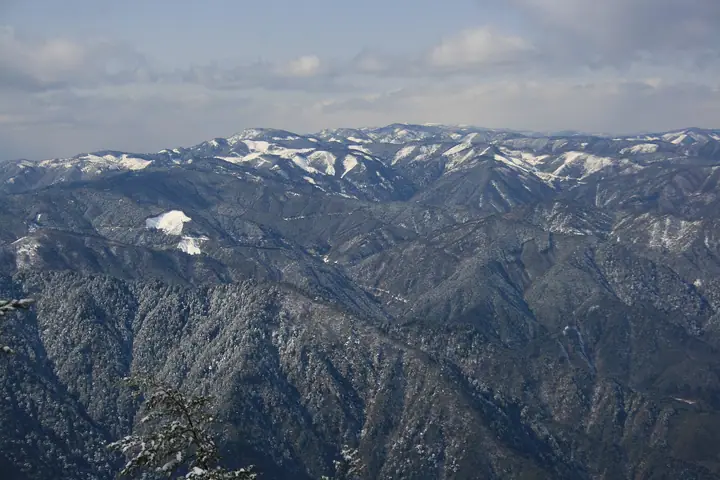
Mt. Okusangaidake (1,810 m), also locally known as Okusangai-san, straddles the border between Nakatsugawa City (Gifu) and the Kiso district (Nagi-Minamikiso Town and Okuwa Village, Nagano), at the northern end of the Adera mountains. Its summit area shelters primary forests of rhododendron, spruce and Japanese white pine and the Kagamiike pond wetland, and lies within Ura-Kiso Prefectural Natural Park. The peak is included in Japan's 300 Famous Mountains and the 100 Mountains of Gifu. The standard route from Yumori Park and Ryujin Falls on the southern foothills is currently closed by Nakatsugawa City due to a corroded suspension bridge, so climbers must check the city's notice before approaching.
Mt. Okusangaidake at a glance
- Weather: The most settled day in the next 7 days is Wed, November 4: clear, gusts up to 7 m/s.
- Route: The shortest is Mount Oku-Sangai Return from the Yumori Park Trailhead: about 7 h 44 min, 13.6 km, about 1,100 m of climbing.
Mt. Okusangaidake weather (hourly, 14 days)
Sunrise today 06:13, sunset 16:54
| Tue, 11/3 | Wed, 11/4 | Thu, 11/5 | Fri, 11/6 | Sat, 11/7 | Sun, 11/8 | Mon, 11/9 | Tue, 11/10 | Wed, 11/11 | Thu, 11/12 | Fri, 11/13 | Sat, 11/14 | Sun, 11/15 | Mon, 11/16 | Tue, 11/17 | |||||||||||||||||||||||||||||||||||||||||||||||||||||||||||||||||||||||
|---|---|---|---|---|---|---|---|---|---|---|---|---|---|---|---|---|---|---|---|---|---|---|---|---|---|---|---|---|---|---|---|---|---|---|---|---|---|---|---|---|---|---|---|---|---|---|---|---|---|---|---|---|---|---|---|---|---|---|---|---|---|---|---|---|---|---|---|---|---|---|---|---|---|---|---|---|---|---|---|---|---|---|---|---|---|
| Japan time | 15 | 17 | 19 | 21 | 23 | 1 | 3 | 5 | 7 | 9 | 11 | 13 | 15 | 18 | 21 | 0 | 3 | 6 | 9 | 12 | 15 | 18 | 21 | 0 | 3 | 6 | 9 | 12 | 15 | 18 | 21 | 0 | 3 | 6 | 9 | 12 | 15 | 18 | 21 | 0 | 3 | 6 | 9 | 12 | 15 | 18 | 21 | 0 | 3 | 6 | 9 | 15 | 21 | 3 | 9 | 15 | 21 | 3 | 9 | 15 | 21 | 3 | 9 | 15 | 21 | 3 | 9 | 15 | 21 | 3 | 9 | 15 | 21 | 3 | 9 | 15 | 21 | 3 | 9 | 15 | 21 | 3 | 9 | 15 | |
 |  |   | | | | | |   | | |   |   |   | |   | | |   | |   | |   | | |   |   | | |  | | | | | | | | | | | | | | | | | | | | | | |   | | | | |   | | | | | | |  | | | | | | | | | | | | | | | | | | | | ||
| Temperature | °C | 11° | 6° | 3° | 1° | 0° | 0° | -1° | -1° | 0° | 9° | 11° | 12° | 10° | 6° | 6° | 5° | 5° | 5° | 8° | 11° | 11° | 7° | 7° | 5° | 7° | 7° | 7° | 11° | 10° | 4° | 2° | 1° | 0° | -1° | 4° | 6° | 4° | -1° | -3° | -5° | -5° | -5° | 5° | 7° | 6° | 2° | 2° | 2° | 2° | 2° | 6° | 8° | 1° | -3° | 5° | 6° | 1° | -2° | 0° | 4° | -5° | -6° | 4° | 5° | -2° | -2° | 5° | 7° | -4° | -5° | 4° | 6° | -1° | 2° | 7° | 8° | 5° | 6° | 7° | 10° | 0° | -3° | 5° | 5° |
| Precipitation | mm | 8 | 11 | 0.2 | 0.8 | 0.1 | 0.5 | 1.1 | 0.3 | 1.1 | 0.2 | 1.4 | 0.5 | 0.2 | 0.3 | 23 | 17 | 1.2 | 1.0 | ||||||||||||||||||||||||||||||||||||||||||||||||||||||||||||||||||
| New snow | cm | ||||||||||||||||||||||||||||||||||||||||||||||||||||||||||||||||||||||||||||||||||||
| Snow depth | cm | 0 | 0 | 0 | 0 | 0 | 0 | 0 | 0 | 0 | 0 | 0 | 0 | 0 | 0 | 0 | 0 | 0 | 0 | 0 | 0 | 0 | 0 | 0 | 0 | 0 | 0 | 0 | 0 | 0 | 0 | 0 | 0 | 0 | 0 | 0 | 0 | 0 | 0 | 0 | 0 | 0 | 0 | 0 | 0 | 0 | 0 | 0 | 0 | 0 | 0 | 0 | 0 | 0 | 0 | 0 | 0 | 0 | 0 | 0 | 0 | 0 | 0 | 0 | 0 | 0 | 0 | 0 | 0 | 0 | 0 | 0 | 0 | 0 | 0 | 0 | 0 | 0 | 0 | 0 | 0 | 0 | 0 | 0 | 0 |
| Wind | m/s | 2 | 0 | 1 | 1 | 1 | 2 | 2 | 2 | 2 | 1 | 1 | 2 | 1 | 1 | 2 | 2 | 2 | 3 | 2 | 1 | 1 | 0 | 1 | 1 | 0 | 0 | 1 | 4 | 4 | 1 | 1 | 1 | 1 | 1 | 2 | 4 | 3 | 1 | 2 | 2 | 2 | 2 | 1 | 2 | 2 | 0 | 0 | 1 | 1 | 1 | 1 | 3 | 0 | 2 | 1 | 3 | 1 | 2 | 1 | 3 | 2 | 2 | 1 | 2 | 1 | 0 | 1 | 2 | 3 | 2 | 0 | 2 | 1 | 1 | 1 | 1 | 0 | 1 | 1 | 4 | 1 | 2 | 0 | 1 |
| Wind gusts | m/s | 7 | 6 | 3 | 3 | 4 | 4 | 5 | 5 | 6 | 6 | 5 | 7 | 6 | 5 | 5 | 9 | 10 | 6 | 6 | 5 | 4 | 4 | 3 | 3 | 5 | 5 | 5 | 11 | 12 | 11 | 7 | 6 | 6 | 6 | 8 | 12 | 11 | 9 | 6 | 6 | 6 | 6 | 5 | 7 | 7 | 5 | 3 | 3 | 3 | 4 | 4 | 10 | 8 | 5 | 5 | 12 | 10 | 12 | 11 | 10 | 9 | 6 | 6 | 9 | 6 | 4 | 7 | 8 | 7 | 7 | 5 | 9 | 5 | 4 | 5 | 8 | 9 | 8 | 5 | 11 | 11 | 6 | 5 | 7 |
| Wind dir. | ↓ | ↓ | ↓ | ↓ | ↓ | ↓ | ↓ | ↓ | ↓ | ↓ | ↓ | ↓ | ↓ | ↓ | ↓ | ↓ | ↓ | ↓ | ↓ | ↓ | ↓ | ↓ | ↓ | ↓ | ↓ | ↓ | ↓ | ↓ | ↓ | ↓ | ↓ | ↓ | ↓ | ↓ | ↓ | ↓ | ↓ | ↓ | ↓ | ↓ | ↓ | ↓ | ↓ | ↓ | ↓ | ↓ | ↓ | ↓ | ↓ | ↓ | ↓ | ↓ | ↓ | ↓ | ↓ | ↓ | ↓ | ↓ | ↓ | ↓ | ↓ | ↓ | ↓ | ↓ | ↓ | ↓ | ↓ | ↓ | ↓ | ↓ | ↓ | ↓ | ↓ | ↓ | ↓ | ↓ | ↓ | ↓ | ↓ | ↓ | ↓ | ↓ | ↓ | ↓ | |
Mt. Okusangaidake hiking routes
Hiking times are estimates calculated from the terrain.
Lists that include Mt. Okusangaidake
Japan's 300 Famous Mountains · 100 Mountains of Gifu · Elevations of 1003 Mountains of Japan · 1000 Mountains of Japan
Mt. Okusangaidake facts
- Also known as
- 奥三界山 · おくさんがいさん
- Elevation
- 1,810 m
- Location
- Nakatsugawa, Gifu
35.681605, 137.507216 - Website
- www.city.nakatsugawa.lg.jp
- Trail Map
- www.pref.gifu.lg.jp (PDF)
- Wikipedia
- ja.wikipedia.org