
Mt. Okusangaidake
奥三界岳
นากัตสึงาวะ, กิฟุ · ความสูง 1,810 ม.
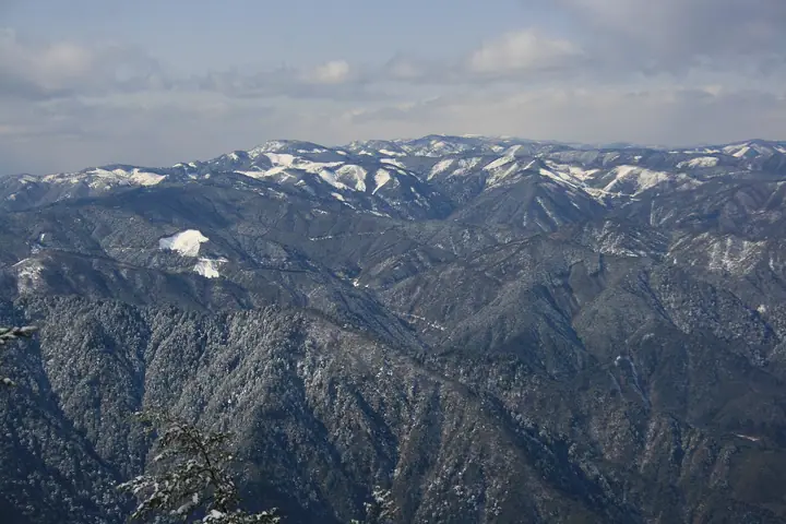
Mt. Okusangaidake (1,810 m), also locally known as Okusangai-san, straddles the border between Nakatsugawa City (Gifu) and the Kiso district (Nagi-Minamikiso Town and Okuwa Village, Nagano), at the northern end of the Adera mountains. Its summit area shelters primary forests of rhododendron, spruce and Japanese white pine and the Kagamiike pond wetland, and lies within Ura-Kiso Prefectural Natural Park. The peak is included in Japan's 300 Famous Mountains and the 100 Mountains of Gifu. The standard route from Yumori Park and Ryujin Falls on the southern foothills is currently closed by Nakatsugawa City due to a corroded suspension bridge, so climbers must check the city's notice before approaching.
สรุป Mt. Okusangaidake
- อากาศ: วันที่อากาศคงที่ที่สุดใน 7 วันข้างหน้าคือ พุธ 4 พฤศจิกายน: ท้องฟ้าแจ่มใส ลมกระโชกสูงสุด 7 ม./วินาที
- เส้นทาง: เส้นทางที่สั้นที่สุดคือ Mount Oku-Sangai Return from the Yumori Park Trailhead: ประมาณ 7 ชม. 44 นาที 13.6 km ขึ้นประมาณ 1,100 m
อากาศ Mt. Okusangaidake (รายชั่วโมง 2 สัปดาห์)
วันนี้พระอาทิตย์ขึ้น 06:13 ตก 16:54
| อังคาร 3/11 | พุธ 4/11 | พฤหัส 5/11 | ศุกร์ 6/11 | เสาร์ 7/11 | อาทิตย์ 8/11 | จันทร์ 9/11 | อังคาร 10/11 | พุธ 11/11 | พฤหัส 12/11 | ศุกร์ 13/11 | เสาร์ 14/11 | อาทิตย์ 15/11 | จันทร์ 16/11 | อังคาร 17/11 | |||||||||||||||||||||||||||||||||||||||||||||||||||||||||||||||||||||||
|---|---|---|---|---|---|---|---|---|---|---|---|---|---|---|---|---|---|---|---|---|---|---|---|---|---|---|---|---|---|---|---|---|---|---|---|---|---|---|---|---|---|---|---|---|---|---|---|---|---|---|---|---|---|---|---|---|---|---|---|---|---|---|---|---|---|---|---|---|---|---|---|---|---|---|---|---|---|---|---|---|---|---|---|---|---|
| เวลาญี่ปุ่น | 15 | 17 | 19 | 21 | 23 | 1 | 3 | 5 | 7 | 9 | 11 | 13 | 15 | 18 | 21 | 0 | 3 | 6 | 9 | 12 | 15 | 18 | 21 | 0 | 3 | 6 | 9 | 12 | 15 | 18 | 21 | 0 | 3 | 6 | 9 | 12 | 15 | 18 | 21 | 0 | 3 | 6 | 9 | 12 | 15 | 18 | 21 | 0 | 3 | 6 | 9 | 15 | 21 | 3 | 9 | 15 | 21 | 3 | 9 | 15 | 21 | 3 | 9 | 15 | 21 | 3 | 9 | 15 | 21 | 3 | 9 | 15 | 21 | 3 | 9 | 15 | 21 | 3 | 9 | 15 | 21 | 3 | 9 | 15 | |
 |  |   | | | | | |   | | |   |   |   | |   | | |   | |   | |   | | |   |   | | |  | | | | | | | | | | | | | | | | | | | | | | |   | | | | |   | | | | | | |  | | | | | | | | | | | | | | | | | | | | ||
| อุณหภูมิ | °C | 11° | 6° | 3° | 1° | 0° | 0° | -1° | -1° | 0° | 9° | 11° | 12° | 10° | 6° | 6° | 5° | 5° | 5° | 8° | 11° | 11° | 7° | 7° | 5° | 7° | 7° | 7° | 11° | 10° | 4° | 2° | 1° | 0° | -1° | 4° | 6° | 4° | -1° | -3° | -5° | -5° | -5° | 5° | 7° | 6° | 2° | 2° | 2° | 2° | 2° | 6° | 8° | 1° | -3° | 5° | 6° | 1° | -2° | 0° | 4° | -5° | -6° | 4° | 5° | -2° | -2° | 5° | 7° | -4° | -5° | 4° | 6° | -1° | 2° | 7° | 8° | 5° | 6° | 7° | 10° | 0° | -3° | 5° | 5° |
| ฝนและหิมะ | mm | 8 | 11 | 0.2 | 0.8 | 0.1 | 0.5 | 1.1 | 0.3 | 1.1 | 0.2 | 1.4 | 0.5 | 0.2 | 0.3 | 23 | 17 | 1.2 | 1.0 | ||||||||||||||||||||||||||||||||||||||||||||||||||||||||||||||||||
| หิมะตก | cm | ||||||||||||||||||||||||||||||||||||||||||||||||||||||||||||||||||||||||||||||||||||
| หิมะสะสม | cm | 0 | 0 | 0 | 0 | 0 | 0 | 0 | 0 | 0 | 0 | 0 | 0 | 0 | 0 | 0 | 0 | 0 | 0 | 0 | 0 | 0 | 0 | 0 | 0 | 0 | 0 | 0 | 0 | 0 | 0 | 0 | 0 | 0 | 0 | 0 | 0 | 0 | 0 | 0 | 0 | 0 | 0 | 0 | 0 | 0 | 0 | 0 | 0 | 0 | 0 | 0 | 0 | 0 | 0 | 0 | 0 | 0 | 0 | 0 | 0 | 0 | 0 | 0 | 0 | 0 | 0 | 0 | 0 | 0 | 0 | 0 | 0 | 0 | 0 | 0 | 0 | 0 | 0 | 0 | 0 | 0 | 0 | 0 | 0 |
| ลม | m/s | 2 | 0 | 1 | 1 | 1 | 2 | 2 | 2 | 2 | 1 | 1 | 2 | 1 | 1 | 2 | 2 | 2 | 3 | 2 | 1 | 1 | 0 | 1 | 1 | 0 | 0 | 1 | 4 | 4 | 1 | 1 | 1 | 1 | 1 | 2 | 4 | 3 | 1 | 2 | 2 | 2 | 2 | 1 | 2 | 2 | 0 | 0 | 1 | 1 | 1 | 1 | 3 | 0 | 2 | 1 | 3 | 1 | 2 | 1 | 3 | 2 | 2 | 1 | 2 | 1 | 0 | 1 | 2 | 3 | 2 | 0 | 2 | 1 | 1 | 1 | 1 | 0 | 1 | 1 | 4 | 1 | 2 | 0 | 1 |
| ลมกระโชก | m/s | 7 | 6 | 3 | 3 | 4 | 4 | 5 | 5 | 6 | 6 | 5 | 7 | 6 | 5 | 5 | 9 | 10 | 6 | 6 | 5 | 4 | 4 | 3 | 3 | 5 | 5 | 5 | 11 | 12 | 11 | 7 | 6 | 6 | 6 | 8 | 12 | 11 | 9 | 6 | 6 | 6 | 6 | 5 | 7 | 7 | 5 | 3 | 3 | 3 | 4 | 4 | 10 | 8 | 5 | 5 | 12 | 10 | 12 | 11 | 10 | 9 | 6 | 6 | 9 | 6 | 4 | 7 | 8 | 7 | 7 | 5 | 9 | 5 | 4 | 5 | 8 | 9 | 8 | 5 | 11 | 11 | 6 | 5 | 7 |
| ทิศทางลม | ↓ | ↓ | ↓ | ↓ | ↓ | ↓ | ↓ | ↓ | ↓ | ↓ | ↓ | ↓ | ↓ | ↓ | ↓ | ↓ | ↓ | ↓ | ↓ | ↓ | ↓ | ↓ | ↓ | ↓ | ↓ | ↓ | ↓ | ↓ | ↓ | ↓ | ↓ | ↓ | ↓ | ↓ | ↓ | ↓ | ↓ | ↓ | ↓ | ↓ | ↓ | ↓ | ↓ | ↓ | ↓ | ↓ | ↓ | ↓ | ↓ | ↓ | ↓ | ↓ | ↓ | ↓ | ↓ | ↓ | ↓ | ↓ | ↓ | ↓ | ↓ | ↓ | ↓ | ↓ | ↓ | ↓ | ↓ | ↓ | ↓ | ↓ | ↓ | ↓ | ↓ | ↓ | ↓ | ↓ | ↓ | ↓ | ↓ | ↓ | ↓ | ↓ | ↓ | ↓ | |
เส้นทางเดินป่า Mt. Okusangaidake
เวลาเดินเป็นค่าประมาณที่คำนวณจากภูมิประเทศ
รายชื่อที่มี Mt. Okusangaidake
300 ภูเขาที่มีชื่อเสียงของญี่ปุ่น · ภูเขา 100 แห่งของกิฟุ · ระดับความสูงของภูเขา 1003 แห่งในญี่ปุ่น · ภูเขา 1000 แห่งของญี่ปุ่น
ข้อมูลพื้นฐาน Mt. Okusangaidake
- ชื่ออื่น
- 奥三界山 · おくさんがいさん
- ความสูง
- 1,810 ม.
- ที่ตั้ง
- นากัตสึงาวะ, กิฟุ
35.681605, 137.507216 - เว็บไซต์
- www.city.nakatsugawa.lg.jp
- แผนที่เส้นทางเดินเขา
- www.pref.gifu.lg.jp (PDF)
- วิกิพีเดีย
- ja.wikipedia.org