
Mt. Myōjin
明神ヶ岳
Minamiashigara, Kanagawa · Elevation 1,169 m
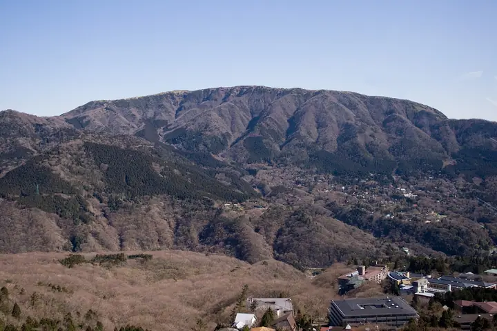
Mt. Myōjin (1,169 m) sits on the border of Minamiashigara City and Hakone Town in Kanagawa, one of the Hakone outer-rim peaks within Fuji-Hakone-Izu National Park. Long associated with the Dōryō-son sanctuary at Daiyū-zan Saijō-ji temple at its eastern foot, it is counted among the Ashigara Three Mountains together with Mt. Myōjō and Mt. Kintoki. Its broad, sasa-grass summit commands a 360-degree view that stretches over Mt. Kintoki to Mt. Fuji, down into the Hakone caldera and Sagami Bay, and across to the Tanzawa Range. The route up from Daiyūzan Station via the Dōryō-son shrine is the most popular, and the peak is listed among Japan's 100 Low Mountains and the 100 Famous Mountains of Kantō.
Mt. Myōjin at a glance
- Weather: The most settled day in the next 7 days is Fri, November 6: clear, gusts up to 6 m/s.
- Route: The shortest is Mount Myojingatake from Miyagino: about 6 h 6 min, 11.2 km, about 940 m of climbing.
Mt. Myōjin weather (hourly, 14 days)
Sunrise today 06:06, sunset 16:49
| Tue, 11/3 | Wed, 11/4 | Thu, 11/5 | Fri, 11/6 | Sat, 11/7 | Sun, 11/8 | Mon, 11/9 | Tue, 11/10 | Wed, 11/11 | Thu, 11/12 | Fri, 11/13 | Sat, 11/14 | Sun, 11/15 | Mon, 11/16 | Tue, 11/17 | |||||||||||||||||||||||||||||||||||||||||||||||||||||||||||||||||||||||
|---|---|---|---|---|---|---|---|---|---|---|---|---|---|---|---|---|---|---|---|---|---|---|---|---|---|---|---|---|---|---|---|---|---|---|---|---|---|---|---|---|---|---|---|---|---|---|---|---|---|---|---|---|---|---|---|---|---|---|---|---|---|---|---|---|---|---|---|---|---|---|---|---|---|---|---|---|---|---|---|---|---|---|---|---|---|
| Japan time | 15 | 17 | 19 | 21 | 23 | 1 | 3 | 5 | 7 | 9 | 11 | 13 | 15 | 18 | 21 | 0 | 3 | 6 | 9 | 12 | 15 | 18 | 21 | 0 | 3 | 6 | 9 | 12 | 15 | 18 | 21 | 0 | 3 | 6 | 9 | 12 | 15 | 18 | 21 | 0 | 3 | 6 | 9 | 12 | 15 | 18 | 21 | 0 | 3 | 6 | 9 | 15 | 21 | 3 | 9 | 15 | 21 | 3 | 9 | 15 | 21 | 3 | 9 | 15 | 21 | 3 | 9 | 15 | 21 | 3 | 9 | 15 | 21 | 3 | 9 | 15 | 21 | 3 | 9 | 15 | 21 | 3 | 9 | 15 | |
  |   |   | | | | |   |   | | | | | | | | | | |   |   |   |   | | | | | | | |  | | | | | | | | | | | |   | | | | | | | | | | | | |   | | |  | | | | | | |   | | | | | | | | | | | | | | | | | | | ||
| Temperature | °C | 13° | 11° | 10° | 9° | 9° | 9° | 9° | 9° | 8° | 10° | 10° | 10° | 8° | 8° | 8° | 8° | 8° | 9° | 12° | 17° | 14° | 12° | 10° | 8° | 7° | 9° | 14° | 18° | 17° | 12° | 9° | 10° | 9° | 8° | 12° | 12° | 11° | 8° | 7° | 6° | 5° | 5° | 9° | 11° | 10° | 7° | 6° | 7° | 7° | 7° | 7° | 9° | 7° | 5° | 7° | 9° | 5° | 5° | 9° | 12° | 4° | 3° | 7° | 8° | 6° | 4° | 9° | 11° | 5° | 3° | 5° | 8° | 6° | 3° | 9° | 13° | 10° | 10° | 13° | 16° | 10° | 5° | 5° | 7° |
| Precipitation | mm | 0.2 | 0.3 | 0.2 | 0.9 | 3.1 | 4.8 | 10 | 12 | 8 | 0.6 | 0.2 | 1.1 | 0.3 | 0.5 | 1.8 | 0.1 | 0.2 | 0.3 | 0.1 | 0.5 | 0.3 | 10 | 23 | 2.9 | 1.1 | 0.6 | ||||||||||||||||||||||||||||||||||||||||||||||||||||||||||
| New snow | cm | ||||||||||||||||||||||||||||||||||||||||||||||||||||||||||||||||||||||||||||||||||||
| Snow depth | cm | 0 | 0 | 0 | 0 | 0 | 0 | 0 | 0 | 0 | 0 | 0 | 0 | 0 | 0 | 0 | 0 | 0 | 0 | 0 | 0 | 0 | 0 | 0 | 0 | 0 | 0 | 0 | 0 | 0 | 0 | 0 | 0 | 0 | 0 | 0 | 0 | 0 | 0 | 0 | 0 | 0 | 0 | 0 | 0 | 0 | 0 | 0 | 0 | 0 | 0 | 0 | 0 | 0 | 0 | 0 | 0 | 0 | 0 | 0 | 0 | 0 | 0 | 0 | 0 | 0 | 0 | 0 | 0 | 0 | 0 | 0 | 0 | 0 | 0 | 0 | 0 | 0 | 0 | 0 | 0 | 0 | 0 | 0 | 0 |
| Wind | m/s | 1 | 0 | 0 | 1 | 0 | 1 | 2 | 2 | 2 | 2 | 2 | 2 | 2 | 2 | 3 | 3 | 4 | 3 | 2 | 1 | 1 | 0 | 0 | 0 | 2 | 1 | 0 | 1 | 1 | 0 | 1 | 1 | 0 | 1 | 1 | 3 | 2 | 0 | 0 | 0 | 0 | 0 | 1 | 1 | 1 | 1 | 1 | 1 | 1 | 1 | 1 | 2 | 1 | 1 | 2 | 2 | 0 | 1 | 2 | 0 | 1 | 0 | 1 | 2 | 1 | 1 | 0 | 1 | 1 | 1 | 1 | 2 | 1 | 1 | 1 | 3 | 1 | 1 | 2 | 1 | 1 | 1 | 1 | 1 |
| Wind gusts | m/s | 7 | 4 | 1 | 2 | 2 | 3 | 5 | 5 | 6 | 7 | 7 | 9 | 8 | 8 | 9 | 10 | 12 | 11 | 9 | 7 | 7 | 4 | 3 | 4 | 6 | 6 | 4 | 5 | 6 | 4 | 3 | 4 | 5 | 4 | 4 | 8 | 8 | 6 | 2 | 2 | 2 | 2 | 3 | 5 | 6 | 5 | 3 | 3 | 3 | 3 | 3 | 6 | 5 | 5 | 6 | 7 | 5 | 4 | 13 | 10 | 4 | 3 | 4 | 7 | 6 | 4 | 4 | 8 | 4 | 2 | 4 | 6 | 5 | 5 | 6 | 11 | 9 | 13 | 7 | 7 | 4 | 6 | 4 | 6 |
| Wind dir. | ↓ | ↓ | ↓ | ↓ | ↓ | ↓ | ↓ | ↓ | ↓ | ↓ | ↓ | ↓ | ↓ | ↓ | ↓ | ↓ | ↓ | ↓ | ↓ | ↓ | ↓ | ↓ | ↓ | ↓ | ↓ | ↓ | ↓ | ↓ | ↓ | ↓ | ↓ | ↓ | ↓ | ↓ | ↓ | ↓ | ↓ | ↓ | ↓ | ↓ | ↓ | ↓ | ↓ | ↓ | ↓ | ↓ | ↓ | ↓ | ↓ | ↓ | ↓ | ↓ | ↓ | ↓ | ↓ | ↓ | ↓ | ↓ | ↓ | ↓ | ↓ | ↓ | ↓ | ↓ | ↓ | ↓ | ↓ | ↓ | ↓ | ↓ | ↓ | ↓ | ↓ | ↓ | ↓ | ↓ | ↓ | ↓ | ↓ | ↓ | ↓ | ↓ | ↓ | ||
Mt. Myōjin hiking routes
- Mount Myojingatake from Miyagino 11.2 km · Ascent 941 m 宮城野橋 (Bus stop), 木賀坂下 (Bus stop), Miyagino Information bus stop (Bus stop)
- Mount Myojin Return from Kintoki Miharashi Parking via Yagurasawa Pass 10.5 km · Ascent 699 m 金時見晴パーキング
- Mount Kintoki and Mount Myojingatake Traverse from Kintoki Shrine to Miyagino 12.1 km · Ascent 1,006 m Kintoni-jinja-iriguchi (Bus stop) (parking) → Miyagino Information bus stop (Bus stop), 宮城野橋 (Bus stop) (parking)
- Hakone Outer Rim: Myōjōgatake, Myōjingatake and Kintokiyama 14.5 km · Ascent 1,361 m Gōra (Station), For S Line (Bus stop), 一番坂 (Bus stop) (parking) → Kintoki-tozanguchi (Bus stop), Sengoku (Bus stop) (parking)
Hiking times are estimates calculated from the terrain.
Huts, campsites and lodging near Mt. Myōjin
Mountain huts
- 明神ヶ岳見晴小屋
- Kintaro Chaya
Campsites
- sotosotodays CAMPGROUNDS
Lodging
- リブマックスリゾート箱根強羅 (家具付き)
- ホテルハーヴェスト 箱根明神平
- 箱根ねんねこや
- 箱根エレカーサ
- HAKONE NICA
Lists that include Mt. Myōjin
100 Low Mountains of Japan · Kanto 100 Famous Mountains · 1000 Mountains of Japan
Mt. Myōjin facts
- Elevation
- 1,169 m
- Location
- Minamiashigara, Kanagawa
35.279499, 139.052512 - National Park
- 富士箱根伊豆国立公園
- Trail Map
- www.pref.kanagawa.jp (PDF)
- Wikipedia
- ja.wikipedia.org