
Mt. Tonomine
塔ノ峰
Odawara, Kanagawa · Elevation 566 m
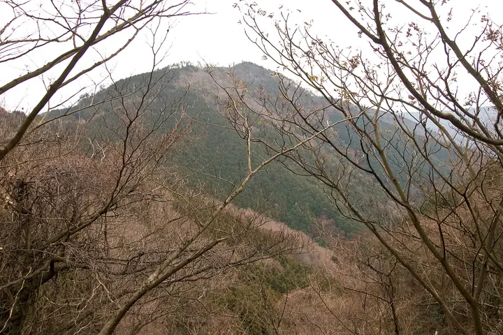
Mt. Tō-no-mine is a 566.3 m peak on the boundary between Odawara City and Hakone Town (Ashigara-Shimo District) in Kanagawa Prefecture, the easternmost summit of the older Hakone caldera rim. The name derives from the discovery of a stūpa containing Buddhist relics in a cave below Amida-ji Temple on the southern flank; a maintained trail climbs from Tōnosawa Station via Amida-ji to the summit, where the route joins the long Hakone outer-rim traverse continuing on to Mt. Myōjō, Mt. Myōjin and Mt. Kintoki. The mountain lies within Fuji-Hakone-Izu National Park; the summit is forested but a short detour to the north-west opens views to the Tanzawa range and Sagami Bay. It features in the 'Kanagawa Day-Hike Mountains', 'Tanzawa-Hakone Day Hikes' and 'Stations to Climb from in the Tokyo Region' selections — a popular gentle introduction to the Hakone outer rim.
Mt. Tonomine at a glance
- Weather: The most settled day in the next 7 days is Fri, November 6: clear, gusts up to 6 m/s.
Mt. Tonomine weather (hourly, 14 days)
Sunrise today 06:06, sunset 16:48
| Tue, 11/3 | Wed, 11/4 | Thu, 11/5 | Fri, 11/6 | Sat, 11/7 | Sun, 11/8 | Mon, 11/9 | Tue, 11/10 | Wed, 11/11 | Thu, 11/12 | Fri, 11/13 | Sat, 11/14 | Sun, 11/15 | Mon, 11/16 | Tue, 11/17 | |||||||||||||||||||||||||||||||||||||||||||||||||||||||||||||||||||||||
|---|---|---|---|---|---|---|---|---|---|---|---|---|---|---|---|---|---|---|---|---|---|---|---|---|---|---|---|---|---|---|---|---|---|---|---|---|---|---|---|---|---|---|---|---|---|---|---|---|---|---|---|---|---|---|---|---|---|---|---|---|---|---|---|---|---|---|---|---|---|---|---|---|---|---|---|---|---|---|---|---|---|---|---|---|---|
| Japan time | 15 | 17 | 19 | 21 | 23 | 1 | 3 | 5 | 7 | 9 | 11 | 13 | 15 | 18 | 21 | 0 | 3 | 6 | 9 | 12 | 15 | 18 | 21 | 0 | 3 | 6 | 9 | 12 | 15 | 18 | 21 | 0 | 3 | 6 | 9 | 12 | 15 | 18 | 21 | 0 | 3 | 6 | 9 | 12 | 15 | 18 | 21 | 0 | 3 | 6 | 9 | 15 | 21 | 3 | 9 | 15 | 21 | 3 | 9 | 15 | 21 | 3 | 9 | 15 | 21 | 3 | 9 | 15 | 21 | 3 | 9 | 15 | 21 | 3 | 9 | 15 | 21 | 3 | 9 | 15 | 21 | 3 | 9 | 15 | |
  |   |   | | | | |   |   | | | | | | | | | | |   |   |   |   | | | | | | | |  | | | | | | | | | | | |   | | | | | | | | | | | | |   | | |  | | | | | | |   | | | | | | | | | | | | | | | | | | | ||
| Temperature | °C | 16° | 14° | 14° | 13° | 13° | 13° | 13° | 12° | 12° | 13° | 14° | 14° | 12° | 12° | 12° | 12° | 12° | 13° | 16° | 21° | 18° | 16° | 14° | 12° | 11° | 13° | 18° | 22° | 21° | 16° | 13° | 14° | 13° | 12° | 16° | 16° | 15° | 12° | 11° | 10° | 9° | 9° | 13° | 15° | 14° | 11° | 10° | 11° | 11° | 11° | 11° | 13° | 11° | 9° | 11° | 13° | 9° | 9° | 13° | 16° | 8° | 7° | 11° | 12° | 10° | 8° | 13° | 15° | 9° | 7° | 8° | 12° | 10° | 7° | 13° | 16° | 14° | 14° | 17° | 20° | 14° | 9° | 9° | 10° |
| Precipitation | mm | 0.2 | 0.3 | 0.2 | 0.9 | 3.1 | 4.8 | 10 | 12 | 8 | 0.6 | 0.2 | 1.1 | 0.3 | 0.5 | 1.8 | 0.1 | 0.2 | 0.3 | 0.1 | 0.5 | 0.3 | 10 | 23 | 2.9 | 1.1 | 0.6 | ||||||||||||||||||||||||||||||||||||||||||||||||||||||||||
| New snow | cm | ||||||||||||||||||||||||||||||||||||||||||||||||||||||||||||||||||||||||||||||||||||
| Snow depth | cm | 0 | 0 | 0 | 0 | 0 | 0 | 0 | 0 | 0 | 0 | 0 | 0 | 0 | 0 | 0 | 0 | 0 | 0 | 0 | 0 | 0 | 0 | 0 | 0 | 0 | 0 | 0 | 0 | 0 | 0 | 0 | 0 | 0 | 0 | 0 | 0 | 0 | 0 | 0 | 0 | 0 | 0 | 0 | 0 | 0 | 0 | 0 | 0 | 0 | 0 | 0 | 0 | 0 | 0 | 0 | 0 | 0 | 0 | 0 | 0 | 0 | 0 | 0 | 0 | 0 | 0 | 0 | 0 | 0 | 0 | 0 | 0 | 0 | 0 | 0 | 0 | 0 | 0 | 0 | 0 | 0 | 0 | 0 | 0 |
| Wind | m/s | 1 | 0 | 0 | 1 | 0 | 1 | 2 | 2 | 2 | 2 | 2 | 2 | 2 | 2 | 3 | 3 | 4 | 3 | 2 | 1 | 1 | 0 | 0 | 0 | 2 | 1 | 0 | 1 | 1 | 0 | 1 | 1 | 0 | 1 | 1 | 3 | 2 | 0 | 0 | 0 | 0 | 0 | 1 | 1 | 1 | 1 | 1 | 1 | 1 | 1 | 1 | 2 | 1 | 1 | 2 | 2 | 0 | 1 | 2 | 0 | 1 | 0 | 1 | 2 | 1 | 1 | 0 | 1 | 1 | 1 | 1 | 2 | 1 | 1 | 1 | 3 | 1 | 1 | 2 | 1 | 1 | 1 | 1 | 1 |
| Wind gusts | m/s | 7 | 4 | 1 | 2 | 2 | 3 | 5 | 5 | 6 | 7 | 7 | 9 | 8 | 8 | 9 | 10 | 12 | 11 | 9 | 7 | 7 | 4 | 3 | 4 | 6 | 6 | 4 | 5 | 6 | 4 | 3 | 4 | 5 | 4 | 4 | 8 | 8 | 6 | 2 | 2 | 2 | 2 | 3 | 5 | 6 | 5 | 3 | 3 | 3 | 3 | 3 | 6 | 5 | 5 | 6 | 7 | 5 | 4 | 13 | 10 | 4 | 3 | 4 | 7 | 6 | 4 | 4 | 8 | 4 | 2 | 4 | 6 | 5 | 5 | 6 | 11 | 9 | 13 | 7 | 7 | 4 | 6 | 4 | 6 |
| Wind dir. | ↓ | ↓ | ↓ | ↓ | ↓ | ↓ | ↓ | ↓ | ↓ | ↓ | ↓ | ↓ | ↓ | ↓ | ↓ | ↓ | ↓ | ↓ | ↓ | ↓ | ↓ | ↓ | ↓ | ↓ | ↓ | ↓ | ↓ | ↓ | ↓ | ↓ | ↓ | ↓ | ↓ | ↓ | ↓ | ↓ | ↓ | ↓ | ↓ | ↓ | ↓ | ↓ | ↓ | ↓ | ↓ | ↓ | ↓ | ↓ | ↓ | ↓ | ↓ | ↓ | ↓ | ↓ | ↓ | ↓ | ↓ | ↓ | ↓ | ↓ | ↓ | ↓ | ↓ | ↓ | ↓ | ↓ | ↓ | ↓ | ↓ | ↓ | ↓ | ↓ | ↓ | ↓ | ↓ | ↓ | ↓ | ↓ | ↓ | ↓ | ↓ | ↓ | ↓ | ||
Huts, campsites and lodging near Mt. Tonomine
Campsites
- 小田原市いこいの森
Lodging
- Ichinoyu Honkan
- Fukuzumiro
- Shiunsu
- Yama No Chaya
- yama no Chaya
Mt. Tonomine facts
- Elevation
- 566 m
- Location
- Odawara, Kanagawa
35.242508, 139.097595 - National Park
- 富士箱根伊豆国立公園
- Website
- www.hakone.or.jp
- Trail Map
- www.hakone.or.jp (PDF)
- Wikipedia
- ja.wikipedia.org