
Mt. Motoyama
本山
Utsunomiya, Tochigi · Elevation 562 m
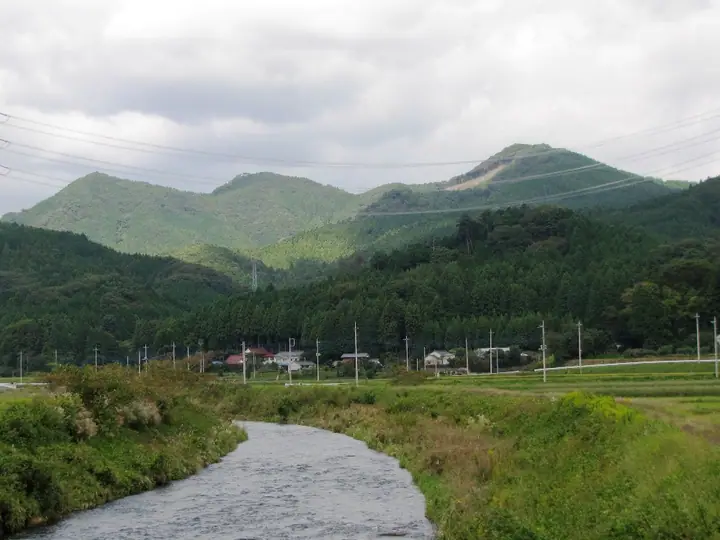
Mt. Motoyama is a 561.6 m peak in Shinoi-machi, Utsunomiya City, Tochigi Prefecture, the highest summit of the Shinoi-Tomiya Range, locally known as the "Utsunomiya Alps," stretching across the city's northern mountains. The summit offers views of the Nikko range, Takahara-san, and the Nasu range. A loop hike from the Utsunomiya Adventure Activity Center crosses Mt. Haruna and Mt. Iimori around the summit in roughly 2.5 hours. The peak is included in the Tochigi 100 Mountains, Tochigi 150, the Tochigi Prefecture mountains guidebook, and the Kanto Day-Hike 60.
Mt. Motoyama at a glance
- Weather: The most settled day in the next 7 days is Fri, November 6: clear, gusts up to 5 m/s.
Mt. Motoyama weather (hourly, 14 days)
Sunrise today 06:05, sunset 16:43
| Tue, 11/3 | Wed, 11/4 | Thu, 11/5 | Fri, 11/6 | Sat, 11/7 | Sun, 11/8 | Mon, 11/9 | Tue, 11/10 | Wed, 11/11 | Thu, 11/12 | Fri, 11/13 | Sat, 11/14 | Sun, 11/15 | Mon, 11/16 | Tue, 11/17 | |||||||||||||||||||||||||||||||||||||||||||||||||||||||||||||||||||||||
|---|---|---|---|---|---|---|---|---|---|---|---|---|---|---|---|---|---|---|---|---|---|---|---|---|---|---|---|---|---|---|---|---|---|---|---|---|---|---|---|---|---|---|---|---|---|---|---|---|---|---|---|---|---|---|---|---|---|---|---|---|---|---|---|---|---|---|---|---|---|---|---|---|---|---|---|---|---|---|---|---|---|---|---|---|---|
| Japan time | 15 | 17 | 19 | 21 | 23 | 1 | 3 | 5 | 7 | 9 | 11 | 13 | 15 | 18 | 21 | 0 | 3 | 6 | 9 | 12 | 15 | 18 | 21 | 0 | 3 | 6 | 9 | 12 | 15 | 18 | 21 | 0 | 3 | 6 | 9 | 12 | 15 | 18 | 21 | 0 | 3 | 6 | 9 | 12 | 15 | 18 | 21 | 0 | 3 | 6 | 9 | 15 | 21 | 3 | 9 | 15 | 21 | 3 | 9 | 15 | 21 | 3 | 9 | 15 | 21 | 3 | 9 | 15 | 21 | 3 | 9 | 15 | 21 | 3 | 9 | 15 | 21 | 3 | 9 | 15 | 21 | 3 | 9 | 15 | |
  |   | | |   | | | |   | | | |   |   | |   | | |   |   | |   | | | | |  | | | | | | | | | | | |  | | | | | | | | | | | | | | | | | | | |   | | |  | | | | | | | | | | | | | | | |   | | | | | | | ||
| Temperature | °C | 15° | 11° | 9° | 8° | 7° | 6° | 6° | 4° | 5° | 11° | 13° | 13° | 12° | 10° | 10° | 8° | 9° | 10° | 11° | 14° | 14° | 11° | 9° | 9° | 9° | 8° | 14° | 18° | 19° | 13° | 11° | 9° | 7° | 5° | 10° | 13° | 12° | 6° | 4° | 4° | 3° | 2° | 8° | 12° | 11° | 7° | 5° | 5° | 5° | 5° | 7° | 10° | 7° | 5° | 8° | 10° | 4° | 1° | 7° | 10° | 7° | 3° | 8° | 11° | 6° | 3° | 10° | 10° | 5° | 1° | 6° | 9° | 3° | 0° | 8° | 12° | 8° | 8° | 11° | 17° | 8° | 3° | 7° | 10° |
| Precipitation | mm | 2.4 | 8 | 11 | 9 | 0.6 | 0.7 | 0.2 | 0.3 | 0.8 | 0.3 | 2.2 | 4.3 | 11 | |||||||||||||||||||||||||||||||||||||||||||||||||||||||||||||||||||||||
| New snow | cm | ||||||||||||||||||||||||||||||||||||||||||||||||||||||||||||||||||||||||||||||||||||
| Snow depth | cm | 0 | 0 | 0 | 0 | 0 | 0 | 0 | 0 | 0 | 0 | 0 | 0 | 0 | 0 | 0 | 0 | 0 | 0 | 0 | 0 | 0 | 0 | 0 | 0 | 0 | 0 | 0 | 0 | 0 | 0 | 0 | 0 | 0 | 0 | 0 | 0 | 0 | 0 | 0 | 0 | 0 | 0 | 0 | 0 | 0 | 0 | 0 | 0 | 0 | 0 | 0 | 0 | 0 | 0 | 0 | 0 | 0 | 0 | 0 | 0 | 0 | 0 | 0 | 0 | 0 | 0 | 0 | 0 | 0 | 0 | 0 | 0 | 0 | 0 | 0 | 0 | 0 | 0 | 0 | 0 | 0 | 0 | 0 | 0 |
| Wind | m/s | 2 | 2 | 2 | 1 | 1 | 1 | 1 | 1 | 2 | 1 | 1 | 2 | 3 | 2 | 2 | 2 | 3 | 3 | 4 | 3 | 2 | 1 | 1 | 1 | 1 | 1 | 0 | 0 | 1 | 0 | 1 | 1 | 1 | 1 | 3 | 2 | 2 | 2 | 2 | 2 | 1 | 1 | 1 | 1 | 2 | 2 | 1 | 1 | 2 | 2 | 2 | 1 | 1 | 1 | 2 | 3 | 1 | 3 | 2 | 3 | 3 | 0 | 1 | 1 | 1 | 1 | 4 | 7 | 5 | 0 | 2 | 2 | 1 | 1 | 1 | 2 | 1 | 1 | 1 | 5 | 5 | 2 | 1 | 1 |
| Wind gusts | m/s | 6 | 5 | 4 | 3 | 3 | 2 | 3 | 3 | 3 | 4 | 4 | 6 | 6 | 6 | 5 | 5 | 5 | 6 | 8 | 8 | 7 | 4 | 2 | 2 | 2 | 3 | 3 | 5 | 4 | 3 | 2 | 2 | 4 | 3 | 7 | 8 | 7 | 6 | 5 | 4 | 4 | 3 | 4 | 5 | 6 | 6 | 4 | 3 | 4 | 4 | 4 | 5 | 4 | 5 | 5 | 6 | 8 | 4 | 6 | 11 | 10 | 6 | 4 | 5 | 4 | 2 | 9 | 15 | 15 | 9 | 5 | 6 | 5 | 3 | 4 | 6 | 5 | 3 | 4 | 11 | 16 | 11 | 5 | 5 |
| Wind dir. | ↓ | ↓ | ↓ | ↓ | ↓ | ↓ | ↓ | ↓ | ↓ | ↓ | ↓ | ↓ | ↓ | ↓ | ↓ | ↓ | ↓ | ↓ | ↓ | ↓ | ↓ | ↓ | ↓ | ↓ | ↓ | ↓ | ↓ | ↓ | ↓ | ↓ | ↓ | ↓ | ↓ | ↓ | ↓ | ↓ | ↓ | ↓ | ↓ | ↓ | ↓ | ↓ | ↓ | ↓ | ↓ | ↓ | ↓ | ↓ | ↓ | ↓ | ↓ | ↓ | ↓ | ↓ | ↓ | ↓ | ↓ | ↓ | ↓ | ↓ | ↓ | ↓ | ↓ | ↓ | ↓ | ↓ | ↓ | ↓ | ↓ | ↓ | ↓ | ↓ | ↓ | ↓ | ↓ | ↓ | ↓ | ↓ | ↓ | ↓ | ↓ | ↓ | ↓ | ↓ | |
Huts, campsites and lodging near Mt. Motoyama
Campsites
- 高間木キャンプ場
Lists that include Mt. Motoyama
Mt. Motoyama facts
- Elevation
- 562 m
- Location
- Utsunomiya, Tochigi
36.689250, 139.835513 - Website
- www.utsunomiya-cvb.org
- Trail Map
- www.utsunomiya-cvb.org (PDF)
- Wikipedia
- ja.wikipedia.org