
Mt. Kuratake
倉岳山
Ōtsuki-shi, Yamanashi · Elevation 990 m
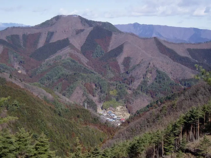
Mt. Kuratake (990 m) sits on the border of Ōtsuki and Uenohara in Yamanashi, the highest summit of the Akiyama Range and one of the 100 Famous Mountains of Yamanashi. Its view of Mt. Fuji is registered as Peak No. 9 of Ōtsuki City's "Twelve Splendid Fuji Views," and the trailheads at Yanagawa and Torisawa stations on the Chūō Main Line make it one of the most accessible Fuji-view hikes from Tokyo. The valley route up passes a small waterfall and water source, offering a cool climb even in summer; the broad summit—comfortable for twenty hikers—looks straight out at Mt. Fuji, with the Dōshi Range to the south and Mt. Ōgi and Mt. Takahata along the Chūō Line to the north.
Mt. Kuratake at a glance
- Weather: The most settled day in the next 7 days is Fri, November 6: clear, gusts up to 6 m/s.
- Route: The shortest is Mount Takahata and Mount Kuratake Traverse from Torisawa to Yanagawa: about 6 h 22 min, 11.9 km, about 1,010 m of climbing.
Mt. Kuratake weather (hourly, 14 days)
Sunrise today 06:07, sunset 16:48
| Tue, 11/3 | Wed, 11/4 | Thu, 11/5 | Fri, 11/6 | Sat, 11/7 | Sun, 11/8 | Mon, 11/9 | Tue, 11/10 | Wed, 11/11 | Thu, 11/12 | Fri, 11/13 | Sat, 11/14 | Sun, 11/15 | Mon, 11/16 | Tue, 11/17 | |||||||||||||||||||||||||||||||||||||||||||||||||||||||||||||||||||||||
|---|---|---|---|---|---|---|---|---|---|---|---|---|---|---|---|---|---|---|---|---|---|---|---|---|---|---|---|---|---|---|---|---|---|---|---|---|---|---|---|---|---|---|---|---|---|---|---|---|---|---|---|---|---|---|---|---|---|---|---|---|---|---|---|---|---|---|---|---|---|---|---|---|---|---|---|---|---|---|---|---|---|---|---|---|---|
| Japan time | 15 | 17 | 19 | 21 | 23 | 1 | 3 | 5 | 7 | 9 | 11 | 13 | 15 | 18 | 21 | 0 | 3 | 6 | 9 | 12 | 15 | 18 | 21 | 0 | 3 | 6 | 9 | 12 | 15 | 18 | 21 | 0 | 3 | 6 | 9 | 12 | 15 | 18 | 21 | 0 | 3 | 6 | 9 | 12 | 15 | 18 | 21 | 0 | 3 | 6 | 9 | 15 | 21 | 3 | 9 | 15 | 21 | 3 | 9 | 15 | 21 | 3 | 9 | 15 | 21 | 3 | 9 | 15 | 21 | 3 | 9 | 15 | 21 | 3 | 9 | 15 | 21 | 3 | 9 | 15 | 21 | 3 | 9 | 15 | |
  |   | | | |   | | |   | | | | | | | | | | |   |   | | | | | |  | | |  |   | |   | | | |   | | | |   | |   | | | | | | | | | | | | | | | | | |   |  | | | | | | | | | | | | | | | | | | | | | | | ||
| Temperature | °C | 12° | 10° | 9° | 8° | 8° | 7° | 6° | 6° | 6° | 7° | 8° | 8° | 7° | 6° | 6° | 7° | 7° | 7° | 10° | 15° | 14° | 11° | 9° | 8° | 8° | 7° | 14° | 20° | 18° | 12° | 10° | 10° | 9° | 5° | 11° | 14° | 10° | 6° | 5° | 5° | 5° | 4° | 9° | 12° | 9° | 7° | 6° | 5° | 4° | 4° | 5° | 8° | 4° | 3° | 5° | 9° | 4° | 3° | 6° | 10° | 1° | -1° | 7° | 8° | 5° | 1° | 9° | 11° | 2° | 1° | 5° | 8° | 3° | 2° | 10° | 14° | 9° | 8° | 14° | 16° | 6° | 5° | 4° | 7° |
| Precipitation | mm | 0.3 | 0.3 | 0.4 | 0.5 | 0.1 | 0.1 | 0.1 | 0.4 | 0.4 | 0.9 | 3.2 | 8 | 15 | 10 | 3.0 | 0.8 | 2.9 | 1.9 | 0.6 | 0.5 | 0.3 | 0.9 | 0.2 | 0.2 | 5 | 22 | 0.4 | 0.2 | ||||||||||||||||||||||||||||||||||||||||||||||||||||||||
| New snow | cm | ||||||||||||||||||||||||||||||||||||||||||||||||||||||||||||||||||||||||||||||||||||
| Snow depth | cm | 0 | 0 | 0 | 0 | 0 | 0 | 0 | 0 | 0 | 0 | 0 | 0 | 0 | 0 | 0 | 0 | 0 | 0 | 0 | 0 | 0 | 0 | 0 | 0 | 0 | 0 | 0 | 0 | 0 | 0 | 0 | 0 | 0 | 0 | 0 | 0 | 0 | 0 | 0 | 0 | 0 | 0 | 0 | 0 | 0 | 0 | 0 | 0 | 0 | 0 | 0 | 0 | 0 | 0 | 0 | 0 | 0 | 0 | 0 | 0 | 0 | 0 | 0 | 0 | 0 | 0 | 0 | 0 | 0 | 0 | 0 | 0 | 0 | 0 | 0 | 0 | 0 | 0 | 0 | 0 | 0 | 0 | 0 | 0 |
| Wind | m/s | 2 | 1 | 1 | 1 | 1 | 1 | 1 | 1 | 1 | 1 | 2 | 2 | 2 | 1 | 1 | 1 | 1 | 0 | 0 | 1 | 1 | 0 | 1 | 1 | 1 | 1 | 0 | 1 | 2 | 1 | 0 | 0 | 1 | 1 | 1 | 1 | 3 | 2 | 1 | 0 | 1 | 0 | 1 | 2 | 2 | 1 | 0 | 1 | 1 | 1 | 2 | 3 | 2 | 2 | 2 | 3 | 1 | 1 | 3 | 2 | 1 | 1 | 1 | 2 | 1 | 2 | 1 | 3 | 0 | 0 | 1 | 1 | 1 | 1 | 1 | 2 | 1 | 1 | 2 | 2 | 1 | 1 | 1 | 2 |
| Wind gusts | m/s | 6 | 5 | 3 | 3 | 3 | 3 | 4 | 4 | 3 | 4 | 5 | 6 | 6 | 5 | 4 | 5 | 4 | 5 | 4 | 8 | 5 | 4 | 3 | 3 | 4 | 4 | 4 | 4 | 6 | 5 | 2 | 2 | 4 | 4 | 5 | 7 | 8 | 7 | 4 | 3 | 2 | 2 | 4 | 7 | 8 | 7 | 3 | 3 | 3 | 3 | 5 | 8 | 7 | 6 | 6 | 8 | 8 | 4 | 11 | 10 | 7 | 4 | 4 | 6 | 5 | 4 | 5 | 9 | 8 | 2 | 4 | 6 | 5 | 3 | 5 | 9 | 6 | 6 | 7 | 8 | 7 | 4 | 5 | 6 |
| Wind dir. | ↓ | ↓ | ↓ | ↓ | ↓ | ↓ | ↓ | ↓ | ↓ | ↓ | ↓ | ↓ | ↓ | ↓ | ↓ | ↓ | ↓ | ↓ | ↓ | ↓ | ↓ | ↓ | ↓ | ↓ | ↓ | ↓ | ↓ | ↓ | ↓ | ↓ | ↓ | ↓ | ↓ | ↓ | ↓ | ↓ | ↓ | ↓ | ↓ | ↓ | ↓ | ↓ | ↓ | ↓ | ↓ | ↓ | ↓ | ↓ | ↓ | ↓ | ↓ | ↓ | ↓ | ↓ | ↓ | ↓ | ↓ | ↓ | ↓ | ↓ | ↓ | ↓ | ↓ | ↓ | ↓ | ↓ | ↓ | ↓ | ↓ | ↓ | ↓ | ↓ | ↓ | ↓ | ↓ | ↓ | ↓ | ↓ | ↓ | ↓ | ↓ | ↓ | ↓ | ↓ | |
Mt. Kuratake hiking routes
Hiking times are estimates calculated from the terrain.
Huts, campsites and lodging near Mt. Kuratake
Campsites
- アオゲラの森キャンプ場
- さかざわキャンプ場
Lodging
- 君恋温泉
Lists that include Mt. Kuratake
Yamanashi 100 Famous Mountains · 12 Beautiful Views of Mount Fuji in Otsuki City (Yamanashi Prefecture)
Mt. Kuratake facts
- Elevation
- 990 m
- Location
- Ōtsuki-shi, Yamanashi
35.584032, 139.019837 - Website
- otsuki-kanko.info
- Trail Map
- www.city.otsuki.yamanashi.jp (PDF)
- Wikipedia
- ja.wikipedia.org