
Mt. Kanyuudouyama
加入道山
Yamakita, Kanagawa / Dōshi-mura, Yamanashi · Elevation 1,418 m
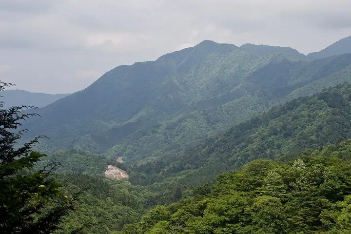
Kanyūdōyama is a 1,418 m peak straddling the boundary between Yamakita Town in Kanagawa and Dōshi Village in Yamanashi, set within the Nishi-Tanzawa portion of Tanzawa-Ōyama Quasi-National Park. The summit itself is forested with little view, but a well-kept emergency shelter sits just below the top and the ridgeline continues north to Ōmuroyama (1,587 m). The peak is included on the Kanagawa and Yamanashi hiking guides, the Tokyo 350 and the Yamanashi Hiking 100.
Mt. Kanyuudouyama at a glance
- Weather: The most settled day in the next 7 days is Fri, November 6: clear, gusts up to 6 m/s.
- Route: The shortest is Mount Kanyudo and Mount Omuro from Nishitanzawa Visitor Center: about 7 h 15 min, 10.9 km, about 1,180 m of climbing.
Mt. Kanyuudouyama weather (hourly, 14 days)
Sunrise today 06:07, sunset 16:48
| Tue, 11/3 | Wed, 11/4 | Thu, 11/5 | Fri, 11/6 | Sat, 11/7 | Sun, 11/8 | Mon, 11/9 | Tue, 11/10 | Wed, 11/11 | Thu, 11/12 | Fri, 11/13 | Sat, 11/14 | Sun, 11/15 | Mon, 11/16 | Tue, 11/17 | |||||||||||||||||||||||||||||||||||||||||||||||||||||||||||||||||||||||
|---|---|---|---|---|---|---|---|---|---|---|---|---|---|---|---|---|---|---|---|---|---|---|---|---|---|---|---|---|---|---|---|---|---|---|---|---|---|---|---|---|---|---|---|---|---|---|---|---|---|---|---|---|---|---|---|---|---|---|---|---|---|---|---|---|---|---|---|---|---|---|---|---|---|---|---|---|---|---|---|---|---|---|---|---|---|
| Japan time | 15 | 17 | 19 | 21 | 23 | 1 | 3 | 5 | 7 | 9 | 11 | 13 | 15 | 18 | 21 | 0 | 3 | 6 | 9 | 12 | 15 | 18 | 21 | 0 | 3 | 6 | 9 | 12 | 15 | 18 | 21 | 0 | 3 | 6 | 9 | 12 | 15 | 18 | 21 | 0 | 3 | 6 | 9 | 12 | 15 | 18 | 21 | 0 | 3 | 6 | 9 | 15 | 21 | 3 | 9 | 15 | 21 | 3 | 9 | 15 | 21 | 3 | 9 | 15 | 21 | 3 | 9 | 15 | 21 | 3 | 9 | 15 | 21 | 3 | 9 | 15 | 21 | 3 | 9 | 15 | 21 | 3 | 9 | 15 | |
  |   | | | |   | | |   | | | | | | | | | | |   |   | | | | | |  | | |  |   | |   | | | |   | | | |   | |   | | | | | | | | | | | | | | | | | |   |  | | | | | | | | | | | | | | | | | | | | | | | ||
| Temperature | °C | 9° | 7° | 6° | 5° | 5° | 4° | 4° | 3° | 3° | 4° | 5° | 5° | 4° | 3° | 3° | 4° | 4° | 4° | 7° | 12° | 11° | 8° | 6° | 5° | 5° | 4° | 12° | 17° | 15° | 9° | 8° | 7° | 6° | 3° | 9° | 11° | 7° | 3° | 2° | 3° | 2° | 1° | 7° | 9° | 7° | 4° | 3° | 2° | 2° | 1° | 2° | 5° | 2° | 0° | 2° | 6° | 2° | 0° | 3° | 7° | -2° | -4° | 4° | 6° | 2° | -1° | 6° | 8° | -1° | -1° | 2° | 5° | 0° | -1° | 7° | 11° | 6° | 6° | 11° | 14° | 4° | 2° | 1° | 4° |
| Precipitation | mm | 0.3 | 0.3 | 0.4 | 0.5 | 0.1 | 0.1 | 0.1 | 0.4 | 0.4 | 0.9 | 3.2 | 8 | 15 | 10 | 3.0 | 0.8 | 2.9 | 1.9 | 0.6 | 0.5 | 0.3 | 0.9 | 0.2 | 0.2 | 5 | 22 | 0.4 | 0.2 | ||||||||||||||||||||||||||||||||||||||||||||||||||||||||
| New snow | cm | ||||||||||||||||||||||||||||||||||||||||||||||||||||||||||||||||||||||||||||||||||||
| Snow depth | cm | 0 | 0 | 0 | 0 | 0 | 0 | 0 | 0 | 0 | 0 | 0 | 0 | 0 | 0 | 0 | 0 | 0 | 0 | 0 | 0 | 0 | 0 | 0 | 0 | 0 | 0 | 0 | 0 | 0 | 0 | 0 | 0 | 0 | 0 | 0 | 0 | 0 | 0 | 0 | 0 | 0 | 0 | 0 | 0 | 0 | 0 | 0 | 0 | 0 | 0 | 0 | 0 | 0 | 0 | 0 | 0 | 0 | 0 | 0 | 0 | 0 | 0 | 0 | 0 | 0 | 0 | 0 | 0 | 0 | 0 | 0 | 0 | 0 | 0 | 0 | 0 | 0 | 0 | 0 | 0 | 0 | 0 | 0 | 0 |
| Wind | m/s | 2 | 1 | 1 | 1 | 1 | 1 | 1 | 1 | 1 | 1 | 2 | 2 | 2 | 1 | 1 | 1 | 1 | 0 | 0 | 1 | 1 | 0 | 1 | 1 | 1 | 1 | 0 | 1 | 2 | 1 | 0 | 0 | 1 | 1 | 1 | 1 | 3 | 2 | 1 | 0 | 1 | 0 | 1 | 2 | 2 | 1 | 0 | 1 | 1 | 1 | 2 | 3 | 2 | 2 | 2 | 3 | 1 | 1 | 3 | 2 | 1 | 1 | 1 | 2 | 1 | 2 | 1 | 3 | 0 | 0 | 1 | 1 | 1 | 1 | 1 | 2 | 1 | 1 | 2 | 2 | 1 | 1 | 1 | 2 |
| Wind gusts | m/s | 6 | 5 | 3 | 3 | 3 | 3 | 4 | 4 | 3 | 4 | 5 | 6 | 6 | 5 | 4 | 5 | 4 | 5 | 4 | 8 | 5 | 4 | 3 | 3 | 4 | 4 | 4 | 4 | 6 | 5 | 2 | 2 | 4 | 4 | 5 | 7 | 8 | 7 | 4 | 3 | 2 | 2 | 4 | 7 | 8 | 7 | 3 | 3 | 3 | 3 | 5 | 8 | 7 | 6 | 6 | 8 | 8 | 4 | 11 | 10 | 7 | 4 | 4 | 6 | 5 | 4 | 5 | 9 | 8 | 2 | 4 | 6 | 5 | 3 | 5 | 9 | 6 | 6 | 7 | 8 | 7 | 4 | 5 | 6 |
| Wind dir. | ↓ | ↓ | ↓ | ↓ | ↓ | ↓ | ↓ | ↓ | ↓ | ↓ | ↓ | ↓ | ↓ | ↓ | ↓ | ↓ | ↓ | ↓ | ↓ | ↓ | ↓ | ↓ | ↓ | ↓ | ↓ | ↓ | ↓ | ↓ | ↓ | ↓ | ↓ | ↓ | ↓ | ↓ | ↓ | ↓ | ↓ | ↓ | ↓ | ↓ | ↓ | ↓ | ↓ | ↓ | ↓ | ↓ | ↓ | ↓ | ↓ | ↓ | ↓ | ↓ | ↓ | ↓ | ↓ | ↓ | ↓ | ↓ | ↓ | ↓ | ↓ | ↓ | ↓ | ↓ | ↓ | ↓ | ↓ | ↓ | ↓ | ↓ | ↓ | ↓ | ↓ | ↓ | ↓ | ↓ | ↓ | ↓ | ↓ | ↓ | ↓ | ↓ | ↓ | ↓ | |
Mt. Kanyuudouyama hiking routes
- Mount Kanyudo and Mount Omuro from Nishitanzawa Visitor Center 10.9 km · Ascent 1,177 m parking
- Mount Omuro and Mount Kanyudo Circuit in West Tanzawa 14.9 km · Ascent 1,248 m 西丹沢自然教室 (Bus stop) (parking)
- West Tanzawa Grand Loop through Border Beech Forest over Omuro, Kanyudo and Azegamaru 18.2 km · Ascent 1,656 m 西丹沢自然教室 (Bus stop) (parking)
Hiking times are estimates calculated from the terrain.
Huts, campsites and lodging near Mt. Kanyuudouyama
Mountain huts
Campsites
- THE Do-c camp! morokubo.GreenPark
- 道志森のコテージ
- 谷相郷キャンプ場
- やぐら沢キャンプ場
- 白石オートキャンプ場
Lodging
- 道志館
- 富士見荘
- 大屋
- 朝日屋
- 北の勢堂
Mt. Kanyuudouyama facts
- Also known as
- ガニュウドウ · カニュード丸
- Elevation
- 1,418 m
- Location
- Yamakita, Kanagawa / Dōshi-mura, Yamanashi
35.509763, 139.046252 - National Park
- 丹沢大山国定公園
- Website
- yamanashi-hiking100.jp