
Mt. Kumakura
熊倉山
Chichibu, Saitama · Elevation 1,427 m
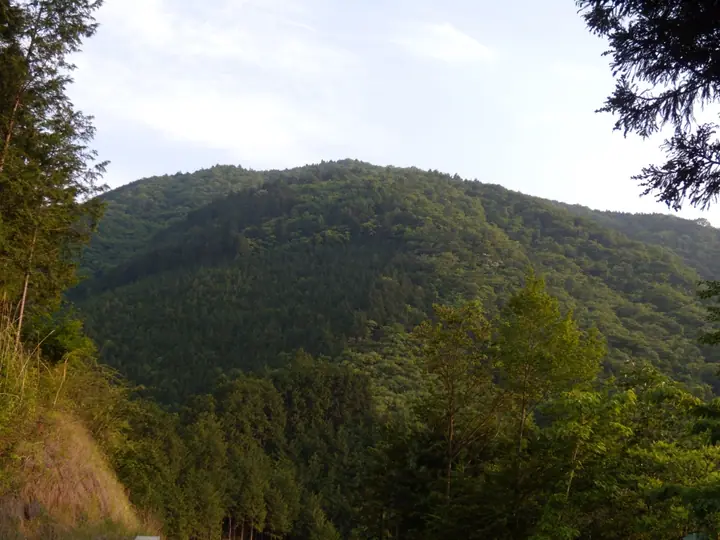
Kumakurasan is a 1,426.5 m peak in the southwestern part of Chichibu City, Saitama, sitting on a spur ridge that breaks off northwards from the Nagasawa-haisō backbone of the Oku-Chichibu range. The two standard approaches are the Shiroyama Course up from Shiroku Station and the Hino Course down to Bushū-Hino Station on the Chichibu Railway; both string together knife-edge ridges, chained rock steps and stream crossings and have a serious reputation despite the modest height. The mountain's deep, silent forest and the unusual frequency of route-finding accidents have earned it the nickname "the wilderness of Chichibu".
Mt. Kumakura at a glance
- Weather: The most settled day in the next 7 days is Fri, November 6: clear, gusts up to 8 m/s.
Mt. Kumakura weather (hourly, 14 days)
Sunrise today 06:08, sunset 16:48
| Tue, 11/3 | Wed, 11/4 | Thu, 11/5 | Fri, 11/6 | Sat, 11/7 | Sun, 11/8 | Mon, 11/9 | Tue, 11/10 | Wed, 11/11 | Thu, 11/12 | Fri, 11/13 | Sat, 11/14 | Sun, 11/15 | Mon, 11/16 | Tue, 11/17 | |||||||||||||||||||||||||||||||||||||||||||||||||||||||||||||||||||||||
|---|---|---|---|---|---|---|---|---|---|---|---|---|---|---|---|---|---|---|---|---|---|---|---|---|---|---|---|---|---|---|---|---|---|---|---|---|---|---|---|---|---|---|---|---|---|---|---|---|---|---|---|---|---|---|---|---|---|---|---|---|---|---|---|---|---|---|---|---|---|---|---|---|---|---|---|---|---|---|---|---|---|---|---|---|---|
| Japan time | 15 | 17 | 19 | 21 | 23 | 1 | 3 | 5 | 7 | 9 | 11 | 13 | 15 | 18 | 21 | 0 | 3 | 6 | 9 | 12 | 15 | 18 | 21 | 0 | 3 | 6 | 9 | 12 | 15 | 18 | 21 | 0 | 3 | 6 | 9 | 12 | 15 | 18 | 21 | 0 | 3 | 6 | 9 | 12 | 15 | 18 | 21 | 0 | 3 | 6 | 9 | 15 | 21 | 3 | 9 | 15 | 21 | 3 | 9 | 15 | 21 | 3 | 9 | 15 | 21 | 3 | 9 | 15 | 21 | 3 | 9 | 15 | 21 | 3 | 9 | 15 | 21 | 3 | 9 | 15 | 21 | 3 | 9 | 15 | |
  |   |   |   | | | | |   | | | | | | | | | | |   |   | | |   |  | |  |   | |   | | | | | | | | | | | | | |   | | | | | | | | | | | | | | | | |   |  | | | | | | | | | | | | | | | |   | | | | | | | ||
| Temperature | °C | 7° | 5° | 5° | 5° | 4° | 4° | 3° | 3° | 3° | 5° | 6° | 6° | 5° | 3° | 3° | 3° | 4° | 5° | 7° | 12° | 9° | 7° | 5° | 4° | 4° | 5° | 11° | 16° | 14° | 8° | 5° | 2° | 1° | 0° | 7° | 10° | 8° | 1° | -1° | -2° | -3° | -3° | 4° | 7° | 5° | 1° | 2° | 1° | 0° | 1° | 3° | 4° | 1° | 0° | 2° | 4° | 1° | -3° | 3° | 3° | -3° | -5° | 3° | 4° | 1° | -4° | 6° | 6° | -4° | -5° | 2° | 4° | -2° | -3° | 4° | 6° | 4° | 4° | 10° | 11° | 2° | 0° | 1° | 3° |
| Precipitation | mm | 0.2 | 0.3 | 0.5 | 0.6 | 0.2 | 0.3 | 0.2 | 0.2 | 0.6 | 0.4 | 5.0 | 11 | 11 | 1.2 | 1.6 | 0.4 | 0.2 | 0.4 | 0.8 | 0.2 | 0.5 | 1.2 | 4.3 | 1.5 | 0.3 | 4.1 | 12 | 0.2 | ||||||||||||||||||||||||||||||||||||||||||||||||||||||||
| New snow | cm | <.1 | <.1 | ||||||||||||||||||||||||||||||||||||||||||||||||||||||||||||||||||||||||||||||||||
| Snow depth | cm | 0 | 0 | 0 | 0 | 0 | 0 | 0 | 0 | 0 | 0 | 0 | 0 | 0 | 0 | 0 | 0 | 0 | 0 | 0 | 0 | 0 | 0 | 0 | 0 | 0 | 0 | 0 | 0 | 0 | 0 | 0 | 0 | 0 | 0 | 0 | 0 | 0 | 0 | 0 | 0 | 0 | 0 | 0 | 0 | 0 | 0 | 0 | 0 | 0 | 0 | 0 | 0 | 0 | <1 | <1 | <1 | 0 | 0 | 0 | 0 | 0 | 0 | 0 | 0 | 0 | 0 | 0 | 0 | 0 | 0 | 0 | 0 | 0 | 0 | 0 | 0 | 0 | 0 | 0 | 0 | 0 | 0 | 0 | 0 |
| Wind | m/s | 2 | 1 | 0 | 0 | 1 | 1 | 1 | 0 | 1 | 1 | 2 | 2 | 2 | 2 | 1 | 1 | 1 | 0 | 1 | 1 | 1 | 0 | 1 | 0 | 1 | 1 | 1 | 2 | 3 | 0 | 1 | 1 | 1 | 1 | 2 | 2 | 3 | 1 | 0 | 0 | 1 | 0 | 1 | 2 | 3 | 0 | 0 | 1 | 1 | 0 | 2 | 2 | 1 | 1 | 2 | 3 | 1 | 1 | 7 | 5 | 2 | 1 | 1 | 3 | 0 | 1 | 4 | 4 | 1 | 0 | 1 | 2 | 0 | 1 | 0 | 2 | 0 | 0 | 0 | 5 | 3 | 0 | 2 | 3 |
| Wind gusts | m/s | 7 | 6 | 2 | 2 | 2 | 3 | 3 | 3 | 2 | 4 | 6 | 7 | 7 | 6 | 5 | 4 | 3 | 5 | 4 | 5 | 6 | 4 | 3 | 3 | 3 | 3 | 3 | 7 | 8 | 8 | 3 | 5 | 5 | 5 | 6 | 9 | 9 | 9 | 3 | 3 | 3 | 3 | 5 | 8 | 9 | 7 | 2 | 3 | 3 | 3 | 5 | 8 | 5 | 5 | 6 | 9 | 8 | 6 | 23 | 22 | 17 | 6 | 5 | 10 | 8 | 4 | 12 | 15 | 11 | 5 | 5 | 8 | 6 | 3 | 3 | 7 | 4 | 5 | 5 | 14 | 15 | 10 | 6 | 9 |
| Wind dir. | ↓ | ↓ | ↓ | ↓ | ↓ | ↓ | ↓ | ↓ | ↓ | ↓ | ↓ | ↓ | ↓ | ↓ | ↓ | ↓ | ↓ | ↓ | ↓ | ↓ | ↓ | ↓ | ↓ | ↓ | ↓ | ↓ | ↓ | ↓ | ↓ | ↓ | ↓ | ↓ | ↓ | ↓ | ↓ | ↓ | ↓ | ↓ | ↓ | ↓ | ↓ | ↓ | ↓ | ↓ | ↓ | ↓ | ↓ | ↓ | ↓ | ↓ | ↓ | ↓ | ↓ | ↓ | ↓ | ↓ | ↓ | ↓ | ↓ | ↓ | ↓ | ↓ | ↓ | ↓ | ↓ | ↓ | ↓ | ↓ | ↓ | ↓ | ↓ | ↓ | ↓ | ↓ | ↓ | ↓ | ↓ | ↓ | ↓ | ↓ | ↓ | ↓ | ↓ | ↓ | |
Huts, campsites and lodging near Mt. Kumakura
Mountain huts
Lodging
- Guesthouse Nishiki
- Satoji
Lists that include Mt. Kumakura
50 Mountains of Saitama Prefecture · 1000 Mountains of Japan
Mt. Kumakura facts
- Elevation
- 1,427 m
- Location
- Chichibu, Saitama
35.924710, 138.991229 - Website
- navi.city.chichibu.lg.jp
- Wikipedia
- ja.wikipedia.org