
Mt. Kumabushiyama
熊伏山
Tenryū-mura, Nagano / Iida, Nagano · Elevation 1,653 m
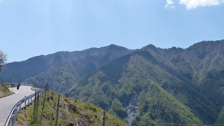
Kumabushi-yama (1,653 m) lies on the border between Iida City and Tenryū Village in southern Nagano Prefecture, just above the historic Akiha Highway near the Nagano–Shizuoka boundary. It is listed among the 300 Famous Mountains of Japan and the 100 Famous Mountains of Shinshū; the Aokuzure Pass on its eastern flank is renowned as one of the visible traces of the Median Tectonic Line. Trailheads on the Tenryū-village side (Hiraoka and Minami-Shinano) and on the Mizukubo side in Hamamatsu (Shizuoka) all follow segments of the old Shio-no-michi salt road before climbing the steep border ridge to the summit.
Mt. Kumabushiyama at a glance
- Weather: The most settled day in the next 7 days is Sun, November 8: clear, gusts up to 9 m/s. Sat, Nov 7: strong wind (gusts up to 17 m/s).
Mt. Kumabushiyama weather (hourly, 14 days)
Sunrise today 06:11, sunset 16:53
| Tue, 11/3 | Wed, 11/4 | Thu, 11/5 | Fri, 11/6 | Sat, 11/7 | Sun, 11/8 | Mon, 11/9 | Tue, 11/10 | Wed, 11/11 | Thu, 11/12 | Fri, 11/13 | Sat, 11/14 | Sun, 11/15 | Mon, 11/16 | Tue, 11/17 | |||||||||||||||||||||||||||||||||||||||||||||||||||||||||||||||||||||||
|---|---|---|---|---|---|---|---|---|---|---|---|---|---|---|---|---|---|---|---|---|---|---|---|---|---|---|---|---|---|---|---|---|---|---|---|---|---|---|---|---|---|---|---|---|---|---|---|---|---|---|---|---|---|---|---|---|---|---|---|---|---|---|---|---|---|---|---|---|---|---|---|---|---|---|---|---|---|---|---|---|---|---|---|---|---|
| Japan time | 15 | 17 | 19 | 21 | 23 | 1 | 3 | 5 | 7 | 9 | 11 | 13 | 15 | 18 | 21 | 0 | 3 | 6 | 9 | 12 | 15 | 18 | 21 | 0 | 3 | 6 | 9 | 12 | 15 | 18 | 21 | 0 | 3 | 6 | 9 | 12 | 15 | 18 | 21 | 0 | 3 | 6 | 9 | 12 | 15 | 18 | 21 | 0 | 3 | 6 | 9 | 15 | 21 | 3 | 9 | 15 | 21 | 3 | 9 | 15 | 21 | 3 | 9 | 15 | 21 | 3 | 9 | 15 | 21 | 3 | 9 | 15 | 21 | 3 | 9 | 15 | 21 | 3 | 9 | 15 | 21 | 3 | 9 | 15 | |
 |   |   | | | |   | |   |   | |   | |   | | | | |   | | | | | | | | |   | |  | | | | | | | | | | | | | | | | | | | | | | | | | | | |   | | |   | | | |  | | | | | | | | | | | | | | | | | |   | | ||
| Temperature | °C | 11° | 5° | 4° | 4° | 2° | 0° | -1° | 0° | 2° | 6° | 11° | 9° | 9° | 6° | 5° | 5° | 5° | 5° | 8° | 12° | 9° | 7° | 7° | 4° | 5° | 6° | 9° | 13° | 10° | 5° | 3° | 2° | 1° | 0° | 4° | 6° | 5° | 0° | -2° | -4° | -4° | -5° | 4° | 8° | 7° | 2° | 2° | 2° | 2° | 2° | 7° | 8° | 0° | -1° | 5° | 6° | 0° | -1° | 1° | 5° | -4° | -4° | 2° | 6° | -3° | -3° | 4° | 8° | -2° | -2° | 3° | 6° | -1° | 0° | 7° | 6° | 5° | 5° | 9° | 11° | 0° | 2° | 3° | 6° |
| Precipitation | mm | 0.3 | 0.4 | 0.7 | 1.4 | 7 | 9 | 2.9 | 0.4 | 0.6 | 0.6 | 0.2 | 0.3 | 0.5 | 16 | 23 | 0.9 | 0.1 | 0.2 | 0.8 | |||||||||||||||||||||||||||||||||||||||||||||||||||||||||||||||||
| New snow | cm | ||||||||||||||||||||||||||||||||||||||||||||||||||||||||||||||||||||||||||||||||||||
| Snow depth | cm | 0 | 0 | 0 | 0 | 0 | 0 | 0 | 0 | 0 | 0 | 0 | 0 | 0 | 0 | 0 | 0 | 0 | 0 | 0 | 0 | 0 | 0 | 0 | 0 | 0 | 0 | 0 | 0 | 0 | 0 | 0 | 0 | 0 | 0 | 0 | 0 | 0 | 0 | 0 | 0 | 0 | 0 | 0 | 0 | 0 | 0 | 0 | 0 | 0 | 0 | 0 | 0 | 0 | 0 | 0 | 0 | 0 | 0 | 0 | 0 | 0 | 0 | 0 | 0 | 0 | 0 | 0 | 0 | 0 | 0 | 0 | 0 | 0 | 0 | 0 | 0 | 0 | 0 | 0 | 0 | 0 | 0 | 0 | 0 |
| Wind | m/s | 3 | 3 | 1 | 0 | 0 | 0 | 1 | 1 | 1 | 1 | 1 | 2 | 1 | 0 | 1 | 1 | 1 | 2 | 2 | 2 | 0 | 1 | 0 | 1 | 0 | 1 | 3 | 4 | 4 | 3 | 3 | 3 | 4 | 4 | 5 | 6 | 5 | 2 | 1 | 1 | 1 | 1 | 1 | 2 | 3 | 2 | 1 | 1 | 0 | 1 | 1 | 3 | 1 | 0 | 0 | 3 | 1 | 5 | 6 | 4 | 1 | 1 | 0 | 3 | 0 | 1 | 3 | 2 | 1 | 1 | 1 | 3 | 0 | 1 | 1 | 3 | 1 | 1 | 3 | 5 | 3 | 1 | 1 | 3 |
| Wind gusts | m/s | 9 | 10 | 7 | 4 | 2 | 1 | 2 | 2 | 3 | 4 | 5 | 5 | 5 | 4 | 5 | 9 | 9 | 9 | 7 | 7 | 7 | 4 | 3 | 3 | 4 | 5 | 9 | 11 | 11 | 11 | 9 | 10 | 12 | 13 | 15 | 17 | 17 | 14 | 7 | 4 | 4 | 4 | 4 | 7 | 9 | 8 | 4 | 3 | 3 | 3 | 4 | 9 | 8 | 4 | 3 | 10 | 8 | 14 | 16 | 16 | 11 | 4 | 3 | 9 | 8 | 5 | 8 | 10 | 6 | 5 | 5 | 9 | 8 | 3 | 4 | 8 | 9 | 8 | 8 | 16 | 15 | 9 | 4 | 11 |
| Wind dir. | ↓ | ↓ | ↓ | ↓ | ↓ | ↓ | ↓ | ↓ | ↓ | ↓ | ↓ | ↓ | ↓ | ↓ | ↓ | ↓ | ↓ | ↓ | ↓ | ↓ | ↓ | ↓ | ↓ | ↓ | ↓ | ↓ | ↓ | ↓ | ↓ | ↓ | ↓ | ↓ | ↓ | ↓ | ↓ | ↓ | ↓ | ↓ | ↓ | ↓ | ↓ | ↓ | ↓ | ↓ | ↓ | ↓ | ↓ | ↓ | ↓ | ↓ | ↓ | ↓ | ↓ | ↓ | ↓ | ↓ | ↓ | ↓ | ↓ | ↓ | ↓ | ↓ | ↓ | ↓ | ↓ | ↓ | ↓ | ↓ | ↓ | ↓ | ↓ | ↓ | ↓ | ↓ | ↓ | ↓ | ↓ | ↓ | ↓ | ↓ | ↓ | ↓ | ↓ | ↓ | |
Huts, campsites and lodging near Mt. Kumabushiyama
Campsites
- Tenjin no Mori Auto Campground
Lodging
- Minshuku Konota
- いろりの宿 島畑
Lists that include Mt. Kumabushiyama
Japan's 300 Famous Mountains · Shinshu 100 Famous Mountains · 100 Mountains of Misakubo · Elevations of 1003 Mountains of Japan · 1000 Mountains of Japan
Mt. Kumabushiyama facts
- Elevation
- 1,653 m
- Location
- Tenryū-mura, Nagano / Iida, Nagano
35.263242, 137.894908 - Website
- www.vill-tenryu.jp
- Wikipedia
- ja.wikipedia.org