
Mt. Kinokoyama
きのこ山
Sakuragawa, Ibaraki · Elevation 528 m
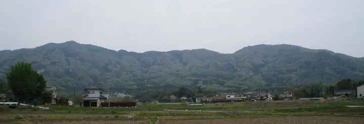
Kinoko-yama is a 527.9 m peak on the boundary between Sakuragawa and Ishioka cities in Ibaraki Prefecture, set in the northern part of the Tsukuba range along the ridge connecting Mt. Ontake, Mt. Amabiki, Mt. Tsubame, Mt. Kaba and Mt. Ashio. Its name — 'Mushroom Mountain' — derives not from any mushroom shape but from the abundance of fungi on its slopes. The Kantō Fureai-no-Michi trail traverses the area, and the peak forms the closing section of the popular 8-hour ridge traverse from Iwase Station over Mt. Ontake, Mt. Kaba and Mt. Ashio; a shorter approach from Makabe-Jō-ato bus stop or the Makabe rest area takes about 80 minutes. The mountain features in the 'Mountains of Ibaraki' prefectural climbing guide and is popular with Kantō-region ridge hikers.
Mt. Kinokoyama at a glance
- Weather: The most settled day in the next 7 days is Sun, November 8: clear, gusts up to 5 m/s.
Mt. Kinokoyama weather (hourly, 14 days)
Sunrise today 06:04, sunset 16:43
| Tue, 11/3 | Wed, 11/4 | Thu, 11/5 | Fri, 11/6 | Sat, 11/7 | Sun, 11/8 | Mon, 11/9 | Tue, 11/10 | Wed, 11/11 | Thu, 11/12 | Fri, 11/13 | Sat, 11/14 | Sun, 11/15 | Mon, 11/16 | Tue, 11/17 | |||||||||||||||||||||||||||||||||||||||||||||||||||||||||||||||||||||||
|---|---|---|---|---|---|---|---|---|---|---|---|---|---|---|---|---|---|---|---|---|---|---|---|---|---|---|---|---|---|---|---|---|---|---|---|---|---|---|---|---|---|---|---|---|---|---|---|---|---|---|---|---|---|---|---|---|---|---|---|---|---|---|---|---|---|---|---|---|---|---|---|---|---|---|---|---|---|---|---|---|---|---|---|---|---|
| Japan time | 15 | 17 | 19 | 21 | 23 | 1 | 3 | 5 | 7 | 9 | 11 | 13 | 15 | 18 | 21 | 0 | 3 | 6 | 9 | 12 | 15 | 18 | 21 | 0 | 3 | 6 | 9 | 12 | 15 | 18 | 21 | 0 | 3 | 6 | 9 | 12 | 15 | 18 | 21 | 0 | 3 | 6 | 9 | 12 | 15 | 18 | 21 | 0 | 3 | 6 | 9 | 15 | 21 | 3 | 9 | 15 | 21 | 3 | 9 | 15 | 21 | 3 | 9 | 15 | 21 | 3 | 9 | 15 | 21 | 3 | 9 | 15 | 21 | 3 | 9 | 15 | 21 | 3 | 9 | 15 | 21 | 3 | 9 | 15 | |
  |   |   |   | | | | | |   | | | | |   | | | |   |   | |   |   | | | |   |  | |  | | | | | | | | | | | | | | | | | | | | | | | | | |   | |   | | | |  | | | | | | | | | | | | | | | | | | | | | | | ||
| Temperature | °C | 16° | 12° | 11° | 11° | 10° | 10° | 10° | 10° | 10° | 11° | 12° | 13° | 12° | 11° | 10° | 9° | 9° | 10° | 11° | 14° | 15° | 12° | 10° | 11° | 11° | 10° | 14° | 19° | 19° | 14° | 12° | 11° | 11° | 7° | 12° | 14° | 13° | 7° | 4° | 7° | 7° | 4° | 9° | 12° | 13° | 8° | 8° | 7° | 7° | 7° | 8° | 10° | 8° | 7° | 9° | 8° | 4° | 3° | 9° | 12° | 6° | 4° | 9° | 11° | 8° | 4° | 11° | 11° | 5° | 2° | 7° | 10° | 4° | 5° | 10° | 14° | 11° | 10° | 12° | 18° | 8° | 5° | 7° | 9° |
| Precipitation | mm | 0.1 | 3.2 | 3.0 | 15 | 23 | 3.3 | 4.0 | 0.2 | 0.1 | 0.1 | 0.1 | 0.2 | 3.2 | 8 | ||||||||||||||||||||||||||||||||||||||||||||||||||||||||||||||||||||||
| New snow | cm | ||||||||||||||||||||||||||||||||||||||||||||||||||||||||||||||||||||||||||||||||||||
| Snow depth | cm | 0 | 0 | 0 | 0 | 0 | 0 | 0 | 0 | 0 | 0 | 0 | 0 | 0 | 0 | 0 | 0 | 0 | 0 | 0 | 0 | 0 | 0 | 0 | 0 | 0 | 0 | 0 | 0 | 0 | 0 | 0 | 0 | 0 | 0 | 0 | 0 | 0 | 0 | 0 | 0 | 0 | 0 | 0 | 0 | 0 | 0 | 0 | 0 | 0 | 0 | 0 | 0 | 0 | 0 | 0 | 0 | 0 | 0 | 0 | 0 | 0 | 0 | 0 | 0 | 0 | 0 | 0 | 0 | 0 | 0 | 0 | 0 | 0 | 0 | 0 | 0 | 0 | 0 | 0 | 0 | 0 | 0 | 0 | 0 |
| Wind | m/s | 2 | 2 | 3 | 2 | 2 | 2 | 2 | 2 | 2 | 2 | 3 | 3 | 2 | 2 | 2 | 3 | 4 | 5 | 5 | 2 | 1 | 1 | 1 | 1 | 1 | 1 | 1 | 2 | 2 | 1 | 3 | 3 | 2 | 1 | 2 | 5 | 5 | 1 | 1 | 1 | 2 | 1 | 2 | 0 | 2 | 2 | 2 | 2 | 2 | 2 | 3 | 3 | 3 | 3 | 4 | 4 | 1 | 2 | 4 | 4 | 2 | 0 | 1 | 2 | 0 | 1 | 2 | 5 | 3 | 2 | 1 | 2 | 1 | 1 | 1 | 2 | 2 | 1 | 1 | 4 | 2 | 3 | 2 | 3 |
| Wind gusts | m/s | 6 | 6 | 6 | 7 | 4 | 5 | 6 | 5 | 4 | 5 | 6 | 7 | 6 | 5 | 5 | 7 | 8 | 12 | 13 | 11 | 6 | 2 | 3 | 3 | 3 | 4 | 5 | 5 | 6 | 4 | 8 | 7 | 6 | 4 | 6 | 12 | 14 | 11 | 4 | 4 | 5 | 5 | 5 | 5 | 4 | 6 | 5 | 4 | 5 | 5 | 6 | 7 | 7 | 7 | 8 | 9 | 9 | 4 | 9 | 11 | 10 | 6 | 3 | 6 | 4 | 2 | 6 | 11 | 11 | 7 | 5 | 5 | 5 | 3 | 3 | 8 | 6 | 8 | 5 | 9 | 16 | 9 | 6 | 6 |
| Wind dir. | ↓ | ↓ | ↓ | ↓ | ↓ | ↓ | ↓ | ↓ | ↓ | ↓ | ↓ | ↓ | ↓ | ↓ | ↓ | ↓ | ↓ | ↓ | ↓ | ↓ | ↓ | ↓ | ↓ | ↓ | ↓ | ↓ | ↓ | ↓ | ↓ | ↓ | ↓ | ↓ | ↓ | ↓ | ↓ | ↓ | ↓ | ↓ | ↓ | ↓ | ↓ | ↓ | ↓ | ↓ | ↓ | ↓ | ↓ | ↓ | ↓ | ↓ | ↓ | ↓ | ↓ | ↓ | ↓ | ↓ | ↓ | ↓ | ↓ | ↓ | ↓ | ↓ | ↓ | ↓ | ↓ | ↓ | ↓ | ↓ | ↓ | ↓ | ↓ | ↓ | ↓ | ↓ | ↓ | ↓ | ↓ | ↓ | ↓ | ↓ | ↓ | ↓ | ↓ | ↓ | |
Huts, campsites and lodging near Mt. Kinokoyama
Campsites
- つくばねオートキャンプ場
- 桜川市 筑波高原キャンプ場
Lodging
- Tsukubane
Mt. Kinokoyama facts
- Elevation
- 528 m
- Location
- Sakuragawa, Ibaraki
36.266672, 140.134129 - Website
- www.kankou-sakuragawa.jp
- Wikipedia
- ja.wikipedia.org