
Mt. Kawageta
川桁山
Inawashiro, Fukushima · Elevation 1,413 m
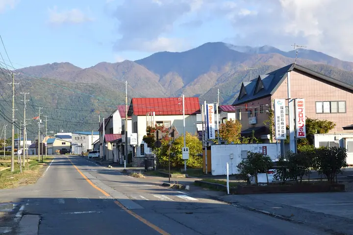
Mt. Kawageta (1,413 m) rises on the border between Inawashiro Town in Yama District and Kōriyama City in Fukushima Prefecture, and is included in the Utsukushima 100, Aizu 100 and Michinoku 120 mountain lists. It stands on the eastern rim of the Inawashiro Basin in the Kawageta range, and its summit offers a panorama of Mt. Bandai, Lake Inawashiro, the Azuma Range and the Nasu Range. The trailhead lies about a fifteen-minute walk from Kawageta Station on the JR Banetsu West Line.
Mt. Kawageta at a glance
- Weather: The most settled day in the next 7 days is Wed, November 4: clear, gusts up to 6 m/s. Fri, Nov 6, Sat, Nov 7, Sun, Nov 8: strong wind (gusts up to 24 m/s).
Mt. Kawageta weather (hourly, 14 days)
Sunrise today 06:05, sunset 16:40
| Tue, 11/3 | Wed, 11/4 | Thu, 11/5 | Fri, 11/6 | Sat, 11/7 | Sun, 11/8 | Mon, 11/9 | Tue, 11/10 | Wed, 11/11 | Thu, 11/12 | Fri, 11/13 | Sat, 11/14 | Sun, 11/15 | Mon, 11/16 | Tue, 11/17 | |||||||||||||||||||||||||||||||||||||||||||||||||||||||||||||||||||||||
|---|---|---|---|---|---|---|---|---|---|---|---|---|---|---|---|---|---|---|---|---|---|---|---|---|---|---|---|---|---|---|---|---|---|---|---|---|---|---|---|---|---|---|---|---|---|---|---|---|---|---|---|---|---|---|---|---|---|---|---|---|---|---|---|---|---|---|---|---|---|---|---|---|---|---|---|---|---|---|---|---|---|---|---|---|---|
| Japan time | 15 | 17 | 19 | 21 | 23 | 1 | 3 | 5 | 7 | 9 | 11 | 13 | 15 | 18 | 21 | 0 | 3 | 6 | 9 | 12 | 15 | 18 | 21 | 0 | 3 | 6 | 9 | 12 | 15 | 18 | 21 | 0 | 3 | 6 | 9 | 12 | 15 | 18 | 21 | 0 | 3 | 6 | 9 | 12 | 15 | 18 | 21 | 0 | 3 | 6 | 9 | 15 | 21 | 3 | 9 | 15 | 21 | 3 | 9 | 15 | 21 | 3 | 9 | 15 | 21 | 3 | 9 | 15 | 21 | 3 | 9 | 15 | 21 | 3 | 9 | 15 | 21 | 3 | 9 | 15 | 21 | 3 | 9 | 15 | |
 |  | |   | | | | |   | | | | | |   |   | | |   | |   | |   | |  | | | |   | | | | | |   | |   | | |   | |   |   | | | | | | | |   | | | | | | | |   | | | | | | | | | | | | | |  | | | | | | | | | | | | ||
| Temperature | °C | 4° | 1° | 0° | -1° | -1° | -1° | -2° | -2° | 0° | 4° | 6° | 7° | 7° | 3° | 3° | 3° | 4° | 5° | 6° | 7° | 9° | 6° | 5° | 7° | 5° | 6° | 6° | 7° | 8° | 4° | 3° | 1° | 0° | -2° | -2° | -2° | -1° | -2° | -3° | -3° | -3° | -3° | -1° | 1° | 0° | -2° | -2° | -2° | -2° | -2° | 0° | 3° | -1° | -4° | 1° | 2° | -1° | -2° | -2° | 1° | -1° | -2° | 0° | 1° | 0° | 0° | 0° | 0° | -3° | -3° | 0° | 3° | 0° | -1° | 5° | 6° | 3° | 5° | 6° | 4° | -2° | -4° | -1° | 1° |
| Precipitation | mm | 3.3 | 7 | 10 | 7 | 2.4 | 0.3 | 2.2 | 0.4 | 0.6 | 0.9 | 0.2 | 0.4 | 1.1 | 1.5 | 1.8 | 0.9 | 0.2 | 0.7 | 0.1 | 0.1 | 0.5 | 0.3 | 0.1 | 3.1 | 1.9 | 2.0 | 0.4 | 0.9 | 0.2 | 3.3 | 9 | 1.5 | 0.8 | |||||||||||||||||||||||||||||||||||||||||||||||||||
| New snow | cm | <.1 | 0.3 | 0.1 | <.1 | <.1 | 0.1 | 0.4 | 1.0 | <.1 | |||||||||||||||||||||||||||||||||||||||||||||||||||||||||||||||||||||||||||
| Snow depth | cm | 0 | 0 | 0 | 0 | 0 | 0 | 0 | 0 | 0 | 0 | 0 | 0 | 0 | 0 | 0 | 0 | 0 | 0 | 0 | 0 | 0 | 0 | 0 | 0 | 0 | 0 | 0 | 0 | 0 | 0 | 0 | 0 | 0 | 0 | 0 | 0 | 0 | 0 | 0 | 0 | 0 | 0 | 0 | 0 | 0 | 0 | 0 | 0 | 0 | 0 | 0 | 0 | 0 | 0 | 0 | 0 | 0 | 0 | <1 | 0 | 0 | 0 | 0 | 0 | 0 | 0 | 0 | 0 | 0 | 0 | 0 | 0 | 0 | 0 | 0 | 0 | 0 | 0 | 0 | 0 | 0 | 0 | 0 | 0 |
| Wind | m/s | 6 | 3 | 3 | 2 | 2 | 2 | 1 | 2 | 2 | 2 | 2 | 1 | 3 | 3 | 3 | 3 | 3 | 2 | 2 | 0 | 1 | 1 | 1 | 3 | 2 | 4 | 5 | 8 | 9 | 7 | 8 | 7 | 8 | 7 | 7 | 8 | 9 | 8 | 9 | 9 | 8 | 8 | 8 | 9 | 8 | 4 | 4 | 3 | 2 | 2 | 2 | 4 | 2 | 1 | 2 | 5 | 2 | 7 | 5 | 7 | 4 | 4 | 4 | 5 | 2 | 4 | 6 | 7 | 4 | 3 | 3 | 2 | 1 | 1 | 1 | 1 | 1 | 1 | 3 | 4 | 7 | 5 | 3 | 2 |
| Wind gusts | m/s | 16 | 14 | 9 | 9 | 7 | 7 | 6 | 6 | 5 | 6 | 6 | 5 | 6 | 7 | 7 | 7 | 8 | 7 | 9 | 7 | 4 | 4 | 3 | 7 | 7 | 11 | 15 | 20 | 22 | 21 | 20 | 19 | 19 | 20 | 18 | 22 | 24 | 23 | 21 | 22 | 21 | 20 | 20 | 22 | 21 | 18 | 11 | 9 | 8 | 6 | 6 | 10 | 10 | 5 | 4 | 10 | 10 | 16 | 18 | 19 | 18 | 10 | 10 | 14 | 13 | 10 | 14 | 17 | 17 | 11 | 9 | 8 | 5 | 5 | 5 | 6 | 4 | 5 | 9 | 14 | 16 | 16 | 11 | 8 |
| Wind dir. | ↓ | ↓ | ↓ | ↓ | ↓ | ↓ | ↓ | ↓ | ↓ | ↓ | ↓ | ↓ | ↓ | ↓ | ↓ | ↓ | ↓ | ↓ | ↓ | ↓ | ↓ | ↓ | ↓ | ↓ | ↓ | ↓ | ↓ | ↓ | ↓ | ↓ | ↓ | ↓ | ↓ | ↓ | ↓ | ↓ | ↓ | ↓ | ↓ | ↓ | ↓ | ↓ | ↓ | ↓ | ↓ | ↓ | ↓ | ↓ | ↓ | ↓ | ↓ | ↓ | ↓ | ↓ | ↓ | ↓ | ↓ | ↓ | ↓ | ↓ | ↓ | ↓ | ↓ | ↓ | ↓ | ↓ | ↓ | ↓ | ↓ | ↓ | ↓ | ↓ | ↓ | ↓ | ↓ | ↓ | ↓ | ↓ | ↓ | ↓ | ↓ | ↓ | ↓ | ↓ | |
Huts, campsites and lodging near Mt. Kawageta
Lodging
- ウィングタワー
Lists that include Mt. Kawageta
Utsukushima 100 Famous Mountains (Fukushima Prefecture) · Aizu 100 Famous Mountains · 1000 Mountains of Japan
Mt. Kawageta facts
- Elevation
- 1,413 m
- Location
- Inawashiro, Fukushima
37.558136, 140.177162 - Website
- www.tif.ne.jp
- Wikipedia
- ja.wikipedia.org