
Mt. Inamura
稲叢山
Ino, Kochi / Tosa, Kochi · Elevation 1,506 m
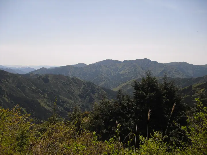
A 1,506-meter peak on the boundary between Ino Town and Tosa Town in Kōchi Prefecture, set in the western Shikoku Mountains. The name comes from the dense sasa bamboo grasslands that once covered the summit like sheaves of rice, and the sheer cliffs that ring the mountain have earned it the alternative name "Onishiro-yama" (Demon-fortress Mountain). Beech forest cloaks its slopes, akebono azaleas brighten the ridge in May, and the summit looks out over the Ishizuchi Range — Mt. Ishizuchi, Mt. Kamegamori, Mt. Sasagamine — to the Pacific Ocean. The route past a Heike-refugee "legendary cave" is a local favourite, accessed from trailheads at the Inamura Dam lakeside and the south portal of the Inamura Tunnel. Listed in the New Japan 100 Famous Mountains, Shikoku 100 Famous Mountains and Shikoku Hyakuzan.
Mt. Inamura at a glance
- Weather: The most settled day in the next 7 days is Sun, November 8: clear, gusts up to 6 m/s.
Mt. Inamura weather (hourly, 14 days)
Sunrise today 06:27, sunset 17:14
| Tue, 11/3 | Wed, 11/4 | Thu, 11/5 | Fri, 11/6 | Sat, 11/7 | Sun, 11/8 | Mon, 11/9 | Tue, 11/10 | Wed, 11/11 | Thu, 11/12 | Fri, 11/13 | Sat, 11/14 | Sun, 11/15 | Mon, 11/16 | Tue, 11/17 | |||||||||||||||||||||||||||||||||||||||||||||||||||||||||||||||||||||||
|---|---|---|---|---|---|---|---|---|---|---|---|---|---|---|---|---|---|---|---|---|---|---|---|---|---|---|---|---|---|---|---|---|---|---|---|---|---|---|---|---|---|---|---|---|---|---|---|---|---|---|---|---|---|---|---|---|---|---|---|---|---|---|---|---|---|---|---|---|---|---|---|---|---|---|---|---|---|---|---|---|---|---|---|---|---|
| Japan time | 21 | 23 | 1 | 3 | 5 | 7 | 9 | 11 | 13 | 15 | 17 | 19 | 21 | 0 | 3 | 6 | 9 | 12 | 15 | 18 | 21 | 0 | 3 | 6 | 9 | 12 | 15 | 18 | 21 | 0 | 3 | 6 | 9 | 12 | 15 | 18 | 21 | 0 | 3 | 6 | 9 | 12 | 15 | 18 | 21 | 0 | 3 | 6 | 9 | 12 | 15 | 21 | 3 | 9 | 15 | 21 | 3 | 9 | 15 | 21 | 3 | 9 | 15 | 21 | 3 | 9 | 15 | 21 | 3 | 9 | 15 | 21 | 3 | 9 | 15 | 21 | 3 | 9 | 15 | 21 | 3 | 9 | 15 | 21 | |
  | |   |   | |   |   |   |   | | | |   | | |   | |   | | | | | | | | |  |  | | | | | | | | | | | | | | | | | | | | | | | | | | | |   | |   | | | | | | | | | |  | | | | | | | | | | | | | | | |  | ||
| Temperature | °C | 3° | 2° | 3° | 3° | 4° | 4° | 6° | 7° | 8° | 8° | 7° | 6° | 7° | 7° | 9° | 10° | 11° | 12° | 11° | 10° | 10° | 9° | 7° | 6° | 6° | 10° | 9° | 4° | 2° | 1° | 0° | -1° | 2° | 4° | 4° | -1° | -1° | -1° | -2° | -2° | 4° | 8° | 7° | 3° | 3° | 4° | 3° | 3° | 5° | 6° | 5° | 2° | -1° | 5° | 6° | 0° | -1° | 0° | 3° | -1° | 0° | 4° | 7° | 0° | 0° | 3° | 5° | -1° | -2° | 6° | 8° | 3° | 4° | 6° | 8° | 8° | 8° | 7° | 9° | 3° | 0° | 3° | 8° | -1° |
| Precipitation | mm | 0.2 | 0.3 | 0.2 | 1.6 | 0.8 | 1.2 | 1.5 | 3.1 | 1.8 | 0.5 | 0.4 | 0.3 | 0.5 | 0.3 | 0.2 | 0.4 | 3.0 | 6 | 0.3 | 0.4 | 1.5 | 0.2 | ||||||||||||||||||||||||||||||||||||||||||||||||||||||||||||||
| New snow | cm | – | – | – | |||||||||||||||||||||||||||||||||||||||||||||||||||||||||||||||||||||||||||||||||
| Snow depth | cm | 0 | 0 | 0 | 0 | 0 | 0 | 0 | 0 | 0 | 0 | 0 | 0 | 0 | 0 | 0 | 0 | 0 | 0 | 0 | 0 | 0 | 0 | 0 | 0 | 0 | 0 | 0 | 0 | 0 | 0 | 0 | 0 | 0 | 0 | 0 | 0 | 0 | 0 | 0 | 0 | 0 | 0 | 0 | 0 | 0 | 0 | 0 | 0 | 0 | 0 | 0 | 0 | 0 | 0 | 0 | 0 | 0 | 0 | 0 | 0 | 0 | 0 | 0 | 0 | 0 | 0 | 0 | 0 | 0 | 0 | 0 | 0 | 0 | 0 | 0 | 0 | 0 | 0 | 0 | 0 | 0 | 0 | 0 | 0 |
| Wind | m/s | 1 | 1 | 2 | 2 | 2 | 2 | 1 | 1 | 1 | 0 | 0 | 0 | 0 | 1 | 1 | 0 | 2 | 2 | 3 | 3 | 2 | 3 | 5 | 3 | 4 | 5 | 4 | 4 | 4 | 4 | 4 | 3 | 5 | 4 | 4 | 3 | 3 | 3 | 2 | 2 | 1 | 0 | 1 | 1 | 0 | 1 | 1 | 2 | 3 | 3 | 3 | 2 | 2 | 3 | 4 | 5 | 6 | 5 | 4 | 2 | 1 | 1 | 1 | 2 | 4 | 3 | 4 | 2 | 1 | 1 | 3 | 1 | 1 | 3 | 3 | 2 | 2 | 4 | 4 | 4 | 3 | 2 | 1 | 1 |
| Wind gusts | m/s | 6 | 4 | 5 | 5 | 5 | 6 | 5 | 5 | 4 | 3 | 2 | 2 | 2 | 3 | 3 | 3 | 5 | 9 | 12 | 10 | 9 | 9 | 14 | 14 | 11 | 14 | 14 | 12 | 13 | 14 | 13 | 12 | 14 | 14 | 13 | 12 | 9 | 9 | 8 | 7 | 6 | 6 | 5 | 4 | 3 | 4 | 5 | 6 | 9 | 11 | 9 | 9 | 6 | 9 | 11 | 13 | 18 | 17 | 14 | 11 | 6 | 5 | 6 | 6 | 10 | 11 | 11 | 11 | 6 | 5 | 8 | 7 | 4 | 8 | 11 | 12 | 8 | 13 | 13 | 12 | 11 | 7 | 7 | 5 |
| Wind dir. | ↓ | ↓ | ↓ | ↓ | ↓ | ↓ | ↓ | ↓ | ↓ | ↓ | ↓ | ↓ | ↓ | ↓ | ↓ | ↓ | ↓ | ↓ | ↓ | ↓ | ↓ | ↓ | ↓ | ↓ | ↓ | ↓ | ↓ | ↓ | ↓ | ↓ | ↓ | ↓ | ↓ | ↓ | ↓ | ↓ | ↓ | ↓ | ↓ | ↓ | ↓ | ↓ | ↓ | ↓ | ↓ | ↓ | ↓ | ↓ | ↓ | ↓ | ↓ | ↓ | ↓ | ↓ | ↓ | ↓ | ↓ | ↓ | ↓ | ↓ | ↓ | ↓ | ↓ | ↓ | ↓ | ↓ | ↓ | ↓ | ↓ | ↓ | ↓ | ↓ | ↓ | ↓ | ↓ | ↓ | ↓ | ↓ | ↓ | ↓ | ↓ | ↓ | ↓ | ↓ | |
Lists that include Mt. Inamura
New Japan 100 Famous Mountains · Shikoku 100 Famous Mountains · Elevations of 1003 Mountains of Japan · 1000 Mountains of Japan
Mt. Inamura facts
- Also known as
- 鬼城山
- Elevation
- 1,506 m
- Location
- Ino, Kochi / Tosa, Kochi
33.747020, 133.359293 - Website
- www.rinya.maff.go.jp
- Wikipedia
- ja.wikipedia.org