
Mt. Oozareyama
大座礼山
Ōkawa-mura, Kochi · Elevation 1,588 m
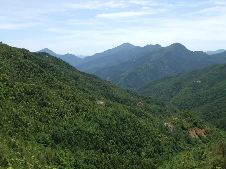
Oozareyama is a 1,587.6 m peak in Ōkawa Village, Tosa District, Kōchi Prefecture, at the southern end of the Ishizuchi range in central Shikoku. The name is thought to come from the large scree fields ('zare') that scar its southwestern slope, while the summit ridge harbours an old-growth forest of giant beech said to include some of the largest specimens on Shikoku. A recently improved trail from the prefectural-border pass reaches the top in about 90 minutes and is popular with families and beginners. The peak is included in the Shikoku Hyakumeizan, the Shikoku Hyakuzan and Nihon-no-Yama 1000.
Mt. Oozareyama at a glance
- Weather: The most settled day in the next 7 days is Sun, November 8: clear, gusts up to 7 m/s. Fri, Nov 6: strong wind (gusts up to 16 m/s).
Mt. Oozareyama weather (hourly, 14 days)
Sunrise today 06:27, sunset 17:13
| Tue, 11/3 | Wed, 11/4 | Thu, 11/5 | Fri, 11/6 | Sat, 11/7 | Sun, 11/8 | Mon, 11/9 | Tue, 11/10 | Wed, 11/11 | Thu, 11/12 | Fri, 11/13 | Sat, 11/14 | Sun, 11/15 | Mon, 11/16 | Tue, 11/17 | |||||||||||||||||||||||||||||||||||||||||||||||||||||||||||||||||||||||
|---|---|---|---|---|---|---|---|---|---|---|---|---|---|---|---|---|---|---|---|---|---|---|---|---|---|---|---|---|---|---|---|---|---|---|---|---|---|---|---|---|---|---|---|---|---|---|---|---|---|---|---|---|---|---|---|---|---|---|---|---|---|---|---|---|---|---|---|---|---|---|---|---|---|---|---|---|---|---|---|---|---|---|---|---|---|
| Japan time | 21 | 23 | 1 | 3 | 5 | 7 | 9 | 11 | 13 | 15 | 17 | 19 | 21 | 0 | 3 | 6 | 9 | 12 | 15 | 18 | 21 | 0 | 3 | 6 | 9 | 12 | 15 | 18 | 21 | 0 | 3 | 6 | 9 | 12 | 15 | 18 | 21 | 0 | 3 | 6 | 9 | 12 | 15 | 18 | 21 | 0 | 3 | 6 | 9 | 12 | 15 | 21 | 3 | 9 | 15 | 21 | 3 | 9 | 15 | 21 | 3 | 9 | 15 | 21 | 3 | 9 | 15 | 21 | 3 | 9 | 15 | 21 | 3 | 9 | 15 | 21 | 3 | 9 | 15 | 21 | 3 | 9 | 15 | 21 | |
  |   |   | | |   |   |   | | | | |   | | |   |   | | | | | | | |   | |  |  | | | | | | | | | | | | | | | | | | | | | | | | | | | | | |   | | | | | | | | | |  | | | | | | | | | | | | | | | |  | ||
| Temperature | °C | 4° | 3° | 4° | 4° | 4° | 4° | 6° | 8° | 9° | 9° | 7° | 6° | 6° | 7° | 8° | 9° | 12° | 13° | 14° | 11° | 11° | 10° | 8° | 7° | 7° | 10° | 9° | 5° | 3° | 2° | 2° | 1° | 2° | 5° | 5° | 1° | 0° | 0° | -1° | -1° | 4° | 7° | 6° | 2° | 3° | 4° | 4° | 3° | 6° | 7° | 6° | 2° | -1° | 5° | 7° | 1° | 0° | 1° | 4° | 1° | 1° | 4° | 7° | 2° | 0° | 4° | 5° | 0° | -3° | 6° | 10° | 3° | 3° | 8° | 9° | 9° | 9° | 8° | 9° | 4° | 0° | 2° | 6° | -1° |
| Precipitation | mm | 0.2 | 0.8 | 0.3 | 1.7 | 1.6 | 0.7 | 3.0 | 1.6 | 2.0 | 1.0 | 0.5 | 0.6 | 0.1 | 0.3 | 0.8 | 1.4 | 0.5 | 1.1 | 0.3 | 1.9 | 4.4 | 0.9 | 2.0 | 4.0 | 0.4 | |||||||||||||||||||||||||||||||||||||||||||||||||||||||||||
| New snow | cm | ||||||||||||||||||||||||||||||||||||||||||||||||||||||||||||||||||||||||||||||||||||
| Snow depth | cm | 0 | 0 | 0 | 0 | 0 | 0 | 0 | 0 | 0 | 0 | 0 | 0 | 0 | 0 | 0 | 0 | 0 | 0 | 0 | 0 | 0 | 0 | 0 | 0 | 0 | 0 | 0 | 0 | 0 | 0 | 0 | 0 | 0 | 0 | 0 | 0 | 0 | 0 | 0 | 0 | 0 | 0 | 0 | 0 | 0 | 0 | 0 | 0 | 0 | 0 | 0 | 0 | 0 | 0 | 0 | 0 | 0 | 0 | 0 | 0 | 0 | 0 | 0 | 0 | 0 | 0 | 0 | 0 | 0 | 0 | 0 | 0 | 0 | 0 | 0 | 0 | 0 | 0 | 0 | 0 | 0 | 0 | 0 | 0 |
| Wind | m/s | 1 | 1 | 1 | 0 | 0 | 0 | 0 | 1 | 0 | 1 | 0 | 1 | 0 | 1 | 1 | 0 | 1 | 1 | 2 | 2 | 2 | 3 | 4 | 4 | 4 | 5 | 4 | 3 | 4 | 4 | 4 | 4 | 5 | 4 | 4 | 2 | 2 | 1 | 0 | 0 | 1 | 2 | 2 | 0 | 1 | 1 | 1 | 2 | 2 | 3 | 3 | 1 | 1 | 3 | 4 | 4 | 5 | 4 | 3 | 1 | 1 | 1 | 2 | 1 | 2 | 3 | 3 | 0 | 0 | 1 | 0 | 2 | 2 | 3 | 3 | 3 | 2 | 4 | 4 | 3 | 0 | 1 | 2 | 0 |
| Wind gusts | m/s | 4 | 4 | 4 | 3 | 3 | 3 | 3 | 5 | 4 | 4 | 3 | 4 | 4 | 5 | 5 | 5 | 6 | 8 | 10 | 10 | 10 | 12 | 15 | 15 | 15 | 16 | 15 | 14 | 14 | 14 | 14 | 14 | 15 | 15 | 13 | 12 | 9 | 7 | 4 | 3 | 4 | 6 | 7 | 6 | 5 | 6 | 6 | 7 | 8 | 10 | 9 | 9 | 5 | 8 | 11 | 13 | 15 | 16 | 12 | 10 | 5 | 5 | 7 | 7 | 8 | 8 | 10 | 9 | 3 | 5 | 5 | 7 | 8 | 11 | 14 | 16 | 11 | 13 | 13 | 12 | 10 | 4 | 7 | 6 |
| Wind dir. | ↓ | ↓ | ↓ | ↓ | ↓ | ↓ | ↓ | ↓ | ↓ | ↓ | ↓ | ↓ | ↓ | ↓ | ↓ | ↓ | ↓ | ↓ | ↓ | ↓ | ↓ | ↓ | ↓ | ↓ | ↓ | ↓ | ↓ | ↓ | ↓ | ↓ | ↓ | ↓ | ↓ | ↓ | ↓ | ↓ | ↓ | ↓ | ↓ | ↓ | ↓ | ↓ | ↓ | ↓ | ↓ | ↓ | ↓ | ↓ | ↓ | ↓ | ↓ | ↓ | ↓ | ↓ | ↓ | ↓ | ↓ | ↓ | ↓ | ↓ | ↓ | ↓ | ↓ | ↓ | ↓ | ↓ | ↓ | ↓ | ↓ | ↓ | ↓ | ↓ | ↓ | ↓ | ↓ | ↓ | ↓ | ↓ | ↓ | ↓ | ↓ | ↓ | ↓ | ↓ | |
Lists that include Mt. Oozareyama
Mt. Oozareyama facts
- Elevation
- 1,588 m
- Location
- Ōkawa-mura, Kochi
33.821108, 133.394392 - Website
- ishizuchisankei.com
- Access Information
- ishizuchisankei.com
- Wikipedia
- ja.wikipedia.org