
Mt. Heikedaira
平家平
Ōkawa-mura, Kochi · Elevation 1,693 m
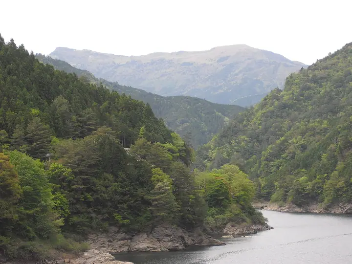
Mt. Heikedaira is a 1,693 m peak straddling Niihama City in Ehime Prefecture and Ino Town and Okawa Village in Kochi Prefecture, on the eastern main ridge of the Ishizuchi Mountain Range. Its broad summit grassland of dwarf bamboo offers an unobstructed 360-degree panorama over the Ishizuchi peaks, the Akaishi Range, and the Seto Inland Sea. The name traces to a legend that survivors of the Taira (Heike) clan, fleeing the Battle of Dan-no-ura, took refuge here while moving from Iya to Mt. Yokogura. Trails ascend from the Takayabu trailhead on the Kochi side and the Nakashichiban (Komuguine) trailhead on the Ehime side, often combined with neighboring Mt. Kanmuri. The peak is included in the Shikoku 100 Famous Mountains, Shikoku 100, the Ehime and Kochi Prefecture mountains guidebooks, the Ehime Yuyu Yamaaruki list, and the Japan 1000 Mountains.
Mt. Heikedaira at a glance
- Weather: The most settled day in the next 7 days is Wed, November 4: cloudy, gusts up to 4 m/s. Fri, Nov 6: strong wind (gusts up to 15 m/s).
Mt. Heikedaira weather (hourly, 14 days)
Sunrise today 06:27, sunset 17:14
| Tue, 11/3 | Wed, 11/4 | Thu, 11/5 | Fri, 11/6 | Sat, 11/7 | Sun, 11/8 | Mon, 11/9 | Tue, 11/10 | Wed, 11/11 | Thu, 11/12 | Fri, 11/13 | Sat, 11/14 | Sun, 11/15 | Mon, 11/16 | Tue, 11/17 | |||||||||||||||||||||||||||||||||||||||||||||||||||||||||||||||||||||||
|---|---|---|---|---|---|---|---|---|---|---|---|---|---|---|---|---|---|---|---|---|---|---|---|---|---|---|---|---|---|---|---|---|---|---|---|---|---|---|---|---|---|---|---|---|---|---|---|---|---|---|---|---|---|---|---|---|---|---|---|---|---|---|---|---|---|---|---|---|---|---|---|---|---|---|---|---|---|---|---|---|---|---|---|---|---|
| Japan time | 15 | 17 | 19 | 21 | 23 | 1 | 3 | 5 | 7 | 9 | 11 | 13 | 15 | 18 | 21 | 0 | 3 | 6 | 9 | 12 | 15 | 18 | 21 | 0 | 3 | 6 | 9 | 12 | 15 | 18 | 21 | 0 | 3 | 6 | 9 | 12 | 15 | 18 | 21 | 0 | 3 | 6 | 9 | 12 | 15 | 18 | 21 | 0 | 3 | 6 | 9 | 15 | 21 | 3 | 9 | 15 | 21 | 3 | 9 | 15 | 21 | 3 | 9 | 15 | 21 | 3 | 9 | 15 | 21 | 3 | 9 | 15 | 21 | 3 | 9 | 15 | 21 | 3 | 9 | 15 | 21 | 3 | 9 | 15 | |
  | |   |   |   | | | |   | |   | | | |   | | | |   |   |   | | |   | | | | |  |  | | | | | | | | | | | | | | | | | | | | | | | | | | | | | | | | | | | | | | |  | | | | | | | | | | | | | | | | ||
| Temperature | °C | 9° | 6° | 4° | 3° | 4° | 4° | 4° | 3° | 3° | 6° | 7° | 9° | 10° | 6° | 6° | 7° | 8° | 8° | 9° | 15° | 13° | 11° | 10° | 11° | 9° | 7° | 7° | 10° | 9° | 4° | 2° | 1° | 1° | 0° | 2° | 4° | 4° | -1° | -1° | -2° | -3° | -3° | 4° | 7° | 6° | 3° | 2° | 2° | 3° | 3° | 6° | 8° | 2° | -2° | 4° | 6° | 0° | -1° | 0° | 4° | 0° | 0° | 3° | 6° | 1° | 0° | 3° | 5° | -1° | -3° | 6° | 9° | 3° | 2° | 7° | 9° | 8° | 9° | 7° | 8° | 3° | 0° | 1° | 6° |
| Precipitation | mm | 0.2 | 1.7 | 1.7 | 2.6 | 0.9 | 0.1 | 3.6 | 0.3 | 0.7 | 0.7 | 2.2 | 0.6 | 0.4 | 0.3 | 0.1 | 0.3 | 0.8 | 1.4 | 0.5 | 1.1 | 0.3 | 1.9 | 4.4 | 0.9 | 2.0 | 4.0 | 0.4 | |||||||||||||||||||||||||||||||||||||||||||||||||||||||||
| New snow | cm | ||||||||||||||||||||||||||||||||||||||||||||||||||||||||||||||||||||||||||||||||||||
| Snow depth | cm | 0 | 0 | 0 | 0 | 0 | 0 | 0 | 0 | 0 | 0 | 0 | 0 | 0 | 0 | 0 | 0 | 0 | 0 | 0 | 0 | 0 | 0 | 0 | 0 | 0 | 0 | 0 | 0 | 0 | 0 | 0 | 0 | 0 | 0 | 0 | 0 | 0 | 0 | 0 | 0 | 0 | 0 | 0 | 0 | 0 | 0 | 0 | 0 | 0 | 0 | 0 | 0 | 0 | 0 | 0 | 0 | 0 | 0 | 0 | 0 | 0 | 0 | 0 | 0 | 0 | 0 | 0 | 0 | 0 | 0 | 0 | 0 | 0 | 0 | 0 | 0 | 0 | 0 | 0 | 0 | 0 | 0 | 0 | 0 |
| Wind | m/s | 2 | 1 | 1 | 1 | 2 | 1 | 0 | 0 | 0 | 1 | 1 | 0 | 1 | 0 | 0 | 2 | 0 | 0 | 0 | 1 | 1 | 2 | 1 | 3 | 4 | 4 | 4 | 5 | 4 | 3 | 4 | 4 | 5 | 4 | 4 | 4 | 3 | 2 | 1 | 0 | 1 | 0 | 1 | 2 | 2 | 0 | 1 | 1 | 1 | 1 | 2 | 3 | 1 | 1 | 3 | 4 | 4 | 5 | 4 | 3 | 1 | 1 | 1 | 2 | 1 | 2 | 3 | 3 | 0 | 0 | 1 | 0 | 2 | 2 | 3 | 3 | 3 | 2 | 4 | 4 | 3 | 0 | 1 | 2 |
| Wind gusts | m/s | 8 | 5 | 4 | 4 | 4 | 5 | 4 | 4 | 4 | 4 | 4 | 4 | 4 | 4 | 5 | 7 | 7 | 3 | 5 | 6 | 6 | 9 | 10 | 13 | 13 | 13 | 14 | 15 | 15 | 14 | 14 | 14 | 15 | 15 | 15 | 14 | 12 | 10 | 7 | 5 | 3 | 3 | 4 | 6 | 7 | 6 | 5 | 6 | 6 | 5 | 7 | 9 | 9 | 5 | 8 | 11 | 13 | 15 | 16 | 12 | 10 | 5 | 5 | 7 | 7 | 8 | 8 | 10 | 9 | 3 | 5 | 5 | 7 | 8 | 11 | 14 | 16 | 11 | 13 | 13 | 12 | 10 | 4 | 7 |
| Wind dir. | ↓ | ↓ | ↓ | ↓ | ↓ | ↓ | ↓ | ↓ | ↓ | ↓ | ↓ | ↓ | ↓ | ↓ | ↓ | ↓ | ↓ | ↓ | ↓ | ↓ | ↓ | ↓ | ↓ | ↓ | ↓ | ↓ | ↓ | ↓ | ↓ | ↓ | ↓ | ↓ | ↓ | ↓ | ↓ | ↓ | ↓ | ↓ | ↓ | ↓ | ↓ | ↓ | ↓ | ↓ | ↓ | ↓ | ↓ | ↓ | ↓ | ↓ | ↓ | ↓ | ↓ | ↓ | ↓ | ↓ | ↓ | ↓ | ↓ | ↓ | ↓ | ↓ | ↓ | ↓ | ↓ | ↓ | ↓ | ↓ | ↓ | ↓ | ↓ | ↓ | ↓ | ↓ | ↓ | ↓ | ↓ | ↓ | ↓ | ↓ | ↓ | ↓ | ↓ | ↓ | |
Huts, campsites and lodging near Mt. Heikedaira
Lodging
- Konoka Onsen
Lists that include Mt. Heikedaira
Mt. Heikedaira facts
- Elevation
- 1,693 m
- Location
- Ōkawa-mura, Kochi
33.814713, 133.326398 - Website
- ishizuchisankei.com
- Trail Map
- www.city.niihama.lg.jp (PDF)
- Access Information
- kochi-tabi.jp
- Wikipedia
- ja.wikipedia.org