
Mt. Hodatsusan
宝達山
Hōdatsu-shimizu-chō, Ishikawa · Elevation 637 m
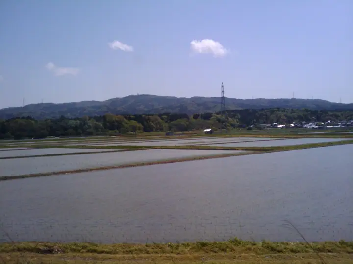
Mt. Hodatsusan is a 637.1-meter peak in Hodatsushimizu Town, Hakui District, Ishikawa Prefecture — the highest mountain on the Noto Peninsula. During the Edo period the Kaga domain mined gold here, inspiring the legend of a mountain of "countless treasure gates" that gives the peak its name. The single trail, "Kobushi-no-michi," climbs from the inner shrine of Tehayahime-jinja to the beech-forested summit park, and the panorama on clear days spans the Noto and Kaga regions and the Sea of Japan. The mountain is also listed among Japan's 100 Water-Source Forests.
Mt. Hodatsusan at a glance
- Weather: The most settled day in the next 7 days is Sun, November 8: cloudy, gusts up to 7 m/s. Fri, Nov 6: strong wind (gusts up to 18 m/s).
- Route: The shortest is Mount Hodatsu via the Kobushi Trail Out-and-Back: about 4 h 50 min, 8.4 km, about 610 m of climbing.
Mt. Hodatsusan weather (hourly, 14 days)
Sunrise today 06:18, sunset 16:55
| Tue, 11/3 | Wed, 11/4 | Thu, 11/5 | Fri, 11/6 | Sat, 11/7 | Sun, 11/8 | Mon, 11/9 | Tue, 11/10 | Wed, 11/11 | Thu, 11/12 | Fri, 11/13 | Sat, 11/14 | Sun, 11/15 | Mon, 11/16 | Tue, 11/17 | |||||||||||||||||||||||||||||||||||||||||||||||||||||||||||||||||||||||
|---|---|---|---|---|---|---|---|---|---|---|---|---|---|---|---|---|---|---|---|---|---|---|---|---|---|---|---|---|---|---|---|---|---|---|---|---|---|---|---|---|---|---|---|---|---|---|---|---|---|---|---|---|---|---|---|---|---|---|---|---|---|---|---|---|---|---|---|---|---|---|---|---|---|---|---|---|---|---|---|---|---|---|---|---|---|
| Japan time | 15 | 17 | 19 | 21 | 23 | 1 | 3 | 5 | 7 | 9 | 11 | 13 | 15 | 18 | 21 | 0 | 3 | 6 | 9 | 12 | 15 | 18 | 21 | 0 | 3 | 6 | 9 | 12 | 15 | 18 | 21 | 0 | 3 | 6 | 9 | 12 | 15 | 18 | 21 | 0 | 3 | 6 | 9 | 12 | 15 | 18 | 21 | 0 | 3 | 6 | 9 | 15 | 21 | 3 | 9 | 15 | 21 | 3 | 9 | 15 | 21 | 3 | 9 | 15 | 21 | 3 | 9 | 15 | 21 | 3 | 9 | 15 | 21 | 3 | 9 | 15 | 21 | 3 | 9 | 15 | 21 | 3 | 9 | 15 | |
  |  |   | | | |   | |   |  | | | | |   | |   |   |   |   | | | | | | | |   | |   | | | | | | | | | | | | | | |   | | | | | | | | | | | | | | | | | | | | | | | |  | | | | | | | | | | | | | | | | ||
| Temperature | °C | 13° | 9° | 8° | 6° | 5° | 5° | 4° | 4° | 4° | 11° | 14° | 14° | 14° | 11° | 10° | 9° | 9° | 9° | 10° | 15° | 17° | 13° | 12° | 11° | 12° | 12° | 13° | 16° | 14° | 10° | 9° | 7° | 6° | 5° | 6° | 7° | 8° | 5° | 6° | 4° | 4° | 4° | 8° | 11° | 9° | 8° | 7° | 6° | 6° | 6° | 8° | 8° | 7° | 7° | 10° | 11° | 6° | 5° | 7° | 9° | 4° | 2° | 8° | 10° | 6° | 7° | 8° | 10° | 4° | 1° | 8° | 12° | 4° | 2° | 12° | 12° | 10° | 11° | 12° | 10° | 6° | 4° | 7° | 9° |
| Precipitation | mm | 2.1 | 3.0 | 4.9 | 0.7 | 0.2 | 2.5 | 4.4 | 4.3 | 2.9 | 0.2 | 0.4 | 1.0 | 0.6 | 1.0 | 0.8 | 1.5 | 1.5 | 2.0 | 1.4 | 0.1 | 0.1 | 0.3 | 0.5 | 0.7 | 0.2 | 1.5 | 1.3 | 0.3 | 0.1 | 0.7 | 9 | 7 | 1.2 | 0.1 | 3.7 | 1.5 | 0.7 | 6 | 6 | 8 | 1.3 | |||||||||||||||||||||||||||||||||||||||||||
| New snow | cm | ||||||||||||||||||||||||||||||||||||||||||||||||||||||||||||||||||||||||||||||||||||
| Snow depth | cm | 0 | 0 | 0 | 0 | 0 | 0 | 0 | 0 | 0 | 0 | 0 | 0 | 0 | 0 | 0 | 0 | 0 | 0 | 0 | 0 | 0 | 0 | 0 | 0 | 0 | 0 | 0 | 0 | 0 | 0 | 0 | 0 | 0 | 0 | 0 | 0 | 0 | 0 | 0 | 0 | 0 | 0 | 0 | 0 | 0 | 0 | 0 | 0 | 0 | 0 | 0 | 0 | 0 | 0 | 0 | 0 | 0 | 0 | 0 | 0 | 0 | 0 | 0 | 0 | 0 | 0 | 0 | 0 | 0 | 0 | 0 | 0 | 0 | 0 | 0 | 0 | 0 | 0 | 0 | 0 | 0 | 0 | 0 | 0 |
| Wind | m/s | 3 | 2 | 1 | 1 | 1 | 1 | 1 | 1 | 1 | 2 | 5 | 5 | 5 | 3 | 1 | 2 | 1 | 1 | 1 | 3 | 0 | 1 | 1 | 1 | 3 | 4 | 4 | 8 | 8 | 5 | 4 | 5 | 4 | 2 | 3 | 5 | 5 | 1 | 1 | 1 | 1 | 1 | 1 | 2 | 3 | 3 | 1 | 1 | 2 | 1 | 0 | 5 | 5 | 4 | 5 | 9 | 5 | 7 | 2 | 4 | 1 | 1 | 1 | 2 | 2 | 1 | 3 | 3 | 2 | 1 | 2 | 2 | 1 | 1 | 1 | 2 | 2 | 4 | 2 | 6 | 3 | 3 | 1 | 4 |
| Wind gusts | m/s | 8 | 7 | 4 | 2 | 3 | 3 | 3 | 3 | 4 | 5 | 11 | 12 | 12 | 12 | 6 | 3 | 5 | 3 | 3 | 7 | 7 | 3 | 3 | 3 | 7 | 8 | 10 | 17 | 18 | 17 | 13 | 11 | 11 | 9 | 9 | 12 | 12 | 10 | 5 | 3 | 3 | 3 | 4 | 6 | 7 | 7 | 6 | 4 | 4 | 4 | 4 | 11 | 12 | 12 | 11 | 18 | 19 | 21 | 15 | 12 | 9 | 3 | 4 | 8 | 5 | 10 | 7 | 8 | 8 | 6 | 5 | 7 | 6 | 4 | 4 | 4 | 8 | 8 | 11 | 14 | 13 | 8 | 6 | 9 |
| Wind dir. | ↓ | ↓ | ↓ | ↓ | ↓ | ↓ | ↓ | ↓ | ↓ | ↓ | ↓ | ↓ | ↓ | ↓ | ↓ | ↓ | ↓ | ↓ | ↓ | ↓ | ↓ | ↓ | ↓ | ↓ | ↓ | ↓ | ↓ | ↓ | ↓ | ↓ | ↓ | ↓ | ↓ | ↓ | ↓ | ↓ | ↓ | ↓ | ↓ | ↓ | ↓ | ↓ | ↓ | ↓ | ↓ | ↓ | ↓ | ↓ | ↓ | ↓ | ↓ | ↓ | ↓ | ↓ | ↓ | ↓ | ↓ | ↓ | ↓ | ↓ | ↓ | ↓ | ↓ | ↓ | ↓ | ↓ | ↓ | ↓ | ↓ | ↓ | ↓ | ↓ | ↓ | ↓ | ↓ | ↓ | ↓ | ↓ | ↓ | ↓ | ↓ | ↓ | ↓ | ↓ | |
Mt. Hodatsusan hiking routes
Hiking times are estimates calculated from the terrain.
Lists that include Mt. Hodatsusan
100 Mountains of Hokuriku · Elevations of 1003 Mountains of Japan · 1000 Mountains of Japan
Mt. Hodatsusan facts
- Elevation
- 637 m
- Location
- Hōdatsu-shimizu-chō, Ishikawa
36.781951, 136.813136 - Season Opens
- April 23
- Season Closes
- November 23
- Website
- www.hodatsushimizu.jp
- Access Information
- www.hodatsushimizu.jp
- Wikipedia
- ja.wikipedia.org