
Mt. Hitaitori
額取山
Kōriyama, Fukushima · Elevation 1,009 m
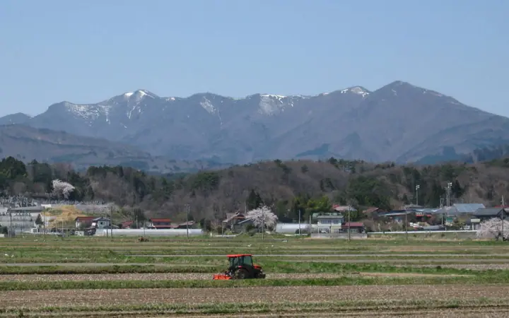
Mt. Hitaitori (1,009 m), also called Asakayama, rises on the ridge between the Kōriyama Basin and Lake Inawashiro in Kōriyama, Fukushima. The peak is identified with the "Asakayama" of the Man'yōshū poems; its alternative name reportedly comes from a legend that Minamoto-no-Yoshiie shaved his forelock here at his coming-of-age. It appears on the Tōhoku 100, Utsukushima 100 and Fukushima 30 lists and can be climbed via three trails from Bandai-Atami, Takinobori or Goreihitsu Pass.
Mt. Hitaitori at a glance
- Weather: The most settled day in the next 7 days is Wed, November 4: clear, gusts up to 6 m/s. Fri, Nov 6, Sat, Nov 7, Sun, Nov 8: strong wind (gusts up to 20 m/s).
- Route: The shortest is Mount Hitaitoriyama Taki Trailhead Return: about 3 h 21 min, 5.0 km, about 560 m of climbing.
Mt. Hitaitori weather (hourly, 14 days)
Sunrise today 06:05, sunset 16:40
| Tue, 11/3 | Wed, 11/4 | Thu, 11/5 | Fri, 11/6 | Sat, 11/7 | Sun, 11/8 | Mon, 11/9 | Tue, 11/10 | Wed, 11/11 | Thu, 11/12 | Fri, 11/13 | Sat, 11/14 | Sun, 11/15 | Mon, 11/16 | Tue, 11/17 | |||||||||||||||||||||||||||||||||||||||||||||||||||||||||||||||||||||||
|---|---|---|---|---|---|---|---|---|---|---|---|---|---|---|---|---|---|---|---|---|---|---|---|---|---|---|---|---|---|---|---|---|---|---|---|---|---|---|---|---|---|---|---|---|---|---|---|---|---|---|---|---|---|---|---|---|---|---|---|---|---|---|---|---|---|---|---|---|---|---|---|---|---|---|---|---|---|---|---|---|---|---|---|---|---|
| Japan time | 15 | 17 | 19 | 21 | 23 | 1 | 3 | 5 | 7 | 9 | 11 | 13 | 15 | 18 | 21 | 0 | 3 | 6 | 9 | 12 | 15 | 18 | 21 | 0 | 3 | 6 | 9 | 12 | 15 | 18 | 21 | 0 | 3 | 6 | 9 | 12 | 15 | 18 | 21 | 0 | 3 | 6 | 9 | 12 | 15 | 18 | 21 | 0 | 3 | 6 | 9 | 15 | 21 | 3 | 9 | 15 | 21 | 3 | 9 | 15 | 21 | 3 | 9 | 15 | 21 | 3 | 9 | 15 | 21 | 3 | 9 | 15 | 21 | 3 | 9 | 15 | 21 | 3 | 9 | 15 | 21 | 3 | 9 | 15 | |
 |  |   | | | | | |   | | | | | |   |   | | |   | |   | | | |  |   | |   |   |   | | | | | | | |   | | | | |   | | | | | | | | | | | | | | | | | | | | | |  | | | | | | | | | | | | | | | | | | | | ||
| Temperature | °C | 8° | 5° | 4° | 3° | 2° | 1° | 1° | 1° | 2° | 7° | 9° | 11° | 10° | 5° | 5° | 5° | 6° | 6° | 8° | 9° | 10° | 8° | 6° | 8° | 6° | 7° | 10° | 12° | 12° | 9° | 6° | 5° | 4° | 2° | 2° | 3° | 3° | 1° | 1° | 1° | 1° | 1° | 4° | 5° | 4° | 2° | 2° | 2° | 2° | 2° | 3° | 7° | 1° | 0° | 4° | 6° | 1° | 2° | 2° | 6° | 2° | 1° | 4° | 5° | 1° | 2° | 5° | 4° | 1° | 0° | 3° | 7° | 1° | 0° | 5° | 9° | 5° | 5° | 10° | 8° | 2° | 0° | 2° | 5° |
| Precipitation | mm | 3.1 | 6 | 10 | 7 | 2.9 | 0.6 | 0.5 | 0.3 | 0.6 | 0.2 | 0.1 | 0.8 | 1.4 | 0.9 | 0.7 | 0.1 | 0.2 | 0.8 | 0.2 | 0.5 | 0.2 | 0.1 | 1.0 | 1.4 | 0.9 | 0.2 | 0.5 | 2.9 | 11 | 0.8 | 0.7 | |||||||||||||||||||||||||||||||||||||||||||||||||||||
| New snow | cm | ||||||||||||||||||||||||||||||||||||||||||||||||||||||||||||||||||||||||||||||||||||
| Snow depth | cm | 0 | 0 | 0 | 0 | 0 | 0 | 0 | 0 | 0 | 0 | 0 | 0 | 0 | 0 | 0 | 0 | 0 | 0 | 0 | 0 | 0 | 0 | 0 | 0 | 0 | 0 | 0 | 0 | 0 | 0 | 0 | 0 | 0 | 0 | 0 | 0 | 0 | 0 | 0 | 0 | 0 | 0 | 0 | 0 | 0 | 0 | 0 | 0 | 0 | 0 | 0 | 0 | 0 | 0 | 0 | 0 | 0 | 0 | 0 | 0 | 0 | 0 | 0 | 0 | 0 | 0 | 0 | 0 | 0 | 0 | 0 | 0 | 0 | 0 | 0 | 0 | 0 | 0 | 0 | 0 | 0 | 0 | 0 | 0 |
| Wind | m/s | 6 | 4 | 3 | 2 | 2 | 2 | 2 | 2 | 2 | 1 | 1 | 2 | 2 | 2 | 1 | 2 | 1 | 1 | 3 | 2 | 2 | 1 | 1 | 2 | 2 | 2 | 4 | 8 | 8 | 8 | 8 | 9 | 9 | 8 | 7 | 8 | 9 | 8 | 8 | 8 | 8 | 7 | 8 | 8 | 7 | 5 | 4 | 3 | 3 | 2 | 1 | 3 | 1 | 1 | 2 | 4 | 0 | 7 | 6 | 7 | 3 | 4 | 4 | 5 | 2 | 3 | 5 | 7 | 3 | 3 | 3 | 2 | 1 | 1 | 1 | 2 | 1 | 1 | 2 | 4 | 7 | 5 | 3 | 2 |
| Wind gusts | m/s | 16 | 13 | 9 | 8 | 6 | 6 | 5 | 5 | 5 | 5 | 5 | 5 | 6 | 6 | 5 | 3 | 4 | 4 | 7 | 7 | 6 | 4 | 2 | 4 | 5 | 7 | 12 | 19 | 19 | 19 | 20 | 20 | 22 | 21 | 20 | 19 | 20 | 20 | 20 | 20 | 19 | 19 | 18 | 20 | 20 | 16 | 12 | 10 | 8 | 7 | 4 | 9 | 8 | 4 | 5 | 10 | 10 | 16 | 21 | 21 | 16 | 9 | 10 | 13 | 11 | 6 | 12 | 16 | 15 | 8 | 8 | 8 | 5 | 3 | 3 | 7 | 4 | 3 | 7 | 13 | 17 | 18 | 12 | 9 |
| Wind dir. | ↓ | ↓ | ↓ | ↓ | ↓ | ↓ | ↓ | ↓ | ↓ | ↓ | ↓ | ↓ | ↓ | ↓ | ↓ | ↓ | ↓ | ↓ | ↓ | ↓ | ↓ | ↓ | ↓ | ↓ | ↓ | ↓ | ↓ | ↓ | ↓ | ↓ | ↓ | ↓ | ↓ | ↓ | ↓ | ↓ | ↓ | ↓ | ↓ | ↓ | ↓ | ↓ | ↓ | ↓ | ↓ | ↓ | ↓ | ↓ | ↓ | ↓ | ↓ | ↓ | ↓ | ↓ | ↓ | ↓ | ↓ | ↓ | ↓ | ↓ | ↓ | ↓ | ↓ | ↓ | ↓ | ↓ | ↓ | ↓ | ↓ | ↓ | ↓ | ↓ | ↓ | ↓ | ↓ | ↓ | ↓ | ↓ | ↓ | ↓ | ↓ | ↓ | ↓ | ↓ | |
Mt. Hitaitori hiking routes
- Mount Hitaitoriyama Taki Trailhead Return 5.0 km · Ascent 562 m parking
- Mount Hitaitori via Mount Taishōhata from Goreibitsu Pass 6.9 km · Ascent 605 m parking
Hiking times are estimates calculated from the terrain.
Lists that include Mt. Hitaitori
Tohoku 100 Famous Mountains · Utsukushima 100 Famous Mountains (Fukushima Prefecture) · 30 Peaks of Fukushima · 1000 Mountains of Japan
Mt. Hitaitori facts
- Also known as
- 安積山
- Elevation
- 1,009 m
- Location
- Kōriyama, Fukushima
37.450277, 140.220410 - Website
- www.tif.ne.jp
- Access Information
- www.kanko-koriyama.gr.jp
- Wikipedia
- ja.wikipedia.org