
Mt. Dohyodake
土俵岳
Hinohara, Tokyo / Uenohara, Yamanashi · Elevation 1,005 m
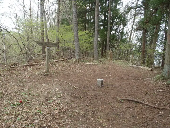
Mt. Dohyodake (1,005 m) rises on the Sasao Ridge along the boundary between Hinohara Village in Tokyo and Uenohara City in Yamanashi Prefecture. The ridge forms the watershed between the Tama and Sagami river systems and was historically the border between the old Musashi and Kai provinces. The wooded summit holds a third-class triangulation point and the peak is included in the Tama 100, Tokyo Hyakumeizan, and Kai 100 lists, typically traversed as part of the Sasao Ridge route from Musashi-Itsukaichi or Uenohara stations.
Mt. Dohyodake at a glance
- Weather: The most settled day in the next 7 days is Fri, November 6: clear, gusts up to 6 m/s.
Mt. Dohyodake weather (hourly, 14 days)
Sunrise today 06:07, sunset 16:48
| Tue, 11/3 | Wed, 11/4 | Thu, 11/5 | Fri, 11/6 | Sat, 11/7 | Sun, 11/8 | Mon, 11/9 | Tue, 11/10 | Wed, 11/11 | Thu, 11/12 | Fri, 11/13 | Sat, 11/14 | Sun, 11/15 | Mon, 11/16 | Tue, 11/17 | |||||||||||||||||||||||||||||||||||||||||||||||||||||||||||||||||||||||
|---|---|---|---|---|---|---|---|---|---|---|---|---|---|---|---|---|---|---|---|---|---|---|---|---|---|---|---|---|---|---|---|---|---|---|---|---|---|---|---|---|---|---|---|---|---|---|---|---|---|---|---|---|---|---|---|---|---|---|---|---|---|---|---|---|---|---|---|---|---|---|---|---|---|---|---|---|---|---|---|---|---|---|---|---|---|
| Japan time | 15 | 17 | 19 | 21 | 23 | 1 | 3 | 5 | 7 | 9 | 11 | 13 | 15 | 18 | 21 | 0 | 3 | 6 | 9 | 12 | 15 | 18 | 21 | 0 | 3 | 6 | 9 | 12 | 15 | 18 | 21 | 0 | 3 | 6 | 9 | 12 | 15 | 18 | 21 | 0 | 3 | 6 | 9 | 12 | 15 | 18 | 21 | 0 | 3 | 6 | 9 | 15 | 21 | 3 | 9 | 15 | 21 | 3 | 9 | 15 | 21 | 3 | 9 | 15 | 21 | 3 | 9 | 15 | 21 | 3 | 9 | 15 | 21 | 3 | 9 | 15 | 21 | 3 | 9 | 15 | 21 | 3 | 9 | 15 | |
  |   | | |   | | | | | | |   | | | | | | | |   |   | | | |   | |  | | |  | | | | | | |   | | |   | | | | | | | | | | | | | | | | | | | | |   |  | | | |   | | | | | | | | | | | | |   | | | | | | ||
| Temperature | °C | 11° | 9° | 8° | 7° | 7° | 6° | 6° | 6° | 5° | 6° | 7° | 7° | 6° | 6° | 6° | 6° | 6° | 7° | 10° | 15° | 12° | 10° | 8° | 7° | 7° | 6° | 14° | 18° | 16° | 10° | 8° | 7° | 6° | 4° | 10° | 13° | 10° | 5° | 4° | 4° | 3° | 2° | 8° | 10° | 8° | 6° | 5° | 3° | 3° | 3° | 4° | 6° | 4° | 2° | 3° | 7° | 3° | 2° | 6° | 9° | -1° | -2° | 6° | 7° | 4° | 1° | 9° | 11° | 0° | 0° | 4° | 7° | 1° | 0° | 9° | 12° | 7° | 6° | 12° | 16° | 5° | 4° | 3° | 5° |
| Precipitation | mm | 0.7 | 1.3 | 0.7 | 0.2 | 0.2 | 0.3 | 1.7 | 7 | 14 | 10 | 3.3 | 1.3 | 4.1 | 0.6 | 0.6 | 0.1 | 0.2 | 0.1 | 3.7 | 14 | 0.1 | 0.1 | ||||||||||||||||||||||||||||||||||||||||||||||||||||||||||||||
| New snow | cm | ||||||||||||||||||||||||||||||||||||||||||||||||||||||||||||||||||||||||||||||||||||
| Snow depth | cm | 0 | 0 | 0 | 0 | 0 | 0 | 0 | 0 | 0 | 0 | 0 | 0 | 0 | 0 | 0 | 0 | 0 | 0 | 0 | 0 | 0 | 0 | 0 | 0 | 0 | 0 | 0 | 0 | 0 | 0 | 0 | 0 | 0 | 0 | 0 | 0 | 0 | 0 | 0 | 0 | 0 | 0 | 0 | 0 | 0 | 0 | 0 | 0 | 0 | 0 | 0 | 0 | 0 | 0 | 0 | 0 | 0 | 0 | 0 | 0 | 0 | 0 | 0 | 0 | 0 | 0 | 0 | 0 | 0 | 0 | 0 | 0 | 0 | 0 | 0 | 0 | 0 | 0 | 0 | 0 | 0 | 0 | 0 | 0 |
| Wind | m/s | 2 | 1 | 0 | 1 | 1 | 1 | 1 | 0 | 0 | 1 | 1 | 2 | 1 | 1 | 1 | 0 | 2 | 1 | 0 | 2 | 2 | 1 | 1 | 1 | 2 | 2 | 1 | 1 | 2 | 1 | 0 | 1 | 1 | 1 | 2 | 0 | 3 | 1 | 1 | 1 | 0 | 1 | 1 | 3 | 2 | 0 | 0 | 1 | 0 | 1 | 1 | 2 | 1 | 2 | 2 | 2 | 0 | 2 | 3 | 2 | 2 | 2 | 1 | 3 | 1 | 2 | 1 | 2 | 0 | 0 | 1 | 2 | 1 | 1 | 1 | 1 | 1 | 2 | 2 | 2 | 0 | 1 | 1 | 2 |
| Wind gusts | m/s | 6 | 6 | 2 | 2 | 2 | 2 | 3 | 3 | 2 | 3 | 5 | 6 | 6 | 4 | 3 | 4 | 3 | 5 | 3 | 5 | 5 | 4 | 4 | 4 | 5 | 5 | 5 | 6 | 6 | 5 | 3 | 3 | 4 | 4 | 6 | 7 | 9 | 9 | 4 | 3 | 3 | 2 | 4 | 7 | 8 | 7 | 2 | 3 | 3 | 2 | 4 | 7 | 6 | 5 | 5 | 7 | 6 | 5 | 9 | 10 | 6 | 5 | 4 | 7 | 7 | 5 | 6 | 7 | 8 | 2 | 4 | 6 | 5 | 4 | 6 | 7 | 5 | 6 | 7 | 8 | 7 | 4 | 5 | 6 |
| Wind dir. | ↓ | ↓ | ↓ | ↓ | ↓ | ↓ | ↓ | ↓ | ↓ | ↓ | ↓ | ↓ | ↓ | ↓ | ↓ | ↓ | ↓ | ↓ | ↓ | ↓ | ↓ | ↓ | ↓ | ↓ | ↓ | ↓ | ↓ | ↓ | ↓ | ↓ | ↓ | ↓ | ↓ | ↓ | ↓ | ↓ | ↓ | ↓ | ↓ | ↓ | ↓ | ↓ | ↓ | ↓ | ↓ | ↓ | ↓ | ↓ | ↓ | ↓ | ↓ | ↓ | ↓ | ↓ | ↓ | ↓ | ↓ | ↓ | ↓ | ↓ | ↓ | ↓ | ↓ | ↓ | ↓ | ↓ | ↓ | ↓ | ↓ | ↓ | ↓ | ↓ | ↓ | ↓ | ↓ | ↓ | ↓ | ↓ | ↓ | ↓ | ↓ | ↓ | ↓ | ↓ | |
Huts, campsites and lodging near Mt. Dohyodake
Campsites
- キャンピングガーデン モク
Lodging
- Yuzurihara Seisho-nen Shizen-no-sato
Mt. Dohyodake facts
- Also known as
- 笹平 · 笹平ノ峰
- Elevation
- 1,005 m
- Location
- Hinohara, Tokyo / Uenohara, Yamanashi
35.693178, 139.084629 - Website
- jac.tokyo
- Wikipedia
- ja.wikipedia.org