
Mount Mitō
三頭山 中央峰
Hinohara, Tokyo / Okutama, Tokyo / Kosuge, Yamanashi · Elevation 1,531 m
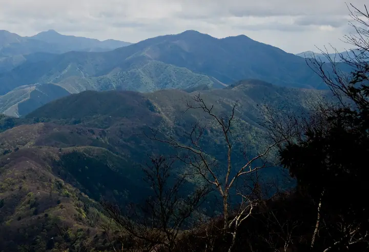
Mount Mitō (1,531 m) stands on the border of Hinohara Village in Tokyo with Uenohara and Kosuge in Yamanashi, within Chichibu-Tama-Kai National Park. It is the highest of the Oku-Tama Three Mountains, named for its trio of summits — West, Central, and East peaks. Trails climb from the Tokyo metropolitan Hinohara Tomin-no-Mori Forest Park (1,000 m) past virgin beech groves and the Mitō Falls. The peak is listed among the 300 Famous Mountains of Japan, the 100 Mountains of Flowers, and the 100 Famous Mountains of Kantō.
Mount Mitō at a glance
- Weather: The most settled day in the next 7 days is Mon, November 9: clear, gusts up to 7 m/s.
- Route: The shortest is Mount Mito Three Peaks Loop from Hinohara Tokyo Citizens' Forest: about 3 h 42 min, 6.1 km, about 630 m of climbing.
Mount Mitō weather (hourly, 14 days)
Sunrise today 06:07, sunset 16:48
| Tue, 11/3 | Wed, 11/4 | Thu, 11/5 | Fri, 11/6 | Sat, 11/7 | Sun, 11/8 | Mon, 11/9 | Tue, 11/10 | Wed, 11/11 | Thu, 11/12 | Fri, 11/13 | Sat, 11/14 | Sun, 11/15 | Mon, 11/16 | Tue, 11/17 | |||||||||||||||||||||||||||||||||||||||||||||||||||||||||||||||||||||||
|---|---|---|---|---|---|---|---|---|---|---|---|---|---|---|---|---|---|---|---|---|---|---|---|---|---|---|---|---|---|---|---|---|---|---|---|---|---|---|---|---|---|---|---|---|---|---|---|---|---|---|---|---|---|---|---|---|---|---|---|---|---|---|---|---|---|---|---|---|---|---|---|---|---|---|---|---|---|---|---|---|---|---|---|---|---|
| Japan time | 15 | 17 | 19 | 21 | 23 | 1 | 3 | 5 | 7 | 9 | 11 | 13 | 15 | 18 | 21 | 0 | 3 | 6 | 9 | 12 | 15 | 18 | 21 | 0 | 3 | 6 | 9 | 12 | 15 | 18 | 21 | 0 | 3 | 6 | 9 | 12 | 15 | 18 | 21 | 0 | 3 | 6 | 9 | 12 | 15 | 18 | 21 | 0 | 3 | 6 | 9 | 15 | 21 | 3 | 9 | 15 | 21 | 3 | 9 | 15 | 21 | 3 | 9 | 15 | 21 | 3 | 9 | 15 | 21 | 3 | 9 | 15 | 21 | 3 | 9 | 15 | 21 | 3 | 9 | 15 | 21 | 3 | 9 | 15 | |
  |   | | | | |   | |   | | | | | | | | | | |   |   |   | |   |  | |  | | | | |   | | | | |   | | | | | | | | | |   | | | | | | | | | | | | | |   |  | | | | | | | | | | | | | | | | | |   | | | | | ||
| Temperature | °C | 7° | 5° | 5° | 5° | 4° | 4° | 4° | 4° | 3° | 4° | 5° | 5° | 4° | 3° | 4° | 4° | 4° | 5° | 8° | 13° | 9° | 7° | 6° | 5° | 4° | 4° | 12° | 15° | 13° | 8° | 6° | 4° | 3° | 3° | 8° | 9° | 6° | 2° | 1° | 0° | -1° | -1° | 6° | 7° | 5° | 3° | 3° | 1° | 1° | 1° | 2° | 4° | 1° | 0° | 1° | 3° | 0° | -2° | 3° | 5° | -4° | -3° | 3° | 3° | 1° | -2° | 7° | 8° | -3° | -2° | 2° | 3° | -2° | -2° | 6° | 8° | 5° | 4° | 10° | 13° | 3° | 2° | 0° | 2° |
| Precipitation | mm | 0.6 | 0.4 | 1.1 | 0.9 | 0.2 | 0.2 | 0.2 | 0.2 | 0.2 | 1.2 | 7 | 14 | 12 | 3.8 | 1.6 | 1.4 | 0.1 | 0.2 | 0.5 | 0.5 | 0.1 | 0.2 | 0.1 | 3.5 | 14 | 1.0 | ||||||||||||||||||||||||||||||||||||||||||||||||||||||||||
| New snow | cm | ||||||||||||||||||||||||||||||||||||||||||||||||||||||||||||||||||||||||||||||||||||
| Snow depth | cm | 0 | 0 | 0 | 0 | 0 | 0 | 0 | 0 | 0 | 0 | 0 | 0 | 0 | 0 | 0 | 0 | 0 | 0 | 0 | 0 | 0 | 0 | 0 | 0 | 0 | 0 | 0 | 0 | 0 | 0 | 0 | 0 | 0 | 0 | 0 | 0 | 0 | 0 | 0 | 0 | 0 | 0 | 0 | 0 | 0 | 0 | 0 | 0 | 0 | 0 | 0 | 0 | 0 | 0 | 0 | 0 | 0 | 0 | 0 | 0 | 0 | 0 | 0 | 0 | 0 | 0 | 0 | 0 | 0 | 0 | 0 | 0 | 0 | 0 | 0 | 0 | 0 | 0 | 0 | 0 | 0 | 0 | 0 | 0 |
| Wind | m/s | 2 | 0 | 0 | 1 | 1 | 1 | 1 | 1 | 1 | 1 | 2 | 2 | 1 | 1 | 1 | 1 | 2 | 2 | 2 | 1 | 2 | 1 | 0 | 1 | 1 | 1 | 1 | 3 | 2 | 2 | 2 | 1 | 1 | 1 | 1 | 1 | 3 | 0 | 1 | 1 | 1 | 1 | 1 | 3 | 2 | 0 | 1 | 0 | 0 | 1 | 1 | 2 | 1 | 2 | 2 | 2 | 1 | 2 | 5 | 4 | 2 | 1 | 1 | 3 | 1 | 1 | 1 | 1 | 1 | 0 | 1 | 2 | 0 | 1 | 1 | 1 | 0 | 1 | 1 | 2 | 3 | 1 | 1 | 2 |
| Wind gusts | m/s | 5 | 5 | 2 | 2 | 2 | 2 | 3 | 2 | 3 | 4 | 5 | 6 | 6 | 4 | 3 | 5 | 5 | 6 | 6 | 7 | 5 | 5 | 3 | 3 | 4 | 4 | 4 | 8 | 8 | 6 | 4 | 5 | 4 | 3 | 5 | 7 | 9 | 9 | 4 | 4 | 3 | 4 | 4 | 9 | 9 | 6 | 3 | 3 | 2 | 2 | 4 | 7 | 6 | 5 | 5 | 7 | 6 | 6 | 15 | 19 | 11 | 6 | 4 | 9 | 8 | 4 | 6 | 11 | 5 | 3 | 5 | 7 | 6 | 3 | 5 | 9 | 4 | 6 | 6 | 7 | 17 | 7 | 5 | 6 |
| Wind dir. | ↓ | ↓ | ↓ | ↓ | ↓ | ↓ | ↓ | ↓ | ↓ | ↓ | ↓ | ↓ | ↓ | ↓ | ↓ | ↓ | ↓ | ↓ | ↓ | ↓ | ↓ | ↓ | ↓ | ↓ | ↓ | ↓ | ↓ | ↓ | ↓ | ↓ | ↓ | ↓ | ↓ | ↓ | ↓ | ↓ | ↓ | ↓ | ↓ | ↓ | ↓ | ↓ | ↓ | ↓ | ↓ | ↓ | ↓ | ↓ | ↓ | ↓ | ↓ | ↓ | ↓ | ↓ | ↓ | ↓ | ↓ | ↓ | ↓ | ↓ | ↓ | ↓ | ↓ | ↓ | ↓ | ↓ | ↓ | ↓ | ↓ | ↓ | ↓ | ↓ | ↓ | ↓ | ↓ | ↓ | ↓ | ↓ | ↓ | ↓ | ↓ | ↓ | ↓ | ||
Mount Mitō hiking routes
- Mount Mito Three Peaks Loop from Hinohara Tokyo Citizens' Forest 6.1 km · Ascent 629 m 都民の森 (Bus stop) (parking)
- Mount Mito, Mount Osawa and Mito Falls Circuit from Hinohara Tokyo Citizens' Forest 6.6 km · Ascent 650 m 都民の森 (Bus stop) (parking)
Hiking times are estimates calculated from the terrain.
Huts, campsites and lodging near Mount Mitō
Mountain huts
Campsites
- 山のふるさと村
- 玉川キャンプ村
- ほうれんぼうの森キャンプ場
Lodging
- 都民の森 森林館
- 兜屋旅館
- 民宿 松坂屋
- 鶴の湯温泉 馬頭館
- 古民家風張
Lists that include Mount Mitō
Japan's 300 Famous Mountains · 100 Famous Mountains of Flowers · 100 Famous Hot Spring Mountains · Kanto 100 Famous Mountains · Yamanashi 100 Famous Mountains · 100 Mountains of Tama · 3 Mountains of Okutama · Elevations of 1003 Mountains of Japan · 1000 Mountains of Japan
Mount Mitō facts
- Also known as
- 三頭山中央峰
- Elevation
- 1,531 m
- Location
- Hinohara, Tokyo / Okutama, Tokyo / Kosuge, Yamanashi
35.738962, 139.013824 - National Park
- 秩父多摩甲斐国立公園
- Website
- hinohara-kankou.jp
- Trail Map
- hinohara-kankou.jp
- Wikipedia
- ja.wikipedia.org