
Mount Izugatake
伊豆ヶ岳
Hannō, Saitama · Elevation 851 m
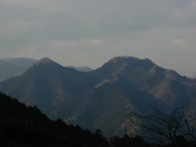
Mount Izugatake is an 850.9 m peak in Hanno City, Saitama, regarded as an emblem of the Okumusashi area. It is the centerpiece of Course 3 of the Kantō Fureai-no-michi ("Path that Crosses Mount Izugatake"), a roughly 14.5 km route linking Shomaru and Agano stations on the Seibu Chichibu Line. The famously steep Otokozaka chain route on the north side of the summit is renowned among scramblers but currently lies outside the official Fureai-no-michi route due to rockfall risk; the Onnazaka alternative is closed for landslide damage, so the present trail runs between them. Modest in elevation but with genuinely rocky ridgelines, the peak features in many lists including Shin Hana no Hyakumeizan, Kantō Hyakumeizan, and Nihon Hyaku Teizan.
Mount Izugatake at a glance
- Weather: The most settled day in the next 7 days is Fri, November 6: clear, gusts up to 6 m/s.
- Route: The shortest is Mount Izugatake in Okumusashi, Loop from Shomaru Station up the Saneya Valley and down by Okurayama and Kame Rock: about 3 h 42 min, 7.3 km, about 600 m of climbing.
Mount Izugatake weather (hourly, 14 days)
Sunrise today 06:07, sunset 16:47
| Tue, 11/3 | Wed, 11/4 | Thu, 11/5 | Fri, 11/6 | Sat, 11/7 | Sun, 11/8 | Mon, 11/9 | Tue, 11/10 | Wed, 11/11 | Thu, 11/12 | Fri, 11/13 | Sat, 11/14 | Sun, 11/15 | Mon, 11/16 | Tue, 11/17 | |||||||||||||||||||||||||||||||||||||||||||||||||||||||||||||||||||||||
|---|---|---|---|---|---|---|---|---|---|---|---|---|---|---|---|---|---|---|---|---|---|---|---|---|---|---|---|---|---|---|---|---|---|---|---|---|---|---|---|---|---|---|---|---|---|---|---|---|---|---|---|---|---|---|---|---|---|---|---|---|---|---|---|---|---|---|---|---|---|---|---|---|---|---|---|---|---|---|---|---|---|---|---|---|---|
| Japan time | 15 | 17 | 19 | 21 | 23 | 1 | 3 | 5 | 7 | 9 | 11 | 13 | 15 | 18 | 21 | 0 | 3 | 6 | 9 | 12 | 15 | 18 | 21 | 0 | 3 | 6 | 9 | 12 | 15 | 18 | 21 | 0 | 3 | 6 | 9 | 12 | 15 | 18 | 21 | 0 | 3 | 6 | 9 | 12 | 15 | 18 | 21 | 0 | 3 | 6 | 9 | 15 | 21 | 3 | 9 | 15 | 21 | 3 | 9 | 15 | 21 | 3 | 9 | 15 | 21 | 3 | 9 | 15 | 21 | 3 | 9 | 15 | 21 | 3 | 9 | 15 | 21 | 3 | 9 | 15 | 21 | 3 | 9 | 15 | |
  |   | |   | | | | | | | | | | | | | | |   |   |   |   |   |   |  | |  | |   | | | | | | | | | | | | | | |   | | | | | | | | | | | | | | | | |   |  | | | | | | | | | | | | | | | |   | | | | | | | ||
| Temperature | °C | 13° | 10° | 10° | 9° | 9° | 8° | 8° | 8° | 8° | 9° | 11° | 10° | 9° | 8° | 8° | 8° | 8° | 8° | 11° | 17° | 14° | 11° | 9° | 9° | 9° | 10° | 16° | 19° | 18° | 13° | 10° | 8° | 6° | 5° | 10° | 12° | 11° | 6° | 3° | 2° | 2° | 1° | 8° | 11° | 10° | 5° | 6° | 5° | 4° | 4° | 7° | 9° | 6° | 5° | 6° | 9° | 5° | 1° | 8° | 9° | 3° | 1° | 8° | 9° | 6° | 2° | 11° | 9° | 1° | 0° | 6° | 9° | 2° | 1° | 8° | 10° | 8° | 8° | 14° | 16° | 8° | 4° | 5° | 8° |
| Precipitation | mm | 0.2 | 0.7 | 1.0 | 0.2 | 0.3 | 0.6 | 5 | 13 | 14 | 2.8 | 0.6 | 1.1 | 0.2 | 0.2 | 0.2 | 1.3 | 0.2 | 2.7 | 14 | |||||||||||||||||||||||||||||||||||||||||||||||||||||||||||||||||
| New snow | cm | ||||||||||||||||||||||||||||||||||||||||||||||||||||||||||||||||||||||||||||||||||||
| Snow depth | cm | 0 | 0 | 0 | 0 | 0 | 0 | 0 | 0 | 0 | 0 | 0 | 0 | 0 | 0 | 0 | 0 | 0 | 0 | 0 | 0 | 0 | 0 | 0 | 0 | 0 | 0 | 0 | 0 | 0 | 0 | 0 | 0 | 0 | 0 | 0 | 0 | 0 | 0 | 0 | 0 | 0 | 0 | 0 | 0 | 0 | 0 | 0 | 0 | 0 | 0 | 0 | 0 | 0 | 0 | 0 | 0 | 0 | 0 | 0 | 0 | 0 | 0 | 0 | 0 | 0 | 0 | 0 | 0 | 0 | 0 | 0 | 0 | 0 | 0 | 0 | 0 | 0 | 0 | 0 | 0 | 0 | 0 | 0 | 0 |
| Wind | m/s | 2 | 1 | 1 | 1 | 0 | 1 | 1 | 1 | 1 | 1 | 2 | 2 | 2 | 1 | 1 | 1 | 2 | 2 | 2 | 1 | 2 | 0 | 1 | 1 | 1 | 1 | 1 | 1 | 1 | 1 | 1 | 1 | 1 | 1 | 2 | 4 | 3 | 0 | 1 | 1 | 1 | 1 | 2 | 1 | 2 | 1 | 0 | 1 | 1 | 1 | 1 | 1 | 1 | 1 | 1 | 3 | 0 | 2 | 7 | 6 | 2 | 1 | 0 | 1 | 1 | 2 | 3 | 5 | 1 | 1 | 1 | 2 | 1 | 2 | 1 | 1 | 0 | 1 | 1 | 5 | 4 | 1 | 1 | 2 |
| Wind gusts | m/s | 7 | 4 | 3 | 2 | 2 | 3 | 3 | 3 | 2 | 4 | 5 | 6 | 6 | 5 | 3 | 3 | 5 | 5 | 6 | 7 | 5 | 3 | 3 | 3 | 3 | 3 | 4 | 6 | 5 | 4 | 4 | 5 | 5 | 5 | 6 | 10 | 11 | 9 | 3 | 4 | 5 | 5 | 5 | 6 | 7 | 6 | 3 | 2 | 3 | 3 | 4 | 7 | 4 | 4 | 4 | 8 | 8 | 4 | 21 | 22 | 16 | 5 | 4 | 7 | 4 | 5 | 9 | 14 | 13 | 5 | 5 | 7 | 5 | 4 | 4 | 6 | 3 | 6 | 5 | 14 | 13 | 12 | 4 | 7 |
| Wind dir. | ↓ | ↓ | ↓ | ↓ | ↓ | ↓ | ↓ | ↓ | ↓ | ↓ | ↓ | ↓ | ↓ | ↓ | ↓ | ↓ | ↓ | ↓ | ↓ | ↓ | ↓ | ↓ | ↓ | ↓ | ↓ | ↓ | ↓ | ↓ | ↓ | ↓ | ↓ | ↓ | ↓ | ↓ | ↓ | ↓ | ↓ | ↓ | ↓ | ↓ | ↓ | ↓ | ↓ | ↓ | ↓ | ↓ | ↓ | ↓ | ↓ | ↓ | ↓ | ↓ | ↓ | ↓ | ↓ | ↓ | ↓ | ↓ | ↓ | ↓ | ↓ | ↓ | ↓ | ↓ | ↓ | ↓ | ↓ | ↓ | ↓ | ↓ | ↓ | ↓ | ↓ | ↓ | ↓ | ↓ | ↓ | ↓ | ↓ | ↓ | ↓ | ↓ | ↓ | ↓ | |
Mount Izugatake hiking routes
- Mount Izugatake in Okumusashi, Loop from Shomaru Station up the Saneya Valley and down by Okurayama and Kame Rock 7.3 km · Ascent 603 m 西武スマイルパーク 正丸駅前, Shomaru (Station) (parking)
- Mount Izugatake and Shomaru Pass Loop from Shomaru Station 8.2 km · Ascent 633 m 西武スマイルパーク 正丸駅前, Shomaru (Station) (parking)
- Mount Izugatake in Okumusashi, Loop from Shomaru Station up via Shomaru Pass and down the Saneya Valley 8.5 km · Ascent 638 m 西武スマイルパーク 正丸駅前, Shomaru (Station) (parking)
Hiking times are estimates calculated from the terrain.
Huts, campsites and lodging near Mount Izugatake
Mountain huts
- Naguri Genki Plaza Emergency Shelter
Campsites
- Naguri Genki Plaza
- Shiraiwa Mountain Stream Camping Ground
- 喜多川キャンピングベース
Lodging
- 休暇村 奥武蔵
Lists that include Mount Izugatake
New 100 Famous Flower Mountains · 100 Low Mountains of Japan · Kanto 100 Famous Mountains · 50 Mountains of Saitama Prefecture · Elevations of 1003 Mountains of Japan · 1000 Mountains of Japan
Mount Izugatake facts
- Elevation
- 851 m
- Location
- Hannō, Saitama
35.926942, 139.160643 - Website
- hanno-tourism.jp
- Trail Map
- www.pref.saitama.lg.jp (PDF)
- Wikipedia
- ja.wikipedia.org