
Mount Izugatake
伊豆ヶ岳
ฮันโน, ไซตามะ · ความสูง 851 ม.
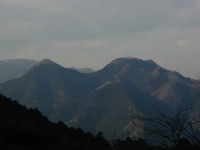
Mount Izugatake is an 850.9 m peak in Hanno City, Saitama, regarded as an emblem of the Okumusashi area. It is the centerpiece of Course 3 of the Kantō Fureai-no-michi ("Path that Crosses Mount Izugatake"), a roughly 14.5 km route linking Shomaru and Agano stations on the Seibu Chichibu Line. The famously steep Otokozaka chain route on the north side of the summit is renowned among scramblers but currently lies outside the official Fureai-no-michi route due to rockfall risk; the Onnazaka alternative is closed for landslide damage, so the present trail runs between them. Modest in elevation but with genuinely rocky ridgelines, the peak features in many lists including Shin Hana no Hyakumeizan, Kantō Hyakumeizan, and Nihon Hyaku Teizan.
สรุป Mount Izugatake
- อากาศ: วันที่อากาศคงที่ที่สุดใน 7 วันข้างหน้าคือ จันทร์ 9 พฤศจิกายน: มีเมฆมาก ลมกระโชกสูงสุด 5 ม./วินาที
- เส้นทาง: เส้นทางที่สั้นที่สุดคือ Mount Izugatake in Okumusashi, Loop from Shomaru Station up the Saneya Valley and down by Okurayama and Kame Rock: ประมาณ 3 ชม. 42 นาที 7.3 km ขึ้นประมาณ 600 m
อากาศ Mount Izugatake (รายชั่วโมง 2 สัปดาห์)
วันนี้พระอาทิตย์ขึ้น 06:07 ตก 16:47
| อังคาร 3/11 | พุธ 4/11 | พฤหัส 5/11 | ศุกร์ 6/11 | เสาร์ 7/11 | อาทิตย์ 8/11 | จันทร์ 9/11 | อังคาร 10/11 | พุธ 11/11 | พฤหัส 12/11 | ศุกร์ 13/11 | เสาร์ 14/11 | อาทิตย์ 15/11 | จันทร์ 16/11 | อังคาร 17/11 | |||||||||||||||||||||||||||||||||||||||||||||||||||||||||||||||||||||||
|---|---|---|---|---|---|---|---|---|---|---|---|---|---|---|---|---|---|---|---|---|---|---|---|---|---|---|---|---|---|---|---|---|---|---|---|---|---|---|---|---|---|---|---|---|---|---|---|---|---|---|---|---|---|---|---|---|---|---|---|---|---|---|---|---|---|---|---|---|---|---|---|---|---|---|---|---|---|---|---|---|---|---|---|---|---|
| เวลาญี่ปุ่น | 21 | 23 | 1 | 3 | 5 | 7 | 9 | 11 | 13 | 15 | 17 | 19 | 21 | 0 | 3 | 6 | 9 | 12 | 15 | 18 | 21 | 0 | 3 | 6 | 9 | 12 | 15 | 18 | 21 | 0 | 3 | 6 | 9 | 12 | 15 | 18 | 21 | 0 | 3 | 6 | 9 | 12 | 15 | 18 | 21 | 0 | 3 | 6 | 9 | 12 | 15 | 21 | 3 | 9 | 15 | 21 | 3 | 9 | 15 | 21 | 3 | 9 | 15 | 21 | 3 | 9 | 15 | 21 | 3 | 9 | 15 | 21 | 3 | 9 | 15 | 21 | 3 | 9 | 15 | 21 | 3 | 9 | 15 | 21 | |
  | |   | | |   | | | |   | | | | | | | |   | |   | |  | | |  | | | | | | | | |   | | | | | | | | | | | | | | | | | | | |   | | |   | | |   |  | | | | | | | | | | | | | | | |   | | | | | | | | ||
| อุณหภูมิ | °C | 9° | 8° | 8° | 8° | 8° | 8° | 10° | 11° | 10° | 9° | 8° | 8° | 8° | 8° | 8° | 9° | 11° | 16° | 15° | 12° | 10° | 9° | 9° | 9° | 17° | 19° | 18° | 13° | 10° | 8° | 6° | 5° | 11° | 12° | 11° | 5° | 4° | 2° | 1° | 1° | 8° | 11° | 10° | 6° | 5° | 5° | 4° | 4° | 5° | 7° | 6° | 6° | 5° | 6° | 9° | 5° | 1° | 8° | 9° | 3° | 1° | 8° | 9° | 6° | 2° | 11° | 9° | 1° | 0° | 6° | 9° | 2° | 1° | 8° | 10° | 8° | 8° | 14° | 16° | 8° | 4° | 5° | 8° | 5° |
| ฝนและหิมะ | mm | 0.2 | 0.2 | 0.1 | 0.3 | 0.8 | 2.6 | 8 | 17 | 8 | 1.1 | 0.4 | 0.1 | 0.1 | 0.2 | 1.3 | 0.2 | 2.7 | 14 | ||||||||||||||||||||||||||||||||||||||||||||||||||||||||||||||||||
| หิมะตก | cm | – | – | – | |||||||||||||||||||||||||||||||||||||||||||||||||||||||||||||||||||||||||||||||||
| หิมะสะสม | cm | 0 | 0 | 0 | 0 | 0 | 0 | 0 | 0 | 0 | 0 | 0 | 0 | 0 | 0 | 0 | 0 | 0 | 0 | 0 | 0 | 0 | 0 | 0 | 0 | 0 | 0 | 0 | 0 | 0 | 0 | 0 | 0 | 0 | 0 | 0 | 0 | 0 | 0 | 0 | 0 | 0 | 0 | 0 | 0 | 0 | 0 | 0 | 0 | 0 | 0 | 0 | 0 | 0 | 0 | 0 | 0 | 0 | 0 | 0 | 0 | 0 | 0 | 0 | 0 | 0 | 0 | 0 | 0 | 0 | 0 | 0 | 0 | 0 | 0 | 0 | 0 | 0 | 0 | 0 | 0 | 0 | 0 | 0 | 0 |
| ลม | m/s | 1 | 0 | 1 | 1 | 1 | 1 | 1 | 2 | 2 | 2 | 1 | 0 | 1 | 1 | 1 | 2 | 2 | 1 | 1 | 1 | 1 | 1 | 1 | 3 | 1 | 2 | 2 | 1 | 1 | 2 | 2 | 1 | 2 | 4 | 4 | 0 | 1 | 1 | 2 | 2 | 2 | 2 | 2 | 1 | 0 | 1 | 1 | 1 | 1 | 1 | 1 | 1 | 1 | 1 | 3 | 0 | 2 | 7 | 6 | 2 | 1 | 0 | 1 | 1 | 2 | 3 | 5 | 1 | 1 | 1 | 2 | 1 | 2 | 1 | 1 | 0 | 1 | 1 | 5 | 4 | 1 | 1 | 2 | 1 |
| ลมกระโชก | m/s | 4 | 3 | 3 | 3 | 3 | 3 | 3 | 5 | 6 | 6 | 5 | 3 | 3 | 3 | 5 | 5 | 7 | 7 | 5 | 3 | 3 | 3 | 3 | 7 | 7 | 6 | 6 | 5 | 4 | 5 | 6 | 6 | 6 | 11 | 11 | 10 | 3 | 4 | 5 | 5 | 6 | 7 | 8 | 5 | 2 | 3 | 3 | 3 | 4 | 4 | 5 | 4 | 4 | 4 | 8 | 8 | 4 | 21 | 22 | 16 | 5 | 4 | 7 | 4 | 5 | 9 | 14 | 13 | 5 | 5 | 7 | 5 | 4 | 4 | 6 | 3 | 6 | 5 | 14 | 13 | 12 | 4 | 7 | 6 |
| ทิศทางลม | ↓ | ↓ | ↓ | ↓ | ↓ | ↓ | ↓ | ↓ | ↓ | ↓ | ↓ | ↓ | ↓ | ↓ | ↓ | ↓ | ↓ | ↓ | ↓ | ↓ | ↓ | ↓ | ↓ | ↓ | ↓ | ↓ | ↓ | ↓ | ↓ | ↓ | ↓ | ↓ | ↓ | ↓ | ↓ | ↓ | ↓ | ↓ | ↓ | ↓ | ↓ | ↓ | ↓ | ↓ | ↓ | ↓ | ↓ | ↓ | ↓ | ↓ | ↓ | ↓ | ↓ | ↓ | ↓ | ↓ | ↓ | ↓ | ↓ | ↓ | ↓ | ↓ | ↓ | ↓ | ↓ | ↓ | ↓ | ↓ | ↓ | ↓ | ↓ | ↓ | ↓ | ↓ | ↓ | ↓ | ↓ | ↓ | ↓ | ↓ | ↓ | ↓ | ↓ | ↓ | |
เส้นทางเดินป่า Mount Izugatake
- Mount Izugatake in Okumusashi, Loop from Shomaru Station up the Saneya Valley and down by Okurayama and Kame Rock 7.3 km · ความสูงสะสมขาขึ้น 603 m 西武スマイルパーク 正丸駅前, Shomaru (สถานี) (มีที่จอดรถ)
- Mount Izugatake and Shomaru Pass Loop from Shomaru Station 8.2 km · ความสูงสะสมขาขึ้น 633 m 西武スマイルパーク 正丸駅前, Shomaru (สถานี) (มีที่จอดรถ)
- Mount Izugatake in Okumusashi, Loop from Shomaru Station up via Shomaru Pass and down the Saneya Valley 8.5 km · ความสูงสะสมขาขึ้น 638 m 西武スマイルパーク 正丸駅前, Shomaru (สถานี) (มีที่จอดรถ)
เวลาเดินเป็นค่าประมาณที่คำนวณจากภูมิประเทศ
กระท่อม ที่ตั้งแคมป์ และที่พักใกล้ Mount Izugatake
กระท่อมบนภูเขา
- Naguri Genki Plaza Emergency Shelter
ที่ตั้งแคมป์
- Naguri Genki Plaza
- Shiraiwa Mountain Stream Camping Ground
- 喜多川キャンピングベース
ที่พัก
- 休暇村 奥武蔵
รายชื่อที่มี Mount Izugatake
100 ภูเขาที่มีชื่อเสียงด้านดอกไม้ฉบับใหม่ · ภูเขาเตี้ย 100 แห่งของญี่ปุ่น · 100 ภูเขาที่มีชื่อเสียงของคันโต · ภูเขา 50 แห่งในจังหวัดไซตามะ · ระดับความสูงของภูเขา 1003 แห่งในญี่ปุ่น · ภูเขา 1000 แห่งของญี่ปุ่น
ข้อมูลพื้นฐาน Mount Izugatake
- ความสูง
- 851 ม.
- ที่ตั้ง
- ฮันโน, ไซตามะ
35.926942, 139.160643 - เว็บไซต์
- hanno-tourism.jp
- แผนที่เส้นทางเดินเขา
- www.pref.saitama.lg.jp (PDF)
- วิกิพีเดีย
- ja.wikipedia.org