
Mount Horohoro
ホロホロ山
Date, Hokkaido · Elevation 1,322 m
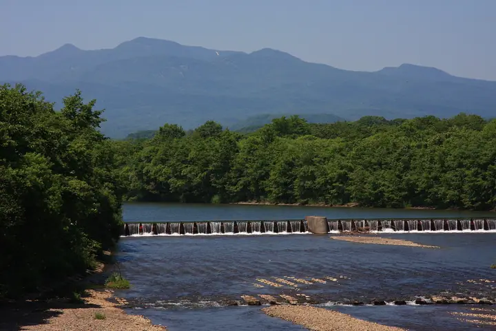
Mount Horohoro is a 1,322.4 m volcano on the border between Date City (Ōtaki district) and Shiraoi Town in Hokkaido — the highest summit in the Iburi Sub-Prefecture, forming a twin peak with neighbouring Mount Tokushunbetsu. Its name derives from the Ainu 'poro-poro-pet' meaning 'an exceedingly great river'. The Shiraoi Course from Prefectural Route 86 (Shikisai Highway) and a traverse from the Ōtaki side via Mount Tokushunbetsu both reach the summit, with the connecting ridge to Tokushunbetsu taking about 30 minutes. The summit offers a 360-degree panorama over Lake Shikotsu, Lake Tōya, Mount Yōtei, and the Ishikari plain.
Mount Horohoro at a glance
- Weather: The most settled day in the next 7 days is Thu, November 5: clear, gusts up to 6 m/s. Wed, Nov 4, Fri, Nov 6, Sat, Nov 7, Sun, Nov 8: strong wind (gusts up to 24 m/s).
- Route: The shortest is Mount Tokushunbetsu and Mount Horohoro Return from the Otaki Trailhead: about 4 h 58 min, 7.5 km, about 800 m of climbing.
Mount Horohoro weather (hourly, 14 days)
Sunrise today 06:11, sunset 16:27
| Tue, 11/3 | Wed, 11/4 | Thu, 11/5 | Fri, 11/6 | Sat, 11/7 | Sun, 11/8 | Mon, 11/9 | Tue, 11/10 | Wed, 11/11 | Thu, 11/12 | Fri, 11/13 | Sat, 11/14 | Sun, 11/15 | Mon, 11/16 | Tue, 11/17 | |||||||||||||||||||||||||||||||||||||||||||||||||||||||||||||||||||||||
|---|---|---|---|---|---|---|---|---|---|---|---|---|---|---|---|---|---|---|---|---|---|---|---|---|---|---|---|---|---|---|---|---|---|---|---|---|---|---|---|---|---|---|---|---|---|---|---|---|---|---|---|---|---|---|---|---|---|---|---|---|---|---|---|---|---|---|---|---|---|---|---|---|---|---|---|---|---|---|---|---|---|---|---|---|---|
| Japan time | 15 | 17 | 19 | 21 | 23 | 1 | 3 | 5 | 7 | 9 | 11 | 13 | 15 | 18 | 21 | 0 | 3 | 6 | 9 | 12 | 15 | 18 | 21 | 0 | 3 | 6 | 9 | 12 | 15 | 18 | 21 | 0 | 3 | 6 | 9 | 12 | 15 | 18 | 21 | 0 | 3 | 6 | 9 | 12 | 15 | 18 | 21 | 0 | 3 | 6 | 9 | 15 | 21 | 3 | 9 | 15 | 21 | 3 | 9 | 15 | 21 | 3 | 9 | 15 | 21 | 3 | 9 | 15 | 21 | 3 | 9 | 15 | 21 | 3 | 9 | 15 | 21 | 3 | 9 | 15 | 21 | 3 | 9 | 15 | |
  |   | | |   | | |   |   | | |  | |  | | | | | | | |   |   | | | |   |   | |   |   | |   | |   |   | | | | | | | | | | | | | | |   | | | | | | | | | | | | |   | | | | | |  | | | | | | | | |   |   | |  | | | ||
| Temperature | °C | -2° | -4° | -4° | -6° | -5° | -4° | -4° | -3° | -3° | -2° | -1° | 0° | 0° | -5° | -6° | -5° | -4° | -3° | 3° | 5° | 5° | 2° | 2° | 3° | 3° | 3° | 6° | 8° | 4° | 0° | -3° | -6° | -7° | -8° | -6° | -5° | -6° | -7° | -7° | -7° | -8° | -8° | -6° | -5° | -6° | -7° | -7° | -7° | -7° | -7° | -6° | -6° | -9° | -9° | -6° | -4° | -6° | -7° | -4° | -2° | -9° | -9° | -3° | -3° | -8° | -8° | -8° | -7° | -7° | -9° | -4° | -2° | -8° | -3° | 1° | 1° | -1° | 0° | -2° | -4° | -8° | -8° | -4° | -4° |
| Precipitation | mm | 0.4 | 3.6 | 1.3 | 0.3 | 4.5 | 4.7 | 4.2 | 1.6 | 0.1 | 0.8 | 0.4 | 0.1 | 0.6 | 0.4 | 0.2 | 0.2 | 0.5 | 0.6 | 0.7 | 0.7 | 0.7 | 0.5 | 0.5 | 0.4 | 0.4 | 0.2 | 0.2 | 2.1 | 1.2 | 0.2 | 0.4 | 0.2 | 0.4 | 0.8 | 2.3 | 2.4 | 1.2 | |||||||||||||||||||||||||||||||||||||||||||||||
| New snow | cm | 0.4 | 3.4 | 1.3 | <.1 | 0.6 | 0.4 | 0.2 | 0.2 | 0.5 | 0.6 | 0.7 | 0.7 | 0.7 | 0.5 | 0.5 | 0.4 | 0.4 | 0.2 | 0.2 | <.1 | <.1 | <.1 | <.1 | <.1 | <.1 | 2.1 | 1.2 | 0.2 | 0.4 | <.1 | <.1 | <.1 | 0.2 | 0.7 | ||||||||||||||||||||||||||||||||||||||||||||||||||
| Snow depth | cm | <1 | <1 | <1 | <1 | <1 | 3 | 3 | 3 | 3 | 3 | 3 | 2 | 2 | 2 | 2 | 2 | 2 | 2 | 2 | 1 | <1 | <1 | <1 | 0 | 0 | 0 | 0 | 0 | 0 | 0 | 0 | <1 | <1 | <1 | <1 | 1 | 2 | 2 | 2 | 3 | 3 | 3 | 3 | 4 | 4 | 4 | 4 | 4 | 4 | 3 | 3 | 3 | 3 | 3 | 3 | 3 | 3 | 5 | 6 | 5 | 5 | 5 | 5 | 5 | 5 | 5 | 5 | 5 | 5 | 5 | 5 | 4 | 4 | 4 | 4 | 2 | 2 | 1 | 1 | 2 | 2 | 2 | 1 | 1 |
| Wind | m/s | 5 | 4 | 4 | 2 | 2 | 4 | 4 | 5 | 5 | 5 | 3 | 2 | 1 | 1 | 1 | 1 | 1 | 1 | 1 | 2 | 1 | 1 | 1 | 1 | 1 | 1 | 3 | 4 | 6 | 6 | 6 | 6 | 6 | 6 | 8 | 9 | 8 | 8 | 7 | 7 | 8 | 7 | 8 | 8 | 7 | 6 | 4 | 4 | 4 | 3 | 5 | 4 | 2 | 1 | 1 | 1 | 3 | 2 | 2 | 1 | 2 | 1 | 2 | 4 | 2 | 3 | 5 | 4 | 3 | 2 | 1 | 1 | 1 | 2 | 2 | 2 | 2 | 0 | 2 | 5 | 5 | 4 | 3 | 3 |
| Wind gusts | m/s | 16 | 14 | 11 | 11 | 8 | 14 | 13 | 16 | 16 | 16 | 15 | 10 | 7 | 5 | 5 | 5 | 5 | 5 | 5 | 6 | 6 | 4 | 4 | 7 | 6 | 5 | 8 | 12 | 17 | 18 | 18 | 19 | 18 | 17 | 21 | 24 | 24 | 23 | 22 | 20 | 21 | 22 | 22 | 22 | 21 | 19 | 17 | 12 | 11 | 11 | 13 | 13 | 12 | 8 | 5 | 6 | 8 | 8 | 7 | 6 | 5 | 6 | 7 | 14 | 11 | 10 | 14 | 15 | 12 | 9 | 6 | 7 | 5 | 7 | 8 | 9 | 7 | 6 | 6 | 14 | 15 | 14 | 12 | 9 |
| Wind dir. | ↓ | ↓ | ↓ | ↓ | ↓ | ↓ | ↓ | ↓ | ↓ | ↓ | ↓ | ↓ | ↓ | ↓ | ↓ | ↓ | ↓ | ↓ | ↓ | ↓ | ↓ | ↓ | ↓ | ↓ | ↓ | ↓ | ↓ | ↓ | ↓ | ↓ | ↓ | ↓ | ↓ | ↓ | ↓ | ↓ | ↓ | ↓ | ↓ | ↓ | ↓ | ↓ | ↓ | ↓ | ↓ | ↓ | ↓ | ↓ | ↓ | ↓ | ↓ | ↓ | ↓ | ↓ | ↓ | ↓ | ↓ | ↓ | ↓ | ↓ | ↓ | ↓ | ↓ | ↓ | ↓ | ↓ | ↓ | ↓ | ↓ | ↓ | ↓ | ↓ | ↓ | ↓ | ↓ | ↓ | ↓ | ↓ | ↓ | ↓ | ↓ | ↓ | ↓ | ↓ | |
Mount Horohoro hiking routes
Hiking times are estimates calculated from the terrain.
Huts, campsites and lodging near Mount Horohoro
Campsites
- 徳舜瞥山麓キャンプ場
Lists that include Mount Horohoro
Mount Horohoro facts
- Elevation
- 1,322 m
- Location
- Date, Hokkaido
42.633517, 141.142527 - Website
- www.iburi.pref.hokkaido.lg.jp
- Trail Map
- www.iburi.pref.hokkaido.lg.jp
- Wikipedia
- ja.wikipedia.org