
Mount Hoko
保古山
Nakatsugawa, Gifu / Ena, Gifu · Elevation 970 m
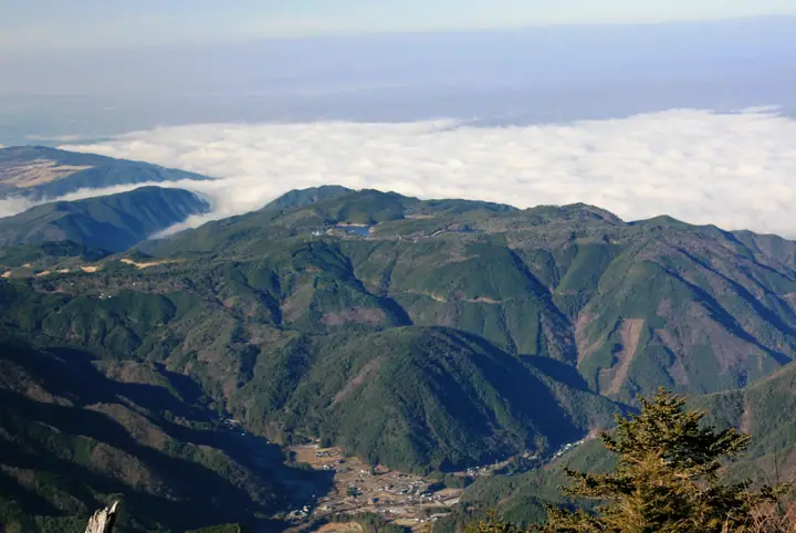
Mount Hoko is a 969.81-metre peak on the boundary between Nakatsugawa City and Ena City, Gifu Prefecture, set among the Byōbu-yama fault-scarp range. Its summit forms a broad plateau—Nene-no-Ue Highlands—designated a Gifu Prefectural Natural Park and National Recreation Area, centred on the twin reservoirs Lake Hoko and Lake Nene-no-Ue. Renowned for some 100,000 azaleas of 25 species, the highland draws visitors in every season—azaleas in spring, cool retreats in summer, foliage in autumn and smelt fishing in winter. The peak is listed in the Zoku Gifu Hyakuzan (Continuing 100 Mountains of Gifu).
Mount Hoko at a glance
- Weather: The most settled day in the next 7 days is Sun, November 8: clear, gusts up to 6 m/s.
Mount Hoko weather (hourly, 14 days)
Sunrise today 06:13, sunset 16:55
| Tue, 11/3 | Wed, 11/4 | Thu, 11/5 | Fri, 11/6 | Sat, 11/7 | Sun, 11/8 | Mon, 11/9 | Tue, 11/10 | Wed, 11/11 | Thu, 11/12 | Fri, 11/13 | Sat, 11/14 | Sun, 11/15 | Mon, 11/16 | Tue, 11/17 | |||||||||||||||||||||||||||||||||||||||||||||||||||||||||||||||||||||
|---|---|---|---|---|---|---|---|---|---|---|---|---|---|---|---|---|---|---|---|---|---|---|---|---|---|---|---|---|---|---|---|---|---|---|---|---|---|---|---|---|---|---|---|---|---|---|---|---|---|---|---|---|---|---|---|---|---|---|---|---|---|---|---|---|---|---|---|---|---|---|---|---|---|---|---|---|---|---|---|---|---|---|---|
| Japan time | 21 | 23 | 1 | 3 | 5 | 7 | 9 | 11 | 13 | 15 | 17 | 19 | 21 | 0 | 3 | 6 | 9 | 12 | 15 | 18 | 21 | 0 | 3 | 6 | 9 | 12 | 15 | 18 | 21 | 0 | 3 | 6 | 9 | 12 | 15 | 18 | 21 | 0 | 3 | 6 | 9 | 12 | 15 | 18 | 21 | 0 | 3 | 6 | 9 | 15 | 21 | 3 | 9 | 15 | 21 | 3 | 9 | 15 | 21 | 3 | 9 | 15 | 21 | 3 | 9 | 15 | 21 | 3 | 9 | 15 | 21 | 3 | 9 | 15 | 21 | 3 | 9 | 15 | 21 | 3 | 9 | 15 | |
 | |   | | |   | |   |   | |   | |   | | |   |   | | | | | | | | |  | |  | | | | | | | | | | | | | | | |   | | | | | | |   | | | | |   | | | |  | | | | | | | | | | | | | |   | | | |   | | | | | ||
| Temperature | °C | 6° | 5° | 5° | 4° | 4° | 6° | 12° | 15° | 14° | 12° | 10° | 10° | 9° | 8° | 8° | 9° | 12° | 15° | 15° | 10° | 10° | 9° | 9° | 8° | 12° | 15° | 14° | 8° | 6° | 5° | 3° | 2° | 6° | 9° | 8° | 3° | 1° | 0° | -1° | -2° | 5° | 10° | 10° | 4° | 5° | 5° | 5° | 5° | 8° | 11° | 4° | 1° | 8° | 10° | 4° | 1° | 4° | 7° | -1° | -2° | 7° | 9° | 2° | 2° | 6° | 9° | 0° | 1° | 8° | 10° | 4° | 5° | 11° | 11° | 8° | 9° | 11° | 14° | 4° | 1° | 7° | 8° |
| Precipitation | mm | 0.4 | 5 | 4.9 | 0.4 | 0.1 | 0.5 | 3.6 | 1.0 | 1.7 | 0.3 | 22 | 12 | 0.2 | 0.5 | 0.5 | |||||||||||||||||||||||||||||||||||||||||||||||||||||||||||||||||||
| New snow | cm | – | – | ||||||||||||||||||||||||||||||||||||||||||||||||||||||||||||||||||||||||||||||||
| Snow depth | cm | 0 | 0 | 0 | 0 | 0 | 0 | 0 | 0 | 0 | 0 | 0 | 0 | 0 | 0 | 0 | 0 | 0 | 0 | 0 | 0 | 0 | 0 | 0 | 0 | 0 | 0 | 0 | 0 | 0 | 0 | 0 | 0 | 0 | 0 | 0 | 0 | 0 | 0 | 0 | 0 | 0 | 0 | 0 | 0 | 0 | 0 | 0 | 0 | 0 | 0 | 0 | 0 | 0 | 0 | 0 | 0 | 0 | 0 | 0 | 0 | 0 | 0 | 0 | 0 | 0 | 0 | 0 | 0 | 0 | 0 | 0 | 0 | 0 | 0 | 0 | 0 | 0 | 0 | 0 | 0 | 0 | 0 |
| Wind | m/s | 1 | 1 | 1 | 1 | 1 | 1 | 1 | 2 | 2 | 1 | 1 | 0 | 0 | 1 | 1 | 3 | 2 | 1 | 1 | 1 | 1 | 1 | 1 | 1 | 2 | 4 | 4 | 2 | 1 | 2 | 2 | 1 | 2 | 5 | 4 | 2 | 0 | 0 | 0 | 0 | 1 | 2 | 1 | 1 | 0 | 0 | 0 | 1 | 0 | 3 | 1 | 1 | 0 | 3 | 0 | 3 | 3 | 4 | 1 | 1 | 1 | 2 | 0 | 1 | 0 | 4 | 1 | 1 | 1 | 2 | 1 | 1 | 0 | 2 | 1 | 1 | 1 | 5 | 1 | 1 | 1 | 2 |
| Wind gusts | m/s | 2 | 2 | 2 | 3 | 3 | 3 | 3 | 6 | 7 | 6 | 3 | 2 | 2 | 7 | 7 | 7 | 6 | 7 | 4 | 3 | 2 | 2 | 3 | 6 | 6 | 11 | 13 | 11 | 7 | 7 | 7 | 6 | 7 | 14 | 14 | 11 | 6 | 3 | 2 | 2 | 3 | 6 | 6 | 5 | 3 | 2 | 2 | 2 | 2 | 9 | 7 | 3 | 4 | 9 | 7 | 12 | 10 | 12 | 11 | 3 | 4 | 8 | 5 | 3 | 4 | 10 | 9 | 4 | 4 | 8 | 6 | 4 | 4 | 7 | 7 | 7 | 4 | 13 | 13 | 4 | 4 | 7 |
| Wind dir. | ↓ | ↓ | ↓ | ↓ | ↓ | ↓ | ↓ | ↓ | ↓ | ↓ | ↓ | ↓ | ↓ | ↓ | ↓ | ↓ | ↓ | ↓ | ↓ | ↓ | ↓ | ↓ | ↓ | ↓ | ↓ | ↓ | ↓ | ↓ | ↓ | ↓ | ↓ | ↓ | ↓ | ↓ | ↓ | ↓ | ↓ | ↓ | ↓ | ↓ | ↓ | ↓ | ↓ | ↓ | ↓ | ↓ | ↓ | ↓ | ↓ | ↓ | ↓ | ↓ | ↓ | ↓ | ↓ | ↓ | ↓ | ↓ | ↓ | ↓ | ↓ | ↓ | ↓ | ↓ | ↓ | ↓ | ↓ | ↓ | ↓ | ↓ | ↓ | ↓ | ↓ | ↓ | ↓ | ↓ | ↓ | ↓ | ↓ | ↓ | ↓ | ||
Huts, campsites and lodging near Mount Hoko
Campsites
- 根の上高原保古の湖キャンプ場
Lodging
- あかまんまロッジ
- ルートイン
- 割烹旅館孫八
Mount Hoko facts
- Elevation
- 970 m
- Location
- Nakatsugawa, Gifu / Ena, Gifu
35.441888, 137.484155 - Website
- www.nenoue969.com
- Trail Map
- www.nenoue969.com (PDF)
- Access Information
- www.nenoue969.com
- Wikipedia
- ja.wikipedia.org