
Mount Hiryū
飛竜山
Chichibu, Saitama · Elevation 2,069 m
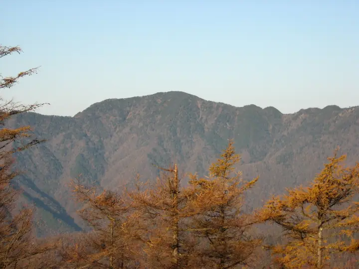
Mount Hiryū is a 2,069.1 m peak on the border between Chichibu City in Saitama and Tabayama Village in Yamanashi, set on the main ridge of the Okuchichibu massif within Chichibu-Tama-Kai National Park. Because it heads the Ōbora River, a tributary of the Arakawa, the Saitama side also knows it as Mount Ōbora. Taller than nearby Mount Kumotori but far less visited, the summit is wonderfully quiet, and the Hage-iwa outcrop on the ridge toward Mae-Hiryū offers one of the great Okuchichibu views. A small Hiryū-gongen shrine sits just below the top, and rhododendrons and iwakagami bloom around June. The peak features in Shin Hana no Hyakumeizan, Yamanashi Hyakumeizan, and Kantō Hyakumeizan.
Mount Hiryū at a glance
- Weather: The most settled day in the next 7 days is Sun, November 8: clear, gusts up to 6 m/s.
Mount Hiryū weather (hourly, 14 days)
Sunrise today 06:08, sunset 16:48
| Tue, 11/3 | Wed, 11/4 | Thu, 11/5 | Fri, 11/6 | Sat, 11/7 | Sun, 11/8 | Mon, 11/9 | Tue, 11/10 | Wed, 11/11 | Thu, 11/12 | Fri, 11/13 | Sat, 11/14 | Sun, 11/15 | Mon, 11/16 | Tue, 11/17 | |||||||||||||||||||||||||||||||||||||||||||||||||||||||||||||||||||||||
|---|---|---|---|---|---|---|---|---|---|---|---|---|---|---|---|---|---|---|---|---|---|---|---|---|---|---|---|---|---|---|---|---|---|---|---|---|---|---|---|---|---|---|---|---|---|---|---|---|---|---|---|---|---|---|---|---|---|---|---|---|---|---|---|---|---|---|---|---|---|---|---|---|---|---|---|---|---|---|---|---|---|---|---|---|---|
| Japan time | 15 | 17 | 19 | 21 | 23 | 1 | 3 | 5 | 7 | 9 | 11 | 13 | 15 | 18 | 21 | 0 | 3 | 6 | 9 | 12 | 15 | 18 | 21 | 0 | 3 | 6 | 9 | 12 | 15 | 18 | 21 | 0 | 3 | 6 | 9 | 12 | 15 | 18 | 21 | 0 | 3 | 6 | 9 | 12 | 15 | 18 | 21 | 0 | 3 | 6 | 9 | 15 | 21 | 3 | 9 | 15 | 21 | 3 | 9 | 15 | 21 | 3 | 9 | 15 | 21 | 3 | 9 | 15 | 21 | 3 | 9 | 15 | 21 | 3 | 9 | 15 | 21 | 3 | 9 | 15 | 21 | 3 | 9 | 15 | |
  |   | | | | |   | |   | | | | | | | | | | |   | | |   |  | | |  | | |   | | | | | | | |   | | | | | | |   | | | | | | | | |   |   |   | | | | |   |  | | | | | | | | | | | | | | | |   | |   | | | | | ||
| Temperature | °C | 4° | 3° | 3° | 2° | 2° | 2° | 2° | 1° | 1° | 3° | 5° | 5° | 4° | 2° | 2° | 2° | 2° | 4° | 6° | 11° | 8° | 6° | 4° | 3° | 3° | 3° | 9° | 14° | 12° | 5° | 2° | 0° | -2° | -3° | 4° | 6° | 6° | -1° | -3° | -2° | -2° | -3° | 4° | 7° | 4° | -1° | 1° | 0° | 0° | 0° | 3° | 2° | -1° | -3° | -1° | 3° | -1° | -5° | 0° | 0° | -6° | -5° | 2° | 4° | -1° | -5° | 3° | 4° | -4° | -4° | 3° | 4° | -3° | -4° | 4° | 6° | 4° | 3° | 10° | 9° | -1° | 1° | 1° | 2° |
| Precipitation | mm | 1.4 | 0.4 | 0.4 | 1.5 | 1.7 | 1.4 | 0.2 | 1.4 | 0.3 | 6 | 12 | 11 | 1.1 | 1.4 | 0.5 | 0.1 | 1.2 | 2.2 | 4.7 | 1.2 | 0.1 | 0.1 | 9 | 14 | 0.1 | 0.3 | ||||||||||||||||||||||||||||||||||||||||||||||||||||||||||
| New snow | cm | 1.7 | 0.6 | ||||||||||||||||||||||||||||||||||||||||||||||||||||||||||||||||||||||||||||||||||
| Snow depth | cm | 0 | 0 | 0 | 0 | 0 | 0 | 0 | 0 | 0 | 0 | 0 | 0 | 0 | 0 | 0 | 0 | 0 | 0 | 0 | 0 | 0 | 0 | 0 | 0 | 0 | 0 | 0 | 0 | 0 | 0 | 0 | 0 | 0 | 0 | 0 | 0 | 0 | 0 | 0 | 0 | 0 | 0 | 0 | 0 | 0 | 0 | 0 | 0 | 0 | 0 | 0 | 0 | 0 | 1 | 1 | <1 | 0 | 0 | 0 | 0 | 0 | 0 | 0 | 0 | 0 | 0 | 0 | 0 | 0 | 0 | 0 | 0 | 0 | 0 | 0 | 0 | 0 | 0 | 0 | 0 | 0 | 0 | 0 | 0 |
| Wind | m/s | 1 | 1 | 0 | 1 | 0 | 0 | 1 | 1 | 1 | 0 | 1 | 2 | 1 | 1 | 1 | 1 | 1 | 1 | 2 | 1 | 2 | 1 | 1 | 1 | 1 | 1 | 1 | 1 | 0 | 1 | 1 | 0 | 1 | 1 | 1 | 3 | 1 | 0 | 1 | 1 | 0 | 1 | 0 | 1 | 1 | 0 | 1 | 1 | 1 | 1 | 1 | 1 | 1 | 0 | 0 | 2 | 1 | 1 | 6 | 4 | 1 | 1 | 1 | 1 | 1 | 1 | 3 | 1 | 1 | 1 | 1 | 1 | 1 | 1 | 2 | 2 | 2 | 3 | 1 | 3 | 2 | 1 | 1 | 1 |
| Wind gusts | m/s | 5 | 4 | 3 | 3 | 3 | 3 | 3 | 4 | 4 | 4 | 5 | 6 | 6 | 6 | 6 | 6 | 6 | 8 | 6 | 6 | 7 | 8 | 6 | 6 | 6 | 6 | 6 | 7 | 7 | 5 | 5 | 5 | 7 | 7 | 8 | 12 | 11 | 7 | 5 | 6 | 6 | 5 | 5 | 6 | 6 | 5 | 6 | 7 | 6 | 6 | 6 | 6 | 5 | 4 | 5 | 9 | 8 | 8 | 21 | 23 | 15 | 6 | 6 | 8 | 6 | 5 | 10 | 12 | 6 | 4 | 4 | 6 | 6 | 6 | 9 | 13 | 10 | 12 | 12 | 10 | 14 | 7 | 5 | 6 |
| Wind dir. | ↓ | ↓ | ↓ | ↓ | ↓ | ↓ | ↓ | ↓ | ↓ | ↓ | ↓ | ↓ | ↓ | ↓ | ↓ | ↓ | ↓ | ↓ | ↓ | ↓ | ↓ | ↓ | ↓ | ↓ | ↓ | ↓ | ↓ | ↓ | ↓ | ↓ | ↓ | ↓ | ↓ | ↓ | ↓ | ↓ | ↓ | ↓ | ↓ | ↓ | ↓ | ↓ | ↓ | ↓ | ↓ | ↓ | ↓ | ↓ | ↓ | ↓ | ↓ | ↓ | ↓ | ↓ | ↓ | ↓ | ↓ | ↓ | ↓ | ↓ | ↓ | ↓ | ↓ | ↓ | ↓ | ↓ | ↓ | ↓ | ↓ | ↓ | ↓ | ↓ | ↓ | ↓ | ↓ | ↓ | ↓ | ↓ | ↓ | ↓ | ↓ | ↓ | ↓ | ↓ | |
Huts, campsites and lodging near Mount Hiryū
Mountain huts
- Sanjo no yu hut with hot springs reservation required
- 将監小屋 sleeps 70
- Kumotori emergency lodge unstaffed
- Okutama-Koya Lodge (Closed)
Campsites
- 五十人平野営場
- 一の瀬高原キャンプ場
Lodging
- 民宿みはらし
Lists that include Mount Hiryū
New 100 Famous Flower Mountains · Kanto 100 Famous Mountains · Yamanashi 100 Famous Mountains · 50 Mountains of Saitama Prefecture · Elevations of 1003 Mountains of Japan
Mount Hiryū facts
- Also known as
- 大洞山
- Elevation
- 2,069 m
- Location
- Chichibu, Saitama
35.839977, 138.893162 - National Park
- 秩父多摩甲斐国立公園
- Website
- www.vill.tabayama.yamanashi.jp
- Trail Map
- www.pref.yamanashi.jp (PDF)
- Wikipedia
- ja.wikipedia.org