
Mount Fujisato-Komagatake
藤里駒ヶ岳
Fujisato, Akita · Elevation 1,158 m
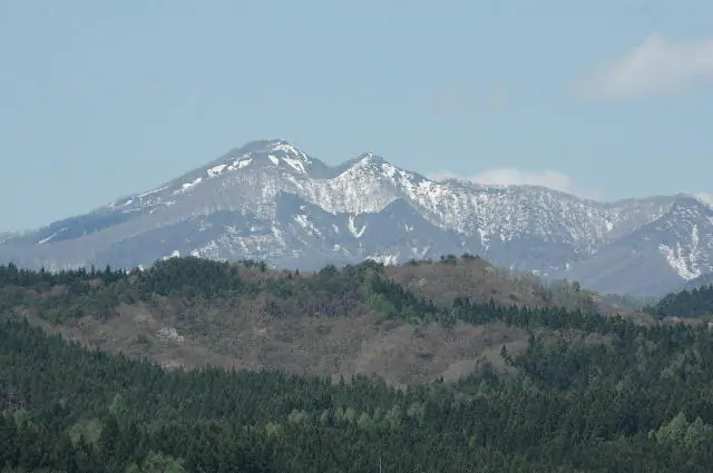
An 1,158 m peak in Fujisato Town, Akita Prefecture, one of the principal summits in the southeastern Shirakami Mountains. Although outside the strict UNESCO-inscribed core area of the Shirakami-sanchi World Heritage Site, its slopes carry the same primeval beech forest, and the Tanashiro Wetland sits on its flank. Three maintained trails — Kuroishi-zawa, Kabadai and Hiyamizu-zawa — climb to the summit. The peak takes its name from a striking horse-shaped snow patch (yukigata) that appears each spring on a subsidiary ridge.
Mount Fujisato-Komagatake at a glance
- Weather: The most settled day in the next 7 days is Thu, November 5: cloudy, gusts up to 8 m/s. Fri, Nov 6, Sat, Nov 7, Sun, Nov 8: strong wind (gusts up to 24 m/s).
Mount Fujisato-Komagatake weather (hourly, 14 days)
Sunrise today 06:10, sunset 16:35
| Tue, 11/3 | Wed, 11/4 | Thu, 11/5 | Fri, 11/6 | Sat, 11/7 | Sun, 11/8 | Mon, 11/9 | Tue, 11/10 | Wed, 11/11 | Thu, 11/12 | Fri, 11/13 | Sat, 11/14 | Sun, 11/15 | Mon, 11/16 | Tue, 11/17 | |||||||||||||||||||||||||||||||||||||||||||||||||||||||||||||||||||||||
|---|---|---|---|---|---|---|---|---|---|---|---|---|---|---|---|---|---|---|---|---|---|---|---|---|---|---|---|---|---|---|---|---|---|---|---|---|---|---|---|---|---|---|---|---|---|---|---|---|---|---|---|---|---|---|---|---|---|---|---|---|---|---|---|---|---|---|---|---|---|---|---|---|---|---|---|---|---|---|---|---|---|---|---|---|---|
| Japan time | 15 | 17 | 19 | 21 | 23 | 1 | 3 | 5 | 7 | 9 | 11 | 13 | 15 | 18 | 21 | 0 | 3 | 6 | 9 | 12 | 15 | 18 | 21 | 0 | 3 | 6 | 9 | 12 | 15 | 18 | 21 | 0 | 3 | 6 | 9 | 12 | 15 | 18 | 21 | 0 | 3 | 6 | 9 | 12 | 15 | 18 | 21 | 0 | 3 | 6 | 9 | 15 | 21 | 3 | 9 | 15 | 21 | 3 | 9 | 15 | 21 | 3 | 9 | 15 | 21 | 3 | 9 | 15 | 21 | 3 | 9 | 15 | 21 | 3 | 9 | 15 | 21 | 3 | 9 | 15 | 21 | 3 | 9 | 15 | |
  |   | | | |   |   | |  | | | | | | |  | | |   |   | |   | | | |   |   | | | | |   |   | |   | | | | | | | |   | | |   | | | | | | | | | |   | |   | | | | | | | |   | | | | | | |  | | | | | | |   | | | | | ||
| Temperature | °C | 2° | -1° | -1° | -1° | 0° | 2° | 3° | 2° | 1° | 5° | 6° | 7° | 6° | 0° | 2° | 2° | 3° | 4° | 7° | 9° | 7° | 6° | 6° | 5° | 5° | 5° | 7° | 7° | 5° | 1° | -1° | -3° | -4° | -4° | -3° | -3° | -3° | -3° | -4° | -4° | -4° | -5° | -3° | -2° | -3° | -3° | -4° | -4° | -4° | -6° | -3° | -3° | -6° | -5° | -3° | 0° | -3° | -2° | -2° | -2° | -3° | -3° | 1° | 0° | -2° | -5° | -3° | -2° | -5° | -5° | 0° | 1° | -3° | -3° | 3° | 3° | 2° | 2° | 3° | -2° | -5° | -4° | -1° | -1° |
| Precipitation | mm | 0.2 | 1.0 | 0.4 | 0.1 | 0.5 | 1.5 | 1.6 | 0.1 | 0.3 | 0.6 | 4.0 | 2.2 | 0.4 | 0.3 | 0.5 | 0.8 | 0.9 | 1.5 | 1.3 | 1.5 | 0.8 | 1.0 | 0.8 | 1.0 | 0.7 | 0.3 | 0.2 | 0.3 | 0.4 | 1.0 | 0.1 | 5.0 | 7 | 12 | 0.8 | 0.1 | 0.5 | 5 | 1.2 | 3.4 | 6 | 1.4 | 4.4 | 1.8 | ||||||||||||||||||||||||||||||||||||||||
| New snow | cm | 0.4 | 0.8 | 0.9 | 1.5 | 1.3 | 1.5 | 0.8 | 1.0 | 0.8 | 1.0 | 0.7 | 0.3 | 0.2 | 0.3 | <.1 | <.1 | 0.4 | 1.0 | 0.1 | <.1 | <.1 | 4.9 | 4.8 | 11 | 0.5 | 1.9 | 0.1 | <.1 | <.1 | 0.6 | 1.5 | <.1 | ||||||||||||||||||||||||||||||||||||||||||||||||||||
| Snow depth | cm | 0 | 0 | 0 | 0 | 0 | 0 | 0 | 0 | 0 | 0 | 0 | 0 | 0 | 0 | 0 | 0 | 0 | 0 | 0 | 0 | 0 | 0 | 0 | 0 | 0 | 0 | 0 | 0 | 0 | 0 | 0 | 0 | <1 | <1 | 2 | 3 | 3 | 4 | 4 | 5 | 5 | 5 | 6 | 5 | 6 | 5 | 5 | 5 | 5 | 5 | 5 | 5 | 5 | 5 | 5 | 5 | 7 | 10 | 16 | 14 | 14 | 13 | 13 | 10 | 11 | 10 | 10 | 10 | 10 | 10 | 10 | 8 | 8 | 8 | 7 | 5 | 4 | 2 | 2 | <1 | 2 | 2 | 2 | 2 |
| Wind | m/s | 5 | 3 | 4 | 3 | 4 | 5 | 6 | 5 | 4 | 3 | 2 | 2 | 1 | 1 | 1 | 1 | 2 | 2 | 3 | 2 | 2 | 1 | 0 | 1 | 1 | 2 | 3 | 6 | 6 | 7 | 8 | 7 | 6 | 7 | 7 | 8 | 8 | 7 | 7 | 7 | 7 | 6 | 7 | 7 | 6 | 5 | 3 | 3 | 2 | 1 | 2 | 2 | 1 | 2 | 2 | 4 | 5 | 2 | 5 | 3 | 1 | 2 | 5 | 4 | 2 | 2 | 4 | 4 | 2 | 2 | 1 | 2 | 2 | 2 | 2 | 2 | 2 | 1 | 2 | 4 | 3 | 3 | 2 | 2 |
| Wind gusts | m/s | 15 | 14 | 10 | 10 | 10 | 13 | 16 | 16 | 14 | 11 | 10 | 7 | 6 | 4 | 3 | 3 | 4 | 6 | 7 | 8 | 7 | 4 | 2 | 4 | 5 | 6 | 9 | 16 | 17 | 18 | 20 | 19 | 18 | 20 | 22 | 24 | 23 | 23 | 20 | 18 | 18 | 18 | 18 | 19 | 18 | 16 | 13 | 9 | 8 | 6 | 7 | 9 | 7 | 5 | 5 | 9 | 13 | 13 | 14 | 15 | 7 | 6 | 12 | 12 | 10 | 6 | 11 | 12 | 11 | 6 | 6 | 7 | 5 | 5 | 5 | 7 | 7 | 6 | 7 | 13 | 14 | 9 | 8 | 8 |
| Wind dir. | ↓ | ↓ | ↓ | ↓ | ↓ | ↓ | ↓ | ↓ | ↓ | ↓ | ↓ | ↓ | ↓ | ↓ | ↓ | ↓ | ↓ | ↓ | ↓ | ↓ | ↓ | ↓ | ↓ | ↓ | ↓ | ↓ | ↓ | ↓ | ↓ | ↓ | ↓ | ↓ | ↓ | ↓ | ↓ | ↓ | ↓ | ↓ | ↓ | ↓ | ↓ | ↓ | ↓ | ↓ | ↓ | ↓ | ↓ | ↓ | ↓ | ↓ | ↓ | ↓ | ↓ | ↓ | ↓ | ↓ | ↓ | ↓ | ↓ | ↓ | ↓ | ↓ | ↓ | ↓ | ↓ | ↓ | ↓ | ↓ | ↓ | ↓ | ↓ | ↓ | ↓ | ↓ | ↓ | ↓ | ↓ | ↓ | ↓ | ↓ | ↓ | ↓ | ↓ | ↓ | |
Huts, campsites and lodging near Mount Fujisato-Komagatake
Campsites
- くるみ台野営場
Lists that include Mount Fujisato-Komagatake
Tohoku 100 Famous Mountains · Elevations of 1003 Mountains of Japan · 1000 Mountains of Japan
Mount Fujisato-Komagatake facts
- Also known as
- 太良駒ヶ岳
- Elevation
- 1,158 m
- Location
- Fujisato, Akita
40.412896, 140.251138 - Website
- www.shirakami-fujisatokan.jp
- Trail Map
- www.shirakami-fujisatokan.jp
- Wikipedia
- ja.wikipedia.org