
Mt. Washigatake
鷲ヶ岳
Gujō-shi, Gifu · Elevation 1,671 m
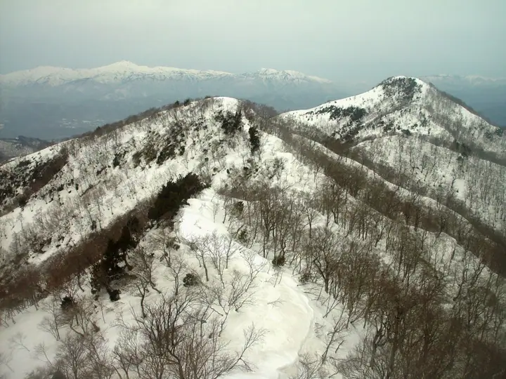
Washigatake is a 1,671 m peak straddling the boundary between Gujō City and Takayama City in Gifu Prefecture, in the Hida Highlands. The summit, blanketed in dwarf bamboo (kumazasa), is the eroded remnant of an old volcano active some 1.2 million years ago. The mountain takes its name from a 12th-century legend in which Fujiwara no Yoriho slew a giant eagle here, and a small shrine — Washigatake Jinja — stands at Ippukudaira on the route. Its western flank is developed as a ski resort, and two main hiking routes (Kuwagaya and Tateishi forest-road courses) lead to the summit. Listed among the Japanese 300 Famous Mountains and the Hundred Mountains of Gifu.
Mt. Washigatake at a glance
- Weather: The most settled day in the next 7 days is Wed, November 4: clear, gusts up to 8 m/s.
Mt. Washigatake weather (hourly, 14 days)
Sunrise today 06:16, sunset 16:56
| Tue, 11/3 | Wed, 11/4 | Thu, 11/5 | Fri, 11/6 | Sat, 11/7 | Sun, 11/8 | Mon, 11/9 | Tue, 11/10 | Wed, 11/11 | Thu, 11/12 | Fri, 11/13 | Sat, 11/14 | Sun, 11/15 | Mon, 11/16 | Tue, 11/17 | |||||||||||||||||||||||||||||||||||||||||||||||||||||||||||||||||||||||
|---|---|---|---|---|---|---|---|---|---|---|---|---|---|---|---|---|---|---|---|---|---|---|---|---|---|---|---|---|---|---|---|---|---|---|---|---|---|---|---|---|---|---|---|---|---|---|---|---|---|---|---|---|---|---|---|---|---|---|---|---|---|---|---|---|---|---|---|---|---|---|---|---|---|---|---|---|---|---|---|---|---|---|---|---|---|
| Japan time | 21 | 23 | 1 | 3 | 5 | 7 | 9 | 11 | 13 | 15 | 17 | 19 | 21 | 0 | 3 | 6 | 9 | 12 | 15 | 18 | 21 | 0 | 3 | 6 | 9 | 12 | 15 | 18 | 21 | 0 | 3 | 6 | 9 | 12 | 15 | 18 | 21 | 0 | 3 | 6 | 9 | 12 | 15 | 18 | 21 | 0 | 3 | 6 | 9 | 12 | 15 | 21 | 3 | 9 | 15 | 21 | 3 | 9 | 15 | 21 | 3 | 9 | 15 | 21 | 3 | 9 | 15 | 21 | 3 | 9 | 15 | 21 | 3 | 9 | 15 | 21 | 3 | 9 | 15 | 21 | 3 | 9 | 15 | 21 | |
  | | |  | |   | | | |   |   | | |   | |   |   |   | | | | | | | |   | |   | |   | | | | | | | | | | | | | | | | | | |  | | | | | |   | |   |   | | |  | | | | | | | | | | | | | | | | | | | | | | | | ||
| Temperature | °C | 0° | 0° | 0° | 0° | -1° | 0° | 7° | 11° | 11° | 10° | 8° | 7° | 7° | 6° | 6° | 5° | 9° | 13° | 12° | 9° | 8° | 8° | 8° | 6° | 8° | 10° | 7° | 3° | 3° | 1° | 0° | -1° | 2° | 4° | 2° | 0° | -1° | -1° | -2° | -3° | 2° | 7° | 5° | 0° | 0° | 2° | 3° | 3° | 5° | 9° | 8° | -1° | -2° | 4° | 5° | 1° | -3° | 0° | 1° | -3° | -5° | 3° | 5° | -3° | 0° | 2° | 3° | -3° | -5° | 4° | 6° | 3° | 3° | 5° | 6° | 6° | 6° | 7° | 7° | 0° | -2° | 2° | 6° | 3° |
| Precipitation | mm | 5.0 | 6 | 1.8 | 0.2 | 0.3 | 2.0 | 4.2 | 6 | 0.1 | 0.3 | 0.2 | 0.2 | 0.1 | 0.2 | 0.1 | 2.8 | 1.4 | 0.2 | 0.1 | 0.2 | 0.8 | 7 | 14 | 3.4 | 0.3 | 0.1 | 0.3 | 0.8 | ||||||||||||||||||||||||||||||||||||||||||||||||||||||||
| New snow | cm | 0.2 | 0.2 | ||||||||||||||||||||||||||||||||||||||||||||||||||||||||||||||||||||||||||||||||||
| Snow depth | cm | 0 | 0 | 0 | 0 | 0 | 0 | 0 | 0 | 0 | 0 | 0 | 0 | 0 | 0 | 0 | 0 | 0 | 0 | 0 | 0 | 0 | 0 | 0 | 0 | 0 | 0 | 0 | 0 | 0 | 0 | 0 | 0 | 0 | 0 | 0 | 0 | 0 | 0 | 0 | 0 | 0 | 0 | 0 | 0 | 0 | 0 | 0 | 0 | 0 | 0 | 0 | 0 | 0 | 0 | 0 | 0 | 0 | 0 | 0 | 0 | 0 | 0 | 0 | 0 | 0 | 0 | 0 | 0 | 0 | 0 | 0 | 0 | 0 | 0 | 0 | 0 | 0 | 0 | 0 | 0 | 0 | 0 | 0 | 0 |
| Wind | m/s | 3 | 2 | 3 | 3 | 3 | 3 | 2 | 2 | 3 | 2 | 0 | 1 | 1 | 1 | 1 | 1 | 0 | 1 | 2 | 1 | 2 | 2 | 2 | 1 | 2 | 5 | 4 | 2 | 2 | 2 | 1 | 2 | 2 | 4 | 4 | 3 | 3 | 4 | 4 | 4 | 3 | 2 | 2 | 2 | 2 | 0 | 1 | 0 | 1 | 3 | 3 | 3 | 2 | 3 | 4 | 3 | 4 | 6 | 6 | 3 | 3 | 0 | 3 | 1 | 1 | 4 | 5 | 3 | 3 | 1 | 3 | 1 | 0 | 2 | 2 | 3 | 1 | 1 | 6 | 5 | 4 | 2 | 3 | 1 |
| Wind gusts | m/s | 6 | 6 | 6 | 7 | 8 | 8 | 8 | 6 | 8 | 8 | 7 | 4 | 4 | 5 | 7 | 6 | 4 | 4 | 7 | 6 | 7 | 8 | 11 | 7 | 7 | 13 | 15 | 12 | 8 | 7 | 6 | 7 | 8 | 12 | 12 | 11 | 11 | 11 | 13 | 13 | 12 | 10 | 7 | 5 | 4 | 4 | 5 | 5 | 4 | 10 | 10 | 7 | 7 | 8 | 13 | 11 | 14 | 16 | 18 | 15 | 10 | 6 | 9 | 7 | 4 | 12 | 14 | 13 | 10 | 6 | 10 | 8 | 5 | 8 | 8 | 9 | 11 | 6 | 17 | 16 | 14 | 10 | 10 | 8 |
| Wind dir. | ↓ | ↓ | ↓ | ↓ | ↓ | ↓ | ↓ | ↓ | ↓ | ↓ | ↓ | ↓ | ↓ | ↓ | ↓ | ↓ | ↓ | ↓ | ↓ | ↓ | ↓ | ↓ | ↓ | ↓ | ↓ | ↓ | ↓ | ↓ | ↓ | ↓ | ↓ | ↓ | ↓ | ↓ | ↓ | ↓ | ↓ | ↓ | ↓ | ↓ | ↓ | ↓ | ↓ | ↓ | ↓ | ↓ | ↓ | ↓ | ↓ | ↓ | ↓ | ↓ | ↓ | ↓ | ↓ | ↓ | ↓ | ↓ | ↓ | ↓ | ↓ | ↓ | ↓ | ↓ | ↓ | ↓ | ↓ | ↓ | ↓ | ↓ | ↓ | ↓ | ↓ | ↓ | ↓ | ↓ | ↓ | ↓ | ↓ | ↓ | ↓ | ↓ | ↓ | ||
Huts, campsites and lodging near Mt. Washigatake
Lodging
- Gujyo Vacance Mura Hotel
Lists that include Mt. Washigatake
Japan's 300 Famous Mountains · 100 Mountains of Gifu · Elevations of 1003 Mountains of Japan · 1000 Mountains of Japan
Mt. Washigatake facts
- Elevation
- 1,671 m
- Location
- Gujō-shi, Gifu
35.940355, 136.971499 - Website
- gujotakasu.com
- Trail Map
- gujotakasu.com
- Wikipedia
- ja.wikipedia.org