
Mt. Shakushi
杓子山
Oshino, Yamanashi / Tsuru, Yamanashi / Fujiyoshida, Yamanashi · Elevation 1,598 m
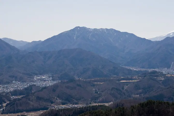
Mt. Shakushi (1,598 m) rises on the boundary of Fujiyoshida, Tsuru, and Oshino in Yamanashi as one of the principal peaks of the Dōshi Range, listed among the 100 Famous Mountains of Yamanashi and the 21 Peaks of Tsuru City. Its summit holds the celebrated "Bell of the Sky" and looks directly out across a sweeping near-perfect view of Mt. Fuji, making it one of the most popular Fuji-viewing peaks within day-trip range of Tokyo. The standard climb is the Fudōyu/Toriidi-tōge route from the Fujiyoshida side, which closes with a steep pitch above Daigonkubi Pass before opening to a 360-degree panorama that reaches the Southern Alps and the Fuji Five Lakes.
Mt. Shakushi at a glance
- Weather: The most settled day in the next 7 days is Sat, November 7: clear, gusts up to 7 m/s.
- Route: The shortest is Mount Shakushi Circuit via Fudoyu and Ozasu Pass: about 3 h 52 min, 7.4 km, about 670 m of climbing.
Mt. Shakushi weather (hourly, 14 days)
Sunrise today 06:07, sunset 16:49
| Tue, 11/3 | Wed, 11/4 | Thu, 11/5 | Fri, 11/6 | Sat, 11/7 | Sun, 11/8 | Mon, 11/9 | Tue, 11/10 | Wed, 11/11 | Thu, 11/12 | Fri, 11/13 | Sat, 11/14 | Sun, 11/15 | Mon, 11/16 | Tue, 11/17 | |||||||||||||||||||||||||||||||||||||||||||||||||||||||||||||||||||||||
|---|---|---|---|---|---|---|---|---|---|---|---|---|---|---|---|---|---|---|---|---|---|---|---|---|---|---|---|---|---|---|---|---|---|---|---|---|---|---|---|---|---|---|---|---|---|---|---|---|---|---|---|---|---|---|---|---|---|---|---|---|---|---|---|---|---|---|---|---|---|---|---|---|---|---|---|---|---|---|---|---|---|---|---|---|---|
| Japan time | 21 | 23 | 1 | 3 | 5 | 7 | 9 | 11 | 13 | 15 | 17 | 19 | 21 | 0 | 3 | 6 | 9 | 12 | 15 | 18 | 21 | 0 | 3 | 6 | 9 | 12 | 15 | 18 | 21 | 0 | 3 | 6 | 9 | 12 | 15 | 18 | 21 | 0 | 3 | 6 | 9 | 12 | 15 | 18 | 21 | 0 | 3 | 6 | 9 | 12 | 15 | 21 | 3 | 9 | 15 | 21 | 3 | 9 | 15 | 21 | 3 | 9 | 15 | 21 | 3 | 9 | 15 | 21 | 3 | 9 | 15 | 21 | 3 | 9 | 15 | 21 | 3 | 9 | 15 | 21 | 3 | 9 | 15 | 21 | |
  | | |   | |   | |   | | | | | | | | |   |   | |   | |  |   | |  | | |   | | | | | | |   | |   | | | | | | | | | | | | | | | | | | | | |   | |   |  | | | | | | | | | | | | | | | | | | | | | | | | ||
| Temperature | °C | 5° | 4° | 4° | 4° | 3° | 3° | 4° | 5° | 5° | 4° | 3° | 3° | 3° | 4° | 5° | 5° | 9° | 11° | 9° | 7° | 5° | 5° | 5° | 5° | 12° | 13° | 11° | 8° | 6° | 5° | 5° | 3° | 6° | 9° | 7° | 3° | 2° | 2° | 2° | 2° | 5° | 8° | 6° | 3° | 2° | 2° | 3° | 3° | 5° | 5° | 4° | 1° | 0° | 2° | 5° | 1° | -2° | 2° | 5° | -2° | -2° | 3° | 5° | 2° | -2° | 5° | 7° | 1° | 1° | 2° | 5° | 1° | 0° | 7° | 9° | 5° | 6° | 11° | 13° | 4° | 4° | 1° | 3° | 1° |
| Precipitation | mm | 0.5 | 0.4 | 0.1 | 0.2 | 0.2 | 0.5 | 1.0 | 2.6 | 2.7 | 7 | 18 | 20 | 12 | 1.0 | 0.1 | 0.9 | 0.2 | 0.1 | 0.2 | 0.4 | 0.1 | 0.1 | 0.1 | 0.9 | 0.2 | 1.1 | 0.6 | 0.4 | 0.5 | 0.9 | 0.2 | 0.3 | 0.4 | 0.4 | 0.1 | 0.2 | 13 | 26 | 0.8 | 2.0 | 1.5 | 0.7 | 0.4 | |||||||||||||||||||||||||||||||||||||||||
| New snow | cm | ||||||||||||||||||||||||||||||||||||||||||||||||||||||||||||||||||||||||||||||||||||
| Snow depth | cm | 0 | 0 | 0 | 0 | 0 | 0 | 0 | 0 | 0 | 0 | 0 | 0 | 0 | 0 | 0 | 0 | 0 | 0 | 0 | 0 | 0 | 0 | 0 | 0 | 0 | 0 | 0 | 0 | 0 | 0 | 0 | 0 | 0 | 0 | 0 | 0 | 0 | 0 | 0 | 0 | 0 | 0 | 0 | 0 | 0 | 0 | 0 | 0 | 0 | 0 | 0 | 0 | 0 | 0 | 0 | 0 | 0 | 0 | 0 | 0 | 0 | 0 | 0 | 0 | 0 | 0 | 0 | 0 | 0 | 0 | 0 | 0 | 0 | 0 | 0 | 0 | 0 | 0 | 0 | 0 | 0 | 0 | 0 | 0 |
| Wind | m/s | 1 | 1 | 1 | 0 | 1 | 1 | 1 | 1 | 1 | 1 | 1 | 0 | 0 | 1 | 1 | 1 | 2 | 0 | 1 | 0 | 1 | 1 | 2 | 2 | 1 | 1 | 2 | 1 | 1 | 1 | 1 | 1 | 1 | 1 | 2 | 1 | 1 | 0 | 0 | 0 | 1 | 1 | 2 | 1 | 1 | 0 | 0 | 1 | 1 | 2 | 2 | 1 | 1 | 1 | 3 | 1 | 1 | 7 | 4 | 1 | 1 | 1 | 2 | 0 | 1 | 3 | 1 | 1 | 0 | 1 | 1 | 0 | 1 | 1 | 2 | 0 | 1 | 1 | 2 | 2 | 1 | 1 | 2 | 1 |
| Wind gusts | m/s | 3 | 3 | 3 | 3 | 4 | 4 | 4 | 5 | 5 | 5 | 5 | 4 | 4 | 4 | 6 | 6 | 5 | 7 | 4 | 3 | 4 | 6 | 7 | 7 | 6 | 6 | 6 | 5 | 4 | 4 | 5 | 5 | 5 | 6 | 7 | 6 | 4 | 3 | 3 | 3 | 4 | 6 | 7 | 7 | 4 | 4 | 4 | 4 | 4 | 6 | 6 | 6 | 5 | 5 | 9 | 9 | 7 | 20 | 20 | 12 | 4 | 5 | 7 | 6 | 4 | 8 | 11 | 4 | 3 | 3 | 5 | 4 | 5 | 6 | 9 | 6 | 9 | 6 | 8 | 7 | 6 | 4 | 6 | 6 |
| Wind dir. | ↓ | ↓ | ↓ | ↓ | ↓ | ↓ | ↓ | ↓ | ↓ | ↓ | ↓ | ↓ | ↓ | ↓ | ↓ | ↓ | ↓ | ↓ | ↓ | ↓ | ↓ | ↓ | ↓ | ↓ | ↓ | ↓ | ↓ | ↓ | ↓ | ↓ | ↓ | ↓ | ↓ | ↓ | ↓ | ↓ | ↓ | ↓ | ↓ | ↓ | ↓ | ↓ | ↓ | ↓ | ↓ | ↓ | ↓ | ↓ | ↓ | ↓ | ↓ | ↓ | ↓ | ↓ | ↓ | ↓ | ↓ | ↓ | ↓ | ↓ | ↓ | ↓ | ↓ | ↓ | ↓ | ↓ | ↓ | ↓ | ↓ | ↓ | ↓ | ↓ | ↓ | ↓ | ↓ | ↓ | ↓ | ↓ | ↓ | ↓ | ↓ | ↓ | ↓ | ↓ | |
Mt. Shakushi hiking routes
Hiking times are estimates calculated from the terrain.
Huts, campsites and lodging near Mt. Shakushi
Lodging
- 不動湯
- レイク忍野
- Masunoie
- Guesthouse E-ne
- Business Hotel Fujimi
Lists that include Mt. Shakushi
Yamanashi 100 Famous Mountains · 21 Outstanding Peaks of Tsuru City (Yamanashi Prefecture) · 1000 Mountains of Japan
Mt. Shakushi facts
- Elevation
- 1,598 m
- Location
- Oshino, Yamanashi / Tsuru, Yamanashi / Fujiyoshida, Yamanashi
35.485213, 138.866211 - Website
- yamanashi-hiking100.jp
- Wikipedia
- ja.wikipedia.org