
Mount Ishiwari
石割山
Yamanakako, Yamanashi · Elevation 1,413 m
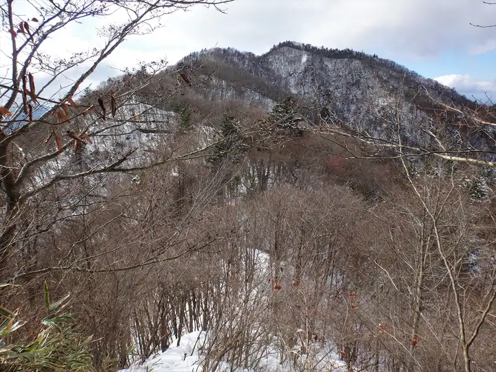
Mount Ishiwari is a 1,413 m peak on the border between Yamanakako Village in Minamitsuru District and Tsuru City in Yamanashi, set within the Fuji Mountain sector of Fuji-Hakone-Izu National Park and the highest summit of Yamanakako Village. Its name comes from the colossal rock just below the summit — split in a shape resembling the kanji 石 — which is enshrined as the sacred body of Ishiwari Shrine; passing three times through the cleft is said to bring good health and good fortune, making it one of Yamanakako's foremost power spots. The classic route climbs 403 stone steps from Yamanakako Kirara, passes the shrine, and tops out on a summit that frames Mount Fuji, Lake Yamanaka, and the Southern Alps. The peak appears in numerous lists including Hana no Hyakumeizan, Yamanashi Hyakumeizan, and Nihon Hyaku Teizan.
Mount Ishiwari at a glance
- Weather: The most settled day in the next 7 days is Fri, November 6: clear, gusts up to 7 m/s.
- Route: The shortest is Mount Ishiwari and Mount Hirao Shrine Circuit: about 2 h 45 min, 4.4 km, about 420 m of climbing.
Mount Ishiwari weather (hourly, 14 days)
Sunrise today 06:07, sunset 16:49
| Tue, 11/3 | Wed, 11/4 | Thu, 11/5 | Fri, 11/6 | Sat, 11/7 | Sun, 11/8 | Mon, 11/9 | Tue, 11/10 | Wed, 11/11 | Thu, 11/12 | Fri, 11/13 | Sat, 11/14 | Sun, 11/15 | Mon, 11/16 | Tue, 11/17 | |||||||||||||||||||||||||||||||||||||||||||||||||||||||||||||||||||||||
|---|---|---|---|---|---|---|---|---|---|---|---|---|---|---|---|---|---|---|---|---|---|---|---|---|---|---|---|---|---|---|---|---|---|---|---|---|---|---|---|---|---|---|---|---|---|---|---|---|---|---|---|---|---|---|---|---|---|---|---|---|---|---|---|---|---|---|---|---|---|---|---|---|---|---|---|---|---|---|---|---|---|---|---|---|---|
| Japan time | 15 | 17 | 19 | 21 | 23 | 1 | 3 | 5 | 7 | 9 | 11 | 13 | 15 | 18 | 21 | 0 | 3 | 6 | 9 | 12 | 15 | 18 | 21 | 0 | 3 | 6 | 9 | 12 | 15 | 18 | 21 | 0 | 3 | 6 | 9 | 12 | 15 | 18 | 21 | 0 | 3 | 6 | 9 | 12 | 15 | 18 | 21 | 0 | 3 | 6 | 9 | 15 | 21 | 3 | 9 | 15 | 21 | 3 | 9 | 15 | 21 | 3 | 9 | 15 | 21 | 3 | 9 | 15 | 21 | 3 | 9 | 15 | 21 | 3 | 9 | 15 | 21 | 3 | 9 | 15 | 21 | 3 | 9 | 15 | |
  |   | | | | | |   |   | | | | | | | | | | |   | | | | |   | |  | |   |  | |   | | | | | | | |   | | | | | | | | | | |   | | | | | | | | | |   |  | | | | | | | | | | | | | | | | | | | | | | | ||
| Temperature | °C | 9° | 8° | 8° | 7° | 7° | 6° | 6° | 5° | 5° | 6° | 7° | 7° | 6° | 5° | 5° | 5° | 6° | 7° | 9° | 14° | 12° | 10° | 8° | 6° | 5° | 5° | 13° | 17° | 14° | 10° | 8° | 8° | 8° | 6° | 9° | 12° | 8° | 6° | 4° | 5° | 4° | 3° | 8° | 11° | 8° | 6° | 5° | 5° | 4° | 4° | 5° | 7° | 4° | 2° | 5° | 7° | 4° | 1° | 5° | 8° | -1° | -1° | 5° | 6° | 4° | -1° | 7° | 9° | 2° | 2° | 4° | 6° | 3° | 1° | 8° | 11° | 8° | 8° | 12° | 16° | 6° | 5° | 3° | 5° |
| Precipitation | mm | 1.1 | 0.4 | 0.5 | 0.8 | 0.2 | 0.2 | 0.2 | 0.2 | 0.5 | 0.6 | 1.3 | 4.2 | 11 | 19 | 9 | 5 | 0.8 | 1.8 | 0.2 | 0.4 | 2.2 | 0.3 | 1.3 | 1.6 | 0.2 | 0.3 | 0.6 | 0.3 | 0.1 | 0.4 | 0.1 | 10 | 25 | 0.8 | 0.5 | 0.2 | ||||||||||||||||||||||||||||||||||||||||||||||||
| New snow | cm | ||||||||||||||||||||||||||||||||||||||||||||||||||||||||||||||||||||||||||||||||||||
| Snow depth | cm | 0 | 0 | 0 | 0 | 0 | 0 | 0 | 0 | 0 | 0 | 0 | 0 | 0 | 0 | 0 | 0 | 0 | 0 | 0 | 0 | 0 | 0 | 0 | 0 | 0 | 0 | 0 | 0 | 0 | 0 | 0 | 0 | 0 | 0 | 0 | 0 | 0 | 0 | 0 | 0 | 0 | 0 | 0 | 0 | 0 | 0 | 0 | 0 | 0 | 0 | 0 | 0 | 0 | 0 | 0 | 0 | 0 | 0 | 0 | 0 | 0 | 0 | 0 | 0 | 0 | 0 | 0 | 0 | 0 | 0 | 0 | 0 | 0 | 0 | 0 | 0 | 0 | 0 | 0 | 0 | 0 | 0 | 0 | 0 |
| Wind | m/s | 2 | 1 | 1 | 1 | 1 | 1 | 2 | 2 | 2 | 1 | 2 | 2 | 2 | 1 | 1 | 2 | 2 | 2 | 2 | 2 | 2 | 0 | 1 | 1 | 1 | 1 | 1 | 1 | 2 | 1 | 1 | 1 | 2 | 1 | 1 | 1 | 2 | 2 | 0 | 1 | 1 | 0 | 1 | 2 | 3 | 1 | 1 | 1 | 1 | 1 | 1 | 3 | 2 | 3 | 2 | 4 | 1 | 1 | 6 | 4 | 1 | 1 | 1 | 2 | 1 | 1 | 2 | 2 | 1 | 1 | 1 | 2 | 0 | 1 | 1 | 2 | 1 | 0 | 1 | 1 | 2 | 1 | 1 | 2 |
| Wind gusts | m/s | 7 | 6 | 3 | 3 | 3 | 3 | 4 | 4 | 4 | 4 | 5 | 5 | 5 | 5 | 4 | 5 | 5 | 6 | 7 | 8 | 5 | 5 | 3 | 3 | 4 | 4 | 4 | 5 | 7 | 5 | 3 | 3 | 5 | 4 | 5 | 6 | 7 | 6 | 4 | 2 | 2 | 2 | 4 | 7 | 10 | 8 | 3 | 3 | 3 | 3 | 4 | 9 | 7 | 7 | 7 | 10 | 10 | 4 | 20 | 18 | 10 | 3 | 4 | 7 | 6 | 4 | 6 | 10 | 5 | 3 | 4 | 6 | 6 | 3 | 4 | 9 | 6 | 5 | 4 | 7 | 5 | 5 | 5 | 7 |
| Wind dir. | ↓ | ↓ | ↓ | ↓ | ↓ | ↓ | ↓ | ↓ | ↓ | ↓ | ↓ | ↓ | ↓ | ↓ | ↓ | ↓ | ↓ | ↓ | ↓ | ↓ | ↓ | ↓ | ↓ | ↓ | ↓ | ↓ | ↓ | ↓ | ↓ | ↓ | ↓ | ↓ | ↓ | ↓ | ↓ | ↓ | ↓ | ↓ | ↓ | ↓ | ↓ | ↓ | ↓ | ↓ | ↓ | ↓ | ↓ | ↓ | ↓ | ↓ | ↓ | ↓ | ↓ | ↓ | ↓ | ↓ | ↓ | ↓ | ↓ | ↓ | ↓ | ↓ | ↓ | ↓ | ↓ | ↓ | ↓ | ↓ | ↓ | ↓ | ↓ | ↓ | ↓ | ↓ | ↓ | ↓ | ↓ | ↓ | ↓ | ↓ | ↓ | ↓ | ↓ | ||
Mount Ishiwari hiking routes
- Mount Ishiwari and Mount Hirao Shrine Circuit 4.4 km · Ascent 416 m parking
- Mount Ishiwari and Ichinosunanosawanokashira Loop 6.7 km · Ascent 447 m ローソン, 石割の湯 (Bus stop), 紀文寮前 (Bus stop), 第三駐車場, 第一駐車場
- Mount Ishiwari and Ichi-no-Suna-no-Sawa-no-Atama Loop from the Ishiwari Hiking Course Entrance 7.1 km · Ascent 464 m Yamanakako Hirano (Bus stop) (parking)
- Ishiwari Shrine to Mount Ishiwari, Mount Hirao and Mount Ohira Out-and-Back 7.0 km · Ascent 640 m parking
- Mount Ishiwari and Mount Ohira Traverse from Hirano to Hana-no-Miyako Park 10.8 km · Ascent 631 m Yamanakako Hirano (Bus stop) (parking) → 観光船のりば (Bus stop)
- Lake Yamanaka North Ridge to Mount Ishiwari 10.6 km · Ascent 750 m Hotel Mt. Fuji
Hiking times are estimates calculated from the terrain.
Huts, campsites and lodging near Mount Ishiwari
Campsites
- 山中湖ふじのもりオートキャンプ場
- sotosotodays CAMPGROUNDS Yamanaka Lake Misaki
- 山伏オートキャンプ場
- 湖山荘キャンプ場
- 奥道志オートキャンプ場
Lodging
- ニュースターホテル山中湖
- レークヴィラ東山
- Marriott Lake Yamanaka
- 城山荘
- ずみのき
Lists that include Mount Ishiwari
100 Famous Mountains of Flowers · 100 Low Mountains of Japan · Yamanashi 100 Famous Mountains · 21 Outstanding Peaks of Tsuru City (Yamanashi Prefecture)
Mount Ishiwari facts
- Elevation
- 1,413 m
- Location
- Yamanakako, Yamanashi
35.450493, 138.901359 - National Park
- 富士箱根伊豆国立公園
- Website
- lake-yamanakako.com
- Trail Map
- www.pref.yamanashi.jp (PDF)
- Wikipedia
- ja.wikipedia.org