
Mt. Sahorodake
佐幌岳
Shintoku, Hokkaido / Minamifurano, Hokkaido · Elevation 1,059 m
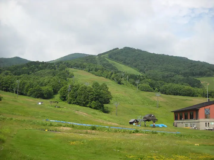
Mt. Sahorodake is a 1,059 m peak straddling Shintoku Town in Kamikawa District and Minami-Furano Town in Sorachi District, Hokkaido, the northernmost forefront summit of the Hidaka Mountains. The name derives from the Ainu "Saoropetsu" ("river that flows in a low place"). The standard route starts from the Karikachi-toge trailhead on National Route 38, reaching the summit via the intermediate Sakurayama peak in about 2 hours 20 minutes. A summit refuge stands at the top, which commands a 360-degree view across the Tokachi Plain. The peak is included in the Hokkaido 100 Mountains and the Japan 1003 Mountain Elevations.
Mt. Sahorodake at a glance
- Weather: The most settled day in the next 7 days is Thu, November 5: cloudy, gusts up to 6 m/s. Wed, Nov 4, Sat, Nov 7, Sun, Nov 8: strong wind (gusts up to 23 m/s).
Mt. Sahorodake weather (hourly, 14 days)
Sunrise today 06:05, sunset 16:20
| Tue, 11/3 | Wed, 11/4 | Thu, 11/5 | Fri, 11/6 | Sat, 11/7 | Sun, 11/8 | Mon, 11/9 | Tue, 11/10 | Wed, 11/11 | Thu, 11/12 | Fri, 11/13 | Sat, 11/14 | Sun, 11/15 | Mon, 11/16 | Tue, 11/17 | |||||||||||||||||||||||||||||||||||||||||||||||||||||||||||||||||||||||
|---|---|---|---|---|---|---|---|---|---|---|---|---|---|---|---|---|---|---|---|---|---|---|---|---|---|---|---|---|---|---|---|---|---|---|---|---|---|---|---|---|---|---|---|---|---|---|---|---|---|---|---|---|---|---|---|---|---|---|---|---|---|---|---|---|---|---|---|---|---|---|---|---|---|---|---|---|---|---|---|---|---|---|---|---|---|
| Japan time | 15 | 17 | 19 | 21 | 23 | 1 | 3 | 5 | 7 | 9 | 11 | 13 | 15 | 18 | 21 | 0 | 3 | 6 | 9 | 12 | 15 | 18 | 21 | 0 | 3 | 6 | 9 | 12 | 15 | 18 | 21 | 0 | 3 | 6 | 9 | 12 | 15 | 18 | 21 | 0 | 3 | 6 | 9 | 12 | 15 | 18 | 21 | 0 | 3 | 6 | 9 | 15 | 21 | 3 | 9 | 15 | 21 | 3 | 9 | 15 | 21 | 3 | 9 | 15 | 21 | 3 | 9 | 15 | 21 | 3 | 9 | 15 | 21 | 3 | 9 | 15 | 21 | 3 | 9 | 15 | 21 | 3 | 9 | 15 | |
  |  |   |   | |   |   |   |   | | |  | |  | | | | | | |   | |   |   | | |   | |   | | | |   | |   | |   | | | | | | | | | | | | | | | | | | | | | | |   |   | | | | | | | | | | | |  | | | | | | |   | | | | | ||
| Temperature | °C | 0° | -2° | -4° | -3° | -4° | -4° | -3° | -2° | -1° | -1° | 0° | 1° | 1° | -4° | -4° | -4° | -4° | -3° | 4° | 6° | 4° | 2° | 2° | 2° | 3° | 3° | 4° | 7° | 8° | 4° | 1° | -2° | -5° | -5° | -4° | -3° | -5° | -5° | -5° | -6° | -6° | -6° | -5° | -4° | -4° | -5° | -5° | -5° | -5° | -6° | -4° | -4° | -7° | -6° | -5° | -4° | -6° | -6° | -5° | -3° | -10° | -8° | -2° | -1° | -5° | -7° | -7° | -5° | -6° | -9° | -4° | -2° | -6° | -6° | 2° | 3° | 1° | -1° | 0° | -2° | -5° | -6° | -3° | -2° |
| Precipitation | mm | 0.2 | 1.8 | 0.4 | 2.6 | 2.1 | 0.9 | 3.9 | 0.7 | 0.5 | 0.6 | 0.3 | 0.3 | 0.6 | 0.7 | 0.6 | 0.7 | 0.7 | 0.8 | 0.6 | 1.0 | 1.2 | 0.6 | 0.5 | 0.2 | 0.1 | 0.3 | 0.2 | 1.3 | 2.5 | 0.2 | 0.3 | 0.2 | 0.2 | 0.3 | 1.5 | 0.9 | 0.4 | 1.4 | 0.2 | 0.1 | ||||||||||||||||||||||||||||||||||||||||||||
| New snow | cm | 0.2 | 1.8 | 0.2 | 0.6 | <.1 | 0.7 | 0.6 | 0.6 | 0.8 | 0.8 | 0.6 | 1.0 | 1.2 | 0.6 | 0.5 | 0.2 | 0.1 | 0.3 | 0.2 | 1.2 | 2.5 | 0.1 | <.1 | <.1 | <.1 | 0.3 | 0.2 | 0.2 | 0.3 | 0.4 | 0.2 | 0.1 | <.1 | |||||||||||||||||||||||||||||||||||||||||||||||||||
| Snow depth | cm | 0 | 0 | 0 | 0 | 0 | 0 | 2 | 2 | <1 | <1 | <1 | <1 | <1 | <1 | <1 | <1 | <1 | <1 | <1 | <1 | <1 | 0 | 0 | 0 | 0 | 0 | 0 | 0 | 0 | 0 | 0 | <1 | <1 | <1 | <1 | <1 | <1 | 2 | 2 | 2 | 3 | 3 | 4 | 4 | 4 | 4 | 4 | 4 | 4 | 4 | 4 | 4 | 4 | 4 | 4 | 4 | 4 | 4 | 6 | 6 | 6 | 6 | 6 | 5 | 6 | 6 | 6 | 5 | 6 | 6 | 5 | 5 | 5 | 5 | 5 | 3 | 2 | 1 | 1 | 1 | 1 | 1 | 1 | 1 |
| Wind | m/s | 7 | 5 | 5 | 4 | 3 | 2 | 3 | 5 | 6 | 8 | 7 | 7 | 5 | 2 | 2 | 2 | 2 | 1 | 1 | 2 | 2 | 1 | 1 | 1 | 1 | 1 | 2 | 1 | 4 | 7 | 8 | 8 | 7 | 6 | 8 | 8 | 8 | 10 | 9 | 8 | 9 | 8 | 8 | 10 | 8 | 8 | 7 | 7 | 6 | 5 | 6 | 5 | 4 | 3 | 3 | 3 | 3 | 4 | 3 | 1 | 1 | 2 | 3 | 4 | 4 | 6 | 7 | 8 | 5 | 4 | 4 | 4 | 3 | 2 | 3 | 3 | 1 | 1 | 4 | 6 | 6 | 6 | 6 | 4 |
| Wind gusts | m/s | 16 | 15 | 11 | 11 | 10 | 8 | 9 | 12 | 14 | 18 | 18 | 17 | 16 | 10 | 6 | 7 | 6 | 5 | 4 | 5 | 6 | 4 | 4 | 3 | 3 | 3 | 4 | 5 | 9 | 16 | 18 | 20 | 18 | 17 | 18 | 20 | 21 | 22 | 23 | 21 | 20 | 20 | 19 | 23 | 23 | 19 | 18 | 17 | 16 | 14 | 13 | 14 | 12 | 9 | 8 | 9 | 7 | 9 | 9 | 9 | 4 | 6 | 7 | 11 | 11 | 13 | 16 | 18 | 18 | 11 | 9 | 11 | 8 | 6 | 8 | 10 | 9 | 6 | 8 | 13 | 15 | 14 | 13 | 13 |
| Wind dir. | ↓ | ↓ | ↓ | ↓ | ↓ | ↓ | ↓ | ↓ | ↓ | ↓ | ↓ | ↓ | ↓ | ↓ | ↓ | ↓ | ↓ | ↓ | ↓ | ↓ | ↓ | ↓ | ↓ | ↓ | ↓ | ↓ | ↓ | ↓ | ↓ | ↓ | ↓ | ↓ | ↓ | ↓ | ↓ | ↓ | ↓ | ↓ | ↓ | ↓ | ↓ | ↓ | ↓ | ↓ | ↓ | ↓ | ↓ | ↓ | ↓ | ↓ | ↓ | ↓ | ↓ | ↓ | ↓ | ↓ | ↓ | ↓ | ↓ | ↓ | ↓ | ↓ | ↓ | ↓ | ↓ | ↓ | ↓ | ↓ | ↓ | ↓ | ↓ | ↓ | ↓ | ↓ | ↓ | ↓ | ↓ | ↓ | ↓ | ↓ | ↓ | ↓ | ↓ | ↓ | |
Huts, campsites and lodging near Mt. Sahorodake
Mountain huts
Campsites
- 狩勝高原キャンプ場
- sahoro lake camp site
Lodging
- Club Med Sahoro
- Sahoro Resort Hotel
Lists that include Mt. Sahorodake
Hokkaido 100 Famous Mountains · Elevations of 1003 Mountains of Japan
Mt. Sahorodake facts
- Elevation
- 1,059 m
- Location
- Shintoku, Hokkaido / Minamifurano, Hokkaido
43.173331, 142.781078 - Website
- shintoku-town.net
- Wikipedia
- ja.wikipedia.org