
Mt. Ryūōzan
竜王山
Ibaraki, Osaka · Elevation 510 m
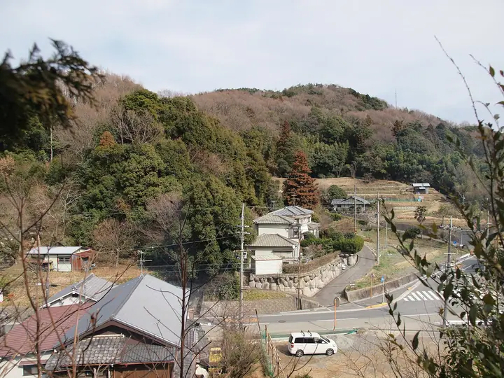
Mt. Ryūōzan, 510 m, rises in the northern Hokusetsu range of Ibaraki City in Osaka Prefecture and is also called Mt. Ninjōji-san after the Ninjōji temple complex at its foot. Known in the Heian period as Kabusan (神岑山), it was counted with Hiei-san and Ibuki-yama among the 'Seven Sacred Mountains' (七高山) and served as a major ascetic site; its present name commemorates a Yōrō-era prayer to the Eight Dragon Kings (八大龍王) for rain. The summit carries a third-class triangulation point on the Tōkai Nature Trail, and the observation tower a short way to the southeast gives sweeping views of the Osaka Plain, the Ikoma range and Mt. Rokkō. A 30-minute climb from the Ninjōji bus stop makes it a popular day-hike, and the peak is listed in both the Osaka 50 Mountains and the Bunken Tozan Guide for Osaka.
Mt. Ryūōzan at a glance
- Weather: The most settled day in the next 7 days is Thu, November 5: clear, gusts up to 5 m/s.
Mt. Ryūōzan weather (hourly, 14 days)
Sunrise today 06:20, sunset 17:03
| Tue, 11/3 | Wed, 11/4 | Thu, 11/5 | Fri, 11/6 | Sat, 11/7 | Sun, 11/8 | Mon, 11/9 | Tue, 11/10 | Wed, 11/11 | Thu, 11/12 | Fri, 11/13 | Sat, 11/14 | Sun, 11/15 | Mon, 11/16 | Tue, 11/17 | |||||||||||||||||||||||||||||||||||||||||||||||||||||||||||||||||||||||
|---|---|---|---|---|---|---|---|---|---|---|---|---|---|---|---|---|---|---|---|---|---|---|---|---|---|---|---|---|---|---|---|---|---|---|---|---|---|---|---|---|---|---|---|---|---|---|---|---|---|---|---|---|---|---|---|---|---|---|---|---|---|---|---|---|---|---|---|---|---|---|---|---|---|---|---|---|---|---|---|---|---|---|---|---|---|
| Japan time | 15 | 17 | 19 | 21 | 23 | 1 | 3 | 5 | 7 | 9 | 11 | 13 | 15 | 18 | 21 | 0 | 3 | 6 | 9 | 12 | 15 | 18 | 21 | 0 | 3 | 6 | 9 | 12 | 15 | 18 | 21 | 0 | 3 | 6 | 9 | 12 | 15 | 18 | 21 | 0 | 3 | 6 | 9 | 12 | 15 | 18 | 21 | 0 | 3 | 6 | 9 | 15 | 21 | 3 | 9 | 15 | 21 | 3 | 9 | 15 | 21 | 3 | 9 | 15 | 21 | 3 | 9 | 15 | 21 | 3 | 9 | 15 | 21 | 3 | 9 | 15 | 21 | 3 | 9 | 15 | 21 | 3 | 9 | 15 | |
  | |   | | | | | | | |   | |   |   |   |   | |   |   | |  | | | | |  | |   | | | | | | | | | | | | | | | | | | | | | | | | |   | | | |   | | | | |  | | | | | | | | | | | | | |   | | | | | |  | | | ||
| Temperature | °C | 15° | 12° | 11° | 10° | 10° | 8° | 8° | 8° | 8° | 12° | 15° | 17° | 16° | 13° | 13° | 12° | 12° | 12° | 13° | 16° | 18° | 15° | 14° | 14° | 14° | 12° | 15° | 17° | 17° | 13° | 10° | 9° | 6° | 5° | 10° | 11° | 10° | 7° | 5° | 4° | 4° | 3° | 9° | 13° | 11° | 9° | 8° | 8° | 8° | 8° | 10° | 13° | 7° | 4° | 8° | 13° | 7° | 6° | 9° | 10° | 5° | 3° | 8° | 12° | 6° | 5° | 11° | 11° | 5° | 3° | 8° | 13° | 8° | 6° | 11° | 14° | 11° | 12° | 13° | 14° | 9° | 4° | 8° | 11° |
| Precipitation | mm | 3.3 | 6 | 2.6 | 0.9 | 0.2 | 0.6 | 0.3 | 0.2 | 0.5 | 0.2 | 0.2 | 0.2 | 2.8 | 1.8 | 0.3 | |||||||||||||||||||||||||||||||||||||||||||||||||||||||||||||||||||||
| New snow | cm | ||||||||||||||||||||||||||||||||||||||||||||||||||||||||||||||||||||||||||||||||||||
| Snow depth | cm | 0 | 0 | 0 | 0 | 0 | 0 | 0 | 0 | 0 | 0 | 0 | 0 | 0 | 0 | 0 | 0 | 0 | 0 | 0 | 0 | 0 | 0 | 0 | 0 | 0 | 0 | 0 | 0 | 0 | 0 | 0 | 0 | 0 | 0 | 0 | 0 | 0 | 0 | 0 | 0 | 0 | 0 | 0 | 0 | 0 | 0 | 0 | 0 | 0 | 0 | 0 | 0 | 0 | 0 | 0 | 0 | 0 | 0 | 0 | 0 | 0 | 0 | 0 | 0 | 0 | 0 | 0 | 0 | 0 | 0 | 0 | 0 | 0 | 0 | 0 | 0 | 0 | 0 | 0 | 0 | 0 | 0 | 0 | 0 |
| Wind | m/s | 3 | 3 | 2 | 2 | 2 | 2 | 2 | 2 | 2 | 2 | 2 | 3 | 2 | 3 | 3 | 3 | 3 | 2 | 2 | 2 | 1 | 1 | 1 | 0 | 3 | 2 | 2 | 4 | 3 | 4 | 4 | 3 | 1 | 1 | 3 | 5 | 4 | 2 | 1 | 1 | 1 | 1 | 0 | 3 | 3 | 2 | 1 | 1 | 1 | 1 | 0 | 3 | 1 | 1 | 1 | 3 | 2 | 3 | 4 | 5 | 2 | 2 | 0 | 1 | 1 | 2 | 5 | 5 | 1 | 1 | 0 | 0 | 0 | 2 | 2 | 2 | 2 | 0 | 2 | 5 | 5 | 1 | 2 | 2 |
| Wind gusts | m/s | 8 | 8 | 7 | 6 | 5 | 5 | 6 | 5 | 4 | 5 | 6 | 7 | 7 | 6 | 7 | 7 | 9 | 6 | 5 | 5 | 5 | 4 | 2 | 2 | 7 | 7 | 6 | 9 | 10 | 9 | 9 | 9 | 7 | 4 | 8 | 13 | 12 | 10 | 6 | 3 | 4 | 4 | 4 | 8 | 9 | 8 | 4 | 3 | 2 | 2 | 3 | 8 | 7 | 3 | 3 | 10 | 8 | 10 | 10 | 14 | 13 | 5 | 4 | 6 | 5 | 4 | 11 | 12 | 12 | 5 | 4 | 5 | 2 | 3 | 5 | 6 | 6 | 4 | 5 | 13 | 15 | 11 | 7 | 8 |
| Wind dir. | ↓ | ↓ | ↓ | ↓ | ↓ | ↓ | ↓ | ↓ | ↓ | ↓ | ↓ | ↓ | ↓ | ↓ | ↓ | ↓ | ↓ | ↓ | ↓ | ↓ | ↓ | ↓ | ↓ | ↓ | ↓ | ↓ | ↓ | ↓ | ↓ | ↓ | ↓ | ↓ | ↓ | ↓ | ↓ | ↓ | ↓ | ↓ | ↓ | ↓ | ↓ | ↓ | ↓ | ↓ | ↓ | ↓ | ↓ | ↓ | ↓ | ↓ | ↓ | ↓ | ↓ | ↓ | ↓ | ↓ | ↓ | ↓ | ↓ | ↓ | ↓ | ↓ | ↓ | ↓ | ↓ | ↓ | ↓ | ↓ | ↓ | ↓ | ↓ | ↓ | ↓ | ↓ | ↓ | ↓ | ↓ | ↓ | ↓ | ↓ | ↓ | ↓ | ↓ | ↓ | |
Huts, campsites and lodging near Mt. Ryūōzan
Campsites
- 摂津峡青少年キャンプ場 第2キャンプ場
- 摂津峡青少年キャンプ場
Lodging
- 花の里温泉 山水館
Lists that include Mt. Ryūōzan
Mt. Ryūōzan facts
- Also known as
- 忍頂寺山 · 神岑山
- Elevation
- 510 m
- Location
- Ibaraki, Osaka
34.898876, 135.549204 - Website
- www.city.ibaraki.osaka.jp
- Access Information
- ibaraki-kankou.or.jp
- Wikipedia
- ja.wikipedia.org