
Mount Ponpon
ポンポン山
Kyoto, Kyoto · Elevation 679 m
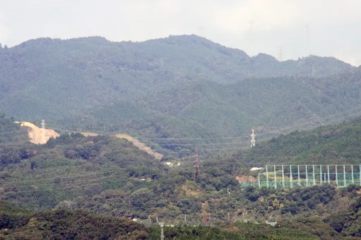
Mount Ponpon is a 678.9 m peak on the border between Takatsuki City in Osaka and Kyoto's Nishikyō Ward, the highest summit of the Kyoto Nishiyama range. The whimsical name reflects the hollow drum-like sound said to ring underfoot near the top; in the Edo period the peak was known as Kamose-yama. Trails approach from Kabusan-ji and Honzan-ji on the Tōkai Nature Trail and from Yoshimine-dera on the Kyoto side, and the peak appears in Kansai Hyakumeizan and Kinki Hyakumeizan. Its modest elevation makes it a year-round family hiking favourite.
Mount Ponpon at a glance
- Weather: The most settled day in the next 7 days is Thu, November 5: clear, gusts up to 4 m/s.
- Route: The shortest is Mount Ponpon from Honzanji Temple: about 4 h 8 min, 7.8 km, about 570 m of climbing.
Mount Ponpon weather (hourly, 14 days)
Sunrise today 06:20, sunset 17:03
| Tue, 11/3 | Wed, 11/4 | Thu, 11/5 | Fri, 11/6 | Sat, 11/7 | Sun, 11/8 | Mon, 11/9 | Tue, 11/10 | Wed, 11/11 | Thu, 11/12 | Fri, 11/13 | Sat, 11/14 | Sun, 11/15 | Mon, 11/16 | Tue, 11/17 | |||||||||||||||||||||||||||||||||||||||||||||||||||||||||||||||||||||||
|---|---|---|---|---|---|---|---|---|---|---|---|---|---|---|---|---|---|---|---|---|---|---|---|---|---|---|---|---|---|---|---|---|---|---|---|---|---|---|---|---|---|---|---|---|---|---|---|---|---|---|---|---|---|---|---|---|---|---|---|---|---|---|---|---|---|---|---|---|---|---|---|---|---|---|---|---|---|---|---|---|---|---|---|---|---|
| Japan time | 15 | 17 | 19 | 21 | 23 | 1 | 3 | 5 | 7 | 9 | 11 | 13 | 15 | 18 | 21 | 0 | 3 | 6 | 9 | 12 | 15 | 18 | 21 | 0 | 3 | 6 | 9 | 12 | 15 | 18 | 21 | 0 | 3 | 6 | 9 | 12 | 15 | 18 | 21 | 0 | 3 | 6 | 9 | 12 | 15 | 18 | 21 | 0 | 3 | 6 | 9 | 15 | 21 | 3 | 9 | 15 | 21 | 3 | 9 | 15 | 21 | 3 | 9 | 15 | 21 | 3 | 9 | 15 | 21 | 3 | 9 | 15 | 21 | 3 | 9 | 15 | 21 | 3 | 9 | 15 | 21 | 3 | 9 | 15 | |
  |  |   | | | | | | | | |   | |   |   |   | |   |   | | |  | | | | | | | | | | | | | |   | | | | | | | | | | | | | | | |   |   | | | |   | | | | |  | | | | | | | | | | | | | |   | | | | | | | | | ||
| Temperature | °C | 15° | 12° | 9° | 9° | 9° | 7° | 7° | 6° | 7° | 12° | 15° | 17° | 15° | 12° | 11° | 11° | 11° | 11° | 12° | 16° | 17° | 14° | 13° | 12° | 13° | 11° | 15° | 17° | 17° | 12° | 10° | 8° | 6° | 5° | 9° | 11° | 10° | 7° | 4° | 4° | 3° | 3° | 9° | 12° | 11° | 8° | 8° | 8° | 7° | 7° | 10° | 13° | 6° | 3° | 7° | 12° | 7° | 6° | 9° | 9° | 5° | 3° | 8° | 12° | 5° | 4° | 10° | 10° | 4° | 2° | 7° | 13° | 7° | 4° | 10° | 13° | 10° | 10° | 13° | 13° | 8° | 4° | 8° | 11° |
| Precipitation | mm | 4.0 | 7 | 2.0 | 0.8 | 0.9 | 0.2 | 0.2 | 0.3 | 0.2 | 4.1 | 1.0 | 0.1 | 0.3 | |||||||||||||||||||||||||||||||||||||||||||||||||||||||||||||||||||||||
| New snow | cm | ||||||||||||||||||||||||||||||||||||||||||||||||||||||||||||||||||||||||||||||||||||
| Snow depth | cm | 0 | 0 | 0 | 0 | 0 | 0 | 0 | 0 | 0 | 0 | 0 | 0 | 0 | 0 | 0 | 0 | 0 | 0 | 0 | 0 | 0 | 0 | 0 | 0 | 0 | 0 | 0 | 0 | 0 | 0 | 0 | 0 | 0 | 0 | 0 | 0 | 0 | 0 | 0 | 0 | 0 | 0 | 0 | 0 | 0 | 0 | 0 | 0 | 0 | 0 | 0 | 0 | 0 | 0 | 0 | 0 | 0 | 0 | 0 | 0 | 0 | 0 | 0 | 0 | 0 | 0 | 0 | 0 | 0 | 0 | 0 | 0 | 0 | 0 | 0 | 0 | 0 | 0 | 0 | 0 | 0 | 0 | 0 | 0 |
| Wind | m/s | 3 | 3 | 2 | 2 | 2 | 2 | 2 | 2 | 2 | 1 | 1 | 2 | 2 | 2 | 1 | 1 | 1 | 1 | 1 | 1 | 1 | 1 | 1 | 0 | 2 | 2 | 3 | 4 | 4 | 4 | 4 | 4 | 2 | 1 | 5 | 6 | 5 | 2 | 1 | 1 | 1 | 1 | 1 | 4 | 3 | 1 | 1 | 1 | 1 | 1 | 1 | 3 | 1 | 1 | 1 | 4 | 3 | 4 | 4 | 6 | 2 | 1 | 0 | 2 | 1 | 1 | 5 | 5 | 2 | 1 | 0 | 1 | 0 | 1 | 2 | 2 | 1 | 0 | 2 | 6 | 5 | 2 | 2 | 2 |
| Wind gusts | m/s | 8 | 9 | 6 | 5 | 5 | 5 | 6 | 6 | 4 | 5 | 5 | 7 | 7 | 5 | 4 | 5 | 6 | 3 | 4 | 4 | 4 | 4 | 2 | 3 | 6 | 7 | 8 | 10 | 11 | 11 | 10 | 9 | 9 | 6 | 11 | 14 | 14 | 12 | 6 | 4 | 4 | 4 | 4 | 10 | 11 | 7 | 4 | 4 | 3 | 3 | 4 | 10 | 8 | 4 | 4 | 11 | 8 | 13 | 11 | 16 | 14 | 6 | 4 | 7 | 6 | 4 | 11 | 13 | 12 | 5 | 4 | 5 | 3 | 2 | 5 | 6 | 6 | 4 | 6 | 14 | 14 | 11 | 7 | 8 |
| Wind dir. | ↓ | ↓ | ↓ | ↓ | ↓ | ↓ | ↓ | ↓ | ↓ | ↓ | ↓ | ↓ | ↓ | ↓ | ↓ | ↓ | ↓ | ↓ | ↓ | ↓ | ↓ | ↓ | ↓ | ↓ | ↓ | ↓ | ↓ | ↓ | ↓ | ↓ | ↓ | ↓ | ↓ | ↓ | ↓ | ↓ | ↓ | ↓ | ↓ | ↓ | ↓ | ↓ | ↓ | ↓ | ↓ | ↓ | ↓ | ↓ | ↓ | ↓ | ↓ | ↓ | ↓ | ↓ | ↓ | ↓ | ↓ | ↓ | ↓ | ↓ | ↓ | ↓ | ↓ | ↓ | ↓ | ↓ | ↓ | ↓ | ↓ | ↓ | ↓ | ↓ | ↓ | ↓ | ↓ | ↓ | ↓ | ↓ | ↓ | ↓ | ↓ | ↓ | ↓ | ↓ | |
Mount Ponpon hiking routes
Hiking times are estimates calculated from the terrain.
Huts, campsites and lodging near Mount Ponpon
Campsites
- 町立キャンプ場
Lists that include Mount Ponpon
Kansai 100 Famous Mountains · Kinki 100 Famous Mountains · Osaka 50 Mountains · Elevations of 1003 Mountains of Japan · 1000 Mountains of Japan
Mount Ponpon facts
- Also known as
- 加茂勢山
- Elevation
- 679 m
- Location
- Kyoto, Kyoto
34.935214, 135.623823 - Website
- www.takatsuki-kankou.org
- Trail Map
- www.city.takatsuki.osaka.jp (PDF)
- Wikipedia
- ja.wikipedia.org