
Mt. Poroshiriyama
幌尻山
Toyotomi, Hokkaido · Elevation 427 m
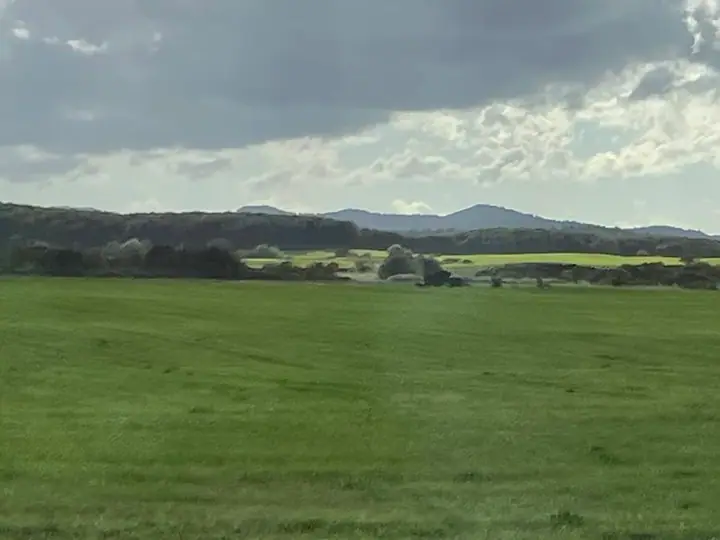
Mt. Poroshiriyama is a 427-meter peak on the boundary between Toyotomi Town in Teshio District and Sarufutsu Village in Sōya District, Hokkaido — one of the central summits of the Sōya Hills. The name derives from the Ainu "poro-shir" meaning "big mountain," and aside from peaks on Rishiri and Rebun Islands, no higher mountain stands further north on Hokkaido proper. Its narrow north-south-trending body is mantled in bamboo-grass thickets with a steep west face, and no maintained hiking trail exists. The peak is included in the Nihon-no-Sangaku-Hyōkō-1003-zan list.
Mt. Poroshiriyama at a glance
- Weather: The most settled day in the next 7 days is Mon, November 9: cloudy, gusts up to 10 m/s. Thu, Nov 5, Sat, Nov 7, Sun, Nov 8: strong wind (gusts up to 23 m/s).
Mt. Poroshiriyama weather (hourly, 14 days)
Sunrise today 06:12, sunset 16:19
| Tue, 11/3 | Wed, 11/4 | Thu, 11/5 | Fri, 11/6 | Sat, 11/7 | Sun, 11/8 | Mon, 11/9 | Tue, 11/10 | Wed, 11/11 | Thu, 11/12 | Fri, 11/13 | Sat, 11/14 | Sun, 11/15 | Mon, 11/16 | Tue, 11/17 | |||||||||||||||||||||||||||||||||||||||||||||||||||||||||||||||||||||||
|---|---|---|---|---|---|---|---|---|---|---|---|---|---|---|---|---|---|---|---|---|---|---|---|---|---|---|---|---|---|---|---|---|---|---|---|---|---|---|---|---|---|---|---|---|---|---|---|---|---|---|---|---|---|---|---|---|---|---|---|---|---|---|---|---|---|---|---|---|---|---|---|---|---|---|---|---|---|---|---|---|---|---|---|---|---|
| Japan time | 15 | 17 | 19 | 21 | 23 | 1 | 3 | 5 | 7 | 9 | 11 | 13 | 15 | 18 | 21 | 0 | 3 | 6 | 9 | 12 | 15 | 18 | 21 | 0 | 3 | 6 | 9 | 12 | 15 | 18 | 21 | 0 | 3 | 6 | 9 | 12 | 15 | 18 | 21 | 0 | 3 | 6 | 9 | 12 | 15 | 18 | 21 | 0 | 3 | 6 | 9 | 15 | 21 | 3 | 9 | 15 | 21 | 3 | 9 | 15 | 21 | 3 | 9 | 15 | 21 | 3 | 9 | 15 | 21 | 3 | 9 | 15 | 21 | 3 | 9 | 15 | 21 | 3 | 9 | 15 | 21 | 3 | 9 | 15 | |
 |   |   | | |   |   | |   | |   |   | |  | | |   | | | | | | | | |   |   |   | |   | |   | | |   | | | | | |   | |   | | | | | | | |   | |   | | | | | | | | |   | | | | | | | | | | | | | | | | | |   | | | | | ||
| Temperature | °C | 1° | -2° | 0° | -1° | -1° | -2° | -2° | -3° | -2° | 2° | 3° | 3° | 2° | 1° | 3° | 3° | 4° | 6° | 9° | 11° | 10° | 7° | 5° | 5° | 4° | 3° | 5° | 9° | 9° | 4° | 1° | -1° | -3° | -3° | -2° | -1° | -2° | -2° | -3° | -3° | -3° | -3° | -2° | -2° | -1° | -1° | -1° | -1° | -2° | -2° | 0° | -1° | -5° | -6° | 0° | 0° | -4° | -5° | 1° | 1° | -2° | -3° | 0° | -1° | -3° | -5° | -2° | 0° | -4° | -4° | 0° | 2° | 3° | 2° | 6° | 7° | 5° | 2° | 2° | -1° | -2° | -2° | -1° | 1° |
| Precipitation | mm | 0.4 | 0.1 | 0.5 | 2.0 | 0.1 | 0.3 | 2.7 | 2.3 | 1.3 | 1.2 | 0.3 | 0.6 | 0.7 | 0.9 | 0.7 | 0.6 | 0.2 | 0.4 | 0.4 | 0.4 | 0.6 | 0.9 | 0.9 | 0.3 | 0.2 | 0.4 | 0.4 | 0.2 | 0.1 | 0.2 | 0.1 | 0.6 | 0.3 | 0.1 | 0.2 | 0.5 | 0.8 | 2.1 | 0.9 | 1.8 | 1.2 | 1.4 | 1.1 | 0.3 | 1.6 | 0.7 | ||||||||||||||||||||||||||||||||||||||
| New snow | cm | 0.4 | 0.1 | 0.5 | 2.0 | <.1 | 0.1 | 0.6 | 0.7 | 0.9 | 0.7 | 0.6 | 0.2 | 0.4 | 0.4 | 0.4 | 0.6 | 0.9 | 0.9 | 0.3 | 0.2 | 0.4 | 0.3 | 0.2 | <.1 | 0.1 | 0.2 | 0.1 | <.1 | <.1 | 0.2 | 0.3 | 0.2 | 0.5 | 0.8 | 2.1 | <.1 | 1.0 | 0.7 | <.1 | |||||||||||||||||||||||||||||||||||||||||||||
| Snow depth | cm | 0 | 0 | 0 | 0 | 0 | <1 | <1 | 1 | 2 | 2 | 2 | 2 | <1 | <1 | <1 | 0 | 0 | 0 | 0 | 0 | 0 | 0 | 0 | 0 | 0 | 0 | 0 | 0 | 0 | 0 | 0 | 0 | <1 | <1 | 1 | 1 | 2 | 2 | 2 | 2 | 2 | 3 | 3 | 3 | 4 | 3 | 4 | 4 | 4 | 4 | 3 | 3 | 3 | 3 | 3 | 3 | 3 | 3 | 3 | 3 | 3 | 3 | 3 | 2 | 2 | 3 | 3 | 4 | 4 | 4 | 4 | 3 | 2 | <1 | 0 | 0 | 0 | 0 | 0 | <1 | <1 | <1 | <1 | <1 |
| Wind | m/s | 5 | 3 | 3 | 3 | 3 | 1 | 3 | 2 | 3 | 4 | 6 | 6 | 6 | 6 | 6 | 6 | 5 | 7 | 7 | 8 | 4 | 3 | 2 | 1 | 2 | 2 | 2 | 2 | 6 | 10 | 9 | 9 | 8 | 8 | 9 | 10 | 9 | 9 | 8 | 8 | 8 | 8 | 8 | 9 | 7 | 6 | 5 | 5 | 4 | 4 | 4 | 4 | 3 | 3 | 3 | 2 | 2 | 2 | 3 | 2 | 3 | 3 | 2 | 4 | 3 | 4 | 4 | 4 | 2 | 2 | 2 | 3 | 5 | 6 | 6 | 7 | 3 | 2 | 2 | 2 | 3 | 3 | 4 | 4 |
| Wind gusts | m/s | 12 | 10 | 7 | 7 | 7 | 5 | 7 | 7 | 8 | 10 | 13 | 13 | 14 | 12 | 12 | 13 | 12 | 14 | 15 | 17 | 16 | 9 | 5 | 4 | 3 | 3 | 5 | 6 | 14 | 20 | 20 | 20 | 21 | 18 | 19 | 22 | 23 | 19 | 18 | 18 | 17 | 18 | 18 | 19 | 19 | 15 | 13 | 10 | 9 | 8 | 10 | 10 | 9 | 6 | 8 | 10 | 6 | 5 | 7 | 9 | 7 | 10 | 6 | 11 | 10 | 9 | 10 | 16 | 8 | 4 | 5 | 12 | 11 | 12 | 14 | 15 | 14 | 7 | 6 | 8 | 7 | 8 | 8 | 9 |
| Wind dir. | ↓ | ↓ | ↓ | ↓ | ↓ | ↓ | ↓ | ↓ | ↓ | ↓ | ↓ | ↓ | ↓ | ↓ | ↓ | ↓ | ↓ | ↓ | ↓ | ↓ | ↓ | ↓ | ↓ | ↓ | ↓ | ↓ | ↓ | ↓ | ↓ | ↓ | ↓ | ↓ | ↓ | ↓ | ↓ | ↓ | ↓ | ↓ | ↓ | ↓ | ↓ | ↓ | ↓ | ↓ | ↓ | ↓ | ↓ | ↓ | ↓ | ↓ | ↓ | ↓ | ↓ | ↓ | ↓ | ↓ | ↓ | ↓ | ↓ | ↓ | ↓ | ↓ | ↓ | ↓ | ↓ | ↓ | ↓ | ↓ | ↓ | ↓ | ↓ | ↓ | ↓ | ↓ | ↓ | ↓ | ↓ | ↓ | ↓ | ↓ | ↓ | ↓ | ↓ | ↓ | |
Lists that include Mt. Poroshiriyama
Mt. Poroshiriyama facts
- Elevation
- 427 m
- Location
- Toyotomi, Hokkaido
45.165624, 142.008516 - Website
- www.vill.sarufutsu.hokkaido.jp
- Wikipedia
- ja.wikipedia.org