
Mt. Nagi
那岐山
Chizu, Tottori / Nagi, Okayama · Elevation 1,254 m
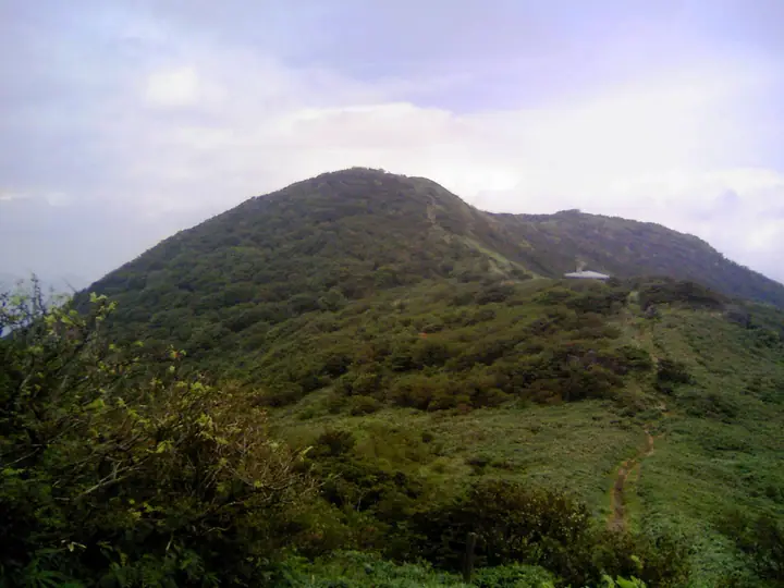
Nagisan is a 1,255 m peak on the boundary between Chizu Town in Tottori Prefecture and Nagi Town in Okayama Prefecture, the principal summit of the Nagi Range. Its name is traditionally said to derive from the Shinto creator deities Izanagi and Izanami. Its open, bamboo-grass-covered summit commands a 360-degree panorama stretching from Mount Daisen to the Seto Inland Sea, and seven maintained routes lead to the top — among them the Tōzan, Nishi-zan and Bodai-ji courses. The slopes preserve a designated natural-monument grove of Japanese pieris (Dōdantsutsuji). The mountain lies within Hyōnosen-Ushiroyama-Nagisan Quasi-National Park and is listed in the Japanese 300 Famous Mountains and the Chūgoku 100, among others.
Mt. Nagi at a glance
- Weather: The most settled day in the next 7 days is Wed, November 4: clear, gusts up to 7 m/s.
- Route: The shortest is Mount Nagi Return past Susanoo Rock and Other Shugendo Rocks to a Summit Looking to the Sea of Japan: about 4 h 36 min, 7.4 km, about 800 m of climbing.
Mt. Nagi weather (hourly, 14 days)
Sunrise today 06:26, sunset 17:08
| Tue, 11/3 | Wed, 11/4 | Thu, 11/5 | Fri, 11/6 | Sat, 11/7 | Sun, 11/8 | Mon, 11/9 | Tue, 11/10 | Wed, 11/11 | Thu, 11/12 | Fri, 11/13 | Sat, 11/14 | Sun, 11/15 | Mon, 11/16 | Tue, 11/17 | |||||||||||||||||||||||||||||||||||||||||||||||||||||||||||||||||||||||
|---|---|---|---|---|---|---|---|---|---|---|---|---|---|---|---|---|---|---|---|---|---|---|---|---|---|---|---|---|---|---|---|---|---|---|---|---|---|---|---|---|---|---|---|---|---|---|---|---|---|---|---|---|---|---|---|---|---|---|---|---|---|---|---|---|---|---|---|---|---|---|---|---|---|---|---|---|---|---|---|---|---|---|---|---|---|
| Japan time | 15 | 17 | 19 | 21 | 23 | 1 | 3 | 5 | 7 | 9 | 11 | 13 | 15 | 18 | 21 | 0 | 3 | 6 | 9 | 12 | 15 | 18 | 21 | 0 | 3 | 6 | 9 | 12 | 15 | 18 | 21 | 0 | 3 | 6 | 9 | 12 | 15 | 18 | 21 | 0 | 3 | 6 | 9 | 12 | 15 | 18 | 21 | 0 | 3 | 6 | 9 | 15 | 21 | 3 | 9 | 15 | 21 | 3 | 9 | 15 | 21 | 3 | 9 | 15 | 21 | 3 | 9 | 15 | 21 | 3 | 9 | 15 | 21 | 3 | 9 | 15 | 21 | 3 | 9 | 15 | 21 | 3 | 9 | 15 | |
  | |   |   | | | | | |   | | | | | |   |   | | |   | | |   |   | | |  | | | | | | | |   | | | |  | | | | | | | | | | | | |   |   | | | | | |   | | | | | | | | | |  | | | | | | | | | | | | | | | | ||
| Temperature | °C | 11° | 8° | 6° | 4° | 4° | 4° | 3° | 3° | 4° | 9° | 12° | 13° | 13° | 9° | 8° | 8° | 8° | 7° | 10° | 13° | 12° | 10° | 10° | 9° | 8° | 6° | 11° | 13° | 11° | 7° | 4° | 3° | 3° | 2° | 5° | 7° | 7° | 4° | 1° | 0° | 0° | -1° | 6° | 8° | 8° | 5° | 4° | 4° | 4° | 4° | 8° | 9° | 1° | 0° | 5° | 9° | 2° | 0° | 3° | 5° | 1° | 0° | 4° | 9° | 1° | 2° | 5° | 5° | 0° | -1° | 5° | 9° | 2° | 4° | 7° | 10° | 9° | 8° | 9° | 7° | 3° | 1° | 4° | 5° |
| Precipitation | mm | 0.3 | 2.3 | 0.2 | 0.8 | 0.2 | 0.4 | 1.9 | 0.9 | 0.2 | 1.1 | 0.4 | 0.3 | 0.2 | 1.2 | 0.3 | 1.1 | 9 | 1.5 | 0.5 | 1.9 | 2.2 | 0.1 | ||||||||||||||||||||||||||||||||||||||||||||||||||||||||||||||
| New snow | cm | ||||||||||||||||||||||||||||||||||||||||||||||||||||||||||||||||||||||||||||||||||||
| Snow depth | cm | 0 | 0 | 0 | 0 | 0 | 0 | 0 | 0 | 0 | 0 | 0 | 0 | 0 | 0 | 0 | 0 | 0 | 0 | 0 | 0 | 0 | 0 | 0 | 0 | 0 | 0 | 0 | 0 | 0 | 0 | 0 | 0 | 0 | 0 | 0 | 0 | 0 | 0 | 0 | 0 | 0 | 0 | 0 | 0 | 0 | 0 | 0 | 0 | 0 | 0 | 0 | 0 | 0 | 0 | 0 | 0 | 0 | 0 | 0 | 0 | 0 | 0 | 0 | 0 | 0 | 0 | 0 | 0 | 0 | 0 | 0 | 0 | 0 | 0 | 0 | 0 | 0 | 0 | 0 | 0 | 0 | 0 | 0 | 0 |
| Wind | m/s | 3 | 3 | 2 | 2 | 2 | 2 | 2 | 2 | 2 | 1 | 0 | 0 | 2 | 0 | 0 | 0 | 0 | 2 | 1 | 2 | 1 | 0 | 0 | 1 | 2 | 1 | 2 | 4 | 3 | 2 | 2 | 2 | 2 | 2 | 5 | 5 | 5 | 2 | 2 | 1 | 1 | 1 | 1 | 4 | 3 | 1 | 1 | 0 | 1 | 2 | 2 | 3 | 1 | 1 | 1 | 4 | 2 | 5 | 4 | 4 | 1 | 1 | 1 | 1 | 1 | 1 | 4 | 5 | 1 | 2 | 1 | 1 | 0 | 1 | 1 | 3 | 2 | 0 | 2 | 6 | 6 | 3 | 3 | 3 |
| Wind gusts | m/s | 9 | 9 | 7 | 6 | 6 | 6 | 6 | 6 | 7 | 6 | 4 | 4 | 5 | 5 | 3 | 4 | 3 | 4 | 4 | 6 | 6 | 3 | 4 | 5 | 6 | 6 | 7 | 10 | 11 | 9 | 7 | 7 | 6 | 7 | 11 | 13 | 13 | 12 | 6 | 5 | 4 | 4 | 5 | 10 | 10 | 9 | 4 | 2 | 3 | 4 | 6 | 8 | 7 | 4 | 4 | 11 | 9 | 13 | 13 | 13 | 11 | 4 | 4 | 7 | 5 | 5 | 9 | 13 | 12 | 6 | 6 | 6 | 4 | 3 | 4 | 10 | 10 | 8 | 7 | 15 | 16 | 14 | 9 | 10 |
| Wind dir. | ↓ | ↓ | ↓ | ↓ | ↓ | ↓ | ↓ | ↓ | ↓ | ↓ | ↓ | ↓ | ↓ | ↓ | ↓ | ↓ | ↓ | ↓ | ↓ | ↓ | ↓ | ↓ | ↓ | ↓ | ↓ | ↓ | ↓ | ↓ | ↓ | ↓ | ↓ | ↓ | ↓ | ↓ | ↓ | ↓ | ↓ | ↓ | ↓ | ↓ | ↓ | ↓ | ↓ | ↓ | ↓ | ↓ | ↓ | ↓ | ↓ | ↓ | ↓ | ↓ | ↓ | ↓ | ↓ | ↓ | ↓ | ↓ | ↓ | ↓ | ↓ | ↓ | ↓ | ↓ | ↓ | ↓ | ↓ | ↓ | ↓ | ↓ | ↓ | ↓ | ↓ | ↓ | ↓ | ↓ | ↓ | ↓ | ↓ | ↓ | ↓ | ↓ | ↓ | ↓ | |
Mt. Nagi hiking routes
- Mount Nagi Return past Susanoo Rock and Other Shugendo Rocks to a Summit Looking to the Sea of Japan 7.4 km · Ascent 805 m First parking lot at the start of a trail up Mt.Nagi, Second parking lot at the start of a trail up Mt.Nagi
- Mount Nagi Circuit via Courses C and B 7.5 km · Ascent 774 m Second parking lot at the start of a trail up Mt.Nagi, First parking lot at the start of a trail up Mt.Nagi
Hiking times are estimates calculated from the terrain.
Huts, campsites and lodging near Mt. Nagi
Mountain huts
Lists that include Mt. Nagi
Japan's 300 Famous Mountains · Chugoku 100 Famous Mountains · Okayama Prefecture 100 Famous Mountains · Elevations of 1003 Mountains of Japan · 1000 Mountains of Japan
Mt. Nagi facts
- Also known as
- なぎせん · なぎのせん
- Elevation
- 1,254 m
- Location
- Chizu, Tottori / Nagi, Okayama
35.171673, 134.180274 - National Park
- 氷ノ山後山那岐山国定公園
- Website
- www.okayama-kanko.jp
- Trail Map
- www.town.nagi.okayama.jp (PDF)
- Wikipedia
- ja.wikipedia.org