
Mt. Monjudake
文珠岳
Shizuoka, Shizuoka · Elevation 1,041 m
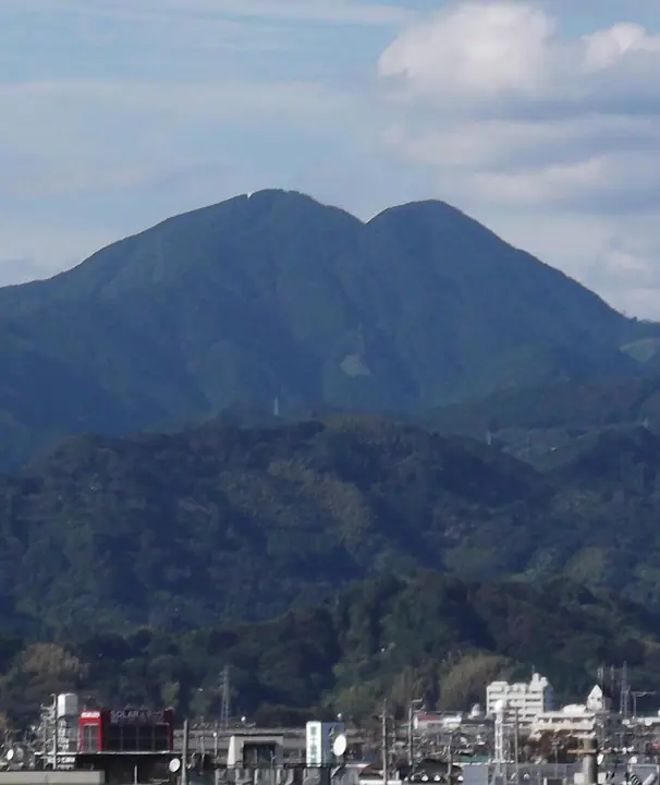
Mt. Monjudake is the southern peak of Mt. Ryusozan in Aoi Ward, Shizuoka City, Shizuoka Prefecture, rising to 1,040.8 m and forming a twin-peaked massif with the northern Mt. Yakushidake (1,051 m). Long climbed as a sacred mountain, its summit holds a first-class triangulation station and offers sweeping views of Mt. Fuji, the Southern Alps, Suruga Bay, and the Izu Peninsula. It is included in the Shizuoka prefectural 100 Mountains guide (Bunken Tozan Guide) and the 223 Mountains with a View of Mt. Fuji list.
Mt. Monjudake at a glance
- Weather: The most settled day in the next 7 days is Mon, November 9: clear, gusts up to 7 m/s.
- Route: The shortest is Mount Ryuso Twin Summits–Mount Dohaku Circuit: about 4 h 17 min, 5.6 km, about 840 m of climbing.
Mt. Monjudake weather (hourly, 14 days)
Sunrise today 06:09, sunset 16:51
| Tue, 11/3 | Wed, 11/4 | Thu, 11/5 | Fri, 11/6 | Sat, 11/7 | Sun, 11/8 | Mon, 11/9 | Tue, 11/10 | Wed, 11/11 | Thu, 11/12 | Fri, 11/13 | Sat, 11/14 | Sun, 11/15 | Mon, 11/16 | Tue, 11/17 | |||||||||||||||||||||||||||||||||||||||||||||||||||||||||||||||||||||||
|---|---|---|---|---|---|---|---|---|---|---|---|---|---|---|---|---|---|---|---|---|---|---|---|---|---|---|---|---|---|---|---|---|---|---|---|---|---|---|---|---|---|---|---|---|---|---|---|---|---|---|---|---|---|---|---|---|---|---|---|---|---|---|---|---|---|---|---|---|---|---|---|---|---|---|---|---|---|---|---|---|---|---|---|---|---|
| Japan time | 15 | 17 | 19 | 21 | 23 | 1 | 3 | 5 | 7 | 9 | 11 | 13 | 15 | 18 | 21 | 0 | 3 | 6 | 9 | 12 | 15 | 18 | 21 | 0 | 3 | 6 | 9 | 12 | 15 | 18 | 21 | 0 | 3 | 6 | 9 | 12 | 15 | 18 | 21 | 0 | 3 | 6 | 9 | 12 | 15 | 18 | 21 | 0 | 3 | 6 | 9 | 15 | 21 | 3 | 9 | 15 | 21 | 3 | 9 | 15 | 21 | 3 | 9 | 15 | 21 | 3 | 9 | 15 | 21 | 3 | 9 | 15 | 21 | 3 | 9 | 15 | 21 | 3 | 9 | 15 | 21 | 3 | 9 | 15 | |
  |   |   |   |   | | | |   | | | | |   | | | | | |   |   |   | | | | |  | | |  | | | | | | | | | | | | | | | | | | | | | | | | | | | | | | |   | | | | | | | | | | | | | | | | | |   | | | | | | ||
| Temperature | °C | 13° | 11° | 9° | 9° | 9° | 8° | 8° | 8° | 8° | 9° | 11° | 12° | 11° | 9° | 9° | 8° | 8° | 8° | 12° | 14° | 13° | 11° | 10° | 8° | 8° | 8° | 12° | 15° | 16° | 11° | 7° | 4° | 3° | 2° | 9° | 12° | 11° | 8° | 7° | 6° | 6° | 5° | 9° | 11° | 10° | 8° | 7° | 7° | 7° | 6° | 8° | 10° | 6° | 4° | 7° | 9° | 4° | 4° | 7° | 10° | 3° | 2° | 6° | 8° | 5° | 2° | 8° | 11° | 6° | 4° | 6° | 8° | 5° | 4° | 9° | 10° | 8° | 8° | 12° | 15° | 11° | 7° | 6° | 7° |
| Precipitation | mm | 0.2 | 0.1 | 0.2 | 1.8 | 0.1 | 13 | 6 | 5 | 0.6 | 0.9 | 0.9 | 0.3 | 0.2 | 1.3 | 0.2 | 0.9 | 0.2 | 1.5 | 26 | 32 | 11 | 0.2 | 0.3 | |||||||||||||||||||||||||||||||||||||||||||||||||||||||||||||
| New snow | cm | ||||||||||||||||||||||||||||||||||||||||||||||||||||||||||||||||||||||||||||||||||||
| Snow depth | cm | 0 | 0 | 0 | 0 | 0 | 0 | 0 | 0 | 0 | 0 | 0 | 0 | 0 | 0 | 0 | 0 | 0 | 0 | 0 | 0 | 0 | 0 | 0 | 0 | 0 | 0 | 0 | 0 | 0 | 0 | 0 | 0 | 0 | 0 | 0 | 0 | 0 | 0 | 0 | 0 | 0 | 0 | 0 | 0 | 0 | 0 | 0 | 0 | 0 | 0 | 0 | 0 | 0 | 0 | 0 | 0 | 0 | 0 | 0 | 0 | 0 | 0 | 0 | 0 | 0 | 0 | 0 | 0 | 0 | 0 | 0 | 0 | 0 | 0 | 0 | 0 | 0 | 0 | 0 | 0 | 0 | 0 | 0 | 0 |
| Wind | m/s | 2 | 2 | 2 | 2 | 2 | 2 | 2 | 3 | 3 | 3 | 3 | 4 | 3 | 3 | 3 | 5 | 5 | 3 | 2 | 1 | 1 | 1 | 1 | 1 | 1 | 0 | 1 | 3 | 1 | 3 | 3 | 2 | 2 | 2 | 1 | 3 | 3 | 3 | 2 | 1 | 1 | 2 | 2 | 1 | 2 | 2 | 1 | 2 | 1 | 1 | 3 | 3 | 3 | 1 | 3 | 2 | 0 | 4 | 2 | 2 | 3 | 0 | 2 | 1 | 1 | 2 | 0 | 3 | 2 | 2 | 2 | 2 | 2 | 1 | 1 | 1 | 2 | 0 | 1 | 2 | 1 | 2 | 3 | 4 |
| Wind gusts | m/s | 6 | 5 | 4 | 4 | 4 | 4 | 4 | 5 | 6 | 6 | 7 | 9 | 8 | 7 | 8 | 12 | 12 | 11 | 8 | 5 | 5 | 3 | 3 | 3 | 3 | 4 | 5 | 7 | 8 | 8 | 8 | 7 | 5 | 5 | 5 | 8 | 9 | 8 | 7 | 4 | 4 | 3 | 6 | 6 | 7 | 5 | 4 | 4 | 4 | 3 | 5 | 7 | 8 | 6 | 7 | 9 | 5 | 9 | 12 | 6 | 6 | 6 | 4 | 5 | 4 | 5 | 4 | 7 | 7 | 5 | 6 | 7 | 5 | 4 | 4 | 5 | 5 | 8 | 5 | 6 | 11 | 5 | 7 | 9 |
| Wind dir. | ↓ | ↓ | ↓ | ↓ | ↓ | ↓ | ↓ | ↓ | ↓ | ↓ | ↓ | ↓ | ↓ | ↓ | ↓ | ↓ | ↓ | ↓ | ↓ | ↓ | ↓ | ↓ | ↓ | ↓ | ↓ | ↓ | ↓ | ↓ | ↓ | ↓ | ↓ | ↓ | ↓ | ↓ | ↓ | ↓ | ↓ | ↓ | ↓ | ↓ | ↓ | ↓ | ↓ | ↓ | ↓ | ↓ | ↓ | ↓ | ↓ | ↓ | ↓ | ↓ | ↓ | ↓ | ↓ | ↓ | ↓ | ↓ | ↓ | ↓ | ↓ | ↓ | ↓ | ↓ | ↓ | ↓ | ↓ | ↓ | ↓ | ↓ | ↓ | ↓ | ↓ | ↓ | ↓ | ↓ | ↓ | ↓ | ↓ | ↓ | ↓ | ↓ | ↓ | ↓ | |
Mt. Monjudake hiking routes
Hiking times are estimates calculated from the terrain.
Huts, campsites and lodging near Mt. Monjudake
Campsites
- 清水森林公園 黒川キャンプ場
Lodging
- 油山苑
- 元湯館
Mt. Monjudake facts
- Also known as
- 文殊岳
- Elevation
- 1,041 m
- Location
- Shizuoka, Shizuoka
35.084263, 138.400826 - Website
- www.shizutan.jp (PDF)
- Wikipedia
- ja.wikipedia.org