
Mt. Mikunisan
三国峠
Uenohara, Yamanashi · Elevation 960 m
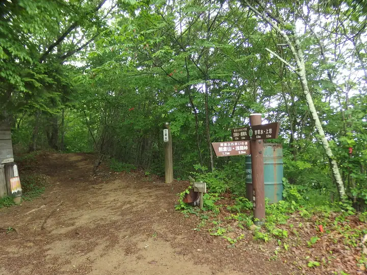
Mikunisan (960 m) stands at the meeting point of Uenohara (Yamanashi), Hinohara (Tokyo), and Sagamihara (Kanagawa)—the northernmost point of Kanagawa Prefecture. Its name reflects the old border of the Koshu, Bushu, and Soshu provinces, and the inner shrine of Gundari Shrine once stood here. Next to Shotosan (990 m) on the Sasaone ridge, it offers airy, view-rich ridge walking famed for its springtime cherry trees, and appears on lists such as the "100 Mountains of Tama," "100 Famous Mountains of Tokyo," and the "100 Mountains of Koshu."
Mt. Mikunisan at a glance
- Weather: The most settled day in the next 7 days is Wed, November 4: cloudy, gusts up to 5 m/s.
Mt. Mikunisan weather (hourly, 14 days)
Sunrise today 06:07, sunset 16:48
| Tue, 11/3 | Wed, 11/4 | Thu, 11/5 | Fri, 11/6 | Sat, 11/7 | Sun, 11/8 | Mon, 11/9 | Tue, 11/10 | Wed, 11/11 | Thu, 11/12 | Fri, 11/13 | Sat, 11/14 | Sun, 11/15 | Mon, 11/16 | Tue, 11/17 | |||||||||||||||||||||||||||||||||||||||||||||||||||||||||||||||||||||||
|---|---|---|---|---|---|---|---|---|---|---|---|---|---|---|---|---|---|---|---|---|---|---|---|---|---|---|---|---|---|---|---|---|---|---|---|---|---|---|---|---|---|---|---|---|---|---|---|---|---|---|---|---|---|---|---|---|---|---|---|---|---|---|---|---|---|---|---|---|---|---|---|---|---|---|---|---|---|---|---|---|---|---|---|---|---|
| Japan time | 15 | 17 | 19 | 21 | 23 | 1 | 3 | 5 | 7 | 9 | 11 | 13 | 15 | 18 | 21 | 0 | 3 | 6 | 9 | 12 | 15 | 18 | 21 | 0 | 3 | 6 | 9 | 12 | 15 | 18 | 21 | 0 | 3 | 6 | 9 | 12 | 15 | 18 | 21 | 0 | 3 | 6 | 9 | 12 | 15 | 18 | 21 | 0 | 3 | 6 | 9 | 15 | 21 | 3 | 9 | 15 | 21 | 3 | 9 | 15 | 21 | 3 | 9 | 15 | 21 | 3 | 9 | 15 | 21 | 3 | 9 | 15 | 21 | 3 | 9 | 15 | 21 | 3 | 9 | 15 | 21 | 3 | 9 | 15 | |
  |   | | | |   | | | | | |   | | | | | | | |   |   |   |   | |   | |  | | | | | | | |   | | | |  | | | | | | | | | | | | | | | | | | | | | |   |  | | | | | | | | | | | | | | | | |   | | | | | | ||
| Temperature | °C | 12° | 10° | 9° | 9° | 8° | 7° | 7° | 7° | 7° | 7° | 8° | 8° | 7° | 7° | 7° | 8° | 8° | 7° | 10° | 15° | 13° | 11° | 9° | 8° | 7° | 6° | 14° | 18° | 17° | 11° | 9° | 8° | 8° | 5° | 10° | 12° | 10° | 6° | 5° | 4° | 4° | 3° | 8° | 10° | 9° | 8° | 6° | 5° | 5° | 4° | 5° | 7° | 5° | 3° | 5° | 7° | 4° | 2° | 8° | 11° | 0° | -2° | 7° | 8° | 5° | 2° | 9° | 10° | 1° | 0° | 4° | 7° | 1° | 1° | 9° | 11° | 8° | 7° | 13° | 16° | 6° | 5° | 4° | 6° |
| Precipitation | mm | 0.2 | 1.1 | 0.9 | 0.1 | 0.3 | 0.4 | 0.7 | 2.7 | 8 | 15 | 11 | 3.3 | 0.7 | 3.9 | 0.5 | 0.4 | 0.9 | 3.3 | 14 | 0.1 | 0.1 | |||||||||||||||||||||||||||||||||||||||||||||||||||||||||||||||
| New snow | cm | ||||||||||||||||||||||||||||||||||||||||||||||||||||||||||||||||||||||||||||||||||||
| Snow depth | cm | 0 | 0 | 0 | 0 | 0 | 0 | 0 | 0 | 0 | 0 | 0 | 0 | 0 | 0 | 0 | 0 | 0 | 0 | 0 | 0 | 0 | 0 | 0 | 0 | 0 | 0 | 0 | 0 | 0 | 0 | 0 | 0 | 0 | 0 | 0 | 0 | 0 | 0 | 0 | 0 | 0 | 0 | 0 | 0 | 0 | 0 | 0 | 0 | 0 | 0 | 0 | 0 | 0 | 0 | 0 | 0 | 0 | 0 | 0 | 0 | 0 | 0 | 0 | 0 | 0 | 0 | 0 | 0 | 0 | 0 | 0 | 0 | 0 | 0 | 0 | 0 | 0 | 0 | 0 | 0 | 0 | 0 | 0 | 0 |
| Wind | m/s | 2 | 0 | 0 | 0 | 0 | 0 | 0 | 0 | 1 | 1 | 1 | 1 | 0 | 1 | 1 | 0 | 2 | 1 | 1 | 2 | 2 | 1 | 1 | 1 | 2 | 2 | 0 | 2 | 2 | 1 | 1 | 1 | 1 | 1 | 1 | 3 | 3 | 1 | 1 | 1 | 0 | 1 | 2 | 3 | 2 | 0 | 1 | 1 | 0 | 1 | 1 | 2 | 1 | 1 | 1 | 2 | 1 | 2 | 3 | 2 | 2 | 2 | 1 | 2 | 1 | 3 | 1 | 3 | 1 | 1 | 1 | 2 | 1 | 1 | 1 | 2 | 1 | 1 | 1 | 3 | 0 | 2 | 1 | 2 |
| Wind gusts | m/s | 6 | 5 | 2 | 1 | 1 | 2 | 2 | 2 | 2 | 3 | 4 | 5 | 5 | 2 | 3 | 4 | 4 | 5 | 4 | 6 | 6 | 4 | 3 | 4 | 5 | 5 | 5 | 7 | 8 | 6 | 3 | 3 | 4 | 3 | 5 | 8 | 10 | 8 | 3 | 3 | 2 | 2 | 5 | 8 | 8 | 6 | 2 | 3 | 3 | 2 | 4 | 7 | 5 | 4 | 4 | 7 | 6 | 4 | 8 | 11 | 6 | 5 | 4 | 8 | 6 | 6 | 6 | 9 | 8 | 2 | 4 | 7 | 6 | 4 | 5 | 7 | 5 | 6 | 7 | 9 | 7 | 5 | 5 | 6 |
| Wind dir. | ↓ | ↓ | ↓ | ↓ | ↓ | ↓ | ↓ | ↓ | ↓ | ↓ | ↓ | ↓ | ↓ | ↓ | ↓ | ↓ | ↓ | ↓ | ↓ | ↓ | ↓ | ↓ | ↓ | ↓ | ↓ | ↓ | ↓ | ↓ | ↓ | ↓ | ↓ | ↓ | ↓ | ↓ | ↓ | ↓ | ↓ | ↓ | ↓ | ↓ | ↓ | ↓ | ↓ | ↓ | ↓ | ↓ | ↓ | ↓ | ↓ | ↓ | ↓ | ↓ | ↓ | ↓ | ↓ | ↓ | ↓ | ↓ | ↓ | ↓ | ↓ | ↓ | ↓ | ↓ | ↓ | ↓ | ↓ | ↓ | ↓ | ↓ | ↓ | ↓ | ↓ | ↓ | ↓ | ↓ | ↓ | ↓ | ↓ | ↓ | ↓ | ↓ | ↓ | ↓ | |
Huts, campsites and lodging near Mt. Mikunisan
Campsites
- 桐花園キャンプ場
- キャンピングガーデン モク
Lodging
- 陣馬の湯陣渓園
- 陣馬の湯姫谷
Lists that include Mt. Mikunisan
Mt. Mikunisan facts
- Also known as
- 三国山 · オサンノウ · 三国峰 · 山王山
- Elevation
- 960 m
- Location
- Uenohara, Yamanashi
35.671944, 139.130977 - Website
- info-fujino.com
- Trail Map
- info-fujino.com (PDF)
- Wikipedia
- ja.wikipedia.org