
Mt. Kitamifuji
北見富士
Kitami, Hokkaido · Elevation 1,291 m
Mt. Kitamifuji is a 1,291-meter local "furusato Fuji" in Rubeshibe-chō of Kitami City, Hokkaido, named for its regular conical profile. A second-class triangulation station marked "Sankakuyama" sits on the summit, and the peak is sometimes distinguished as "Rubeshibe Kitami-Fuji" to set it apart from the similarly named 1,307-meter peak in Engaru Town. No maintained hiking trail exists — climbers follow forest roads, work tracks, and informal foot trails — but the mountain is recognized in the Hokkaido Hyakumeizan and Nihon Hyaku-Fuji compilations as one of eastern Hokkaido's notable peaks.
Mt. Kitamifuji at a glance
- Weather: The most settled day in the next 7 days is Mon, November 9: cloudy, gusts up to 6 m/s. Sat, Nov 7, Sun, Nov 8: strong wind (gusts up to 25 m/s).
Mt. Kitamifuji weather (hourly, 14 days)
Sunrise today 06:04, sunset 16:17
| Tue, 11/3 | Wed, 11/4 | Thu, 11/5 | Fri, 11/6 | Sat, 11/7 | Sun, 11/8 | Mon, 11/9 | Tue, 11/10 | Wed, 11/11 | Thu, 11/12 | Fri, 11/13 | Sat, 11/14 | Sun, 11/15 | Mon, 11/16 | Tue, 11/17 | |||||||||||||||||||||||||||||||||||||||||||||||||||||||||||||||||||||||
|---|---|---|---|---|---|---|---|---|---|---|---|---|---|---|---|---|---|---|---|---|---|---|---|---|---|---|---|---|---|---|---|---|---|---|---|---|---|---|---|---|---|---|---|---|---|---|---|---|---|---|---|---|---|---|---|---|---|---|---|---|---|---|---|---|---|---|---|---|---|---|---|---|---|---|---|---|---|---|---|---|---|---|---|---|---|
| Japan time | 21 | 23 | 1 | 3 | 5 | 7 | 9 | 11 | 13 | 15 | 17 | 19 | 21 | 0 | 3 | 6 | 9 | 12 | 15 | 18 | 21 | 0 | 3 | 6 | 9 | 12 | 15 | 18 | 21 | 0 | 3 | 6 | 9 | 12 | 15 | 18 | 21 | 0 | 3 | 6 | 9 | 12 | 15 | 18 | 21 | 0 | 3 | 6 | 9 | 12 | 15 | 21 | 3 | 9 | 15 | 21 | 3 | 9 | 15 | 21 | 3 | 9 | 15 | 21 | 3 | 9 | 15 | 21 | 3 | 9 | 15 | 21 | 3 | 9 | 15 | 21 | 3 | 9 | 15 | 21 | 3 | 9 | 15 | 21 | |
  |   |   | | |   | | |   |  |  | | | | |   | |   | | | | |   | |   | |   | | | |   | |   | | | | | | | | | | | | | | | |   | | | | | | | | | | | | | | | | | | | |  | | | | | | | |   | | | | | | |  | ||
| Temperature | °C | -6° | -6° | -7° | -4° | -4° | -3° | -3° | -2° | -1° | -1° | -6° | -9° | -9° | -9° | -9° | -8° | 2° | 5° | 3° | -2° | -2° | -2° | -1° | 0° | 1° | 3° | 4° | 1° | -2° | -4° | -7° | -8° | -7° | -6° | -8° | -8° | -7° | -7° | -7° | -7° | -6° | -5° | -6° | -8° | -8° | -8° | -9° | -9° | -6° | -4° | -6° | -11° | -11° | -6° | -5° | -9° | -9° | -6° | -3° | -12° | -15° | -5° | -4° | -8° | -9° | -9° | -8° | -8° | -14° | -5° | -2° | -11° | -12° | 1° | 1° | -1° | -2° | -2° | -3° | -7° | -8° | -6° | -3° | -11° |
| Precipitation | mm | 0.2 | 0.7 | 0.6 | 0.2 | 0.1 | 1.5 | 1.8 | 3.8 | 1.0 | 0.1 | 0.3 | 0.4 | 0.2 | 0.2 | 0.2 | 0.7 | 1.0 | 1.2 | 0.8 | 1.3 | 1.7 | 1.7 | 1.1 | 0.5 | 0.2 | 0.1 | 0.7 | 1.4 | 0.3 | 0.7 | 0.3 | 0.4 | 0.3 | 0.3 | 0.2 | 1.2 | 0.8 | 0.7 | 3.2 | 0.3 | 0.1 | |||||||||||||||||||||||||||||||||||||||||||
| New snow | cm | 0.2 | 0.7 | 0.6 | 0.2 | 0.1 | <.1 | <.1 | 0.2 | 0.2 | 0.1 | 0.7 | 1.0 | 1.2 | 0.8 | 1.3 | 1.7 | 1.6 | 1.1 | 0.5 | 0.2 | 0.1 | <.1 | <.1 | <.1 | <.1 | <.1 | <.1 | 0.7 | 1.4 | 0.3 | 0.7 | 0.3 | 0.4 | 0.3 | 0.3 | 2.9 | 0.3 | 0.1 | ||||||||||||||||||||||||||||||||||||||||||||||
| Snow depth | cm | 1 | 1 | 1 | 2 | 2 | 2 | 2 | 2 | 2 | 2 | 2 | 2 | 2 | 2 | 2 | 2 | 2 | 2 | 1 | 1 | 1 | 1 | 1 | 1 | <1 | <1 | <1 | <1 | <1 | <1 | <1 | <1 | <1 | 1 | 2 | 2 | 2 | 2 | 2 | 3 | 4 | 4 | 5 | 5 | 5 | 5 | 5 | 5 | 5 | 5 | 4 | 4 | 4 | 4 | 4 | 4 | 4 | 6 | 5 | 5 | 5 | 5 | 5 | 5 | 5 | 6 | 6 | 6 | 6 | 6 | 5 | 5 | 5 | 5 | 4 | 3 | 3 | 3 | 5 | 5 | 5 | 5 | 4 | 4 |
| Wind | m/s | 1 | 1 | 2 | 3 | 2 | 4 | 5 | 4 | 2 | 1 | 1 | 1 | 2 | 2 | 2 | 2 | 2 | 4 | 2 | 2 | 2 | 1 | 1 | 1 | 1 | 1 | 2 | 3 | 3 | 4 | 6 | 5 | 7 | 8 | 7 | 1 | 1 | 6 | 9 | 10 | 5 | 8 | 7 | 4 | 1 | 1 | 1 | 1 | 1 | 1 | 2 | 1 | 1 | 0 | 3 | 0 | 0 | 1 | 1 | 0 | 1 | 0 | 0 | 1 | 2 | 4 | 4 | 5 | 2 | 1 | 1 | 1 | 0 | 1 | 2 | 2 | 2 | 1 | 3 | 4 | 1 | 0 | 1 | 0 |
| Wind gusts | m/s | 4 | 4 | 5 | 7 | 7 | 11 | 13 | 13 | 11 | 6 | 3 | 4 | 5 | 6 | 6 | 7 | 7 | 11 | 10 | 6 | 5 | 4 | 4 | 4 | 4 | 4 | 6 | 9 | 9 | 12 | 15 | 14 | 17 | 21 | 24 | 18 | 7 | 17 | 22 | 25 | 25 | 20 | 20 | 18 | 11 | 4 | 3 | 3 | 3 | 5 | 6 | 5 | 4 | 3 | 8 | 8 | 3 | 3 | 6 | 4 | 3 | 3 | 4 | 3 | 5 | 9 | 13 | 17 | 13 | 7 | 5 | 4 | 3 | 5 | 7 | 7 | 7 | 6 | 8 | 11 | 10 | 6 | 5 | 4 |
| Wind dir. | ↓ | ↓ | ↓ | ↓ | ↓ | ↓ | ↓ | ↓ | ↓ | ↓ | ↓ | ↓ | ↓ | ↓ | ↓ | ↓ | ↓ | ↓ | ↓ | ↓ | ↓ | ↓ | ↓ | ↓ | ↓ | ↓ | ↓ | ↓ | ↓ | ↓ | ↓ | ↓ | ↓ | ↓ | ↓ | ↓ | ↓ | ↓ | ↓ | ↓ | ↓ | ↓ | ↓ | ↓ | ↓ | ↓ | ↓ | ↓ | ↓ | ↓ | ↓ | ↓ | ↓ | ↓ | ↓ | ↓ | ↓ | ↓ | ↓ | ↓ | ↓ | ↓ | ↓ | ↓ | ↓ | ↓ | ↓ | ↓ | ↓ | ↓ | ↓ | ↓ | ↓ | ↓ | ↓ | ↓ | ↓ | ↓ | ↓ | ↓ | ↓ | ↓ | ↓ | ↓ | |
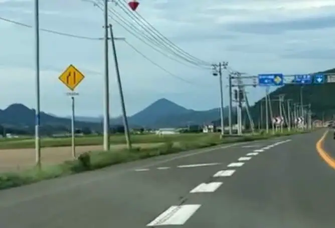
Lists that include Mt. Kitamifuji
Mt. Kitamifuji facts
- Also known as
- 留辺蘂北見富士
- Elevation
- 1,291 m
- Location
- Kitami, Hokkaido
43.693752, 143.295901