
Mt. Kenashigasen
毛無山
Shinjō-son, Okayama / Kōfu-chō, Tottori · Elevation 1,218 m
Mt. Kenashigasen is a 1,218 m peak straddling Kōfu in Tottori and Shinjō in Okayama, set in the Chūgoku Mountains within Daisen-Oki National Park. Covered in old-growth beech forest, its summit hosts a katakuri (dogtooth violet) colony designated one of Japan's "100 Fragrant Landscapes" by the Ministry of the Environment, blooming in late April, and its valleys feature the Shichidan and Hakuba waterfalls. The peak is featured in Chūgoku Hyakumeizan, Okayama-ken Hyakumeizan, Nihon Hyakuteizan (2017), and Chūgoku Chihō no Yama 100-sen.
Mt. Kenashigasen at a glance
- Weather: The most settled day in the next 7 days is Wed, November 4: cloudy, gusts up to 8 m/s. Fri, Nov 6, Sat, Nov 7: strong wind (gusts up to 17 m/s).
- Route: The shortest is Mount Kenashigasen to Mount Hakuba Loop through Beech Forest and Katakuri: about 3 h 55 min, 6.5 km, about 580 m of climbing.
Mt. Kenashigasen weather (hourly, 14 days)
Sunrise today 06:28, sunset 17:11
| Tue, 11/3 | Wed, 11/4 | Thu, 11/5 | Fri, 11/6 | Sat, 11/7 | Sun, 11/8 | Mon, 11/9 | Tue, 11/10 | Wed, 11/11 | Thu, 11/12 | Fri, 11/13 | Sat, 11/14 | Sun, 11/15 | Mon, 11/16 | Tue, 11/17 | |||||||||||||||||||||||||||||||||||||||||||||||||||||||||||||||||||||||
|---|---|---|---|---|---|---|---|---|---|---|---|---|---|---|---|---|---|---|---|---|---|---|---|---|---|---|---|---|---|---|---|---|---|---|---|---|---|---|---|---|---|---|---|---|---|---|---|---|---|---|---|---|---|---|---|---|---|---|---|---|---|---|---|---|---|---|---|---|---|---|---|---|---|---|---|---|---|---|---|---|---|---|---|---|---|
| Japan time | 15 | 17 | 19 | 21 | 23 | 1 | 3 | 5 | 7 | 9 | 11 | 13 | 15 | 18 | 21 | 0 | 3 | 6 | 9 | 12 | 15 | 18 | 21 | 0 | 3 | 6 | 9 | 12 | 15 | 18 | 21 | 0 | 3 | 6 | 9 | 12 | 15 | 18 | 21 | 0 | 3 | 6 | 9 | 12 | 15 | 18 | 21 | 0 | 3 | 6 | 9 | 15 | 21 | 3 | 9 | 15 | 21 | 3 | 9 | 15 | 21 | 3 | 9 | 15 | 21 | 3 | 9 | 15 | 21 | 3 | 9 | 15 | 21 | 3 | 9 | 15 | 21 | 3 | 9 | 15 | 21 | 3 | 9 | 15 | |
  |   |   | | | | | |   |   |   | | |   | | | |   | | | |   | | | | |   | | | | | | | | | | |   | |  | | | | | | | | | | | | |   | | | | | | | | | |  | | | | | |  | | | | | | | | | | | | | | | | ||
| Temperature | °C | 9° | 6° | 5° | 5° | 5° | 5° | 4° | 3° | 3° | 8° | 10° | 11° | 11° | 6° | 7° | 6° | 6° | 8° | 10° | 11° | 11° | 10° | 9° | 8° | 8° | 8° | 8° | 10° | 8° | 5° | 4° | 3° | 2° | 2° | 3° | 5° | 5° | 2° | 0° | 0° | 0° | 0° | 5° | 7° | 6° | 4° | 3° | 3° | 3° | 3° | 6° | 6° | 2° | 2° | 4° | 5° | 1° | -1° | 2° | 3° | 1° | 0° | 4° | 8° | 4° | 3° | 3° | 4° | 0° | -3° | 5° | 9° | 3° | 3° | 7° | 7° | 9° | 9° | 8° | 5° | 2° | 1° | 3° | 4° |
| Precipitation | mm | 0.4 | 0.2 | 0.8 | 1.2 | 2.3 | 3.1 | 4.8 | 8 | 0.7 | 0.6 | 0.4 | 1.1 | 0.9 | 0.2 | 1.7 | 0.2 | 0.9 | 2.2 | 0.5 | 1.3 | 0.4 | 1.4 | 0.5 | 0.7 | 2.9 | 0.5 | 6 | 12 | 0.8 | 3.8 | 5 | 3.2 | 0.2 | |||||||||||||||||||||||||||||||||||||||||||||||||||
| New snow | cm | ||||||||||||||||||||||||||||||||||||||||||||||||||||||||||||||||||||||||||||||||||||
| Snow depth | cm | 0 | 0 | 0 | 0 | 0 | 0 | 0 | 0 | 0 | 0 | 0 | 0 | 0 | 0 | 0 | 0 | 0 | 0 | 0 | 0 | 0 | 0 | 0 | 0 | 0 | 0 | 0 | 0 | 0 | 0 | 0 | 0 | 0 | 0 | 0 | 0 | 0 | 0 | 0 | 0 | 0 | 0 | 0 | 0 | 0 | 0 | 0 | 0 | 0 | 0 | 0 | 0 | 0 | 0 | 0 | 0 | 0 | 0 | 0 | 0 | 0 | 0 | 0 | 0 | 0 | 0 | 0 | 0 | 0 | 0 | 0 | 0 | 0 | 0 | 0 | 0 | 0 | 0 | 0 | 0 | 0 | 0 | 0 | 0 |
| Wind | m/s | 2 | 2 | 1 | 1 | 1 | 1 | 2 | 2 | 2 | 3 | 2 | 2 | 2 | 2 | 2 | 1 | 1 | 1 | 1 | 1 | 1 | 2 | 1 | 2 | 4 | 5 | 5 | 6 | 6 | 4 | 5 | 5 | 5 | 5 | 6 | 6 | 5 | 2 | 1 | 1 | 1 | 1 | 2 | 4 | 2 | 1 | 0 | 0 | 1 | 2 | 4 | 3 | 2 | 1 | 5 | 5 | 6 | 6 | 4 | 4 | 1 | 0 | 1 | 4 | 4 | 3 | 3 | 4 | 1 | 1 | 1 | 3 | 2 | 2 | 4 | 6 | 4 | 4 | 3 | 4 | 3 | 2 | 1 | 1 |
| Wind gusts | m/s | 8 | 6 | 4 | 4 | 4 | 4 | 5 | 6 | 6 | 8 | 8 | 8 | 7 | 7 | 7 | 9 | 5 | 4 | 4 | 5 | 5 | 7 | 7 | 8 | 11 | 13 | 14 | 16 | 16 | 15 | 14 | 14 | 15 | 15 | 17 | 17 | 15 | 14 | 7 | 5 | 5 | 5 | 6 | 10 | 10 | 7 | 2 | 2 | 4 | 6 | 10 | 11 | 8 | 6 | 13 | 15 | 16 | 19 | 16 | 13 | 9 | 4 | 5 | 11 | 11 | 10 | 9 | 11 | 10 | 4 | 6 | 9 | 8 | 7 | 10 | 15 | 19 | 12 | 11 | 11 | 11 | 9 | 7 | 7 |
| Wind dir. | ↓ | ↓ | ↓ | ↓ | ↓ | ↓ | ↓ | ↓ | ↓ | ↓ | ↓ | ↓ | ↓ | ↓ | ↓ | ↓ | ↓ | ↓ | ↓ | ↓ | ↓ | ↓ | ↓ | ↓ | ↓ | ↓ | ↓ | ↓ | ↓ | ↓ | ↓ | ↓ | ↓ | ↓ | ↓ | ↓ | ↓ | ↓ | ↓ | ↓ | ↓ | ↓ | ↓ | ↓ | ↓ | ↓ | ↓ | ↓ | ↓ | ↓ | ↓ | ↓ | ↓ | ↓ | ↓ | ↓ | ↓ | ↓ | ↓ | ↓ | ↓ | ↓ | ↓ | ↓ | ↓ | ↓ | ↓ | ↓ | ↓ | ↓ | ↓ | ↓ | ↓ | ↓ | ↓ | ↓ | ↓ | ↓ | ↓ | ↓ | ↓ | ↓ | ↓ | ↓ | |
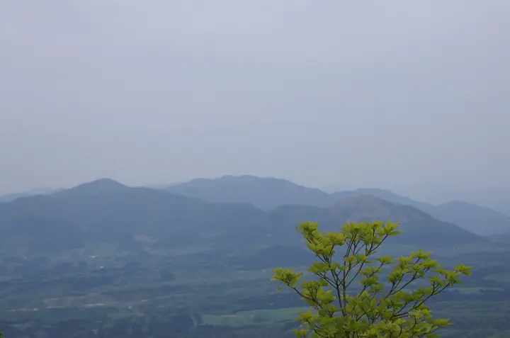
Mt. Kenashigasen hiking routes
Hiking times are estimates calculated from the terrain.
Lists that include Mt. Kenashigasen
Chugoku 100 Famous Mountains · Okayama Prefecture 100 Famous Mountains · Elevations of 1003 Mountains of Japan · 1000 Mountains of Japan
Mt. Kenashigasen facts
- Also known as
- 新庄毛無山
- Elevation
- 1,218 m
- Location
- Shinjō-son, Okayama / Kōfu-chō, Tottori
35.235612, 133.514689 - National Park
- 大山隠岐国立公園
- Website
- www.town-kofu.jp
- Trail Map
- www.pref.tottori.lg.jp
- Wikipedia
- ja.wikipedia.org