
Mt. Inafukumiyama
稲含山
Shimonita, Gunma / Kanra, Gunma · Elevation 1,370 m
Mt. Inafukumiyama is a 1,370 m peak on the boundary between Kanra Town and Shimonita Town in Gunma Prefecture, the northernmost summit of the Nishi-Jōshū range and Kanra's highest point. The summit has long enshrined Inafukumi Shrine, a deity of agriculture revered for harvest prosperity, and a 360-degree summit panorama looks out over the Jōetsu border ranges and Mt. Asama. The peak appears on the Gunma 100, Kantō 100 and Japan Top 100 Low Mountains lists, with maintained trails from the Toriitōge pass on the Kanra side and from Takakura on the Shimonita side.
Mt. Inafukumiyama at a glance
- Weather: The most settled day in the next 7 days is Sun, November 8: clear, gusts up to 8 m/s. Sat, Nov 7: strong wind (gusts up to 17 m/s).
- Route: The shortest is Mount Inafukuyama Out-and-Back from Mogaki Pass: about 1 h 39 min, 2.1 km, about 340 m of climbing.
Mt. Inafukumiyama weather (hourly, 14 days)
Sunrise today 06:09, sunset 16:48
| Tue, 11/3 | Wed, 11/4 | Thu, 11/5 | Fri, 11/6 | Sat, 11/7 | Sun, 11/8 | Mon, 11/9 | Tue, 11/10 | Wed, 11/11 | Thu, 11/12 | Fri, 11/13 | Sat, 11/14 | Sun, 11/15 | Mon, 11/16 | Tue, 11/17 | |||||||||||||||||||||||||||||||||||||||||||||||||||||||||||||||||||||||
|---|---|---|---|---|---|---|---|---|---|---|---|---|---|---|---|---|---|---|---|---|---|---|---|---|---|---|---|---|---|---|---|---|---|---|---|---|---|---|---|---|---|---|---|---|---|---|---|---|---|---|---|---|---|---|---|---|---|---|---|---|---|---|---|---|---|---|---|---|---|---|---|---|---|---|---|---|---|---|---|---|---|---|---|---|---|
| Japan time | 15 | 17 | 19 | 21 | 23 | 1 | 3 | 5 | 7 | 9 | 11 | 13 | 15 | 18 | 21 | 0 | 3 | 6 | 9 | 12 | 15 | 18 | 21 | 0 | 3 | 6 | 9 | 12 | 15 | 18 | 21 | 0 | 3 | 6 | 9 | 12 | 15 | 18 | 21 | 0 | 3 | 6 | 9 | 12 | 15 | 18 | 21 | 0 | 3 | 6 | 9 | 15 | 21 | 3 | 9 | 15 | 21 | 3 | 9 | 15 | 21 | 3 | 9 | 15 | 21 | 3 | 9 | 15 | 21 | 3 | 9 | 15 | 21 | 3 | 9 | 15 | 21 | 3 | 9 | 15 | 21 | 3 | 9 | 15 | |
  |   |   | | | | | | | |   |   | |   |   | | | |   | |   | | | | | |  | | |  | | | | | | | | | | | | | | | | | | | | | | | | | | | | | | |   | | | | |  | | | | | | | | | | | |   | | | |  | | | ||
| Temperature | °C | 11° | 7° | 6° | 5° | 4° | 4° | 3° | 3° | 4° | 8° | 9° | 10° | 7° | 5° | 5° | 4° | 5° | 5° | 9° | 14° | 11° | 9° | 8° | 7° | 5° | 5° | 13° | 19° | 16° | 10° | 6° | 4° | 3° | 2° | 8° | 10° | 8° | 3° | 0° | -1° | -2° | -3° | 5° | 9° | 7° | 3° | 2° | 2° | 2° | 2° | 5° | 7° | 3° | 2° | 3° | 5° | 2° | -1° | 4° | 6° | 1° | -2° | 5° | 7° | 1° | -2° | 7° | 7° | 0° | -3° | 4° | 6° | 0° | -3° | 5° | 8° | 4° | 5° | 13° | 14° | 4° | -1° | 4° | 6° |
| Precipitation | mm | 0.3 | 2.9 | 9 | 6 | 0.6 | 1.0 | 2.2 | 0.7 | 0.2 | 0.1 | 1.5 | 7 | ||||||||||||||||||||||||||||||||||||||||||||||||||||||||||||||||||||||||
| New snow | cm | ||||||||||||||||||||||||||||||||||||||||||||||||||||||||||||||||||||||||||||||||||||
| Snow depth | cm | 0 | 0 | 0 | 0 | 0 | 0 | 0 | 0 | 0 | 0 | 0 | 0 | 0 | 0 | 0 | 0 | 0 | 0 | 0 | 0 | 0 | 0 | 0 | 0 | 0 | 0 | 0 | 0 | 0 | 0 | 0 | 0 | 0 | 0 | 0 | 0 | 0 | 0 | 0 | 0 | 0 | 0 | 0 | 0 | 0 | 0 | 0 | 0 | 0 | 0 | 0 | 0 | 0 | 0 | 0 | 0 | 0 | 0 | 0 | 0 | 0 | 0 | 0 | 0 | 0 | 0 | 0 | 0 | 0 | 0 | 0 | 0 | 0 | 0 | 0 | 0 | 0 | 0 | 0 | 0 | 0 | 0 | 0 | 0 |
| Wind | m/s | 2 | 1 | 0 | 1 | 0 | 0 | 1 | 1 | 1 | 1 | 2 | 2 | 2 | 2 | 0 | 1 | 2 | 1 | 2 | 1 | 1 | 0 | 1 | 1 | 1 | 2 | 1 | 3 | 2 | 0 | 1 | 2 | 3 | 2 | 3 | 6 | 4 | 1 | 2 | 2 | 2 | 2 | 2 | 2 | 3 | 0 | 1 | 0 | 1 | 1 | 1 | 2 | 0 | 1 | 2 | 2 | 0 | 2 | 7 | 6 | 3 | 2 | 1 | 2 | 1 | 2 | 4 | 4 | 3 | 2 | 1 | 2 | 1 | 1 | 1 | 1 | 1 | 1 | 2 | 4 | 4 | 2 | 1 | 2 |
| Wind gusts | m/s | 7 | 7 | 2 | 3 | 3 | 3 | 3 | 4 | 4 | 4 | 7 | 7 | 7 | 6 | 6 | 5 | 5 | 5 | 5 | 6 | 4 | 4 | 4 | 5 | 5 | 7 | 8 | 9 | 9 | 8 | 6 | 10 | 11 | 11 | 11 | 17 | 17 | 13 | 7 | 8 | 8 | 8 | 8 | 8 | 8 | 7 | 4 | 4 | 4 | 5 | 5 | 6 | 5 | 3 | 6 | 7 | 6 | 8 | 26 | 23 | 18 | 8 | 8 | 7 | 6 | 6 | 11 | 15 | 13 | 9 | 7 | 7 | 5 | 4 | 4 | 6 | 5 | 6 | 6 | 13 | 14 | 15 | 8 | 7 |
| Wind dir. | ↓ | ↓ | ↓ | ↓ | ↓ | ↓ | ↓ | ↓ | ↓ | ↓ | ↓ | ↓ | ↓ | ↓ | ↓ | ↓ | ↓ | ↓ | ↓ | ↓ | ↓ | ↓ | ↓ | ↓ | ↓ | ↓ | ↓ | ↓ | ↓ | ↓ | ↓ | ↓ | ↓ | ↓ | ↓ | ↓ | ↓ | ↓ | ↓ | ↓ | ↓ | ↓ | ↓ | ↓ | ↓ | ↓ | ↓ | ↓ | ↓ | ↓ | ↓ | ↓ | ↓ | ↓ | ↓ | ↓ | ↓ | ↓ | ↓ | ↓ | ↓ | ↓ | ↓ | ↓ | ↓ | ↓ | ↓ | ↓ | ↓ | ↓ | ↓ | ↓ | ↓ | ↓ | ↓ | ↓ | ↓ | ↓ | ↓ | ↓ | ↓ | ↓ | ↓ | ↓ | |
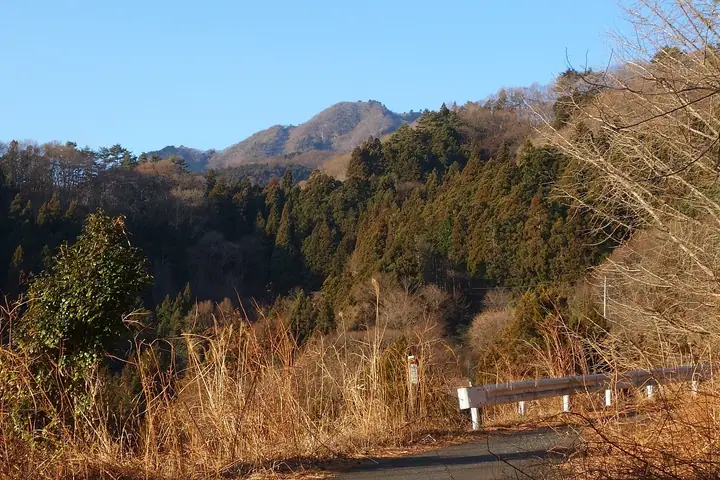
Mt. Inafukumiyama hiking routes
Hiking times are estimates calculated from the terrain.
Lists that include Mt. Inafukumiyama
100 Low Mountains of Japan · Kanto 100 Famous Mountains · Gunma 100 Famous Mountains · Mountain Walking in Shimonita · 1000 Mountains of Japan
Mt. Inafukumiyama facts
- Elevation
- 1,370 m
- Location
- Shimonita, Gunma / Kanra, Gunma
36.169494, 138.825238 - Website
- www.town.shimonita.lg.jp
- Trail Map
- www.town.kanra.lg.jp (PDF)
- Wikipedia
- ja.wikipedia.org