
Mt. Gonomiyadake
五ノ宮嶽
Kazuno, Akita · Elevation 1,115 m
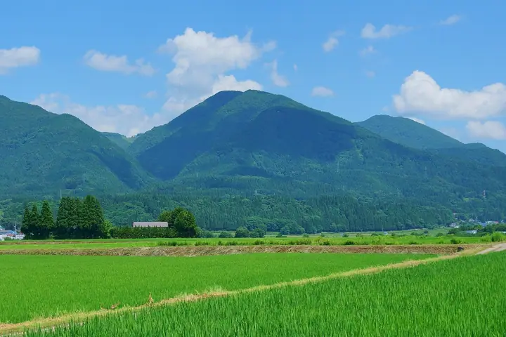
Gonomiyadake (1,115 m) rises in the southeastern part of Kazuno City, Akita Prefecture, in the northern Ou Mountains. The summit shrine honors the fifth son of Emperor Sutoku from local legend, and a numbered pilgrim's trail with nine stations climbs from the Hachimantai Hall area past Yakushi Shrine to the top. Together with Kawanagedake and Mikurayama it forms the Kazuno Three Peaks, traversed every spring and autumn by the local alpine club as the Sangaku pilgrimage.
Mt. Gonomiyadake at a glance
- Weather: The most settled day in the next 7 days is Wed, November 4: clear, gusts up to 14 m/s. Fri, Nov 6, Sat, Nov 7, Sun, Nov 8: strong wind (gusts up to 26 m/s).
Mt. Gonomiyadake weather (hourly, 14 days)
Sunrise today 06:07, sunset 16:33
| Tue, 11/3 | Wed, 11/4 | Thu, 11/5 | Fri, 11/6 | Sat, 11/7 | Sun, 11/8 | Mon, 11/9 | Tue, 11/10 | Wed, 11/11 | Thu, 11/12 | Fri, 11/13 | Sat, 11/14 | Sun, 11/15 | Mon, 11/16 | Tue, 11/17 | |||||||||||||||||||||||||||||||||||||||||||||||||||||||||||||||||||||||
|---|---|---|---|---|---|---|---|---|---|---|---|---|---|---|---|---|---|---|---|---|---|---|---|---|---|---|---|---|---|---|---|---|---|---|---|---|---|---|---|---|---|---|---|---|---|---|---|---|---|---|---|---|---|---|---|---|---|---|---|---|---|---|---|---|---|---|---|---|---|---|---|---|---|---|---|---|---|---|---|---|---|---|---|---|---|
| Japan time | 15 | 17 | 19 | 21 | 23 | 1 | 3 | 5 | 7 | 9 | 11 | 13 | 15 | 18 | 21 | 0 | 3 | 6 | 9 | 12 | 15 | 18 | 21 | 0 | 3 | 6 | 9 | 12 | 15 | 18 | 21 | 0 | 3 | 6 | 9 | 12 | 15 | 18 | 21 | 0 | 3 | 6 | 9 | 12 | 15 | 18 | 21 | 0 | 3 | 6 | 9 | 15 | 21 | 3 | 9 | 15 | 21 | 3 | 9 | 15 | 21 | 3 | 9 | 15 | 21 | 3 | 9 | 15 | 21 | 3 | 9 | 15 | 21 | 3 | 9 | 15 | 21 | 3 | 9 | 15 | 21 | 3 | 9 | 15 | |
  |   | |  | | | |   |   |  | | | | | | | |   |   |   | |   | | | | | | | | | | |   | |   | |   |   |   | | | | | |   | | | | | | |   | |   | | | | | | | | | | | | |   | | | | | |  | | | | | | | |   | | | | ||
| Temperature | °C | 4° | 1° | 0° | 0° | -1° | 1° | 2° | 2° | 2° | 6° | 8° | 8° | 7° | 1° | -1° | -2° | 0° | 3° | 5° | 7° | 6° | 6° | 5° | 6° | 6° | 6° | 9° | 9° | 6° | 3° | 0° | -1° | -2° | -3° | -2° | -1° | -2° | -3° | -3° | -3° | -3° | -3° | -1° | 0° | 0° | -1° | -1° | -2° | -2° | -4° | -2° | -1° | -5° | -5° | -1° | 3° | -2° | -1° | -2° | -1° | -4° | -4° | 1° | 2° | -1° | -2° | -2° | 0° | -4° | -5° | 0° | 3° | -6° | -6° | 4° | 7° | 1° | 1° | 4° | 0° | -4° | -4° | 0° | 1° |
| Precipitation | mm | 0.2 | 1.6 | 2.1 | 1.6 | 2.1 | 1.4 | 3.3 | 1.6 | 0.7 | 0.3 | 3.0 | 2.2 | 0.4 | 1.5 | 0.6 | 0.6 | 1.5 | 2.2 | 1.5 | 2.1 | 1.6 | 0.8 | 0.9 | 0.4 | 0.3 | 0.2 | 0.1 | 0.5 | 1.5 | 7 | 12 | 1.7 | 0.2 | 0.2 | 0.6 | 2.7 | 0.4 | 1.4 | 2.6 | 1.0 | 6 | 5 | ||||||||||||||||||||||||||||||||||||||||||
| New snow | cm | 0.2 | 1.1 | 2.1 | 1.3 | 1.9 | 1.5 | 0.7 | 0.8 | 0.4 | 0.3 | 0.2 | <.1 | <.1 | <.1 | <.1 | 1.0 | 1.3 | 5.8 | 0.7 | <.1 | 0.3 | 0.1 | <.1 | 1.8 | <.1 | |||||||||||||||||||||||||||||||||||||||||||||||||||||||||||
| Snow depth | cm | 0 | 0 | 0 | 0 | 0 | 0 | 0 | 0 | 0 | 0 | 0 | 0 | 0 | 0 | 0 | 0 | 0 | 0 | 0 | 0 | 0 | 0 | 0 | 0 | 0 | 0 | 0 | 0 | 0 | 0 | 0 | 0 | 0 | <1 | 1 | 2 | 2 | 3 | 3 | 3 | 3 | 3 | 3 | 3 | 2 | 2 | 1 | 1 | 1 | 1 | <1 | <1 | <1 | <1 | <1 | 0 | <1 | <1 | 4 | 2 | 2 | 2 | 1 | <1 | <1 | <1 | <1 | <1 | <1 | <1 | <1 | 0 | 0 | 0 | 0 | 0 | 0 | 0 | 0 | 0 | <1 | <1 | <1 | <1 |
| Wind | m/s | 6 | 4 | 4 | 4 | 3 | 4 | 4 | 4 | 4 | 5 | 5 | 4 | 3 | 0 | 1 | 2 | 2 | 1 | 2 | 2 | 2 | 1 | 1 | 1 | 0 | 1 | 2 | 6 | 7 | 6 | 7 | 7 | 6 | 7 | 7 | 9 | 6 | 7 | 7 | 7 | 7 | 7 | 8 | 10 | 9 | 6 | 5 | 3 | 3 | 2 | 3 | 4 | 2 | 0 | 1 | 4 | 6 | 2 | 2 | 2 | 1 | 1 | 4 | 4 | 1 | 3 | 4 | 5 | 2 | 1 | 2 | 3 | 1 | 1 | 0 | 1 | 1 | 1 | 1 | 5 | 4 | 3 | 4 | 4 |
| Wind gusts | m/s | 17 | 16 | 12 | 11 | 11 | 10 | 11 | 13 | 12 | 14 | 14 | 12 | 11 | 7 | 3 | 5 | 6 | 6 | 7 | 8 | 6 | 5 | 4 | 3 | 3 | 4 | 8 | 17 | 18 | 19 | 19 | 19 | 18 | 19 | 21 | 26 | 25 | 23 | 20 | 19 | 19 | 19 | 21 | 24 | 24 | 23 | 15 | 13 | 9 | 9 | 9 | 13 | 11 | 5 | 5 | 11 | 16 | 15 | 8 | 10 | 5 | 4 | 10 | 14 | 10 | 7 | 11 | 14 | 12 | 6 | 7 | 10 | 8 | 3 | 3 | 5 | 5 | 6 | 4 | 12 | 13 | 10 | 9 | 12 |
| Wind dir. | ↓ | ↓ | ↓ | ↓ | ↓ | ↓ | ↓ | ↓ | ↓ | ↓ | ↓ | ↓ | ↓ | ↓ | ↓ | ↓ | ↓ | ↓ | ↓ | ↓ | ↓ | ↓ | ↓ | ↓ | ↓ | ↓ | ↓ | ↓ | ↓ | ↓ | ↓ | ↓ | ↓ | ↓ | ↓ | ↓ | ↓ | ↓ | ↓ | ↓ | ↓ | ↓ | ↓ | ↓ | ↓ | ↓ | ↓ | ↓ | ↓ | ↓ | ↓ | ↓ | ↓ | ↓ | ↓ | ↓ | ↓ | ↓ | ↓ | ↓ | ↓ | ↓ | ↓ | ↓ | ↓ | ↓ | ↓ | ↓ | ↓ | ↓ | ↓ | ↓ | ↓ | ↓ | ↓ | ↓ | ↓ | ↓ | ↓ | ↓ | ↓ | ↓ | ↓ | ↓ | |
Huts, campsites and lodging near Mt. Gonomiyadake
Lodging
- 六助旅館
- 湯瀬ホテル
- 姫の湯
- ホテル滝の湯
- 両国旅館
Lists that include Mt. Gonomiyadake
Elevations of 1003 Mountains of Japan · 1000 Mountains of Japan
Mt. Gonomiyadake facts
- Also known as
- 五の宮岳
- Elevation
- 1,115 m
- Location
- Kazuno, Akita
40.145757, 140.845912 - Website
- www.pref.akita.lg.jp (PDF)
- Wikipedia
- ja.wikipedia.org