
Mt. Dangamine
段ヶ峰
Asago, Hyogo / Shisō-shi, Hyogo · Elevation 1,103 m
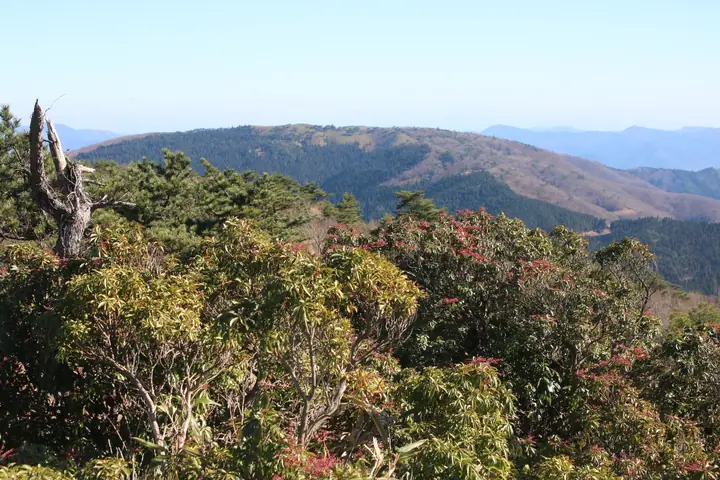
Dangamine is a 1,103 m mountain straddling the border between Asago and Shisō in Hyōgo Prefecture. Its broad, grass-and-bamboo-clad summit sits on the Ikuno Highlands and offers sweeping views from Hyōnosen to the distant Rokkō range. Long popular with Kansai hikers, it appears in numerous regional 100-peak lists including Kansai Hyakumeizan, Kinki Hyakumeizan, Furusato Hyōgo 100 and Shisō 50.
Mt. Dangamine at a glance
- Weather: The most settled day in the next 7 days is Mon, November 9: clear, gusts up to 10 m/s.
- Route: The shortest is Mount Darumagamine, Mount Futōga, and Mount Dangamine Return from Ikuno Plateau: about 7 h 7 min, 12.0 km, about 890 m of climbing.
Mt. Dangamine weather (hourly, 14 days)
Sunrise today 06:23, sunset 17:06
| Tue, 11/3 | Wed, 11/4 | Thu, 11/5 | Fri, 11/6 | Sat, 11/7 | Sun, 11/8 | Mon, 11/9 | Tue, 11/10 | Wed, 11/11 | Thu, 11/12 | Fri, 11/13 | Sat, 11/14 | Sun, 11/15 | Mon, 11/16 | Tue, 11/17 | |||||||||||||||||||||||||||||||||||||||||||||||||||||||||||||||||||||||
|---|---|---|---|---|---|---|---|---|---|---|---|---|---|---|---|---|---|---|---|---|---|---|---|---|---|---|---|---|---|---|---|---|---|---|---|---|---|---|---|---|---|---|---|---|---|---|---|---|---|---|---|---|---|---|---|---|---|---|---|---|---|---|---|---|---|---|---|---|---|---|---|---|---|---|---|---|---|---|---|---|---|---|---|---|---|
| Japan time | 21 | 23 | 1 | 3 | 5 | 7 | 9 | 11 | 13 | 15 | 17 | 19 | 21 | 0 | 3 | 6 | 9 | 12 | 15 | 18 | 21 | 0 | 3 | 6 | 9 | 12 | 15 | 18 | 21 | 0 | 3 | 6 | 9 | 12 | 15 | 18 | 21 | 0 | 3 | 6 | 9 | 12 | 15 | 18 | 21 | 0 | 3 | 6 | 9 | 12 | 15 | 21 | 3 | 9 | 15 | 21 | 3 | 9 | 15 | 21 | 3 | 9 | 15 | 21 | 3 | 9 | 15 | 21 | 3 | 9 | 15 | 21 | 3 | 9 | 15 | 21 | 3 | 9 | 15 | 21 | 3 | 9 | 15 | 21 | |
  | | | | |   | |   | | | |   | |   | |   | |   |   | |   | |   | | | | | | | | |  | |   | | | | | | | | | | | | | | |  | | |   | | | | | | | | | | | |  | |   | | | | | | | | | | | | | | | | | |  | ||
| Temperature | °C | 6° | 6° | 5° | 5° | 5° | 5° | 9° | 11° | 10° | 11° | 9° | 8° | 8° | 8° | 8° | 8° | 12° | 13° | 14° | 11° | 11° | 10° | 9° | 8° | 11° | 14° | 11° | 7° | 5° | 4° | 3° | 3° | 6° | 7° | 6° | 4° | 3° | 3° | 3° | 2° | 4° | 7° | 6° | 4° | 4° | 4° | 4° | 4° | 8° | 11° | 10° | 3° | 1° | 7° | 10° | 3° | 1° | 4° | 5° | 2° | 1° | 6° | 10° | 3° | 3° | 4° | 6° | 2° | 1° | 6° | 10° | 4° | 6° | 9° | 10° | 10° | 10° | 10° | 7° | 3° | 1° | 4° | 5° | 2° |
| Precipitation | mm | 0.9 | 0.3 | 1.4 | 0.6 | 0.4 | 1.8 | 2.9 | 2.4 | 0.2 | 0.7 | 0.2 | 0.5 | 0.9 | 1.8 | 10 | 1.9 | 0.4 | 1.6 | 2.3 | |||||||||||||||||||||||||||||||||||||||||||||||||||||||||||||||||
| New snow | cm | ||||||||||||||||||||||||||||||||||||||||||||||||||||||||||||||||||||||||||||||||||||
| Snow depth | cm | 0 | 0 | 0 | 0 | 0 | 0 | 0 | 0 | 0 | 0 | 0 | 0 | 0 | 0 | 0 | 0 | 0 | 0 | 0 | 0 | 0 | 0 | 0 | 0 | 0 | 0 | 0 | 0 | 0 | 0 | 0 | 0 | 0 | 0 | 0 | 0 | 0 | 0 | 0 | 0 | 0 | 0 | 0 | 0 | 0 | 0 | 0 | 0 | 0 | 0 | 0 | 0 | 0 | 0 | 0 | 0 | 0 | 0 | 0 | 0 | 0 | 0 | 0 | 0 | 0 | 0 | 0 | 0 | 0 | 0 | 0 | 0 | 0 | 0 | 0 | 0 | 0 | 0 | 0 | 0 | 0 | 0 | 0 | 0 |
| Wind | m/s | 3 | 3 | 3 | 3 | 4 | 4 | 4 | 3 | 3 | 3 | 2 | 1 | 1 | 0 | 1 | 0 | 1 | 2 | 2 | 1 | 3 | 1 | 1 | 2 | 3 | 4 | 4 | 3 | 3 | 3 | 3 | 3 | 5 | 5 | 5 | 3 | 3 | 3 | 3 | 4 | 5 | 5 | 4 | 3 | 3 | 1 | 1 | 0 | 2 | 4 | 3 | 1 | 0 | 2 | 4 | 3 | 5 | 6 | 5 | 3 | 1 | 0 | 1 | 1 | 1 | 5 | 6 | 3 | 3 | 2 | 3 | 2 | 2 | 3 | 4 | 4 | 2 | 4 | 6 | 6 | 4 | 5 | 3 | 2 |
| Wind gusts | m/s | 9 | 9 | 9 | 9 | 10 | 10 | 11 | 11 | 9 | 8 | 7 | 4 | 4 | 5 | 4 | 4 | 4 | 5 | 7 | 6 | 10 | 10 | 6 | 7 | 9 | 12 | 12 | 11 | 8 | 9 | 10 | 8 | 13 | 14 | 14 | 13 | 9 | 9 | 9 | 10 | 13 | 13 | 12 | 11 | 9 | 7 | 4 | 3 | 6 | 10 | 10 | 8 | 5 | 7 | 12 | 10 | 14 | 17 | 17 | 13 | 8 | 4 | 6 | 5 | 5 | 13 | 16 | 15 | 10 | 10 | 7 | 8 | 7 | 9 | 13 | 14 | 15 | 11 | 17 | 18 | 16 | 13 | 13 | 9 |
| Wind dir. | ↓ | ↓ | ↓ | ↓ | ↓ | ↓ | ↓ | ↓ | ↓ | ↓ | ↓ | ↓ | ↓ | ↓ | ↓ | ↓ | ↓ | ↓ | ↓ | ↓ | ↓ | ↓ | ↓ | ↓ | ↓ | ↓ | ↓ | ↓ | ↓ | ↓ | ↓ | ↓ | ↓ | ↓ | ↓ | ↓ | ↓ | ↓ | ↓ | ↓ | ↓ | ↓ | ↓ | ↓ | ↓ | ↓ | ↓ | ↓ | ↓ | ↓ | ↓ | ↓ | ↓ | ↓ | ↓ | ↓ | ↓ | ↓ | ↓ | ↓ | ↓ | ↓ | ↓ | ↓ | ↓ | ↓ | ↓ | ↓ | ↓ | ↓ | ↓ | ↓ | ↓ | ↓ | ↓ | ↓ | ↓ | ↓ | ↓ | ↓ | ↓ | ↓ | ↓ | ↓ | |
Mt. Dangamine hiking routes
Hiking times are estimates calculated from the terrain.
Lists that include Mt. Dangamine
Kansai 100 Famous Mountains · Kinki 100 Famous Mountains · 100 Mountains of Our Home Hyogo · Shiso 50 Famous Mountains · Elevations of 1003 Mountains of Japan · 1000 Mountains of Japan
Mt. Dangamine facts
- Also known as
- だるがみね
- Elevation
- 1,103 m
- Location
- Asago, Hyogo / Shisō-shi, Hyogo
35.191609, 134.727552 - Website
- www.ikuno-kankou.jp
- Trail Map
- www.ikuno-kankou.jp (PDF)
- Access Information
- asago-kanko.com
- Wikipedia
- ja.wikipedia.org