
Mount Towari
十和利山
Kazuno, Akita / Towada, Aomori / Shingo, Aomori · Elevation 991 m
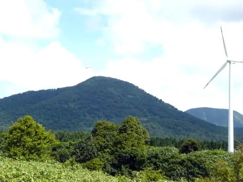
Mount Towari is a 990.9-meter peak on the southeastern rim of the Towada Caldera, straddling Towada City and Shingō Village in Aomori and Kazuno City in Akita. Its symmetrical, beech-forested cone, together with Mount Henrai and Mount Towada, makes up the Towada Three Mountains. The southern slopes form the Forest Agency's Mayogadaira Natural Recreation Forest, and the peak lies within Towada-Hachimantai National Park. It is counted among the 100 famous mountains of Tohoku.
Mount Towari at a glance
- Weather: The most settled day in the next 7 days is Wed, November 4: clear, gusts up to 13 m/s. Fri, Nov 6, Sat, Nov 7, Sun, Nov 8: strong wind (gusts up to 20 m/s).
Mount Towari weather (hourly, 14 days)
Sunrise today 06:07, sunset 16:32
| Tue, 11/3 | Wed, 11/4 | Thu, 11/5 | Fri, 11/6 | Sat, 11/7 | Sun, 11/8 | Mon, 11/9 | Tue, 11/10 | Wed, 11/11 | Thu, 11/12 | Fri, 11/13 | Sat, 11/14 | Sun, 11/15 | Mon, 11/16 | Tue, 11/17 | |||||||||||||||||||||||||||||||||||||||||||||||||||||||||||||||||||||||
|---|---|---|---|---|---|---|---|---|---|---|---|---|---|---|---|---|---|---|---|---|---|---|---|---|---|---|---|---|---|---|---|---|---|---|---|---|---|---|---|---|---|---|---|---|---|---|---|---|---|---|---|---|---|---|---|---|---|---|---|---|---|---|---|---|---|---|---|---|---|---|---|---|---|---|---|---|---|---|---|---|---|---|---|---|---|
| Japan time | 15 | 17 | 19 | 21 | 23 | 1 | 3 | 5 | 7 | 9 | 11 | 13 | 15 | 18 | 21 | 0 | 3 | 6 | 9 | 12 | 15 | 18 | 21 | 0 | 3 | 6 | 9 | 12 | 15 | 18 | 21 | 0 | 3 | 6 | 9 | 12 | 15 | 18 | 21 | 0 | 3 | 6 | 9 | 12 | 15 | 18 | 21 | 0 | 3 | 6 | 9 | 15 | 21 | 3 | 9 | 15 | 21 | 3 | 9 | 15 | 21 | 3 | 9 | 15 | 21 | 3 | 9 | 15 | 21 | 3 | 9 | 15 | 21 | 3 | 9 | 15 | 21 | 3 | 9 | 15 | 21 | 3 | 9 | 15 | |
  |  | | | | |   |   |  | | | | | | | | |   |   | | |   | | | | |   |   | | | |   |   | |   | | | |   | | | | | | | | | | | | |   | | | |   | |   |   | | | | | | |   | | | | | | |  | | | | | | | | | | | | ||
| Temperature | °C | 4° | 2° | 1° | 1° | 1° | 1° | 2° | 3° | 4° | 6° | 7° | 8° | 7° | 3° | 3° | 5° | 4° | 5° | 7° | 8° | 8° | 7° | 7° | 7° | 7° | 7° | 8° | 9° | 8° | 4° | 2° | 0° | -1° | -2° | -1° | 0° | -1° | -2° | -2° | -3° | -3° | -3° | -1° | 1° | 0° | -1° | -2° | -1° | -1° | -2° | -1° | -1° | -2° | -4° | -1° | 0° | -1° | -1° | -2° | 0° | -2° | -2° | 1° | 2° | 0° | -1° | -1° | -1° | -3° | -3° | 1° | 4° | -1° | 0° | 4° | 6° | 4° | 4° | 5° | 0° | -3° | -2° | 0° | 1° |
| Precipitation | mm | 0.1 | 0.3 | 0.4 | 1.4 | 2.1 | 4.5 | 3.7 | 0.5 | 0.1 | 1.3 | 1.4 | 0.5 | 1.5 | 2.3 | 2.5 | 3.3 | 3.0 | 0.2 | 0.2 | 0.2 | 0.3 | 1.1 | 9 | 18 | 2.7 | 0.1 | 0.6 | 1.4 | 0.2 | 0.1 | 0.5 | 2.7 | 1.0 | 3.0 | 2.0 | 0.9 | ||||||||||||||||||||||||||||||||||||||||||||||||
| New snow | cm | 0.1 | 0.4 | 1.5 | 2.3 | 2.5 | 3.3 | 3.0 | 0.2 | 0.2 | 0.2 | <.1 | <.1 | 0.2 | <.1 | <.1 | 0.9 | 5.4 | 14 | 1.9 | 0.2 | <.1 | 0.2 | 0.1 | 0.2 | 1.5 | 0.8 | ||||||||||||||||||||||||||||||||||||||||||||||||||||||||||
| Snow depth | cm | 0 | 0 | 0 | 0 | 0 | 0 | 0 | 0 | 0 | 0 | 0 | 0 | 0 | 0 | 0 | 0 | 0 | 0 | 0 | 0 | 0 | 0 | 0 | 0 | 0 | 0 | 0 | 0 | 0 | 0 | 0 | 0 | 0 | 0 | 0 | <1 | <1 | <1 | <1 | <1 | <1 | <1 | <1 | <1 | <1 | <1 | <1 | 0 | 0 | 0 | 0 | 0 | 0 | 0 | 0 | 0 | <1 | <1 | 3 | 3 | 3 | 2 | 2 | <1 | <1 | <1 | <1 | <1 | <1 | <1 | <1 | 0 | 0 | 0 | 0 | 0 | 0 | 0 | 0 | 0 | <1 | <1 | <1 | 0 |
| Wind | m/s | 7 | 5 | 4 | 5 | 4 | 5 | 6 | 6 | 6 | 6 | 4 | 3 | 2 | 2 | 1 | 0 | 1 | 1 | 0 | 1 | 0 | 2 | 2 | 2 | 3 | 3 | 4 | 7 | 7 | 8 | 9 | 8 | 8 | 7 | 9 | 9 | 8 | 7 | 7 | 7 | 7 | 7 | 9 | 10 | 10 | 8 | 6 | 5 | 5 | 4 | 5 | 5 | 3 | 2 | 1 | 6 | 5 | 4 | 7 | 2 | 3 | 3 | 4 | 5 | 4 | 2 | 5 | 4 | 2 | 2 | 3 | 3 | 3 | 3 | 3 | 2 | 2 | 3 | 2 | 5 | 4 | 3 | 4 | 4 |
| Wind gusts | m/s | 14 | 13 | 9 | 9 | 9 | 11 | 12 | 12 | 13 | 12 | 11 | 8 | 6 | 5 | 5 | 3 | 3 | 4 | 3 | 4 | 4 | 4 | 5 | 4 | 6 | 6 | 7 | 15 | 16 | 16 | 18 | 18 | 16 | 17 | 19 | 20 | 19 | 18 | 15 | 14 | 14 | 14 | 17 | 20 | 20 | 19 | 15 | 11 | 10 | 10 | 11 | 11 | 9 | 7 | 4 | 10 | 12 | 9 | 13 | 13 | 6 | 7 | 8 | 11 | 11 | 8 | 10 | 11 | 9 | 5 | 7 | 8 | 7 | 6 | 6 | 6 | 7 | 7 | 6 | 11 | 11 | 9 | 9 | 10 |
| Wind dir. | ↓ | ↓ | ↓ | ↓ | ↓ | ↓ | ↓ | ↓ | ↓ | ↓ | ↓ | ↓ | ↓ | ↓ | ↓ | ↓ | ↓ | ↓ | ↓ | ↓ | ↓ | ↓ | ↓ | ↓ | ↓ | ↓ | ↓ | ↓ | ↓ | ↓ | ↓ | ↓ | ↓ | ↓ | ↓ | ↓ | ↓ | ↓ | ↓ | ↓ | ↓ | ↓ | ↓ | ↓ | ↓ | ↓ | ↓ | ↓ | ↓ | ↓ | ↓ | ↓ | ↓ | ↓ | ↓ | ↓ | ↓ | ↓ | ↓ | ↓ | ↓ | ↓ | ↓ | ↓ | ↓ | ↓ | ↓ | ↓ | ↓ | ↓ | ↓ | ↓ | ↓ | ↓ | ↓ | ↓ | ↓ | ↓ | ↓ | ↓ | ↓ | ↓ | ↓ | ↓ | |
Huts, campsites and lodging near Mount Towari
Campsites
- 平子沢キャンプ場
Lodging
- Kobayashi
Lists that include Mount Towari
Tohoku 100 Famous Mountains · 110 Mountains of Aomori · 1000 Mountains of Japan
Mount Towari facts
- Elevation
- 991 m
- Location
- Kazuno, Akita / Towada, Aomori / Shingo, Aomori
40.426957, 140.985156 - National Park
- 十和田八幡平国立公園
- Website
- www.rinya.maff.go.jp
- Wikipedia
- ja.wikipedia.org