
Mount Mukaishirakami
向白神岳
Fukaura, Aomori · Elevation 1,250 m
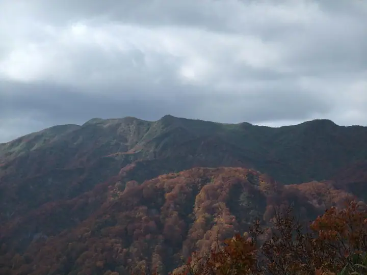
Mount Mukaishirakami is a 1,250-meter peak in Fukaura Town, Nishi-Tsugaru District of Aomori Prefecture, and the highest summit of the Shirakami Mountains. It lies within the core zone of the Shirakami-Sanchi UNESCO World Natural Heritage site; a trail to neighbouring peaks was opened in 1965, but maintenance was discontinued after the 1993 World Heritage inscription to preserve the wilderness. The mountain has no maintained route, and reaching the top requires demanding bushwhacking. It is counted among the Aomori 110 Peaks.
Mount Mukaishirakami at a glance
- Weather: The most settled day in the next 7 days is Wed, November 4: clear, gusts up to 14 m/s. Fri, Nov 6, Sat, Nov 7, Sun, Nov 8: strong wind (gusts up to 26 m/s).
Mount Mukaishirakami weather (hourly, 14 days)
Sunrise today 06:11, sunset 16:36
| Tue, 11/3 | Wed, 11/4 | Thu, 11/5 | Fri, 11/6 | Sat, 11/7 | Sun, 11/8 | Mon, 11/9 | Tue, 11/10 | Wed, 11/11 | Thu, 11/12 | Fri, 11/13 | Sat, 11/14 | Sun, 11/15 | Mon, 11/16 | Tue, 11/17 | |||||||||||||||||||||||||||||||||||||||||||||||||||||||||||||||||||||||
|---|---|---|---|---|---|---|---|---|---|---|---|---|---|---|---|---|---|---|---|---|---|---|---|---|---|---|---|---|---|---|---|---|---|---|---|---|---|---|---|---|---|---|---|---|---|---|---|---|---|---|---|---|---|---|---|---|---|---|---|---|---|---|---|---|---|---|---|---|---|---|---|---|---|---|---|---|---|---|---|---|---|---|---|---|---|
| Japan time | 15 | 17 | 19 | 21 | 23 | 1 | 3 | 5 | 7 | 9 | 11 | 13 | 15 | 18 | 21 | 0 | 3 | 6 | 9 | 12 | 15 | 18 | 21 | 0 | 3 | 6 | 9 | 12 | 15 | 18 | 21 | 0 | 3 | 6 | 9 | 12 | 15 | 18 | 21 | 0 | 3 | 6 | 9 | 12 | 15 | 18 | 21 | 0 | 3 | 6 | 9 | 15 | 21 | 3 | 9 | 15 | 21 | 3 | 9 | 15 | 21 | 3 | 9 | 15 | 21 | 3 | 9 | 15 | 21 | 3 | 9 | 15 | 21 | 3 | 9 | 15 | 21 | 3 | 9 | 15 | 21 | 3 | 9 | 15 | |
  |   | | |   | |   | |  |   | | | | | | | |   |   | |   | | | | |   |   | | | | |   | |   |   |   |   | | |   | | | |   | | | | |   | | | | | | |   | |   |   | | | | | | | | | | |   | | |  | | | | | | | | | | | | ||
| Temperature | °C | 2° | 0° | 1° | 0° | 1° | 3° | 4° | 3° | 2° | 5° | 5° | 6° | 5° | 0° | -2° | -1° | -1° | 1° | 8° | 9° | 8° | 5° | 4° | 5° | 5° | 5° | 7° | 7° | 5° | 2° | -1° | -3° | -3° | -4° | -3° | -2° | -2° | -3° | -3° | -3° | -3° | -3° | -2° | -1° | -2° | -2° | -3° | -2° | -2° | -4° | -3° | -3° | -4° | -5° | -2° | 0° | -3° | -2° | -3° | -1° | -3° | -2° | 1° | 1° | -1° | -4° | -2° | -2° | -3° | -4° | 1° | 1° | -3° | -2° | 3° | 4° | 2° | 2° | 3° | -2° | -4° | -3° | 0° | 0° |
| Precipitation | mm | 0.2 | 0.2 | 0.1 | 0.2 | 1.1 | 0.1 | 0.2 | 0.5 | 0.7 | 0.3 | 0.5 | 1.6 | 4.8 | 3.3 | 0.4 | 0.2 | 0.9 | 1.4 | 1.6 | 1.7 | 2.0 | 1.7 | 1.5 | 2.3 | 1.2 | 1.9 | 1.2 | 0.2 | 0.3 | 0.3 | 0.2 | 0.5 | 1.4 | 0.4 | 0.1 | 0.2 | 2.5 | 4.9 | 9 | 0.6 | 1.0 | 0.6 | 6 | 2.1 | 0.3 | 0.2 | 0.1 | 2.4 | 4.5 | 2.6 | 8 | 2.0 | 0.2 | 0.1 | ||||||||||||||||||||||||||||||
| New snow | cm | 0.5 | 0.9 | 1.3 | 1.5 | 1.8 | 1.4 | 1.2 | 1.9 | 1.0 | 1.5 | 1.1 | 0.2 | 0.3 | 0.3 | <.1 | 0.1 | 0.5 | 1.1 | 0.3 | 0.1 | 0.1 | 2.1 | 2.9 | 6.0 | 0.2 | <.1 | 0.6 | 0.2 | 0.2 | <.1 | 0.3 | 1.3 | 0.2 | |||||||||||||||||||||||||||||||||||||||||||||||||||
| Snow depth | cm | 0 | 0 | 0 | 0 | 0 | 0 | 0 | 0 | 0 | 0 | 0 | 0 | 0 | 0 | 0 | 0 | 0 | 0 | 0 | 0 | 0 | 0 | 0 | 0 | 0 | 0 | 0 | 0 | 0 | 0 | 0 | 0 | <1 | 1 | 2 | 2 | 2 | 3 | 4 | 4 | 4 | 5 | 5 | 5 | 4 | 4 | 4 | 4 | 4 | 3 | 3 | 4 | 4 | 4 | 4 | 3 | 5 | 6 | 10 | 8 | 7 | 7 | 7 | 5 | 5 | 5 | 5 | 5 | 5 | 5 | 4 | 4 | 3 | 3 | 3 | 2 | 1 | <1 | <1 | <1 | 1 | 1 | 1 | <1 |
| Wind | m/s | 5 | 3 | 4 | 3 | 4 | 5 | 7 | 5 | 3 | 4 | 2 | 2 | 1 | 2 | 2 | 1 | 1 | 2 | 3 | 3 | 1 | 1 | 1 | 2 | 2 | 2 | 4 | 5 | 6 | 7 | 8 | 6 | 7 | 8 | 8 | 9 | 8 | 8 | 8 | 8 | 8 | 7 | 7 | 7 | 6 | 5 | 4 | 3 | 3 | 2 | 3 | 3 | 2 | 1 | 1 | 3 | 4 | 2 | 5 | 2 | 1 | 2 | 4 | 4 | 1 | 3 | 4 | 4 | 2 | 0 | 2 | 2 | 2 | 3 | 3 | 2 | 3 | 1 | 3 | 5 | 4 | 3 | 3 | 2 |
| Wind gusts | m/s | 16 | 13 | 10 | 10 | 10 | 15 | 18 | 18 | 14 | 10 | 10 | 7 | 6 | 4 | 5 | 5 | 5 | 7 | 10 | 10 | 9 | 4 | 3 | 5 | 6 | 7 | 11 | 17 | 18 | 19 | 21 | 20 | 20 | 24 | 25 | 26 | 26 | 25 | 23 | 21 | 22 | 22 | 20 | 20 | 19 | 16 | 14 | 10 | 10 | 9 | 8 | 10 | 8 | 5 | 5 | 8 | 13 | 15 | 14 | 14 | 7 | 6 | 11 | 11 | 10 | 8 | 12 | 13 | 11 | 7 | 6 | 7 | 6 | 7 | 8 | 8 | 12 | 10 | 9 | 14 | 15 | 11 | 9 | 8 |
| Wind dir. | ↓ | ↓ | ↓ | ↓ | ↓ | ↓ | ↓ | ↓ | ↓ | ↓ | ↓ | ↓ | ↓ | ↓ | ↓ | ↓ | ↓ | ↓ | ↓ | ↓ | ↓ | ↓ | ↓ | ↓ | ↓ | ↓ | ↓ | ↓ | ↓ | ↓ | ↓ | ↓ | ↓ | ↓ | ↓ | ↓ | ↓ | ↓ | ↓ | ↓ | ↓ | ↓ | ↓ | ↓ | ↓ | ↓ | ↓ | ↓ | ↓ | ↓ | ↓ | ↓ | ↓ | ↓ | ↓ | ↓ | ↓ | ↓ | ↓ | ↓ | ↓ | ↓ | ↓ | ↓ | ↓ | ↓ | ↓ | ↓ | ↓ | ↓ | ↓ | ↓ | ↓ | ↓ | ↓ | ↓ | ↓ | ↓ | ↓ | ↓ | ↓ | ↓ | ↓ | ↓ | |
Huts, campsites and lodging near Mount Mukaishirakami
Mountain huts
- 白神岳避難小屋
Lists that include Mount Mukaishirakami
110 Mountains of Aomori · Elevations of 1003 Mountains of Japan · 1000 Mountains of Japan
Mount Mukaishirakami facts
- Elevation
- 1,250 m
- Location
- Fukaura, Aomori
40.525980, 140.047359 - Website
- www.rinya.maff.go.jp
- Wikipedia
- ja.wikipedia.org