
Mount Irumukeppu
イルムケップ山
Ashibetsu, Hokkaido / Akabira, Hokkaido · Elevation 864 m
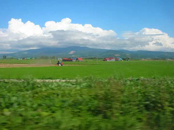
Mount Irumukeppu is an 864.3-meter stratovolcano in the Otoe range of central Hokkaido, the highest of the chain, straddling the cities of Akabira and Ashibetsu. The summit carries a third-class triangulation point and the name derives from Ainu. From the Fukagawa side the peak can be traversed from Mount Okirikawa and Mount Otoe along the Irumukeppu Skyline, while the Akabira side is reached via the Otanizawa forest road.
Mount Irumukeppu at a glance
- Weather: The most settled day in the next 7 days is Thu, November 5: clear, gusts up to 9 m/s. Sat, Nov 7, Sun, Nov 8: strong wind (gusts up to 18 m/s).
Mount Irumukeppu weather (hourly, 14 days)
Sunrise today 06:09, sunset 16:22
| Tue, 11/3 | Wed, 11/4 | Thu, 11/5 | Fri, 11/6 | Sat, 11/7 | Sun, 11/8 | Mon, 11/9 | Tue, 11/10 | Wed, 11/11 | Thu, 11/12 | Fri, 11/13 | Sat, 11/14 | Sun, 11/15 | Mon, 11/16 | Tue, 11/17 | |||||||||||||||||||||||||||||||||||||||||||||||||||||||||||||||||||||||
|---|---|---|---|---|---|---|---|---|---|---|---|---|---|---|---|---|---|---|---|---|---|---|---|---|---|---|---|---|---|---|---|---|---|---|---|---|---|---|---|---|---|---|---|---|---|---|---|---|---|---|---|---|---|---|---|---|---|---|---|---|---|---|---|---|---|---|---|---|---|---|---|---|---|---|---|---|---|---|---|---|---|---|---|---|---|
| Japan time | 15 | 17 | 19 | 21 | 23 | 1 | 3 | 5 | 7 | 9 | 11 | 13 | 15 | 18 | 21 | 0 | 3 | 6 | 9 | 12 | 15 | 18 | 21 | 0 | 3 | 6 | 9 | 12 | 15 | 18 | 21 | 0 | 3 | 6 | 9 | 12 | 15 | 18 | 21 | 0 | 3 | 6 | 9 | 12 | 15 | 18 | 21 | 0 | 3 | 6 | 9 | 15 | 21 | 3 | 9 | 15 | 21 | 3 | 9 | 15 | 21 | 3 | 9 | 15 | 21 | 3 | 9 | 15 | 21 | 3 | 9 | 15 | 21 | 3 | 9 | 15 | 21 | 3 | 9 | 15 | 21 | 3 | 9 | 15 | |
  |   | |   |   | |   | |   |   | | |  |  | | | | | | | | |   |   |   | |   |   |   | |   | | | |   | |   | | | | | |   | | | | | | | | | | | | | | | | | | | | | | | | | |   | | | |  | | | | | | |   | | | | | ||
| Temperature | °C | 0° | -3° | -5° | -5° | -5° | -3° | -4° | -4° | -4° | 0° | 1° | 2° | 1° | -4° | -4° | -3° | -4° | -3° | 5° | 9° | 9° | 4° | 4° | 3° | 3° | 3° | 6° | 11° | 8° | 3° | -1° | -3° | -5° | -5° | -5° | -4° | -4° | -6° | -5° | -6° | -6° | -6° | -4° | -3° | -4° | -6° | -6° | -6° | -7° | -6° | -4° | -4° | -8° | -10° | -5° | -4° | -8° | -7° | -3° | -2° | -5° | -7° | -2° | -2° | -5° | -7° | -6° | -4° | -8° | -9° | -4° | -1° | -6° | -4° | 2° | 4° | 1° | 1° | -1° | -2° | -6° | -5° | -3° | -1° |
| Precipitation | mm | 0.7 | 1.1 | 0.6 | 0.5 | 6 | 2.8 | 2.6 | 0.6 | 0.6 | 1.9 | 0.3 | 0.8 | 0.9 | 1.5 | 2.0 | 1.4 | 0.5 | 0.2 | 0.3 | 0.3 | 0.6 | 0.7 | 1.0 | 1.0 | 0.4 | 0.2 | 0.7 | 0.2 | 0.3 | 0.3 | 0.3 | 0.2 | 0.7 | 0.9 | 0.8 | 0.8 | 0.1 | 0.3 | 1.9 | 5 | 3.0 | 0.1 | ||||||||||||||||||||||||||||||||||||||||||
| New snow | cm | <.1 | 0.7 | 1.1 | 0.5 | <.1 | 0.6 | 0.9 | 1.5 | 2.0 | 1.4 | 0.5 | 0.2 | 0.3 | 0.3 | 0.6 | 0.7 | 1.0 | 1.0 | 0.4 | 0.2 | <.1 | <.1 | 0.7 | <.1 | 0.2 | <.1 | 0.3 | 0.3 | 0.1 | 0.2 | 0.2 | 0.6 | 0.9 | 0.8 | 0.8 | 0.7 | 0.1 | <.1 | <.1 | |||||||||||||||||||||||||||||||||||||||||||||
| Snow depth | cm | <1 | <1 | <1 | <1 | <1 | <1 | 1 | 1 | 1 | 1 | <1 | <1 | <1 | <1 | <1 | <1 | <1 | <1 | <1 | <1 | 0 | 0 | 0 | 0 | 0 | 0 | 0 | 0 | 0 | 0 | 0 | 0 | <1 | 2 | 3 | 4 | 4 | 4 | 4 | 4 | 4 | 5 | 5 | 6 | 6 | 6 | 6 | 6 | 6 | 6 | 6 | 6 | 6 | 6 | 6 | 6 | 6 | 6 | 6 | 6 | 6 | 6 | 6 | 6 | 6 | 6 | 7 | 7 | 8 | 8 | 8 | 7 | 7 | 7 | 6 | 3 | 2 | 1 | <1 | 1 | 1 | 1 | 1 | 1 |
| Wind | m/s | 4 | 1 | 2 | 2 | 2 | 3 | 3 | 3 | 1 | 3 | 4 | 4 | 3 | 2 | 2 | 3 | 2 | 2 | 3 | 4 | 2 | 2 | 2 | 2 | 2 | 2 | 3 | 5 | 5 | 5 | 6 | 7 | 6 | 6 | 6 | 6 | 5 | 5 | 5 | 5 | 5 | 5 | 5 | 6 | 4 | 2 | 2 | 2 | 2 | 2 | 3 | 2 | 1 | 1 | 1 | 0 | 2 | 2 | 0 | 1 | 0 | 1 | 2 | 2 | 3 | 1 | 3 | 4 | 0 | 1 | 1 | 1 | 2 | 2 | 2 | 4 | 3 | 2 | 2 | 4 | 2 | 1 | 0 | 1 |
| Wind gusts | m/s | 14 | 11 | 4 | 5 | 6 | 9 | 11 | 10 | 9 | 9 | 11 | 10 | 10 | 8 | 7 | 8 | 7 | 8 | 9 | 9 | 9 | 4 | 5 | 5 | 5 | 7 | 7 | 15 | 14 | 16 | 15 | 18 | 17 | 17 | 18 | 18 | 18 | 16 | 14 | 14 | 14 | 14 | 16 | 18 | 17 | 12 | 6 | 6 | 6 | 8 | 7 | 11 | 6 | 3 | 4 | 5 | 4 | 4 | 4 | 4 | 2 | 3 | 7 | 9 | 8 | 8 | 10 | 13 | 11 | 4 | 3 | 4 | 4 | 5 | 8 | 12 | 11 | 10 | 7 | 10 | 11 | 7 | 5 | 5 |
| Wind dir. | ↓ | ↓ | ↓ | ↓ | ↓ | ↓ | ↓ | ↓ | ↓ | ↓ | ↓ | ↓ | ↓ | ↓ | ↓ | ↓ | ↓ | ↓ | ↓ | ↓ | ↓ | ↓ | ↓ | ↓ | ↓ | ↓ | ↓ | ↓ | ↓ | ↓ | ↓ | ↓ | ↓ | ↓ | ↓ | ↓ | ↓ | ↓ | ↓ | ↓ | ↓ | ↓ | ↓ | ↓ | ↓ | ↓ | ↓ | ↓ | ↓ | ↓ | ↓ | ↓ | ↓ | ↓ | ↓ | ↓ | ↓ | ↓ | ↓ | ↓ | ↓ | ↓ | ↓ | ↓ | ↓ | ↓ | ↓ | ↓ | ↓ | ↓ | ↓ | ↓ | ↓ | ↓ | ↓ | ↓ | ↓ | ↓ | ↓ | ↓ | ↓ | ↓ | ↓ | ↓ | |
Lists that include Mount Irumukeppu
Mount Irumukeppu facts
- Also known as
- 入霧月峰
- Elevation
- 864 m
- Location
- Ashibetsu, Hokkaido / Akabira, Hokkaido
43.629218, 142.110289 - Season Opens
- June 14
- Website
- www.city.fukagawa.lg.jp
- Trail Map
- www.city.fukagawa.lg.jp (PDF)
- Wikipedia
- ja.wikipedia.org