
Mount Futago
二子山
Ogano, Saitama · Elevation 1,166 m
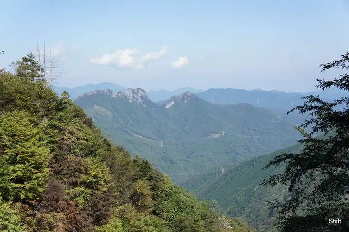
Mount Futago is a twin-summit limestone peak rising to 1,165.79 m in Ogano Town, Chichibu District, Saitama. Its name reflects the two rock spires — West Peak (Nishi-dake) and East Peak — that frame the skyline. Exposed walls, chain sections, and razor-edge ridges make it one of Saitama's most demanding routes, earning the nicknames "Jandarme of Okuchichibu" and "Crazy Mountain," with a steady record of serious falls. The view from the western ridge takes in Mount Ryōkami close at hand and sweeps 360 degrees over Okutama, Okumusashi, and the Chichibu range. Long developed as a limestone climbing sanctuary, in part through the efforts of pro climber Yuji Hirayama, the peak is included in numerous lists including Kantō Hyakumeizan.
Mount Futago at a glance
- Weather: The most settled day in the next 7 days is Fri, November 6: clear, gusts up to 7 m/s.
- Route: The shortest is Futagoyama East and West Peaks Loop from Kurao Trailhead: about 2 h 5 min, 2.9 km, about 450 m of climbing.
Mount Futago weather (hourly, 14 days)
Sunrise today 06:08, sunset 16:48
| Tue, 11/3 | Wed, 11/4 | Thu, 11/5 | Fri, 11/6 | Sat, 11/7 | Sun, 11/8 | Mon, 11/9 | Tue, 11/10 | Wed, 11/11 | Thu, 11/12 | Fri, 11/13 | Sat, 11/14 | Sun, 11/15 | Mon, 11/16 | Tue, 11/17 | |||||||||||||||||||||||||||||||||||||||||||||||||||||||||||||||||||||||
|---|---|---|---|---|---|---|---|---|---|---|---|---|---|---|---|---|---|---|---|---|---|---|---|---|---|---|---|---|---|---|---|---|---|---|---|---|---|---|---|---|---|---|---|---|---|---|---|---|---|---|---|---|---|---|---|---|---|---|---|---|---|---|---|---|---|---|---|---|---|---|---|---|---|---|---|---|---|---|---|---|---|---|---|---|---|
| Japan time | 15 | 17 | 19 | 21 | 23 | 1 | 3 | 5 | 7 | 9 | 11 | 13 | 15 | 18 | 21 | 0 | 3 | 6 | 9 | 12 | 15 | 18 | 21 | 0 | 3 | 6 | 9 | 12 | 15 | 18 | 21 | 0 | 3 | 6 | 9 | 12 | 15 | 18 | 21 | 0 | 3 | 6 | 9 | 12 | 15 | 18 | 21 | 0 | 3 | 6 | 9 | 15 | 21 | 3 | 9 | 15 | 21 | 3 | 9 | 15 | 21 | 3 | 9 | 15 | 21 | 3 | 9 | 15 | 21 | 3 | 9 | 15 | 21 | 3 | 9 | 15 | 21 | 3 | 9 | 15 | 21 | 3 | 9 | 15 | |
  |   |   |   | | | | |   | | | |   |   | | | | | | |   | | |  | | |  | | | |   | | | | | | | | | | | |   | | | | | | | | | | | | | | | |   | |   |  | | | | | | | | | | | | | | | | | | | |  | | | ||
| Temperature | °C | 11° | 7° | 7° | 7° | 6° | 6° | 5° | 5° | 6° | 8° | 9° | 9° | 7° | 5° | 5° | 5° | 6° | 7° | 10° | 15° | 12° | 9° | 8° | 7° | 6° | 7° | 14° | 19° | 17° | 10° | 6° | 4° | 3° | 2° | 9° | 11° | 9° | 3° | 0° | -1° | -2° | -2° | 6° | 10° | 8° | 4° | 4° | 3° | 3° | 3° | 5° | 7° | 4° | 3° | 4° | 5° | 2° | 0° | 5° | 5° | 0° | -3° | 6° | 6° | 2° | -1° | 7° | 7° | -1° | -3° | 5° | 6° | 0° | -1° | 7° | 8° | 5° | 7° | 14° | 13° | 4° | 0° | 4° | 5° |
| Precipitation | mm | 0.1 | 0.3 | 0.4 | 3.8 | 9 | 6 | 0.5 | 2.1 | 0.3 | 0.1 | 0.1 | 0.3 | 4.6 | 2.2 | 0.4 | 0.2 | 2.7 | 8 | ||||||||||||||||||||||||||||||||||||||||||||||||||||||||||||||||||
| New snow | cm | ||||||||||||||||||||||||||||||||||||||||||||||||||||||||||||||||||||||||||||||||||||
| Snow depth | cm | 0 | 0 | 0 | 0 | 0 | 0 | 0 | 0 | 0 | 0 | 0 | 0 | 0 | 0 | 0 | 0 | 0 | 0 | 0 | 0 | 0 | 0 | 0 | 0 | 0 | 0 | 0 | 0 | 0 | 0 | 0 | 0 | 0 | 0 | 0 | 0 | 0 | 0 | 0 | 0 | 0 | 0 | 0 | 0 | 0 | 0 | 0 | 0 | 0 | 0 | 0 | 0 | 0 | 0 | 0 | 0 | 0 | 0 | 0 | 0 | 0 | 0 | 0 | 0 | 0 | 0 | 0 | 0 | 0 | 0 | 0 | 0 | 0 | 0 | 0 | 0 | 0 | 0 | 0 | 0 | 0 | 0 | 0 | 0 |
| Wind | m/s | 2 | 1 | 0 | 0 | 1 | 1 | 1 | 1 | 1 | 2 | 3 | 3 | 2 | 2 | 1 | 0 | 1 | 1 | 1 | 2 | 1 | 0 | 1 | 0 | 0 | 1 | 1 | 2 | 2 | 0 | 2 | 3 | 3 | 2 | 3 | 4 | 4 | 0 | 2 | 2 | 2 | 1 | 2 | 2 | 2 | 0 | 1 | 1 | 1 | 1 | 2 | 1 | 1 | 1 | 2 | 3 | 1 | 2 | 8 | 7 | 2 | 2 | 1 | 2 | 1 | 1 | 5 | 5 | 2 | 2 | 2 | 2 | 0 | 0 | 1 | 1 | 1 | 0 | 1 | 5 | 5 | 1 | 2 | 2 |
| Wind gusts | m/s | 8 | 6 | 2 | 2 | 2 | 3 | 2 | 2 | 2 | 6 | 8 | 9 | 8 | 6 | 5 | 3 | 3 | 3 | 4 | 6 | 5 | 5 | 2 | 3 | 3 | 3 | 5 | 7 | 7 | 7 | 5 | 8 | 8 | 9 | 8 | 11 | 12 | 10 | 5 | 5 | 6 | 6 | 6 | 8 | 8 | 7 | 2 | 3 | 3 | 2 | 5 | 8 | 4 | 4 | 7 | 10 | 8 | 6 | 25 | 22 | 18 | 7 | 6 | 9 | 7 | 4 | 12 | 16 | 13 | 7 | 5 | 8 | 6 | 2 | 3 | 7 | 4 | 4 | 4 | 15 | 15 | 14 | 6 | 8 |
| Wind dir. | ↓ | ↓ | ↓ | ↓ | ↓ | ↓ | ↓ | ↓ | ↓ | ↓ | ↓ | ↓ | ↓ | ↓ | ↓ | ↓ | ↓ | ↓ | ↓ | ↓ | ↓ | ↓ | ↓ | ↓ | ↓ | ↓ | ↓ | ↓ | ↓ | ↓ | ↓ | ↓ | ↓ | ↓ | ↓ | ↓ | ↓ | ↓ | ↓ | ↓ | ↓ | ↓ | ↓ | ↓ | ↓ | ↓ | ↓ | ↓ | ↓ | ↓ | ↓ | ↓ | ↓ | ↓ | ↓ | ↓ | ↓ | ↓ | ↓ | ↓ | ↓ | ↓ | ↓ | ↓ | ↓ | ↓ | ↓ | ↓ | ↓ | ↓ | ↓ | ↓ | ↓ | ↓ | ↓ | ↓ | ↓ | ↓ | ↓ | ↓ | ↓ | ↓ | ↓ | ↓ | |
Mount Futago hiking routes
Hiking times are estimates calculated from the terrain.
Huts, campsites and lodging near Mount Futago
Lodging
- 両神山荘
Lists that include Mount Futago
Kanto 100 Famous Mountains · 50 Mountains of Saitama Prefecture · Elevations of 1003 Mountains of Japan · 1000 Mountains of Japan
Mount Futago facts
- Also known as
- 西岳
- Elevation
- 1,166 m
- Location
- Ogano, Saitama
36.069698, 138.863727 - Website
- kanko-ogano.jp
- Wikipedia
- ja.wikipedia.org