
Mt. Azumaya
四阿屋山
Ogano, Saitama · Elevation 772 m
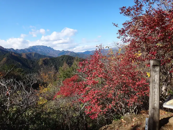
Mt. Azumaya (772 m) rises in the Ryōkami area of Ogano Town, Chichibu, Saitama, on the Chichibu Mountains, and is famed as one of the Kantō region's prime flower mountains. The Fukujusō (Adonis) Garden on its midslope holds some 5,000 plants over 3,000 square metres, including the locally-endemic crimson "Chichibu-beni" cultivar that draws crowds in early spring. From Roadside Station Ryōkami-Onsen Yakushi-no-Yu, a hiking trail climbs through the Sankyo-Hiroba plateau and Fukujusō Garden to the summit, with rōbai blooming in late December, fukujusō from February to early March, and akebono azaleas in April. It is counted among Japan's 100 Low Mountains and the 100 Famous Mountains of Kantō.
Mt. Azumaya at a glance
- Weather: The most settled day in the next 7 days is Fri, November 6: clear, gusts up to 8 m/s.
- Route: The shortest is Mount Azumaya via Torii-yama and Yakushido Courses: about 3 h 27 min, 5.7 km, about 540 m of climbing.
Mt. Azumaya weather (hourly, 14 days)
Sunrise today 06:08, sunset 16:48
| Tue, 11/3 | Wed, 11/4 | Thu, 11/5 | Fri, 11/6 | Sat, 11/7 | Sun, 11/8 | Mon, 11/9 | Tue, 11/10 | Wed, 11/11 | Thu, 11/12 | Fri, 11/13 | Sat, 11/14 | Sun, 11/15 | Mon, 11/16 | Tue, 11/17 | |||||||||||||||||||||||||||||||||||||||||||||||||||||||||||||||||||||||
|---|---|---|---|---|---|---|---|---|---|---|---|---|---|---|---|---|---|---|---|---|---|---|---|---|---|---|---|---|---|---|---|---|---|---|---|---|---|---|---|---|---|---|---|---|---|---|---|---|---|---|---|---|---|---|---|---|---|---|---|---|---|---|---|---|---|---|---|---|---|---|---|---|---|---|---|---|---|---|---|---|---|---|---|---|---|
| Japan time | 21 | 23 | 1 | 3 | 5 | 7 | 9 | 11 | 13 | 15 | 17 | 19 | 21 | 0 | 3 | 6 | 9 | 12 | 15 | 18 | 21 | 0 | 3 | 6 | 9 | 12 | 15 | 18 | 21 | 0 | 3 | 6 | 9 | 12 | 15 | 18 | 21 | 0 | 3 | 6 | 9 | 12 | 15 | 18 | 21 | 0 | 3 | 6 | 9 | 12 | 15 | 21 | 3 | 9 | 15 | 21 | 3 | 9 | 15 | 21 | 3 | 9 | 15 | 21 | 3 | 9 | 15 | 21 | 3 | 9 | 15 | 21 | 3 | 9 | 15 | 21 | 3 | 9 | 15 | 21 | 3 | 9 | 15 | 21 | |
  | |   |   | |   | |   | |   | | | | | | | | | |   | |  | |   |  | |   | | | | | | | | | | | | | | |   | | | | | | | | | | | | | | | | | |   |  | | | | | | | | | | | | | | | |   | |   | | | | | | ||
| Temperature | °C | 9° | 8° | 8° | 8° | 7° | 8° | 9° | 10° | 10° | 8° | 7° | 7° | 7° | 8° | 9° | 9° | 11° | 16° | 14° | 11° | 10° | 8° | 7° | 9° | 16° | 20° | 18° | 12° | 8° | 6° | 4° | 4° | 11° | 14° | 12° | 6° | 4° | 2° | 2° | 1° | 8° | 11° | 9° | 6° | 5° | 5° | 5° | 5° | 6° | 8° | 7° | 6° | 5° | 6° | 8° | 5° | 1° | 7° | 7° | 1° | -1° | 7° | 8° | 5° | 1° | 10° | 10° | 0° | -1° | 7° | 8° | 2° | 1° | 9° | 11° | 8° | 8° | 15° | 15° | 6° | 4° | 6° | 7° | 4° |
| Precipitation | mm | 0.2 | 0.1 | 0.3 | 0.4 | 0.8 | 2.5 | 8 | 12 | 8 | 1.0 | 0.2 | 0.1 | 0.7 | 0.1 | 0.1 | 0.5 | 0.2 | 0.4 | 1.2 | 4.3 | 1.5 | 0.3 | 4.1 | 12 | 0.2 | |||||||||||||||||||||||||||||||||||||||||||||||||||||||||||
| New snow | cm | <.1 | <.1 | ||||||||||||||||||||||||||||||||||||||||||||||||||||||||||||||||||||||||||||||||||
| Snow depth | cm | 0 | 0 | 0 | 0 | 0 | 0 | 0 | 0 | 0 | 0 | 0 | 0 | 0 | 0 | 0 | 0 | 0 | 0 | 0 | 0 | 0 | 0 | 0 | 0 | 0 | 0 | 0 | 0 | 0 | 0 | 0 | 0 | 0 | 0 | 0 | 0 | 0 | 0 | 0 | 0 | 0 | 0 | 0 | 0 | 0 | 0 | 0 | 0 | 0 | 0 | 0 | 0 | <1 | <1 | <1 | 0 | 0 | 0 | 0 | 0 | 0 | 0 | 0 | 0 | 0 | 0 | 0 | 0 | 0 | 0 | 0 | 0 | 0 | 0 | 0 | 0 | 0 | 0 | 0 | 0 | 0 | 0 | 0 | 0 |
| Wind | m/s | 0 | 1 | 0 | 0 | 0 | 1 | 1 | 2 | 2 | 2 | 2 | 1 | 1 | 0 | 0 | 0 | 1 | 1 | 1 | 0 | 0 | 1 | 1 | 1 | 1 | 2 | 2 | 1 | 1 | 1 | 1 | 1 | 2 | 2 | 3 | 1 | 0 | 1 | 0 | 0 | 2 | 3 | 3 | 0 | 1 | 1 | 1 | 1 | 1 | 2 | 1 | 1 | 1 | 2 | 3 | 1 | 1 | 7 | 5 | 2 | 1 | 1 | 3 | 0 | 1 | 4 | 4 | 1 | 0 | 1 | 2 | 0 | 1 | 0 | 2 | 0 | 0 | 0 | 5 | 3 | 0 | 2 | 3 | 1 |
| Wind gusts | m/s | 1 | 2 | 2 | 2 | 2 | 3 | 5 | 7 | 7 | 6 | 6 | 5 | 5 | 5 | 3 | 3 | 5 | 5 | 5 | 4 | 3 | 4 | 6 | 6 | 5 | 7 | 8 | 7 | 4 | 5 | 5 | 5 | 6 | 9 | 9 | 9 | 3 | 3 | 3 | 3 | 5 | 8 | 9 | 7 | 3 | 4 | 4 | 4 | 4 | 7 | 7 | 5 | 5 | 6 | 9 | 8 | 6 | 23 | 22 | 17 | 6 | 5 | 10 | 8 | 4 | 12 | 15 | 11 | 5 | 5 | 8 | 6 | 3 | 3 | 7 | 4 | 5 | 5 | 14 | 15 | 10 | 6 | 9 | 7 |
| Wind dir. | ↓ | ↓ | ↓ | ↓ | ↓ | ↓ | ↓ | ↓ | ↓ | ↓ | ↓ | ↓ | ↓ | ↓ | ↓ | ↓ | ↓ | ↓ | ↓ | ↓ | ↓ | ↓ | ↓ | ↓ | ↓ | ↓ | ↓ | ↓ | ↓ | ↓ | ↓ | ↓ | ↓ | ↓ | ↓ | ↓ | ↓ | ↓ | ↓ | ↓ | ↓ | ↓ | ↓ | ↓ | ↓ | ↓ | ↓ | ↓ | ↓ | ↓ | ↓ | ↓ | ↓ | ↓ | ↓ | ↓ | ↓ | ↓ | ↓ | ↓ | ↓ | ↓ | ↓ | ↓ | ↓ | ↓ | ↓ | ↓ | ↓ | ↓ | ↓ | ↓ | ↓ | ↓ | ↓ | ↓ | ↓ | ↓ | ↓ | ↓ | ↓ | ↓ | ↓ | ↓ | |
Mt. Azumaya hiking routes
Hiking times are estimates calculated from the terrain.
Huts, campsites and lodging near Mt. Azumaya
Lodging
- Ryokamiso
Lists that include Mt. Azumaya
50 Mountains of Saitama Prefecture · 1000 Mountains of Japan
Mt. Azumaya facts
- Elevation
- 772 m
- Location
- Ogano, Saitama
35.998107, 138.951650 - Website
- kanko-ogano.jp
- Trail Map
- www.pref.saitama.lg.jp (PDF)
- Wikipedia
- ja.wikipedia.org