
Mount Futago
二子山
โองาโนะ, ไซตามะ · ความสูง 1,166 ม.
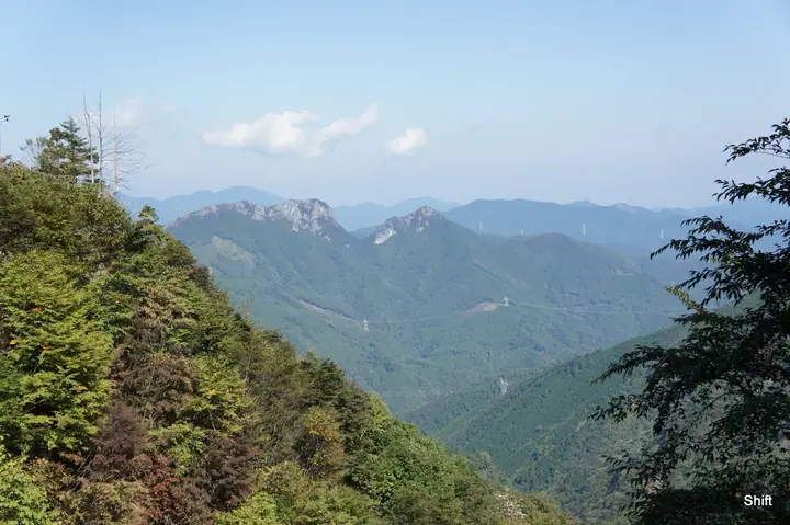
Mount Futago is a twin-summit limestone peak rising to 1,165.79 m in Ogano Town, Chichibu District, Saitama. Its name reflects the two rock spires — West Peak (Nishi-dake) and East Peak — that frame the skyline. Exposed walls, chain sections, and razor-edge ridges make it one of Saitama's most demanding routes, earning the nicknames "Jandarme of Okuchichibu" and "Crazy Mountain," with a steady record of serious falls. The view from the western ridge takes in Mount Ryōkami close at hand and sweeps 360 degrees over Okutama, Okumusashi, and the Chichibu range. Long developed as a limestone climbing sanctuary, in part through the efforts of pro climber Yuji Hirayama, the peak is included in numerous lists including Kantō Hyakumeizan.
สรุป Mount Futago
- อากาศ: วันที่อากาศคงที่ที่สุดใน 7 วันข้างหน้าคือ ศุกร์ 6 พฤศจิกายน: ท้องฟ้าแจ่มใส ลมกระโชกสูงสุด 7 ม./วินาที
- เส้นทาง: เส้นทางที่สั้นที่สุดคือ Futagoyama East and West Peaks Loop from Kurao Trailhead: ประมาณ 2 ชม. 5 นาที 2.9 km ขึ้นประมาณ 450 m
อากาศ Mount Futago (รายชั่วโมง 2 สัปดาห์)
วันนี้พระอาทิตย์ขึ้น 06:08 ตก 16:48
| อังคาร 3/11 | พุธ 4/11 | พฤหัส 5/11 | ศุกร์ 6/11 | เสาร์ 7/11 | อาทิตย์ 8/11 | จันทร์ 9/11 | อังคาร 10/11 | พุธ 11/11 | พฤหัส 12/11 | ศุกร์ 13/11 | เสาร์ 14/11 | อาทิตย์ 15/11 | จันทร์ 16/11 | อังคาร 17/11 | |||||||||||||||||||||||||||||||||||||||||||||||||||||||||||||||||||||||
|---|---|---|---|---|---|---|---|---|---|---|---|---|---|---|---|---|---|---|---|---|---|---|---|---|---|---|---|---|---|---|---|---|---|---|---|---|---|---|---|---|---|---|---|---|---|---|---|---|---|---|---|---|---|---|---|---|---|---|---|---|---|---|---|---|---|---|---|---|---|---|---|---|---|---|---|---|---|---|---|---|---|---|---|---|---|
| เวลาญี่ปุ่น | 21 | 23 | 1 | 3 | 5 | 7 | 9 | 11 | 13 | 15 | 17 | 19 | 21 | 0 | 3 | 6 | 9 | 12 | 15 | 18 | 21 | 0 | 3 | 6 | 9 | 12 | 15 | 18 | 21 | 0 | 3 | 6 | 9 | 12 | 15 | 18 | 21 | 0 | 3 | 6 | 9 | 12 | 15 | 18 | 21 | 0 | 3 | 6 | 9 | 12 | 15 | 21 | 3 | 9 | 15 | 21 | 3 | 9 | 15 | 21 | 3 | 9 | 15 | 21 | 3 | 9 | 15 | 21 | 3 | 9 | 15 | 21 | 3 | 9 | 15 | 21 | 3 | 9 | 15 | 21 | 3 | 9 | 15 | 21 | |
  | |   | |   |   | |   | | | |   | | | | |   |   | | | | | |   |  | | | |  | | | | | | | | | | | | | | | | | | | | | | | | | | | | |   | |   |  | | | | | | | | | | | | | | | | | | | |  | | | | ||
| อุณหภูมิ | °C | 6° | 6° | 6° | 5° | 5° | 6° | 8° | 10° | 9° | 6° | 5° | 5° | 5° | 5° | 6° | 8° | 10° | 14° | 13° | 10° | 8° | 6° | 5° | 7° | 14° | 19° | 18° | 10° | 6° | 4° | 3° | 1° | 9° | 12° | 9° | 3° | 0° | -1° | -2° | -2° | 6° | 9° | 7° | 4° | 4° | 2° | 2° | 2° | 4° | 7° | 6° | 4° | 3° | 4° | 5° | 2° | 0° | 5° | 5° | 0° | -3° | 6° | 6° | 2° | -1° | 7° | 7° | -1° | -3° | 5° | 6° | 0° | -1° | 7° | 8° | 5° | 7° | 14° | 13° | 4° | 0° | 4° | 5° | 2° |
| ฝนและหิมะ | mm | 0.4 | 1.4 | 7 | 9 | 6 | 1.8 | 0.5 | 0.3 | 0.3 | 4.6 | 2.2 | 0.4 | 0.2 | 2.7 | 8 | |||||||||||||||||||||||||||||||||||||||||||||||||||||||||||||||||||||
| หิมะตก | cm | ||||||||||||||||||||||||||||||||||||||||||||||||||||||||||||||||||||||||||||||||||||
| หิมะสะสม | cm | 0 | 0 | 0 | 0 | 0 | 0 | 0 | 0 | 0 | 0 | 0 | 0 | 0 | 0 | 0 | 0 | 0 | 0 | 0 | 0 | 0 | 0 | 0 | 0 | 0 | 0 | 0 | 0 | 0 | 0 | 0 | 0 | 0 | 0 | 0 | 0 | 0 | 0 | 0 | 0 | 0 | 0 | 0 | 0 | 0 | 0 | 0 | 0 | 0 | 0 | 0 | 0 | 0 | 0 | 0 | 0 | 0 | 0 | 0 | 0 | 0 | 0 | 0 | 0 | 0 | 0 | 0 | 0 | 0 | 0 | 0 | 0 | 0 | 0 | 0 | 0 | 0 | 0 | 0 | 0 | 0 | 0 | 0 | 0 |
| ลม | m/s | 0 | 1 | 1 | 1 | 1 | 1 | 2 | 3 | 3 | 2 | 1 | 1 | 1 | 0 | 1 | 0 | 0 | 1 | 2 | 1 | 1 | 0 | 1 | 1 | 2 | 2 | 1 | 0 | 2 | 2 | 3 | 2 | 2 | 3 | 4 | 2 | 2 | 3 | 2 | 2 | 2 | 3 | 2 | 0 | 1 | 1 | 1 | 1 | 2 | 3 | 1 | 1 | 1 | 2 | 3 | 1 | 2 | 8 | 7 | 2 | 2 | 1 | 2 | 1 | 1 | 5 | 5 | 2 | 2 | 2 | 2 | 0 | 0 | 1 | 1 | 1 | 0 | 1 | 5 | 5 | 1 | 2 | 2 | 1 |
| ลมกระโชก | m/s | 1 | 2 | 2 | 2 | 3 | 2 | 6 | 8 | 9 | 8 | 5 | 4 | 4 | 4 | 3 | 3 | 3 | 5 | 6 | 5 | 3 | 3 | 4 | 6 | 6 | 7 | 7 | 6 | 6 | 7 | 8 | 8 | 8 | 10 | 12 | 12 | 7 | 7 | 7 | 7 | 6 | 9 | 9 | 6 | 3 | 4 | 3 | 3 | 5 | 8 | 8 | 4 | 4 | 7 | 10 | 8 | 6 | 25 | 22 | 18 | 7 | 6 | 9 | 7 | 4 | 12 | 16 | 13 | 7 | 5 | 8 | 6 | 2 | 3 | 7 | 4 | 4 | 4 | 15 | 15 | 14 | 6 | 8 | 7 |
| ทิศทางลม | ↓ | ↓ | ↓ | ↓ | ↓ | ↓ | ↓ | ↓ | ↓ | ↓ | ↓ | ↓ | ↓ | ↓ | ↓ | ↓ | ↓ | ↓ | ↓ | ↓ | ↓ | ↓ | ↓ | ↓ | ↓ | ↓ | ↓ | ↓ | ↓ | ↓ | ↓ | ↓ | ↓ | ↓ | ↓ | ↓ | ↓ | ↓ | ↓ | ↓ | ↓ | ↓ | ↓ | ↓ | ↓ | ↓ | ↓ | ↓ | ↓ | ↓ | ↓ | ↓ | ↓ | ↓ | ↓ | ↓ | ↓ | ↓ | ↓ | ↓ | ↓ | ↓ | ↓ | ↓ | ↓ | ↓ | ↓ | ↓ | ↓ | ↓ | ↓ | ↓ | ↓ | ↓ | ↓ | ↓ | ↓ | ↓ | ↓ | ↓ | ↓ | ↓ | ↓ | ↓ | |
เส้นทางเดินป่า Mount Futago
- Futagoyama East and West Peaks Loop from Kurao Trailhead 2.9 km · ความสูงสะสมขาขึ้น 454 m มีที่จอดรถ
เวลาเดินเป็นค่าประมาณที่คำนวณจากภูมิประเทศ
กระท่อม ที่ตั้งแคมป์ และที่พักใกล้ Mount Futago
ที่พัก
- 両神山荘
รายชื่อที่มี Mount Futago
100 ภูเขาที่มีชื่อเสียงของคันโต · ภูเขา 50 แห่งในจังหวัดไซตามะ · ระดับความสูงของภูเขา 1003 แห่งในญี่ปุ่น · ภูเขา 1000 แห่งของญี่ปุ่น
ข้อมูลพื้นฐาน Mount Futago
- ชื่ออื่น
- 西岳
- ความสูง
- 1,166 ม.
- ที่ตั้ง
- โองาโนะ, ไซตามะ
36.069698, 138.863727 - เว็บไซต์
- kanko-ogano.jp
- วิกิพีเดีย
- ja.wikipedia.org