
Mount Ashitaka
越前岳
Fuji, Shizuoka / Susono, Shizuoka · Elevation 1,504 m
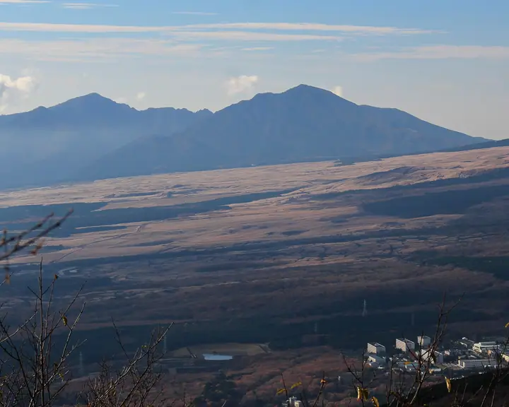
Mount Ashitaka (Echizen-dake, 1,504.2 m) is the highest peak of the Ashitaka Range, an ancient volcano facing the southern slopes of Mount Fuji and straddling Numazu, Susono, Fuji, and Nagaizumi in Shizuoka Prefecture. The range comprises nine peaks — Echizen, Ihai, Yobiko, Hakamagoshi and the eponymous Ashitaka summit among them — with Echizen-dake as the highest. Lying within Fuji-Hakone-Izu National Park, it is famed for Ashitaka azalea and Yamaboushi blooms and serves as one of the finest viewpoints of Mount Fuji. It is listed in the 200 Famous Japanese Mountains.
Mount Ashitaka at a glance
- Weather: The most settled day in the next 7 days is Fri, November 6: clear, gusts up to 7 m/s.
- Route: The shortest is Ashitaka Range from Mount Echizen, the Highest Peak, past the Lookout Facing Fuji's Hoei Crater to the Southern Foot: about 5 h 11 min, 8.7 km, about 770 m of climbing.
Mount Ashitaka weather (hourly, 14 days)
Sunrise today 06:07, sunset 16:50
| Tue, 11/3 | Wed, 11/4 | Thu, 11/5 | Fri, 11/6 | Sat, 11/7 | Sun, 11/8 | Mon, 11/9 | Tue, 11/10 | Wed, 11/11 | Thu, 11/12 | Fri, 11/13 | Sat, 11/14 | Sun, 11/15 | Mon, 11/16 | Tue, 11/17 | |||||||||||||||||||||||||||||||||||||||||||||||||||||||||||||||||||||||
|---|---|---|---|---|---|---|---|---|---|---|---|---|---|---|---|---|---|---|---|---|---|---|---|---|---|---|---|---|---|---|---|---|---|---|---|---|---|---|---|---|---|---|---|---|---|---|---|---|---|---|---|---|---|---|---|---|---|---|---|---|---|---|---|---|---|---|---|---|---|---|---|---|---|---|---|---|---|---|---|---|---|---|---|---|---|
| Japan time | 15 | 17 | 19 | 21 | 23 | 1 | 3 | 5 | 7 | 9 | 11 | 13 | 15 | 18 | 21 | 0 | 3 | 6 | 9 | 12 | 15 | 18 | 21 | 0 | 3 | 6 | 9 | 12 | 15 | 18 | 21 | 0 | 3 | 6 | 9 | 12 | 15 | 18 | 21 | 0 | 3 | 6 | 9 | 12 | 15 | 18 | 21 | 0 | 3 | 6 | 9 | 15 | 21 | 3 | 9 | 15 | 21 | 3 | 9 | 15 | 21 | 3 | 9 | 15 | 21 | 3 | 9 | 15 | 21 | 3 | 9 | 15 | 21 | 3 | 9 | 15 | 21 | 3 | 9 | 15 | 21 | 3 | 9 | 15 | |
  |   |   |   | | | | |   | | | | | | | | | |   | | | |   |  | | |  |   | | | | | | | |   | | |   | | | | | | | | | | | | | | | | | | | | | |   | | | | | | |   | | | | | | | | | | | | | | | | | ||
| Temperature | °C | 10° | 8° | 7° | 6° | 5° | 5° | 6° | 6° | 6° | 8° | 10° | 11° | 9° | 8° | 7° | 7° | 8° | 8° | 12° | 14° | 11° | 10° | 9° | 9° | 9° | 9° | 12° | 14° | 14° | 10° | 9° | 8° | 6° | 3° | 8° | 9° | 8° | 5° | 4° | 4° | 4° | 4° | 7° | 9° | 7° | 6° | 5° | 5° | 5° | 5° | 6° | 7° | 4° | 3° | 5° | 7° | 3° | 1° | 5° | 7° | 2° | 2° | 5° | 5° | 4° | 2° | 7° | 8° | 5° | 3° | 3° | 5° | 4° | 2° | 7° | 9° | 8° | 8° | 11° | 13° | 8° | 5° | 5° | 6° |
| Precipitation | mm | 0.5 | 0.2 | 0.8 | 1.6 | 16 | 15 | 5 | 1.3 | 1.5 | 1.4 | 0.3 | 2.4 | 0.3 | 0.2 | 0.4 | 0.8 | 0.4 | 0.2 | 0.2 | 24 | 35 | 4.3 | 6 | 2.5 | 0.1 | |||||||||||||||||||||||||||||||||||||||||||||||||||||||||||
| New snow | cm | ||||||||||||||||||||||||||||||||||||||||||||||||||||||||||||||||||||||||||||||||||||
| Snow depth | cm | 0 | 0 | 0 | 0 | 0 | 0 | 0 | 0 | 0 | 0 | 0 | 0 | 0 | 0 | 0 | 0 | 0 | 0 | 0 | 0 | 0 | 0 | 0 | 0 | 0 | 0 | 0 | 0 | 0 | 0 | 0 | 0 | 0 | 0 | 0 | 0 | 0 | 0 | 0 | 0 | 0 | 0 | 0 | 0 | 0 | 0 | 0 | 0 | 0 | 0 | 0 | 0 | 0 | 0 | 0 | 0 | 0 | 0 | 0 | 0 | 0 | 0 | 0 | 0 | 0 | 0 | 0 | 0 | 0 | 0 | 0 | 0 | 0 | 0 | 0 | 0 | 0 | 0 | 0 | 0 | 0 | 0 | 0 | 0 |
| Wind | m/s | 2 | 1 | 0 | 1 | 1 | 1 | 1 | 1 | 1 | 1 | 1 | 1 | 1 | 1 | 2 | 2 | 2 | 2 | 0 | 2 | 1 | 0 | 0 | 0 | 0 | 0 | 1 | 2 | 2 | 0 | 0 | 0 | 1 | 1 | 2 | 3 | 3 | 1 | 1 | 1 | 0 | 0 | 1 | 2 | 2 | 0 | 0 | 1 | 0 | 0 | 0 | 2 | 1 | 1 | 1 | 2 | 0 | 2 | 2 | 2 | 1 | 0 | 1 | 1 | 0 | 0 | 1 | 2 | 0 | 1 | 1 | 1 | 1 | 1 | 1 | 1 | 0 | 1 | 0 | 2 | 1 | 1 | 1 | 1 |
| Wind gusts | m/s | 7 | 6 | 2 | 1 | 3 | 3 | 3 | 3 | 3 | 4 | 4 | 6 | 5 | 4 | 6 | 6 | 8 | 8 | 4 | 7 | 6 | 3 | 2 | 2 | 3 | 3 | 4 | 7 | 7 | 4 | 1 | 1 | 2 | 3 | 6 | 9 | 9 | 8 | 2 | 3 | 2 | 2 | 4 | 6 | 7 | 5 | 2 | 2 | 2 | 2 | 3 | 7 | 6 | 3 | 4 | 7 | 6 | 5 | 5 | 7 | 6 | 2 | 4 | 6 | 4 | 2 | 5 | 7 | 4 | 3 | 4 | 6 | 4 | 3 | 4 | 6 | 5 | 8 | 7 | 7 | 6 | 5 | 4 | 5 |
| Wind dir. | ↓ | ↓ | ↓ | ↓ | ↓ | ↓ | ↓ | ↓ | ↓ | ↓ | ↓ | ↓ | ↓ | ↓ | ↓ | ↓ | ↓ | ↓ | ↓ | ↓ | ↓ | ↓ | ↓ | ↓ | ↓ | ↓ | ↓ | ↓ | ↓ | ↓ | ↓ | ↓ | ↓ | ↓ | ↓ | ↓ | ↓ | ↓ | ↓ | ↓ | ↓ | ↓ | ↓ | ↓ | ↓ | ↓ | ↓ | ↓ | ↓ | ↓ | ↓ | ↓ | ↓ | ↓ | ↓ | ↓ | ↓ | ↓ | ↓ | ↓ | ↓ | ↓ | ↓ | ↓ | ↓ | ↓ | ↓ | ↓ | ↓ | ↓ | ↓ | ↓ | ↓ | ↓ | ↓ | ↓ | ↓ | ↓ | ↓ | ↓ | ↓ | ↓ | ↓ | ↓ | |
Mount Ashitaka hiking routes
- Ashitaka Range from Mount Echizen, the Highest Peak, past the Lookout Facing Fuji's Hoei Crater to the Southern Foot 8.7 km · Ascent 769 m 十里木高原登山口 (parking) → 愛鷹登山口 (Bus stop)
- Mount Kuro, Mount Echizen and Mount Yobiko Circuit from Yama Shrine 10.5 km · Ascent 963 m 愛鷹山黒岳登山口山神社 (parking)
Hiking times are estimates calculated from the terrain.
Huts, campsites and lodging near Mount Ashitaka
Mountain huts
Lists that include Mount Ashitaka
Japan 200 Famous Mountains · Japan's 300 Famous Mountains · Illustrated Collection of Japan's Famous Mountains · 100 Mountains of Shizuoka · Elevations of 1003 Mountains of Japan · 1000 Mountains of Japan
Mount Ashitaka facts
- Elevation
- 1,504 m
- Location
- Fuji, Shizuoka / Susono, Shizuoka
35.238066, 138.794001 - National Park
- 富士箱根伊豆国立公園
- Website
- www.city.numazu.shizuoka.jp
- Trail Map
- www.susonokanko.jp (PDF)
- Access Information
- www.susonokanko.jp (PDF)
- Wikipedia
- ja.wikipedia.org