
Mt. Ashitakayama
愛鷹山
Numazu, Shizuoka · Elevation 1,187 m
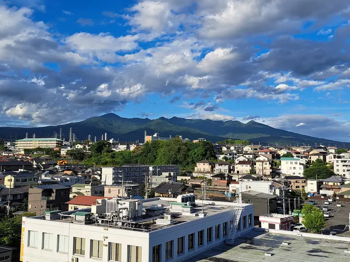
Mt. Ashitakayama, 1,187 m, is the southernmost summit of the Ashitaka volcanic range spreading south of Mt. Fuji, on the borders of Numazu City, Susono City and Nagaizumi Town in Shizuoka Prefecture, and is the highest point of Numazu City. The name is also used collectively for the range's nine peaks (Kurodake, Echizen, Yobuko, Nokogiri, Ihai, Mae, Hakamagoshi, Ō and Ashitaka). The summit holds a first-class triangulation point that draws survey enthusiasts. Slopes formed by long-extinct volcanism support natural beech forest and the endemic Ashitaka azalea — both designated as Special Plant Communities by the Ministry of the Environment — and the summit gives sweeping views of Mt. Fuji, Suruga Bay and the Izu Peninsula. Both Numazu and Susono cities publish official hiking guides for routes from Suijinja, Suyama and Momozawa.
Mt. Ashitakayama at a glance
- Weather: The most settled day in the next 7 days is Fri, November 6: clear, gusts up to 6 m/s.
Mt. Ashitakayama weather (hourly, 14 days)
Sunrise today 06:07, sunset 16:50
| Tue, 11/3 | Wed, 11/4 | Thu, 11/5 | Fri, 11/6 | Sat, 11/7 | Sun, 11/8 | Mon, 11/9 | Tue, 11/10 | Wed, 11/11 | Thu, 11/12 | Fri, 11/13 | Sat, 11/14 | Sun, 11/15 | Mon, 11/16 | Tue, 11/17 | |||||||||||||||||||||||||||||||||||||||||||||||||||||||||||||||||||||||
|---|---|---|---|---|---|---|---|---|---|---|---|---|---|---|---|---|---|---|---|---|---|---|---|---|---|---|---|---|---|---|---|---|---|---|---|---|---|---|---|---|---|---|---|---|---|---|---|---|---|---|---|---|---|---|---|---|---|---|---|---|---|---|---|---|---|---|---|---|---|---|---|---|---|---|---|---|---|---|---|---|---|---|---|---|---|
| Japan time | 15 | 17 | 19 | 21 | 23 | 1 | 3 | 5 | 7 | 9 | 11 | 13 | 15 | 18 | 21 | 0 | 3 | 6 | 9 | 12 | 15 | 18 | 21 | 0 | 3 | 6 | 9 | 12 | 15 | 18 | 21 | 0 | 3 | 6 | 9 | 12 | 15 | 18 | 21 | 0 | 3 | 6 | 9 | 12 | 15 | 18 | 21 | 0 | 3 | 6 | 9 | 15 | 21 | 3 | 9 | 15 | 21 | 3 | 9 | 15 | 21 | 3 | 9 | 15 | 21 | 3 | 9 | 15 | 21 | 3 | 9 | 15 | 21 | 3 | 9 | 15 | 21 | 3 | 9 | 15 | 21 | 3 | 9 | 15 | |
  |   |   |   | | | | |   | | |   | |   | | | | | | |   | | | | | |   |  | |  | | | | | | | | | | | | | | | | | | | | | | | |   | |   |   | | | | | | | | |   | | | | | | | | | | | | | | | | | | | ||
| Temperature | °C | 11° | 9° | 8° | 7° | 7° | 7° | 7° | 7° | 7° | 8° | 9° | 9° | 8° | 6° | 6° | 7° | 7° | 7° | 10° | 14° | 12° | 10° | 9° | 8° | 7° | 8° | 12° | 15° | 15° | 11° | 9° | 7° | 6° | 5° | 9° | 10° | 9° | 7° | 5° | 4° | 4° | 4° | 7° | 9° | 9° | 6° | 5° | 5° | 5° | 5° | 6° | 8° | 5° | 3° | 5° | 7° | 3° | 3° | 5° | 7° | 3° | 2° | 5° | 5° | 4° | 3° | 6° | 9° | 4° | 2° | 4° | 6° | 4° | 3° | 7° | 9° | 7° | 9° | 11° | 15° | 9° | 4° | 5° | 5° |
| Precipitation | mm | 0.2 | 0.7 | 5 | 5 | 9 | 8 | 4.4 | 0.7 | 0.2 | 1.0 | 0.7 | 0.1 | 0.1 | 0.2 | 0.2 | 0.7 | 0.1 | 0.3 | 0.7 | 15 | 28 | 7 | 1.2 | 0.2 | ||||||||||||||||||||||||||||||||||||||||||||||||||||||||||||
| New snow | cm | ||||||||||||||||||||||||||||||||||||||||||||||||||||||||||||||||||||||||||||||||||||
| Snow depth | cm | 0 | 0 | 0 | 0 | 0 | 0 | 0 | 0 | 0 | 0 | 0 | 0 | 0 | 0 | 0 | 0 | 0 | 0 | 0 | 0 | 0 | 0 | 0 | 0 | 0 | 0 | 0 | 0 | 0 | 0 | 0 | 0 | 0 | 0 | 0 | 0 | 0 | 0 | 0 | 0 | 0 | 0 | 0 | 0 | 0 | 0 | 0 | 0 | 0 | 0 | 0 | 0 | 0 | 0 | 0 | 0 | 0 | 0 | 0 | 0 | 0 | 0 | 0 | 0 | 0 | 0 | 0 | 0 | 0 | 0 | 0 | 0 | 0 | 0 | 0 | 0 | 0 | 0 | 0 | 0 | 0 | 0 | 0 | 0 |
| Wind | m/s | 3 | 2 | 2 | 2 | 2 | 2 | 2 | 3 | 3 | 3 | 4 | 5 | 4 | 4 | 5 | 3 | 1 | 2 | 1 | 1 | 1 | 1 | 0 | 1 | 1 | 1 | 1 | 2 | 2 | 1 | 1 | 1 | 2 | 2 | 3 | 3 | 4 | 2 | 1 | 1 | 1 | 2 | 2 | 2 | 2 | 2 | 1 | 2 | 1 | 2 | 2 | 3 | 3 | 3 | 3 | 3 | 2 | 2 | 2 | 1 | 1 | 1 | 1 | 1 | 1 | 1 | 1 | 2 | 2 | 2 | 3 | 1 | 1 | 0 | 1 | 2 | 2 | 1 | 2 | 1 | 1 | 2 | 3 | 3 |
| Wind gusts | m/s | 9 | 7 | 4 | 5 | 5 | 5 | 6 | 8 | 8 | 9 | 10 | 12 | 12 | 11 | 13 | 13 | 12 | 7 | 7 | 5 | 5 | 3 | 2 | 2 | 3 | 3 | 3 | 6 | 6 | 5 | 2 | 4 | 5 | 5 | 7 | 8 | 10 | 10 | 6 | 4 | 3 | 4 | 5 | 6 | 7 | 6 | 4 | 4 | 4 | 4 | 6 | 8 | 8 | 7 | 8 | 9 | 7 | 5 | 8 | 8 | 4 | 4 | 5 | 6 | 5 | 4 | 4 | 6 | 6 | 6 | 7 | 8 | 5 | 4 | 4 | 7 | 6 | 16 | 9 | 6 | 8 | 6 | 7 | 8 |
| Wind dir. | ↓ | ↓ | ↓ | ↓ | ↓ | ↓ | ↓ | ↓ | ↓ | ↓ | ↓ | ↓ | ↓ | ↓ | ↓ | ↓ | ↓ | ↓ | ↓ | ↓ | ↓ | ↓ | ↓ | ↓ | ↓ | ↓ | ↓ | ↓ | ↓ | ↓ | ↓ | ↓ | ↓ | ↓ | ↓ | ↓ | ↓ | ↓ | ↓ | ↓ | ↓ | ↓ | ↓ | ↓ | ↓ | ↓ | ↓ | ↓ | ↓ | ↓ | ↓ | ↓ | ↓ | ↓ | ↓ | ↓ | ↓ | ↓ | ↓ | ↓ | ↓ | ↓ | ↓ | ↓ | ↓ | ↓ | ↓ | ↓ | ↓ | ↓ | ↓ | ↓ | ↓ | ↓ | ↓ | ↓ | ↓ | ↓ | ↓ | ↓ | ↓ | ↓ | ↓ | ↓ | |
Huts, campsites and lodging near Mt. Ashitakayama
Mountain huts
Campsites
- Suzu-san Kyūyōrin camp site
Lodging
- Nagaizumi Sanso
Lists that include Mt. Ashitakayama
Mt. Ashitakayama facts
- Elevation
- 1,187 m
- Location
- Numazu, Shizuoka
35.198487, 138.807718 - Website
- www.city.numazu.shizuoka.jp
- Trail Map
- www.city.susono.shizuoka.jp (PDF)
- Access Information
- www.city.numazu.shizuoka.jp
- Wikipedia
- ja.wikipedia.org